The best road cycling routes around Saint-Appolinard
4.6
(121)
2,719
riders
137
rides
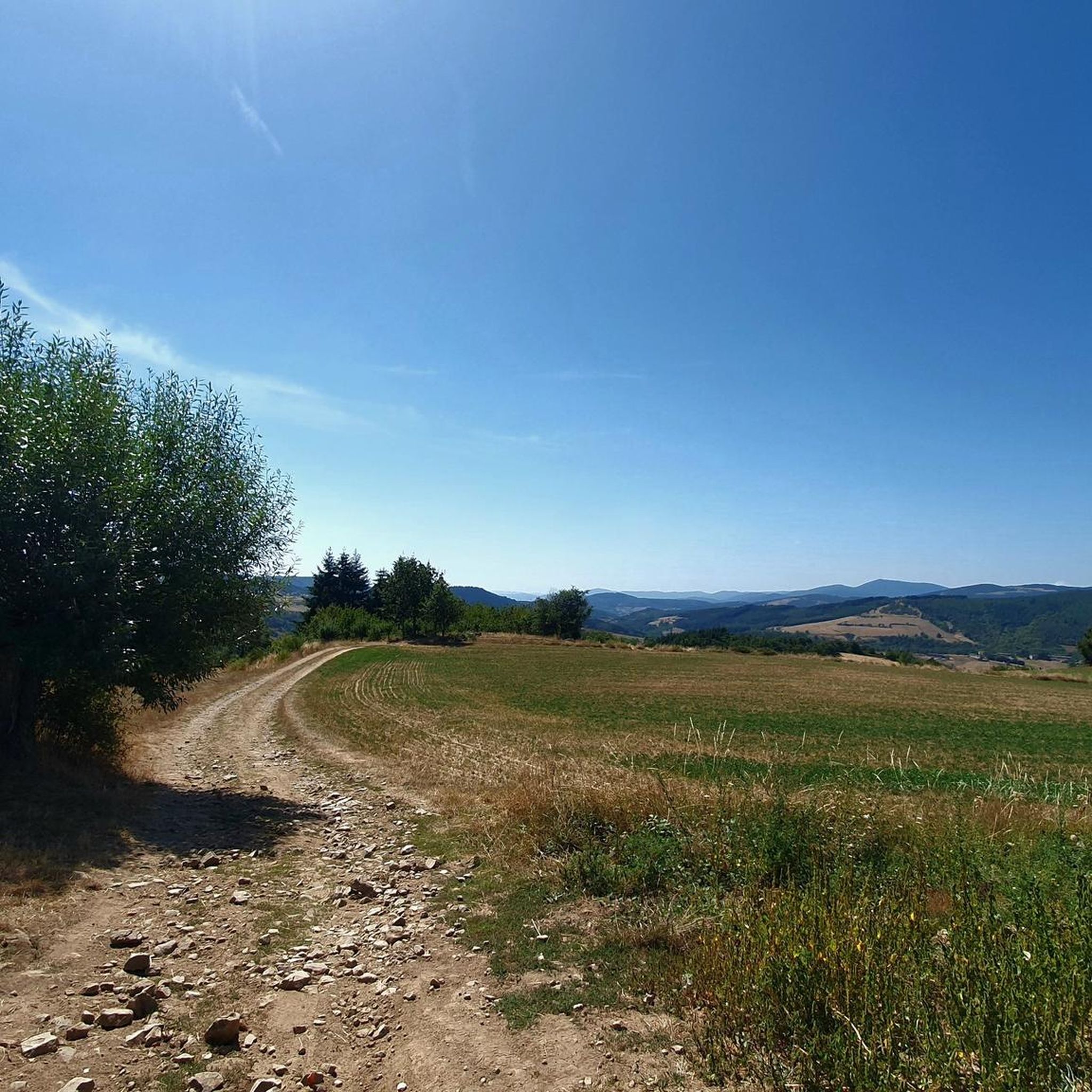
Road cycling around Saint-Appolinard, located in the Loire department of the Auvergne-Rhône-Alpes region, offers diverse landscapes for cyclists. The area features quiet roads traversing a mix of terrain, from gentle climbs to more challenging ascents. Cyclists can experience picturesque natural beauty, including views towards the Oeillon Crest and Perdrix Crest, which provide scenic backdrops. The region also offers access to charming villages and local hills, contributing to a varied environment for outdoor enthusiasts.
Best road cycling routes around Saint-Appolinard
- The most popular road cycling route is Pavezin Pass – Grenouze Pass loop from Saint-Appolinard, a 41.7 miles (67.1 km) trail that takes 3 hours 17 minutes to complete. This difficult route features significant elevation gain through varied terrain.
- Another top favourite among local road cyclists is Col de Pavezin (651 m) – Pavezin Pass loop from Saint-Appolinard, a moderate 31.0 miles (49.9 km) path. This route offers a substantial climb to Col de Pavezin, providing panoramic views of the surrounding countryside.
- Local road cyclists also love the Col du Banchet – Saint-Blaise Church loop from Saint-Appolinard, a 31.5 miles (50.7 km) trail leading through local hills and past historical points of interest, often completed in about 2 hours 39 minutes.
- Road cycling around Saint-Appolinard is defined by quiet roads, diverse landscapes, and views of the Oeillon Crest and Perdrix Crest. The network offers options for various ability levels, from moderate rides to more challenging climbs.
- The routes in Saint-Appolinard are highly rated by the komoot community with an average score of 4.6 stars from over 140 reviews. More than 3,800 road cyclists have used komoot to explore Saint-Appolinard's varied terrain.
Last updated: July 1, 2026
4.0
(1)
53
riders
67.2km
03:17
930m
930m
Hard road ride. Very good fitness required. Mostly well-paved surfaces and easy to ride.
27
riders
43.7km
02:11
620m
620m
Moderate road ride. Good fitness required. Mostly well-paved surfaces and easy to ride.

Sign up for free
5.0
(1)
43
riders
34.6km
01:37
440m
440m
Moderate road ride. Good fitness required. Mostly well-paved surfaces and easy to ride.
36
riders
71.6km
04:03
1,590m
1,590m
Hard road ride. Very good fitness required. Some segments of this route may be unpaved and difficult to ride.
4.0
(3)
15
riders
Moderate road ride. Good fitness required. Some segments of this route may be unpaved and difficult to ride.
Get access to more routes and recommendations from other explorers.
Sign up for free
Already have an account?
Our route recommendations are based on thousands of hikes, rides, and runs completed by other people on komoot.
Start today with a free account
Your next adventure awaits.
Login or Signup
Tips from the Community

The Col de Pavezin is certainly not the highest, but it is no less mythical. The inventor of the derailleur, Paul de Vivié, who settled here, made it an unmissable rendezvous. The pass is located between the Rhône valley and the Gier valley, and opens up a grandiose panorama of the Alps and the Rhône furrow.
0
0

beautiful bridge with great views
0
0

A wonderful stretch of the route! The stunning scenery and excellent cycle paths make the Via Rhôna cycle tour a truly memorable experience!
0
0
A wonderful stretch of route! The stunning scenery and excellent cycle paths make this bike tour a truly memorable experience!
0
0

Here is the route for the ascent of the Col de la Croix de Montvieux starting from La Terrasse-sur-Dorlay.
1
0
A pleasant stretch of the Rhône, easy to ride, well-paved and directly on the riverbank.
0
0

The Condrieu suspension bridge spans the Rhône between the towns of Condrieu in the Rhône department and Les Roches-de-Condrieu in the Isère department. The suspension bridge consists of two spans separated by a central concrete pylon forming an arch, in which the metal suspension cables are anchored. The entrance to the bridge is marked by two concrete pylons that receive the cables on the banks. These are connected to the deck by hangers. The deck, with its metal frame and reinforced concrete cover slab, carries a two-lane, two-way roadway, bordered by sidewalks lined with guardrails. The current Condrieu bridge is the second bridge to be built at this location; it replaces an earlier structure constructed in 1832 and declared to be in very poor condition in 1929. The 1934 work was barely completed when the bridge was closed in June 1940 due to an act of war. A cable ferry was put back into service to restore the river crossing. In spring 2025, due to structural weaknesses, the bridge was closed to traffic for several months while new cables were installed and reinforcement work was carried out.
1
0

Frequently Asked Questions
How many road cycling routes are available around Saint-Appolinard?
There are over 130 road cycling routes around Saint-Appolinard, offering a wide range of options for cyclists of all abilities.
What kind of terrain can I expect on road cycling routes in Saint-Appolinard?
The region offers diverse terrain, from quiet roads with gentle climbs to more challenging ascents. You'll find routes traversing local hills, valleys, and even some notable passes like the Col de la Madeleine (Chambarans), providing a mix of experiences from moderate to difficult. The landscape includes picturesque natural beauty with views towards the Oeillon Crest and Perdrix Crest.
Are there routes suitable for beginners or those looking for an easier ride?
Yes, Saint-Appolinard offers a good selection of routes for less experienced cyclists. There are 15 easy routes available, allowing beginners to enjoy the scenic beauty without overly strenuous climbs.
What are some challenging road cycling routes for experienced riders?
Experienced riders can find plenty of challenging routes with significant elevation gain. For example, the Pavezin Pass – Grenouze Pass loop from Saint-Appolinard is a difficult 41.7-mile trail with over 930 meters of elevation gain. Another demanding option is the Col du Banchet – Saint-Blaise Church loop from Saint-Appolinard, which also features substantial climbing.
What natural landmarks or viewpoints can I see while cycling in the area?
The routes around Saint-Appolinard offer stunning views and access to several natural landmarks. You can enjoy vistas of the Crêt de l'Oeillon and Crêt de la Perdrix. Other notable natural features include The Three Teeth and the Crêt de la Botte, providing scenic backdrops for your ride.
Are there any historical or cultural points of interest along the cycling routes?
Yes, the region is rich in history and culture. Some routes, like the Col du Banchet – Saint-Blaise Church loop from Saint-Appolinard, pass historical points of interest. Nearby, you can explore the medieval village of Saint-Antoine-l'Abbaye, known for its Gothic abbey, or Pont-en-Royans with its unique houses perched above a river gorge. The extraordinary Palais Idéal is also within reach for a unique cultural stop.
What is the best time of year for road cycling around Saint-Appolinard?
The Auvergne-Rhône-Alpes region generally offers pleasant cycling conditions from spring through autumn. Summer provides warm weather ideal for longer rides, though some roads might have mediocre asphalt in parts, the magnificent views of the Vercors and Royans regions often compensate. Spring and early autumn offer cooler temperatures and beautiful scenery.
Are there any circular road cycling routes available?
Many of the road cycling routes around Saint-Appolinard are designed as loops, allowing you to start and finish in the same location. Examples include the Col de Pavezin (651 m) – Pavezin Pass loop from Saint-Appolinard and the Ternay Dam and Lake – Ternay Dam Loop loop from Saint-Appolinard, which offer convenient circular journeys.
What do other road cyclists enjoy most about cycling in Saint-Appolinard?
The area is highly rated by the komoot community, with an average score of 4.6 stars from over 140 reviews. Cyclists often praise the diverse landscapes, quiet roads, and the variety of routes that cater to different ability levels, from moderate rides to challenging climbs with panoramic views.
Are there any routes that pass by lakes or water features?
Yes, you can find routes that incorporate water features. The Ternay Dam and Lake – Ternay Dam Loop loop from Saint-Appolinard is a moderate 41.8-kilometer route that takes you past the Ternay Dam and its lake, offering a refreshing change of scenery.
Is it possible to combine road cycling with other outdoor activities in the region?
Absolutely. The broader Auvergne-Rhône-Alpes region, where Saint-Appolinard is located, is a hub for various outdoor pursuits. Beyond road cycling, you can find opportunities for hiking, mountain biking, paragliding, rafting, and via ferrata, making it a comprehensive destination for outdoor adventurers.
Most popular routes around Saint-Appolinard
Most popular attractions around Saint-Appolinard

Get inspired with the komoot mobile app


Explore more
Browse the best Road cycling routes in other regions.
