The best walks and hikes around Fillé
4.5
(153)
974
hikers
62
hikes
Hiking around Fillé offers routes through a landscape characterized by the Sarthe river, canals, and gentle terrain. The area features paths along waterways and around small islands, with minimal elevation changes. This makes the region suitable for accessible walks and longer, flat excursions. The natural environment primarily consists of riverside paths and open countryside.
Best hiking trails around Fillé
- The most popular hiking route is Île MoulinSart and Canal Loop from Fillé, a 8.0 miles (12.9 km) trail that…
Last updated: June 24, 2026
4.4
(7)
37
hikers
12.9km
03:16
20m
20m
Moderate hike. Good fitness required. Easily-accessible paths. Suitable for all skill levels.
4.7
(9)
61
hikers
6.65km
01:41
10m
10m
Easy hike. Great for any fitness level. Easily-accessible paths. Suitable for all skill levels.

Sign up for free
4.9
(7)
52
hikers
5.18km
01:19
10m
10m
Easy hike. Great for any fitness level. Easily-accessible paths. Suitable for all skill levels.
3.3
(3)
22
hikers
6.34km
01:37
10m
20m
Easy hike. Great for any fitness level. Easily-accessible paths. Suitable for all skill levels.
2.8
(4)
14
hikers
11.4km
02:53
20m
20m
Moderate hike. Good fitness required. Easily-accessible paths. Suitable for all skill levels.
Get access to more routes and recommendations from other explorers.
Sign up for free
Already have an account?
Our route recommendations are based on thousands of hikes, rides, and runs completed by other people on komoot.
Start today with a free account
Your next adventure awaits.
Login or Signup

Tips from the Community

Autumn is a wonderful season to enjoy the colors of nature but summer must also be very nice because the route is most often shaded.
0
0
8 kilometers of flat ground along the pond then the river, accessible to people with low mobility (possibility of doing the route in a wheelchair). When you reach the end of the path, you have to turn around. The walk is very beautiful, dotted with magnificent trees. Very well maintained trail.
0
0

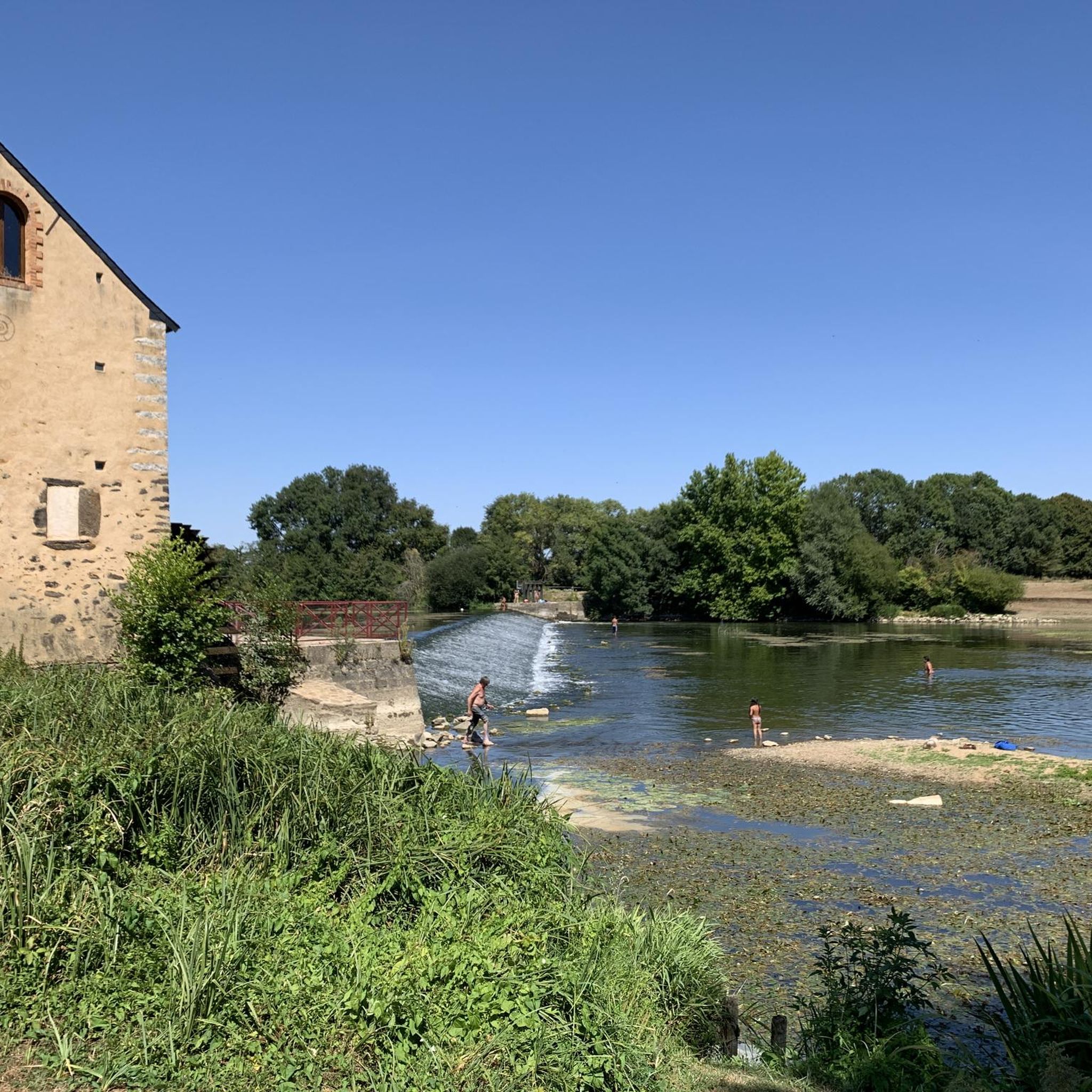
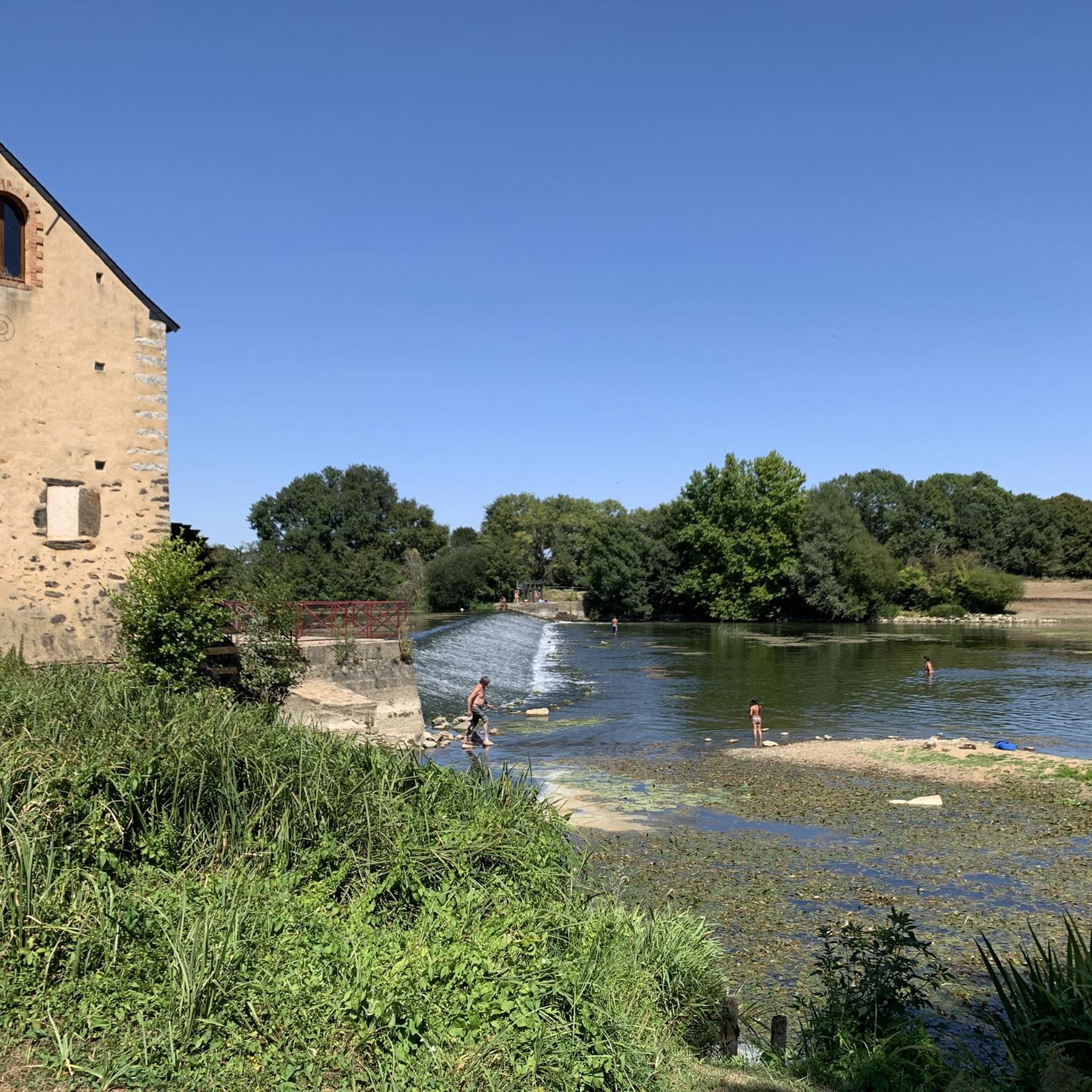
This small island has a lot to offer: green spaces to stroll and relax, an art center and a working mill.
2
0
This section of the Fillé canal, close to the water and away from the hustle and bustle, is a pleasant walk.
3
0
Outdoor activities, numerous throughout the year, accompany the pleasant walks around the lake.
2
0

to be done with possible variants towards the Bernache castle and the Roeze lock. On foot or by bike
0
0
Frequently Asked Questions
How many hiking trails are available around Fillé?
There are over 60 hiking routes around Fillé, offering a variety of options for different preferences and skill levels. This includes 22 easy trails, 35 moderate routes, and 5 more challenging excursions.
What kind of terrain can I expect on hikes around Fillé?
The landscape around Fillé is characterized by the Sarthe river, canals, and gentle terrain. You can expect paths along waterways, around small islands, and through open countryside, with minimal elevation changes. This makes the region suitable for accessible walks and longer, flat excursions.
Are there easy hiking options suitable for beginners or casual walkers?
Yes, Fillé offers many easy hiking options. There are 22 trails classified as easy, perfect for beginners or those looking for a relaxed stroll. An example is the Moulin Sart Island loop from Fillé, an easy 4.1-mile (6.7 km) path offering views of the island and surrounding water.
Are there any circular walks around Fillé?
Many of the routes around Fillé are circular, allowing you to start and end at the same point. Popular circular options include the Île MoulinSart and Canal Loop from Fillé, which is 8.0 miles (12.9 km), and the shorter Lock on the Canal loop from Spay, at 3.9 miles (6.3 km).
What kind of scenic viewpoints or natural attractions can I find along the trails?
The trails often feature views of the Sarthe river and canals. You can explore natural attractions like Moulinsart Island and Lac de la Gémerie. Many routes, such as the Lac de la Gémerie – Stroll along the water's edge. loop from Spay, specifically highlight these water bodies.
Are the hiking trails around Fillé suitable for families with children?
Yes, the gentle terrain and minimal elevation changes make many trails around Fillé suitable for families. The numerous easy and moderate routes, often along flat riverside or canal paths, are ideal for walks with children. The Moulin Sart Island loop from Fillé is a good example of an easy, family-friendly option.
Are dogs allowed on the hiking trails in Fillé?
Generally, dogs are welcome on most public hiking trails in the Fillé area, especially on paths through open countryside and along canals. However, it's always recommended to keep dogs on a leash, particularly near wildlife or in agricultural areas, and to check for any specific local regulations on individual routes.
What do other hikers say about the trails in Fillé?
The hiking routes in Fillé are highly rated by the komoot community, with an average score of 4.4 stars from over 140 reviews. Hikers often praise the peaceful riverside and canal paths, the flat and accessible terrain, and the scenic views of the water and surrounding nature.
What are the typical trail conditions like in Fillé?
Given the region's gentle terrain and proximity to waterways, trails are generally well-maintained and mostly flat. Paths are often natural earth, gravel, or paved sections along canals. During wet periods, some unpaved sections near the river or canals might be muddy, so appropriate footwear is advisable.
What is the best season for hiking around Fillé?
The best seasons for hiking around Fillé are typically spring, summer, and early autumn. During these months, the weather is generally mild and pleasant, and the natural scenery along the river and canals is at its most vibrant. Winter hiking is also possible, but trails may be colder or potentially muddy.
Are there any challenging hikes in the Fillé area?
While the region is known for its gentle terrain, there are 5 routes classified as difficult for those seeking a greater challenge, often due to longer distances rather than significant elevation. For example, the Île MoulinSart and Canal Loop from Fillé is a moderate 8.0-mile (12.9 km) route that offers a longer excursion.
Can I reach the hiking trails around Fillé using public transport?
While specific public transport links directly to every trailhead may vary, Fillé is a small commune. It's advisable to check local bus schedules for connections from larger nearby towns like Le Mans. Many routes are accessible from the village center, making it possible to start your hike if you arrive by public transport.
What are the options for parking near Fillé hiking trailheads?
Parking is generally available in or near the village of Fillé, especially at popular starting points for trails or near local amenities. For specific routes, it's recommended to check the individual tour details on komoot, as many routes provide information on designated parking areas close to the trailhead.
Most popular attractions around Fillé

Get inspired with the komoot mobile app


Explore more
Browse the best Hikes in other regions.
