The best running trails around Saint-Céneri-Le-Gérei
4.5
(27)
2,373
runners
196
runs
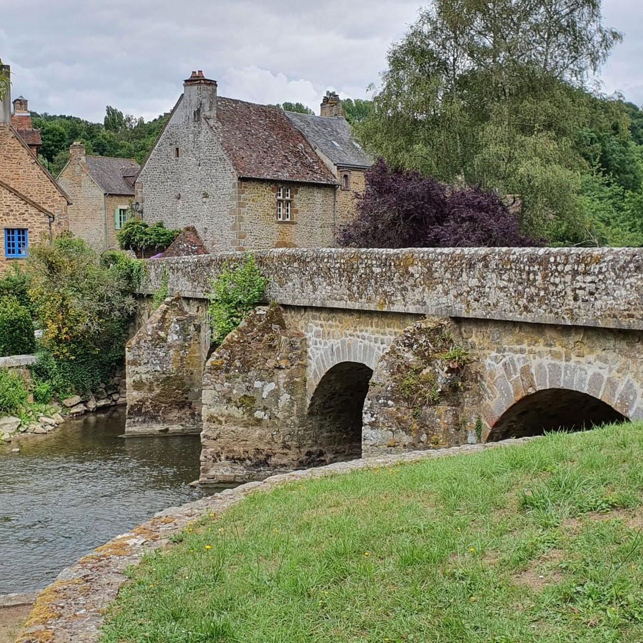
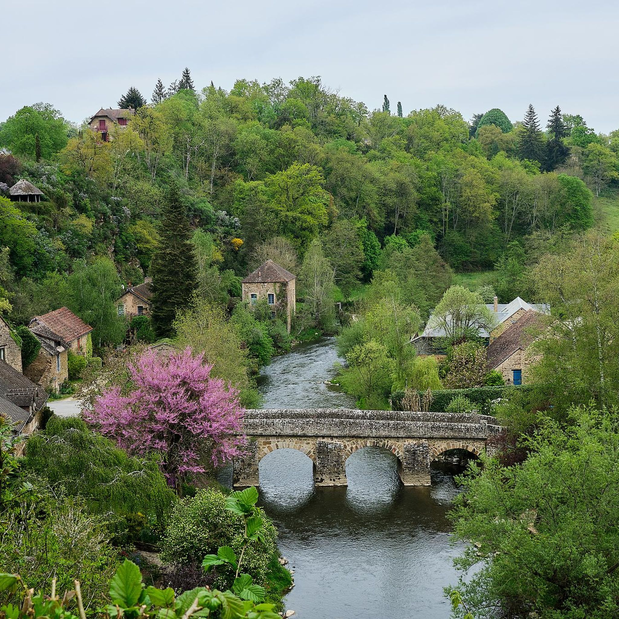
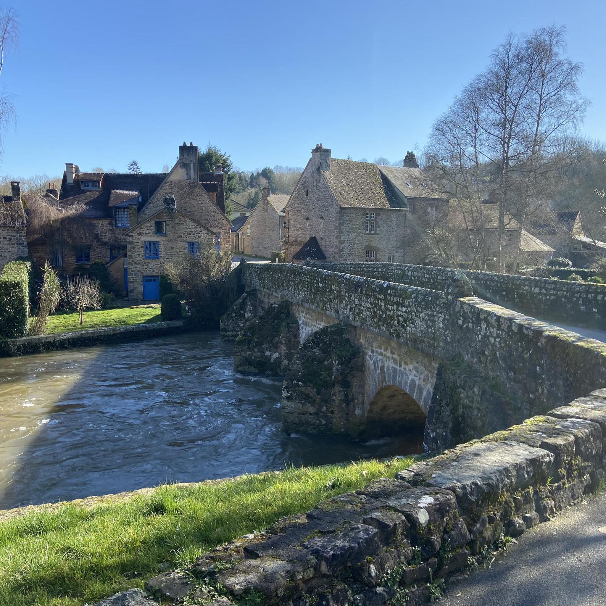
Jogging around Saint-Céneri-Le-Gérei offers an exceptional experience within the Normandy-Maine Regional Nature Park, characterized by its varied terrain. The region features wooded hills, rocky cliffs, and steep river valleys, all embraced by the River Sarthe. These natural features, part of the "Alpes Mancelles," provide a diverse and engaging landscape for running enthusiasts. The area's verdant setting, with old stone houses and a historic stone bridge, creates a picturesque backdrop for active exploration.
Best jogging routes around Saint-Céneri-Le-Gérei
- The most popular jogging route is Trotté par la Corniche Trail, a 3.3 miles (5.2 km) trail that takes 39 minutes to complete. This moderate route offers views over the scenic river valley.
- Another top favourite among local runners is Moulin de Trotté – View of St-Généri-le-Gérei loop from Saint-Léonard-des-Bois, a moderate 6.7 miles (10.8 km) path. This route winds through the natural landscapes of the Alpes Mancelles, offering diverse scenery.
- Local runners also love the Sphinx Rocks – Le Haut Fourché loop from Saint-Léonard-des-Bois, a 6.4 miles (10.3 km) trail leading through wooded areas and past notable rock formations, often completed in about 1 hour 17 minutes.
- Jogging around Saint-Céneri-Le-Gérei is defined by wooded hills, rocky cliffs, and the meandering River Sarthe. The network of routes offers options for various ability levels, from easy paths to more challenging trails.
- The routes in Saint-Céneri-Le-Gérei are highly rated by the komoot community with an average score of 4.4 stars from over 20 reviews. More than 1600 runners have used komoot to explore Saint-Céneri-Le-Gérei's varied terrain.
Last updated: July 7, 2026
9
runners
5.23km
00:39
120m
120m
Moderate run. Good fitness required. Mostly paved surfaces. Suitable for all skill levels.
5.0
(2)
145
runners
Moderate run. Good fitness required. Mostly paved surfaces. Suitable for all skill levels.

Sign up for free
155
runners
Moderate run. Good fitness required. Mostly paved surfaces. Suitable for all skill levels.
3.0
(2)
26
runners
Hard run. Very good fitness required. Mostly paved surfaces. Suitable for all skill levels.
4.0
(1)
20
runners
11.5km
01:27
250m
250m
Moderate run. Good fitness required. Mostly paved surfaces. Suitable for all skill levels.
Get access to more routes and recommendations from other explorers.
Sign up for free
Already have an account?
Our route recommendations are based on thousands of hikes, rides, and runs completed by other people on komoot.
Start today with a free account
Your next adventure awaits.
Login or Signup


Tips from the Community

A truly magnificent landscape
0
0

very varied and pleasant hike
0
0

you have to make an effort to see this! but woo top
0
0

beautiful region
0
0

Very pretty mill, well maintained, which you can admire at the bend of a path.
0
0
Charming city of character. I highly recommend. On the other hand, the positive altitude difference is unavoidable since the village is in a hollow with significant cliffs around it.
0
0

Starting from the center of the village and crossing the bridge to this point, remember to look back and appreciate the view of the village and the church towering above you.
2
0
Starting from the center of the village and crossing the bridge to this point, remember to look back and appreciate the view of the village and the church towering above you.
2
0
Frequently Asked Questions
How many running routes are available around Saint-Céneri-le-Gérei?
There are nearly 200 dedicated running routes around Saint-Céneri-le-Gérei, offering a wide variety of options for all skill levels. Over 1600 runners have already explored these trails using komoot.
What kind of terrain can I expect on jogging trails in Saint-Céneri-le-Gérei?
The terrain in Saint-Céneri-le-Gérei, nestled within the Alpes Mancelles, is quite varied. You can expect a mix of wooded hills, rocky cliffs, and scenic paths along the River Sarthe. This diverse landscape provides an engaging experience for runners, from gentle riverside paths to more challenging ascents.
Are there any easy running routes suitable for beginners or a relaxed jog?
Yes, Saint-Céneri-le-Gérei offers 17 easy running routes perfect for beginners or those seeking a more relaxed pace. These paths typically feature less elevation gain and smoother surfaces, allowing you to enjoy the picturesque scenery without excessive challenge.
Can I find circular running routes in the Saint-Céneri-le-Gérei area?
Absolutely. Many of the running routes in the region are circular, allowing you to start and finish at the same point. For example, the Moulin de Trotté – View of St-Généri-le-Gérei loop from Saint-Léonard-des-Bois is a popular moderate 10.8 km loop, and the Sphinx Rocks – Le Haut Fourché loop from Saint-Léonard-des-Bois offers a 10.3 km circular trail through wooded areas.
What are some notable landmarks or attractions I might see while running?
The region is rich in natural beauty and historical sites. You might encounter the historic stone bridge over the River Sarthe, the tranquil 15th-century Saint-Céneri Chapel, or the 11th-century Romanesque Church of Saint-Céneri-le-Gérei with its ancient frescoes. Natural features like the Rochers du Sphinx are also prominent along some trails.
Are there any viewpoints along the running trails in Saint-Céneri-le-Gérei?
Yes, several routes offer stunning viewpoints. The Trotté par la Corniche Trail provides excellent views over the scenic river valley. Additionally, you can find highlights like the Mont des Avaloirs viewpoint and the Alpes mancelle viewpoint st léonard des bois in the wider area, offering panoramic vistas of the surrounding landscapes.
What do other runners say about the trails in Saint-Céneri-le-Gérei?
The running routes in Saint-Céneri-le-Gérei are highly rated by the komoot community, with an average score of 4.4 out of 5 stars from over 20 reviews. Runners often praise the diverse scenery, the well-maintained paths, and the charming blend of natural beauty and historic village atmosphere.
Are the running routes in Saint-Céneri-le-Gérei suitable for families?
Many of the easier and moderate routes are suitable for families, especially those with older children. The varied terrain and scenic beauty make for an engaging outdoor experience. Look for routes with lower elevation gain and shorter distances if running with younger family members.
Is there parking available near the running trailheads?
Yes, parking is generally available in and around Saint-Céneri-le-Gérei, particularly in the village center and near popular starting points for trails. It's advisable to check specific route details for the most convenient parking options.
What is the best time of year to go jogging in Saint-Céneri-le-Gérei?
Saint-Céneri-le-Gérei is beautiful year-round, but spring and autumn offer particularly pleasant conditions for jogging. The mild temperatures and vibrant colors of the changing foliage make for an ideal running environment. Summer can also be great, especially in the mornings or evenings, to avoid the midday heat.
Are there any longer running trails for experienced runners?
For experienced runners seeking a longer challenge, there are several options. The Saint-Léonard-des-Bois – Saint-Léonard-des-Bois loop from Saint-Céneri-le-Gérei, at 12.6 km, offers a substantial moderate run. Many routes can also be combined or extended to create longer distances through the Alpes Mancelles.
Can I find cafes or places to refresh myself along or near the running routes?
Saint-Céneri-le-Gérei, being one of the 'most beautiful villages of France,' offers charming options for refreshments. You'll find cafes and small eateries in the village center where you can refuel after your run, enjoying the local atmosphere.
Most popular routes around Saint-Céneri-Le-Gérei
Most popular attractions around Saint-Céneri-Le-Gérei

Get inspired with the komoot mobile app


Explore more
Browse the best Running Trails & Routes in other regions.
