The best cycling routes around Louzac-Saint-André
4.3
(307)
1,939
riders
121
rides
Touring cycling around Louzac-Saint-André offers a network of over 100 routes through the Charente countryside. The region is characterized by rolling hills, river valleys, and agricultural landscapes, providing varied terrain for cyclists. Routes often traverse vineyards and connect charming villages, with elevations ranging from gentle inclines to more challenging ascents.
Best touring cycling routes around Louzac-Saint-André
- The most popular touring cycling route is Port of the Lys – Crouin bridge loop from Saint-Laurent-de-Cognac, an 18.1 miles (29.1 km) trail…
Last updated: October 5, 2026
4.8
(12)
84
riders
96.9km
06:53
470m
470m
Hard bike ride. Very good fitness required. Mostly paved surfaces. Suitable for all skill levels.
4.7
(3)
31
riders
22.0km
01:20
80m
80m
Easy bike ride. Great for any fitness level. Mostly paved surfaces. Suitable for all skill levels.

47
riders
42.3km
03:31
360m
360m
Moderate bike ride. Good fitness required. Mostly paved surfaces. Suitable for all skill levels.
3.3
(3)
19
riders
24.8km
01:37
270m
270m
Moderate bike ride. Good fitness required. Mostly paved surfaces. Suitable for all skill levels.
5.0
(2)
18
riders
30.9km
02:48
340m
340m
Hard bike ride. Good fitness required. You may need to push your bike for some segments of this route.
Get access to more routes and recommendations from other explorers.
Already have an account?
Our route recommendations are based on thousands of hikes, rides, and runs completed by other people on komoot.
Start today with a free account
Your next adventure awaits.




Tips from the Community

🏛️ Construction: 18-19 AD The arch was built around 18-19 AD, during the reign of Emperor Tiberius. It stood at the entrance to the Roman bridge crossing the Charente, at the outlet of the Via Agrippa, which connected Lyon to Saintes. It is therefore not truly a "triumphal arch": it was both a road monument and a monumental gate marking the entrance to Mediolanum Santonum, the capital of Roman Aquitaine. 👤 Who had it built? The arch was financed by Caius Julius Rufus, a Romanized notable from Saintonge. He dedicated it to Tiberius as well as his nephew Germanicus. The inscriptions engraved on the entablature still allow us today to know the figures to whom it was dedicated. The name "Arch of Germanicus" therefore comes from this dedication, and not from the fact that Germanicus personally had the arch built or crossed it. 🏗️ A rather exceptional monument The arch has two bays, likely allowing for the differentiation of traffic flows. It measures approximately 15 m high by 16 m wide. Its Corinthian and composite capitals bear witness to particularly meticulous Roman architecture. It constituted a true demonstration of the power and Romanization of Saintes. ⚠️ The moment the arch almost disappeared This is probably the most interesting episode in its history. For centuries, the arch was always located at the level of the Roman bridge and then the medieval bridge, on the right bank of the Charente. In the 19th century, the old bridge had become dilapidated. When it was decided to demolish it, around 1843, the arch was also threatened with destruction. It was then that Prosper Mérimée, Inspector General of Historical Monuments, intervened. He advocated for its preservation and arranged for its dismantling, relocation, and reassembly on the new bank. Another figure is also associated with this preservation: Victor Hugo, who stayed in Saintes in September 1843 and intervened in favor of the monument's conservation with Mérimée. 📍 Why is the arch no longer exactly in its ancient location? The arch we see today, on Place Bassompierre, is therefore no longer in its original location. It was moved a few dozen meters during the transformation of the quays and the disappearance of the old bridge. It was dismantled stone by stone and then reassembled in order to preserve it. It is now located in the immediate vicinity of the ancient Roman bridge crossing. 🏛️ Protection The Arch of Germanicus was finally classified as a historical monument in July 1905. An interesting detail The Crazannes quarries, located near Saintes, supplied a limestone widely used in the region's ancient constructions. Crazannes stone was notably used for monuments such as the Arch of Germanicus. In summary: 18-19 → construction of the arch at the entrance to the Roman bridge ↓ Antiquity → Middle Ages → the arch remains associated with the crossing of the Charente ↓ 1843 → demolition of the old bridge and threat to the arch ↓ 1843-1844 → Mérimée's intervention and relocation of the arch ↓ 1905 → classified as a Historical Monument
0
0


The original construction of the bridge was carried out from 1876 to 1878 by the contractors Chaumont and Bonnamy; the bridge was rebuilt in concrete in the second half of the 19th century
0
0

On the banks of the Charente, the Château de Cognac symbolizes the town's reputation. Today a Cognac House, it welcomes visitors to help them discover its history, but also that of the eaux-de-vie produced there.
0
0

Chesnel Castle, which has the appearance of a fortified castle, is intriguing. However, the niches here have a purely decorative function. The architecture of this building, erected in 1610, is therefore rather original. You can visit the castle by making an appointment via this link: https://patrivia.net/visit/chateau-chesnel
0
0

Cognac is a beautiful, wealthy town where the future François 1st was born (hence the house of the same name). This wealth comes mainly from the pineau and cognac trade… It was in the 15th century that this distillation process appeared to better preserve these wines which were sent throughout Europe and in particular to the countries of the Hanseatic League where this "burnt wine", brandevin or brandy is very appreciated, most often cut off from water. In Cognac, the Henessy, Rémy Martin, Courvoisier and Martell houses have numerous buildings. I also passed in a town next to an old building used as a cellar, a very pleasant smell emanated from it.
2
0

A small bridge over the Etier de Rousson which leads to La Charente. It is on the V92 cycle path.
2
0
Frequently Asked Questions
How many touring cycling routes are available in Louzac-Saint-André?
There are over 100 touring cycling routes around Louzac-Saint-André, offering a wide variety of options for different skill levels and preferences. The komoot community has explored more than 116 routes in the area.
What is the best time of year for touring cycling in Louzac-Saint-André?
The spring and autumn months are generally ideal for touring cycling in Louzac-Saint-André. The weather is typically mild, and the vineyards offer beautiful scenery, whether in bloom or during harvest. Summer can also be pleasant, especially in the mornings or late afternoons, though it can get warm.
Are there easy touring cycling routes suitable for beginners or families?
Yes, Louzac-Saint-André offers 36 easy touring cycling routes perfect for beginners or families. These routes typically feature gentle elevation changes and often follow riverine paths or quiet country roads. An example is the Crouin bridge – Port of the Lys loop from Saint-Laurent-de-Cognac, which is 10.3 miles (16.6 km) long with minimal elevation gain.
Are there challenging touring cycling routes for experienced cyclists?
For experienced cyclists seeking a challenge, there are 15 difficult touring cycling routes around Louzac-Saint-André. These routes often include more significant elevation gains and longer distances, winding through varied landscapes. A notable option is the Pont de L'Antenne loop from Richemont, a 20.3 miles (32.6 km) path with substantial climbs.
What kind of landscapes can I expect on touring cycling routes around Louzac-Saint-André?
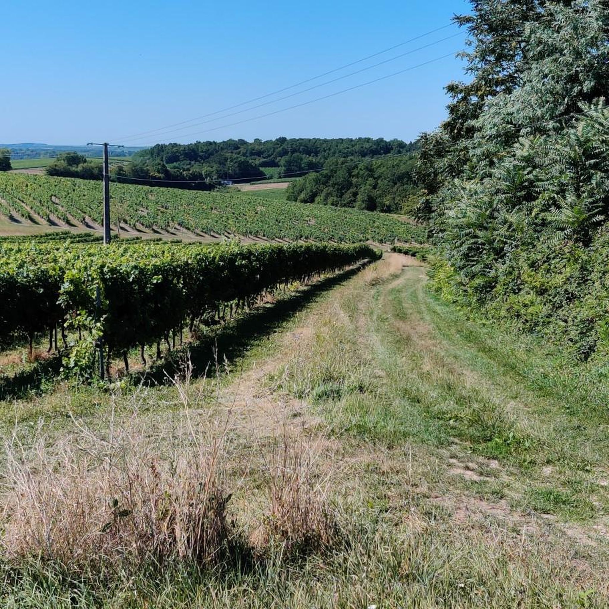
Touring cycling routes in Louzac-Saint-André traverse the picturesque Charente countryside. You can expect rolling hills, tranquil river valleys, and extensive agricultural landscapes, including numerous vineyards. Routes often connect charming villages, offering a blend of natural beauty and cultural sights.
Are there any touring cycling routes that pass by interesting historical sites or landmarks?
Many routes in the region offer glimpses of historical sites and landmarks. For example, the Cognac Castle – Hennessy Distillery loop from Cherves-Richemont passes by significant cultural points. You might also encounter highlights such as Abbaye de Fontdouce or Gademoulin Castle in Gensac-la-Pallue, which are part of the broader attractions in the area.
Can I find circular touring cycling routes in the area?
Yes, many touring cycling routes around Louzac-Saint-André are designed as circular loops, allowing you to start and end at the same point. Examples include the popular Port of the Lys – Crouin bridge loop from Saint-Laurent-de-Cognac and the Bike loop from Chérac.
Are touring cycling routes around Louzac-Saint-André dog-friendly?
While many outdoor routes in the region are generally dog-friendly, it's important to keep your dog on a leash, especially when passing through villages, near livestock, or on roads. Always ensure your dog is well-behaved and that you carry water for them. Check specific route details for any restrictions.
Is parking available near touring cycling routes in Louzac-Saint-André?
Yes, parking is generally available in or near the villages that serve as starting points for many touring cycling routes. Look for public parking areas in towns like Saint-Laurent-de-Cognac, Richemont, or Chérac. These spots often provide convenient access to the trails.
What do other touring cyclists say about the routes in Louzac-Saint-André?
The touring cycling routes in Louzac-Saint-André are highly regarded by the komoot community, with an average rating of 4.3 stars from nearly 300 reviews. Cyclists often praise the peaceful countryside, the well-maintained paths, and the charming villages encountered along the way.
Are there touring cycling routes with cafes or places to stop for refreshments?
Yes, many touring cycling routes around Louzac-Saint-André pass through or near charming villages where you can find cafes, bakeries, or small restaurants. These provide excellent opportunities to stop for a coffee, a snack, or a meal, allowing you to refuel and experience local hospitality.
What is the typical length of touring cycling routes around Louzac-Saint-André?
The lengths of touring cycling routes vary significantly. You can find shorter routes, such as the Crouin bridge – Port of the Lys loop from Saint-Laurent-de-Cognac at 10.3 miles (16.6 km), to longer options like the Bike loop from Chérac, which is 27.8 miles (44.8 km) long.
Most popular routes around Louzac-Saint-André
Most popular attractions around Louzac-Saint-André

Get inspired with the komoot mobile app


Explore more
Browse the best Cycling routes in other regions.
