The best walks and hikes around Saint-Georges-Nigremont
4.6
(26)
124
hikers
26
hikes
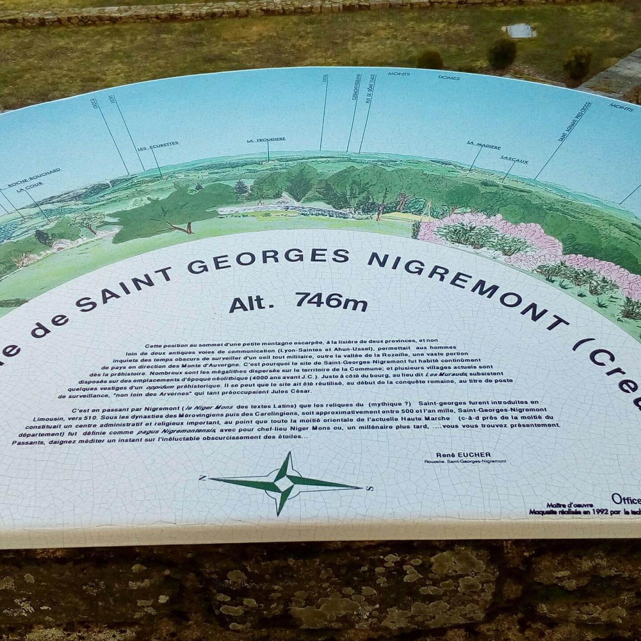
Hiking around Saint-Georges-Nigremont offers exploration of a region characterized by its elevated position, granite landscapes, and preserved natural environment. The village itself is perched at 746 meters, providing panoramic views of the Crocq region and the Monts d'Auvergne. This "King Granite" country features abundant granite formations, rocky chaos, and gorges, particularly along the Rozeille river. The area is also part of or near the Millevaches Regional Natural Park, ensuring a green and wooded terrain for hikers.
Best hiking trails around…
Last updated: July 11, 2026
4.0
(3)
8
hikers
15.0km
04:07
230m
230m
Hike the moderate 9.3-mile Crocq loop in Millevaches Regional Natural Park, exploring historical towers and diverse landscapes.
5.0
(1)
10
hikers
11.7km
03:10
160m
160m
Moderate hike. Good fitness required. Easily-accessible paths. Suitable for all skill levels.

Sign up for free
4.7
(3)
13
hikers
6.65km
01:52
130m
130m
Easy hike. Great for any fitness level. Easily-accessible paths. Suitable for all skill levels.
5.0
(1)
8
hikers
5.15km
01:29
130m
130m
Easy hike. Great for any fitness level. Easily-accessible paths. Suitable for all skill levels.
4.7
(6)
9
hikers
9.27km
02:41
240m
240m
Moderate hike. Good fitness required. Easily-accessible paths. Suitable for all skill levels.
Get access to more routes and recommendations from other explorers.
Sign up for free
Already have an account?
Our route recommendations are based on thousands of hikes, rides, and runs completed by other people on komoot.
Start today with a free account
Your next adventure awaits.
Login or Signup


Tips from the Community

This medieval bridge, known as the 'Soubre Bridge' and made up of four arches, those at the ends in a semi-circular arch, the other two in a pointed arch, bears the name of a tapestry manufacturer whose workshops were located nearby. In the 16th century, Felletin was a prosperous town which saw the development of a significant number of industries: flour milling, tanning, paper milling, dyeing, etc. The river provided the energy necessary for the operation of the numerous mills. Next to the bridge, we notice the toll terminal symbolizing the duty that had to be paid to bring certain goods and foodstuffs into the city. Listed as a Historic Monument in 1926. Source: https://www.tourisme-creuse.com/
0
0

These two impressive towers are what remains of a 12th century castle. From there, you enjoy a panoramic view of the Limousin and Auvergne regions. You can also discover the restoration work and the history of the castle on the site which is open from March to October.
2
0

Medieval bridge bearing the name of an upholsterer from Felletin and listed as a Historic Monument.
1
0
Remains of a 12th century fortified castle. At the top of the towers, we discover a very beautiful view of the Limousin and the Puys d'Auvergne. Two exhibition halls to visit. Admission costs €2. Open from March to October.
2
0
Frequently Asked Questions
How many hiking trails are available around Saint-Georges-Nigremont?
There are over 20 hiking trails in the Saint-Georges-Nigremont area, offering a range of options from easy walks to more challenging routes. You'll find 9 easy, 14 moderate, and 1 difficult trail to explore.
What kind of terrain and landscapes can I expect on hikes around Saint-Georges-Nigremont?
Hikes around Saint-Georges-Nigremont are characterized by the region's 'King Granite' country, featuring abundant granite formations, rocky chaos, and gorges, particularly along the Rozeille river. The area's elevated position, with the village itself at 746 meters, provides exceptional panoramic views. You'll also experience preserved, green, and wooded natural environments, as the region is near or within the Millevaches Regional Natural Park.
Are there easy hiking trails suitable for beginners or families?
Yes, Saint-Georges-Nigremont offers 9 easy hiking trails perfect for beginners or families. One such option is the Dolmen and keep – Point de vue sur Crocq loop from Crocq, a 4.2-mile (6.8 km) trail that takes about 1 hour 54 minutes to complete.
What are some notable viewpoints or natural features to look out for on the trails?
The region is rich in natural beauty. From the village's elevated position on the Nigremont, you can enjoy panoramic views of the Crocq region and the Monts d'Auvergne. The 'King Granite' country means you'll encounter unique rock formations and gorges. For a specific viewpoint, consider the Vue sur crocq – Dolmen and keep loop from Crocq, which offers views towards Crocq.
Are there any circular hiking routes in the area?
Yes, many of the trails around Saint-Georges-Nigremont are circular, allowing you to start and end at the same point. Examples include the Vue sur crocq – Dolmen and keep loop from Crocq and the Dolmen and keep – Point de vue sur Crocq loop from Crocq.
What do other hikers enjoy most about hiking in Saint-Georges-Nigremont?
The hiking routes in Saint-Georges-Nigremont are highly rated by the komoot community, with an average score of 4.4 stars from over 20 reviews. Hikers often praise the panoramic views, the distinctive granite rock formations, and the preserved, wooded natural environment that defines the area.
Are the hiking trails around Saint-Georges-Nigremont dog-friendly?
Generally, dogs are welcome on trails in the Creuse department, including around Saint-Georges-Nigremont. However, it's always recommended to keep your dog on a leash, especially in areas with livestock or protected wildlife, and to clean up after them. Specific rules may apply within the Millevaches Regional Natural Park, so check local signage.
What attractions or landmarks can I see near the hiking trails?
Beyond the natural landscapes, you can discover several interesting points. The village itself boasts well-preserved built heritage, including the Saint Georges Church and terraced gardens. Nearby attractions include the Roby bridge, the Felletin Historic Center, and the Saint-Georges Nigremont Promontory for its views. You might also encounter historical sites like the Gallo-Roman Villa of Maisonnières.
Is there parking available near the hiking trailheads in Saint-Georges-Nigremont?
While specific parking details for every trailhead are not always available, Saint-Georges-Nigremont is a rural commune, and parking is generally accessible in or near the village center and at common starting points for popular routes. It's advisable to check local maps or information boards upon arrival for designated parking areas.
What is the best time of year to go hiking in Saint-Georges-Nigremont?
The region is beautiful throughout the warmer months. Spring and autumn offer pleasant temperatures and vibrant scenery, with spring bringing lush greenery and autumn showcasing colorful foliage. Summer is also suitable, though it can be warmer. Winter hiking is possible but may require appropriate gear for colder conditions.
Are there any cafes or places to eat near the hiking routes?
Saint-Georges-Nigremont is a small commune, but you can find local amenities. For a wider selection of cafes, pubs, and restaurants, you might need to visit slightly larger nearby towns. It's always a good idea to pack snacks and water for your hike, especially on longer routes.
What is the longest moderate hike available in the area?
One of the longer moderate hikes is the Trail of Stones and Valleys, which spans 9.3 miles (15.0 km) and typically takes around 4 hours and 7 minutes to complete. This route navigates through the region's distinctive granite formations and varied topography.
Most popular routes around Saint-Georges-Nigremont
Most popular attractions around Saint-Georges-Nigremont

Get inspired with the komoot mobile app


Explore more
Browse the best Hikes in other regions.
