The best MTB trails around Sous-Parsat
4.1
(30)
713
riders
32
rides
Mountain biking around Sous-Parsat offers diverse terrain within the Creuse department, characterized by tranquil countryside, rolling hills, and wooded reliefs. The region features a network of trails winding through dense forests and open meadows, with an abundance of lakes and streams. This natural environment provides varied mountain biking terrain, from gentle paths to more technical descents, suitable for different skill levels. The area's "wild" landscapes include rural roads and single tracks, making it a destination for exploring the wider Creuse region.
Best mountain bike trails around Sous-Parsat
- The most popular mountain bike trail is Wolves of Chabrières – View from Puy de Chiroux loop from Peyrabout, a 26.8 miles (43.1 km) trail that takes 3 hours 40 minutes to complete. This route features rolling hills and offers panoramic views from Puy de Chiroux.
- Another top favourite among local mountain bikers is Pierre La Grosle loop from Saint-Christophe, a moderate 11.2 miles (18.1 km) path. This trail winds through tranquil countryside, wooded reliefs, and meadows.
- Local mountain bikers also love the Sainte-Feyre loop from Peyrabout, a 17.7 miles (28.5 km) trail leading through dense forests and rolling hills, often completed in about 2 hours 22 minutes.
- Mountain biking around Sous-Parsat is defined by rolling hills, dense forests, and varied single tracks. The network offers options for different ability levels, from family-friendly rides to more challenging routes.
- The routes in Sous-Parsat are highly rated by the komoot community with an average score of 4.1 stars from over 29 reviews. More than 778 mountain bikers have used komoot to explore Sous-Parsat's varied terrain.
Last updated: June 27, 2026
4.8
(9)
66
riders
51.3km
04:17
980m
980m
Hard mountain bike ride. Very good fitness required. Suitable for all skill levels.
5.0
(5)
22
riders
28.7km
02:23
500m
500m
Moderate mountain bike ride. Good fitness required. Suitable for all skill levels.

Sign up for free
3.0
(2)
10
riders
37.7km
02:59
510m
500m
Moderate mountain bike ride. Good fitness required. Suitable for all skill levels.
11
riders
15.3km
01:23
310m
310m
Moderate mountain bike ride. Good fitness required. Suitable for all skill levels.
12
riders
33.1km
03:04
770m
770m
Moderate mountain bike ride. Good fitness required. Suitable for all skill levels.
Get access to more routes and recommendations from other explorers.
Sign up for free
Already have an account?
Our route recommendations are based on thousands of hikes, rides, and runs completed by other people on komoot.
Start today with a free account
Your next adventure awaits.
Login or Signup
Tips from the Community

First aid station, water point, restaurant
0
0


La Grosle or Graule is a granite group of two blocks. Their superposition in a precarious balance is surrounded by a legend. The crows would come there to celebrate their engagement, hence the name of the site taken from the dialect word for crows.
0
0
Located in the heart of the Chabrières forest, this animal park is dedicated to the wolf. It accommodates around forty specimens in semi-freedom in its natural space.
0
0
The historic character of the place makes Puy Gaudy unique. Inhabited since prehistoric times, the puy offers a strategic position. Today there are still some traces of the oppidum, notably the ruins of a mill and granite sarcophagi. Another interest, the splendid 360 degree view rewards the effort made to climb up here.
0
0
It is a granite chaos. It takes its name from the shape of these large stones. They would have served as a refuge for peasants who wanted to escape the Russian countryside under Napoleon. On site, an orientation table gives you information to appreciate the panorama. Access via the coniferous forest also offers a splendid setting.
0
0
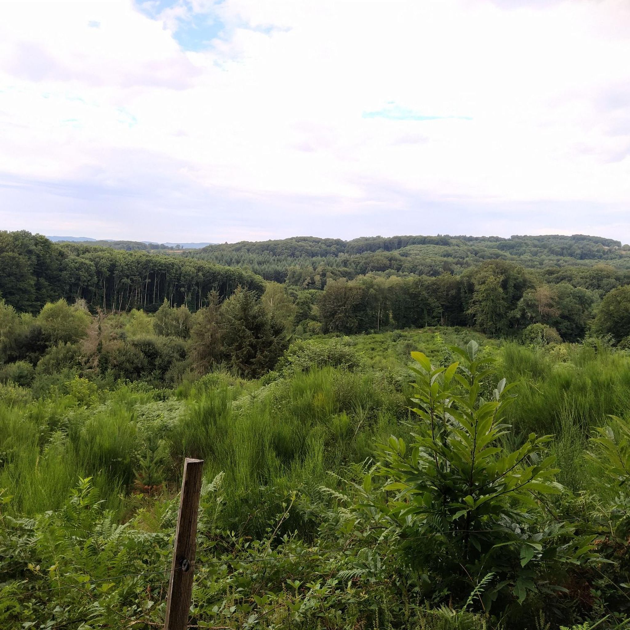
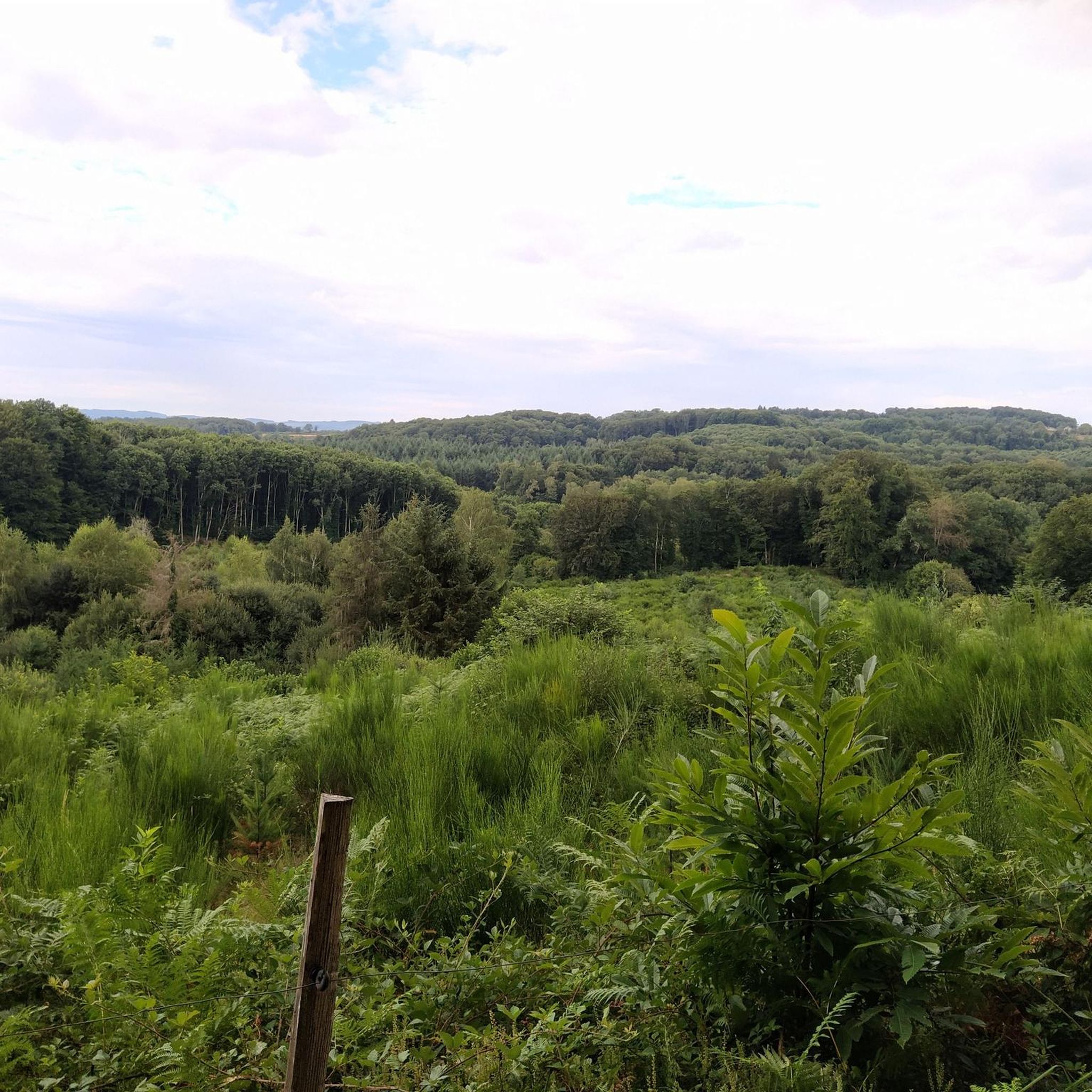
Excellent panoramic view of the Guéret countryside from this north face of Maupuy. On the right, we can see Guéret and the Courtille pond, Saint-Sulpice in the center and Saint-Vaury further to the west.
0
0
Frequently Asked Questions
How many mountain bike trails are available around Sous-Parsat?
There are over 30 mountain bike trails around Sous-Parsat listed on komoot, offering a variety of experiences for different skill levels. The wider Creuse department boasts over 2,300 km of marked mountain bike trails across 37 circuits.
What is the typical terrain like for mountain biking near Sous-Parsat?
The terrain around Sous-Parsat is characterized by tranquil countryside, rolling hills, and wooded reliefs. You'll find a mix of dense forests, open meadows, rural roads, and single tracks. The region's 'wild' landscapes provide varied riding, from gentle paths to more technical descents with significant elevation changes.
Are there mountain bike trails suitable for beginners or families?
Yes, Sous-Parsat offers trails suitable for various abilities, including easier options. For example, the region's network includes routes that wind through tranquil countryside and meadows, which can be less demanding. While specific 'family-friendly' routes are not explicitly detailed, the presence of easier trails suggests suitable options for those looking for a less challenging ride.
What kind of natural features or landmarks can I expect to see while mountain biking?
The region is rich in natural beauty. You can expect to encounter lush forests, rolling hills, and an abundance of lakes and streams. Notable attractions include the Wolves of Chabrières forest and viewpoints like Puy du Gaudy. The wider Creuse region also features impressive waterfalls like the Cascade du Saut de la Veuve and the Cascade de Chabannes, and the significant Lake Vassivière is approximately 29 km away.
Are there any circular mountain bike routes around Sous-Parsat?
Yes, many of the mountain bike routes around Sous-Parsat are designed as loops. For instance, you can explore the Pierre La Grosle loop from Saint-Christophe, which offers a moderate 18.1 km ride through tranquil countryside, or the longer Sous-Parsat Church loop from Fransèches, covering nearly 40 km.
What do other mountain bikers enjoy most about the trails in Sous-Parsat?
The mountain bike trails around Sous-Parsat are highly rated by the komoot community, with an average score of 4.1 stars from over 29 reviews. Riders often praise the varied terrain, which includes rolling hills, dense forests, and diverse single tracks, providing options for different ability levels and scenic views.
What is the best time of year to go mountain biking in Sous-Parsat?
The Creuse region, including Sous-Parsat, offers pleasant conditions for mountain biking through much of the year. Spring and autumn generally provide comfortable temperatures and beautiful scenery with changing foliage. Summer is also popular, though trails might be busier. Winters can be colder, but the region's 'wild' landscapes can offer a unique experience for those prepared for cooler weather.
Are there any challenging mountain bike trails for experienced riders?
Yes, the area provides challenging routes for experienced mountain bikers. For example, the Gartempe River loop from Savennes is rated as 'difficult' and features significant elevation changes. The wider Creuse department also includes areas like the Monts de Guéret, known for over 700 km of marked trails, some of which are technical and demanding.
Can I bring my dog on the mountain bike trails?
While the region's natural environment is generally welcoming, specific rules regarding dogs on mountain bike trails can vary. It's always best to check local signage or with local tourism offices for any restrictions, especially in protected natural areas or private lands. Generally, dogs on a leash are often permitted on public trails, but responsible pet ownership is encouraged.
Where can I find information about parking or public transport for mountain biking in Sous-Parsat?
Specific parking areas for individual trailheads are not detailed in the guide. However, Sous-Parsat is a small village, and parking is generally available within or near the village center. For public transport, options might be limited to regional bus services connecting to larger towns. It's advisable to check local transport schedules if you plan to rely on public transport to reach Sous-Parsat.
Are there any long-distance mountain biking routes in the wider Creuse region?
Yes, the Creuse department is home to the notable Grande Traversée de la Creuse (GT 23), a long-distance itinerary designed for itinerant mountain biking. This route offers an immersive experience, combining rural roads, forest single tracks, and stunning panoramic views across the region, including areas like the Monts de Guéret. More information can be found on the Creuse Tourism website.
What are some of the longer mountain bike routes available?
For those seeking longer rides, the Wolves of Chabrières – View from Puy de Chiroux loop from Peyrabout is a substantial 43.1 km trail. Another option is the Sainte-Feyre loop from Peyrabout, which covers 28.5 km and leads through dense forests and rolling hills.
Most popular attractions around Sous-Parsat

Get inspired with the komoot mobile app


Explore more
Browse the best MTB trails in other regions.
