The best running trails around Saint-Palais-Sur-Mer
4.5
(57)
4,471
runners
51
runs
Jogging around Saint-Palais-Sur-Mer offers a variety of coastal and inland running experiences. The region is characterized by its Atlantic coastline, featuring sandy beaches, small coves, and low cliffs. Running routes often traverse coastal paths, providing views of the ocean and access to natural areas. The terrain is generally flat to gently undulating, with minimal elevation changes, making it suitable for various fitness levels.
Best jogging routes around Saint-Palais-Sur-Mer
- The most popular jogging route is Conche de Nauzan – Conche de Gilet loop from Saint-Palais-sur-Mer, a 6.5 miles (10.5 km) trail that takes 1 hour 6 minutes to complete. This moderate route offers scenic views of the coastal coves.
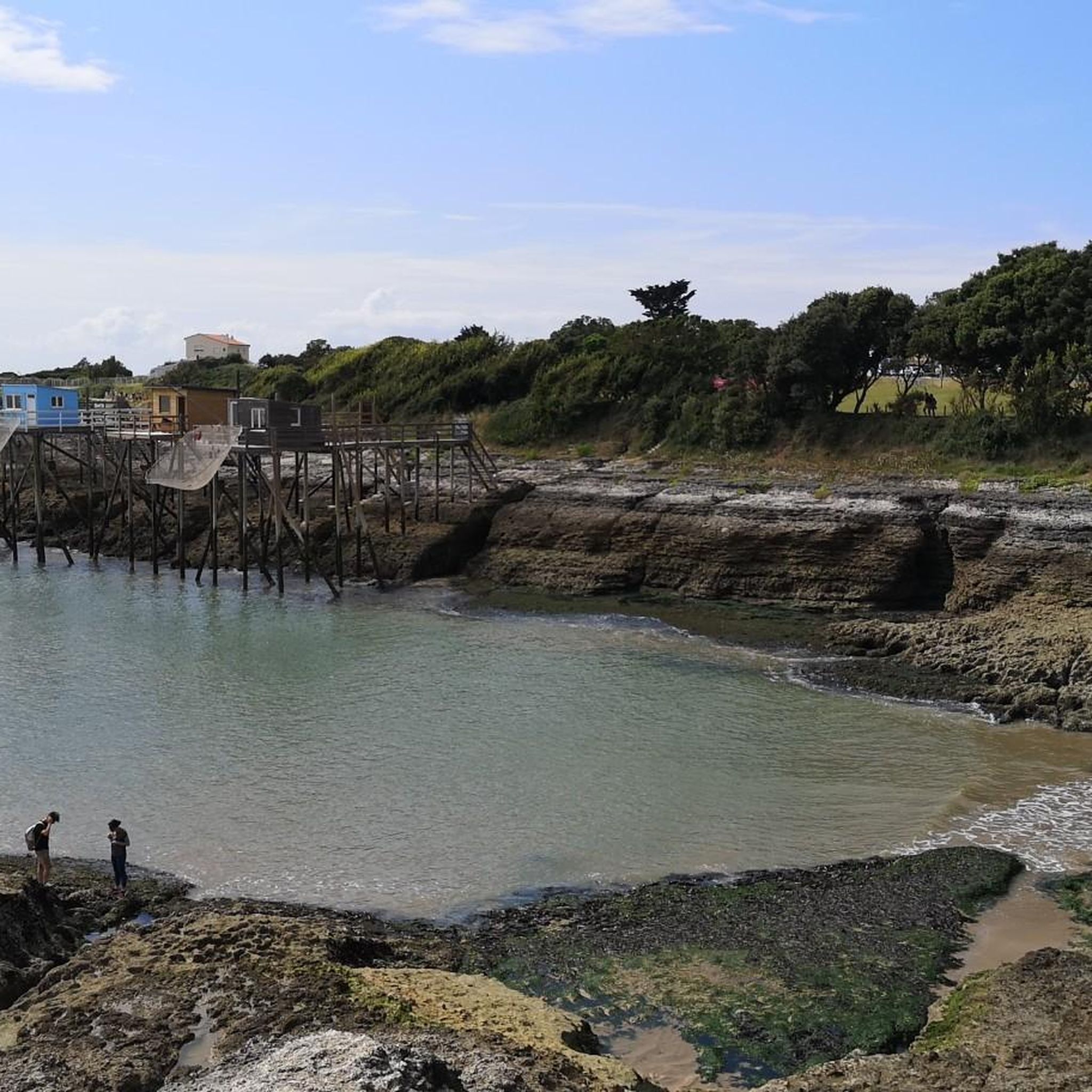
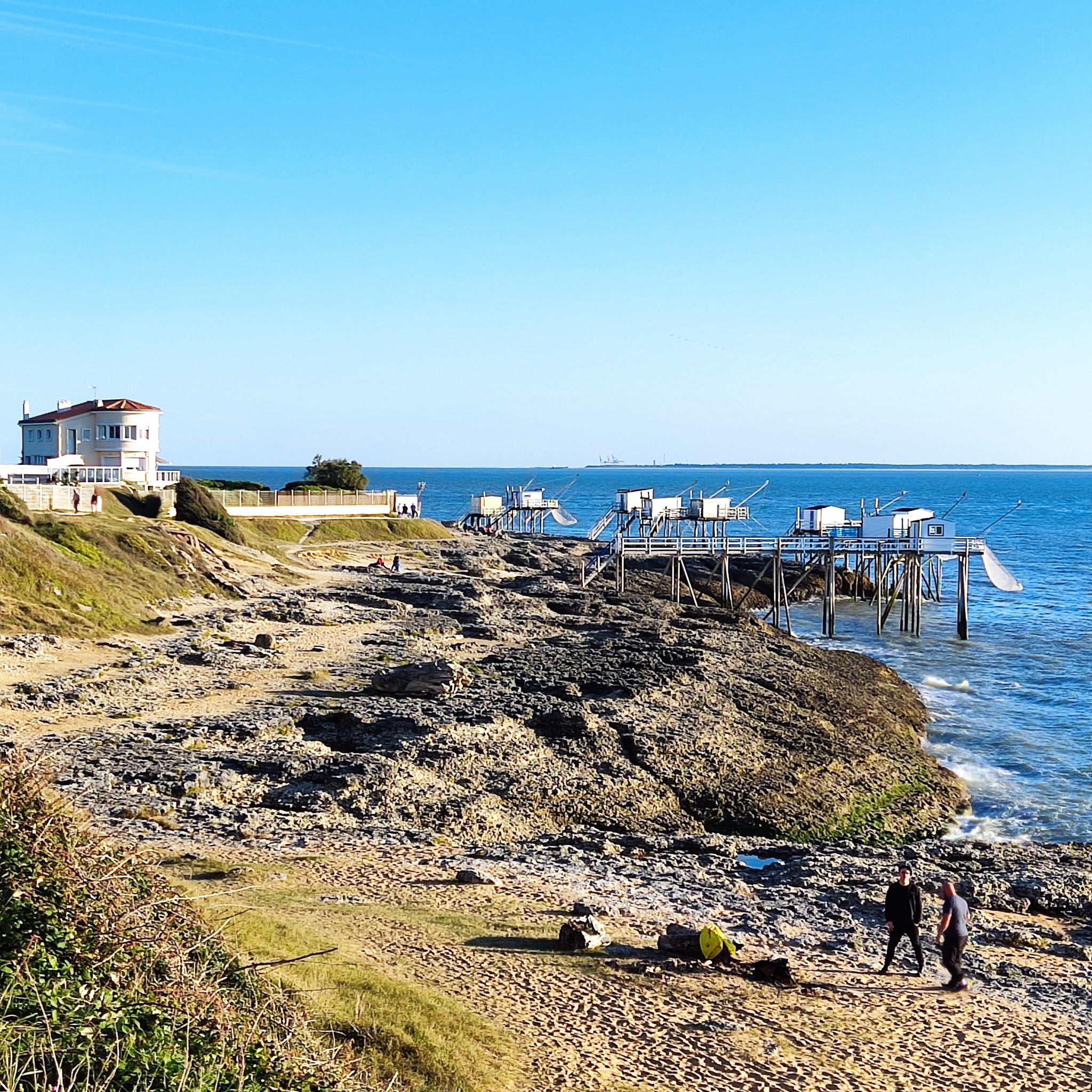
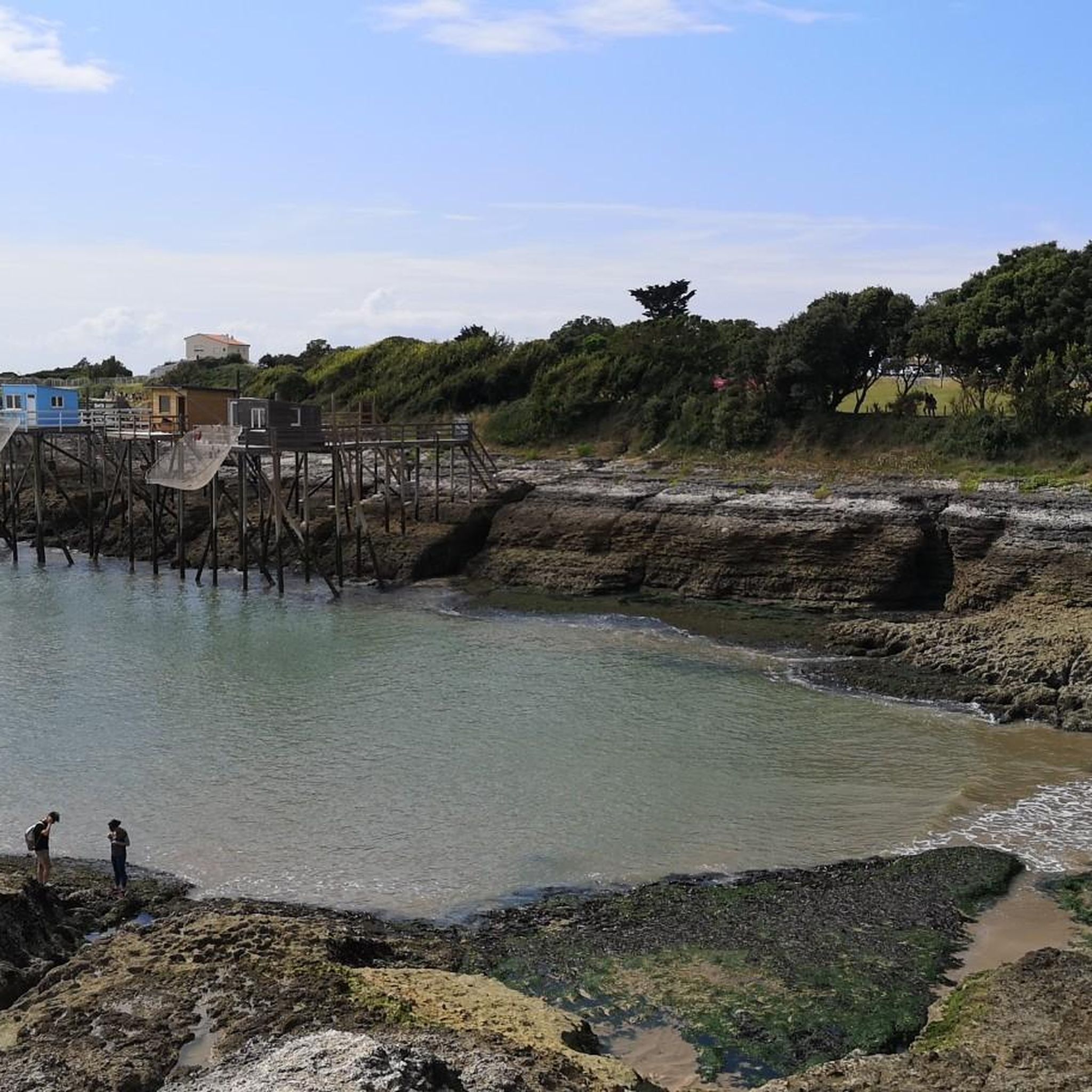
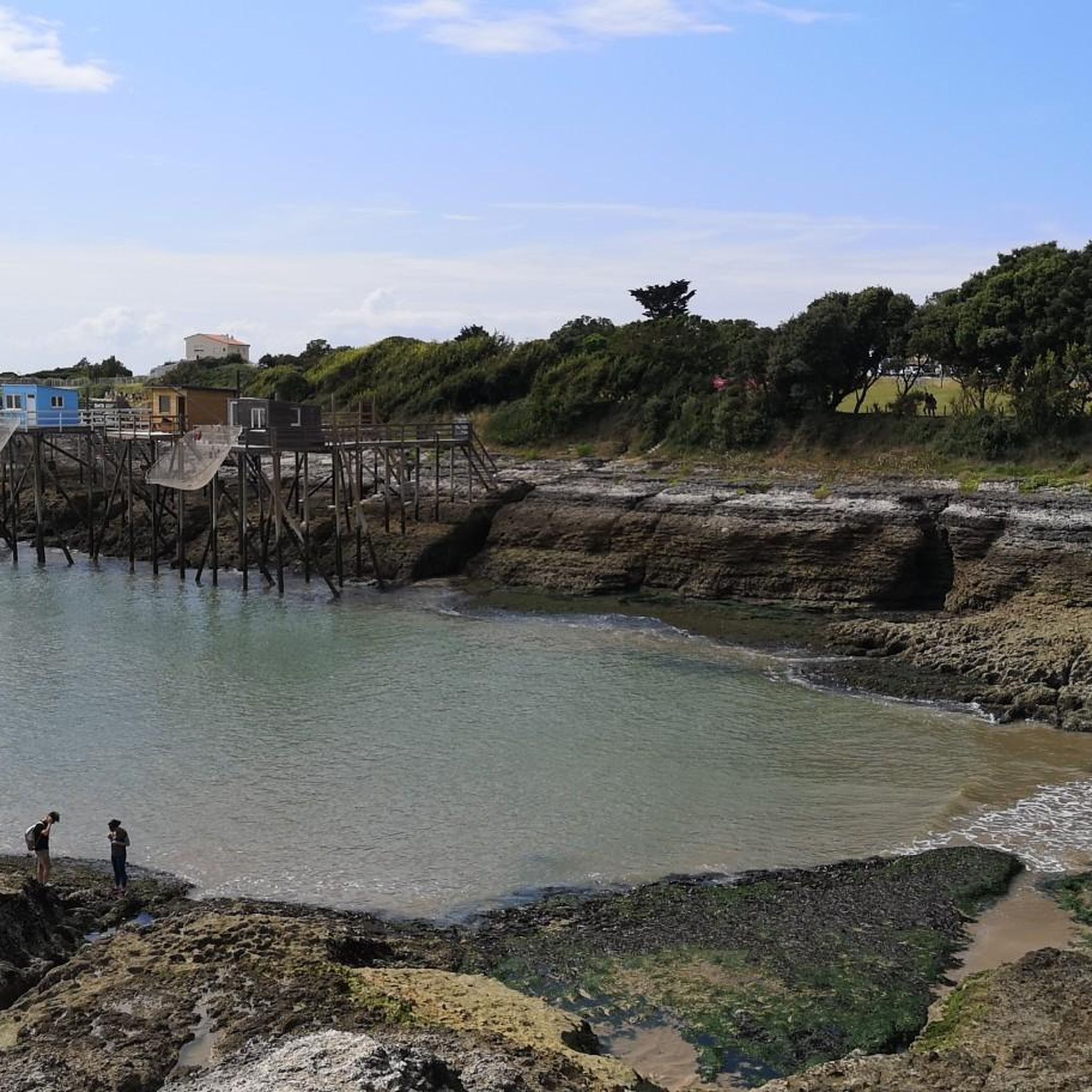
- Another top favourite among local runners is Fisheries or Carrelets – Grande Côte Beach loop from Saint-Palais-sur-Mer, a moderate 7.1 miles (11.4 km) path. This route features traditional fishing huts and stretches along the Grande Côte Beach.
- Local runners also love the Promenade des Deux Phares – Côte sauvage loop from Phare de Terre-Nègre, an 11.0 miles (17.7 km) trail leading through coastal landscapes and past lighthouses, often completed in about 1 hour 53 minutes.
- Jogging around Saint-Palais-Sur-Mer is defined by coastal paths, sandy beaches, and natural coves. The network offers options for different ability levels, from easy jogging routes to more challenging long-distance runs.
- The routes in Saint-Palais-Sur-Mer are highly rated by the komoot community with an average score of 4.4 stars from over 50 reviews. More than 3000 runners have used komoot to explore Saint-Palais-Sur-Mer's varied terrain.
Last updated: June 27, 2026
4.9
(13)
705
runners
10.8km
01:08
60m
60m
Moderate run. Good fitness required. Mostly paved surfaces. Suitable for all skill levels.
4.6
(7)
474
runners
Moderate run. Good fitness required. Mostly paved surfaces. Suitable for all skill levels.

Sign up for free
174
runners
Hard run. Very good fitness required. Mostly paved surfaces. Suitable for all skill levels.
116
runners
20.5km
02:23
110m
110m
Hard run. Very good fitness required. Mostly accessible paths. Some sure footedness required.
4.8
(4)
295
runners
Moderate run. Good fitness required. Mostly paved surfaces. Suitable for all skill levels.
Get access to more routes and recommendations from other explorers.
Sign up for free
Already have an account?
Our route recommendations are based on thousands of hikes, rides, and runs completed by other people on komoot.
Start today with a free account
Your next adventure awaits.
Login or Signup

Tips from the Community

The puits de l’Auture is an emblematic natural site located in Puits de l’Auture, north of the commune of Saint-Palais-sur-Mer. Its name often intrigues, and its history blends geology, local traditions, and maritime observation. 🌊 Origin and formation The puits de l’Auture is not a man-made well, but a natural formation: It is a cavity carved into the limestone rock by marine erosion. Under the effect of waves and infiltrations, the rock gradually collapsed, forming a sort of vertical chasm open to the sea. During strong swells or tides, water rushes in violently, creating spectacular eddies. 📜 Origin of the name The term “Auture” probably comes from Old French or the local dialect: It could derive from “hauteur” (height) or “autre” (other), evoking a high or separate place. Another hypothesis suggests a deformation of an old word related to a natural cavity or opening. No completely certain origin has been formally established, which adds to the mystery of the place. ⚓ Local historical role The site has had several uses or functions over time: 👀 Observation point Located on the rocky cornice, it served as a natural observation post to monitor the sea. Locals and fishermen could spot boats, storms, or dangers. 🎣 Fishing activities As elsewhere on the coast of Royan, particularly near the famous carrelets (fishing huts on stilts), the area was frequented by fishermen. The rocks around the well allowed for shore fishing or line fishing. 🌿 A remarkable natural site Today, the puits de l’Auture is mainly: A popular walking spot along the coastal path. A listed site for its landscape and geological interest. A remarkable viewpoint over the Atlantic Ocean, especially at sunset. ⚠️ Caution The site remains fragile and potentially dangerous: Unstable cliffs Powerful waves during storms It is advisable to stay on the marked trails.
0
0
The Church of the Assumption of Our Lady, also known as the Pontaillac Chapel, is a small 19th-century chapel built to serve the parishioners of the Pontaillac seaside district. Replaced around 1890 by a larger chapel (Our Lady of the Angels), it was deconsecrated and converted into a private residence, while retaining its heritage exterior: a discreet yet significant witness to the religious and urban history of Royan and its beaches. 📍 Location and context • The building is located on Boulevard de la Falaise in Royan, facing the ocean, in the Pontaillac/Vaux-sur-Mer district, right on the beach. 🏛️ Origins and Religious History 🛠️ Construction • Faced with the rise of seaside tourism in the mid-19th century, the Catholic community of Pontaillac wanted a place of worship near the beaches and the developing villas. • After disagreements with the parish priest of Royan regarding the location of a church, parishioners had this small Neo-Romanesque/Neo-Gothic chapel built in 1870 on the cliff, then administratively within the territory of Vaux-sur-Mer (and therefore outside the parish jurisdiction of Royan). 🙏 Liturgical Role and Replacement • For a few years, it served as the local place of worship for the faithful of the seaside district. • With the development of Pontaillac, the building proved too small and too far from the town center. • Thus, the construction of the larger Notre-Dame-des-Anges Chapel (still a Catholic chapel today) in the center of Pontaillac in 1891 eventually replaced this first place of worship. 🏗️ Deconsecration and Transformation 🏡 End of Religious Function • Once the new chapel (Notre-Dame-des-Anges) was built, the old chapel on the cliff gradually lost its religious function and ceased to be used for regular services. 🏠 Conversion into a Private Residence • The building was then deconsecrated (that is, removed from official Catholic worship) and transformed into a private residence. • Today, while the exterior still reflects its original function with its simple and traditional architecture, the interior has been adapted for residential use, having lost its liturgical purpose. 🗺️ Architecture and Style 🧱 Original Style The chapel features modest architecture, typical of small rural/seaside chapels of the 19th century: simple volumes, use of local materials, and small proportions suited to a limited community. • In the Neo-Gothic style, it forms a single nave of five bays, lit by a series of round-arched windows. • The façade, pierced by a rose window, is flanked by two buttresses and surmounted by a simple stone cross. 🏖️ Landscape Setting • Perched on the cliff above the beach, the building formerly offered worshippers a direct view of the ocean, a setting very characteristic of seaside chapels on the Atlantic coast. 📌 Historical and Heritage Significance • The former chapel illustrates the beginnings of organized religious life in Pontaillac before the growth and complete urban development of the area. • It is an architectural and historical testament to the first phase of the local community's development, before the construction of larger buildings in the town center. • Its conversion into a residence reflects the evolving uses of religious heritage in areas where the population and needs have changed over time.
0
0
📍 Introducing the Gilet Cove The Gilet Cove is a small, natural beach on the oceanfront, located on Boulevard de la Conche de Gilet / Boulevard de la Falaise, in the town of Vaux-sur-Mer, just before Royan. 🌿 It's a sheltered, rocky cove, appreciated for its tranquility and more intimate setting compared to the larger urban beaches nearby. 🏖️ At high tide, the sea can completely cover this small beach, making the space very limited; at low tide, you can enjoy a patch of sand and rocks for relaxing or swimming. 🧭 Features & Tips 📍 Type of place: small, unsupervised beach, nestled among the rocks with sand and cliffs. 🏖️ Tides: access is best at low tide — at high tide the beach can disappear underwater. 🐶 Animals: prohibited from April 1st to September 30th (subject to municipal regulations). 👣 Access: via stairs from the boulevard above, surrounded by villas with sea views. 🚫 Lifeguard services: no lifeguard station or marked services. 📍 Location La Conche de Gilet is often considered the last small beach in Vaux-sur-Mer before reaching Royan/Pontaillac when following the coastline from Saint-Palais-sur-Mer.
0
0
Forming a transitional space between the sandy coves and cliffs that characterize the surroundings of Royan, from Meschers-sur-Gironde to the tip of Terre-Nègre, and the vast straight expanse of the wild coast, exposed to the furious assaults of the ocean, the Grande-Côte presents itself as a large beach of fine sand, edged with dunes planted with pine trees. Overlooking the mouth of the Gironde and the Atlantic Ocean, it is often subject to a strong swell, taken advantage of by many surfers in the region. If the phenomena of rip currents are absent, strong currents require a certain amount of caution. The Grande-Côte is divided into 4 sectors: the beach of the Grande-Côte itself, the beaches of Combots and Lède, both partly naturist (over a length of 800 meters) and the beach of Pins de Cordouan. The Grande-Côte stretches from the tip of the Grande-Côte (Saint-Palais-sur-Mer) to the bay of Bonne Anse (La Palmyre, commune of Les Mathes). A vast, straight expanse bordered by a dune line and a pine forest, the Combots d'Ansoine forest (La Coubre massif), it announces, by its configuration and its geomorphological characteristics, the beaches of the Côte Sauvage and the Côte d'Argent. Its northwest/southeast orientation, however, differentiates it from the latter, which face due west. Less exposed to the swell, it is nonetheless occasionally subject to strong waves and rollers, which make it a favorite spot for surfers. Outside of the summer period, sports such as sand yachting are also practiced there. The site of the tip of the Grande-Côte, accessible from the city center by a wide avenue doubled by a cycle path, is a prime tourist site, where souvenir shops, bars, restaurants and fast food restaurants are located. Several parking areas have been set up there. It is a stopover on the EuroVelo 1 cycle route, a European route linking Norway to Portugal, known in its French part as the "Vélodyssée". Its section between the Grande-Côte and Ronce-les-Bains has been developed into a greenway, on a dedicated site for nearly thirty kilometers: the greenway from Ronce-les-Bains to Saint-Palais-sur-Mer thus goes back up towards La Palmyre and crosses part of the Arvert peninsula.
0
0
The Grande Côte, a strategic point covering the entrance to the Gironde estuary, concentrated artillery batteries. From mid-1943 and faced with the threat of an Anglo-Saxon landing, Saint-Palais-sur-Mer became part of the Atlantic Wall. While the Todt Organization built massive blockhouses and small concrete structures there, a multitude of anti-landing obstacles dotted the coastal front of St Palais. We can notably mention the fortified battery of the Grande Côte beach, that of the Grande Côte promontory and that of the Puits de l’AUture, as well as the bunker of the Kriegsmarine artillery headquarters. Guided and commented tours of these bunkers are organized and offered on the WEB, among others http://www.blockhausstpalaissurmer.com/descriptif-visite/
0
0

The Promenade des Deux Phares offers a picturesque mountain bike route along the Atlantic coast, with panoramic views of the sea and beaches. Between the two lighthouses, you will cross sandy paths, coastal paths and pine forests typical of Charente-Maritime.
1
0

This forest path offers breathtaking views of the coast. Bordering the Cambots d'Ansoine forest near La Palmyre, it is a place where nature and the sea meet. From the forest paths, the views open onto the sandbanks that change with the tides.
0
0
Discover the hidden history of the Second World War along the coast of Saint-Palais-sur-Mer. There you can explore the well-preserved German bunkers, nestled between the forest and the ocean. Don't miss the German Command Bunker, which served as headquarters for Abteilung 284 of the marine artillery. You will be able to enjoy breathtaking views of the ocean while discovering this fascinating historical site.
2
0
Frequently Asked Questions
How many running routes are available in Saint-Palais-Sur-Mer?
There are over 50 dedicated running routes around Saint-Palais-Sur-Mer listed on komoot, offering a wide range of options for all fitness levels. You'll find everything from easy coastal jogs to more challenging long-distance runs.
Are there easy running routes suitable for beginners in Saint-Palais-Sur-Mer?
Yes, Saint-Palais-Sur-Mer offers several easy running routes perfect for beginners or those looking for a relaxed jog. There are 6 routes specifically rated as easy, characterized by generally flat terrain and scenic coastal views. These are ideal for getting started or enjoying a leisurely pace.
What kind of terrain can I expect on the jogging trails in Saint-Palais-Sur-Mer?
The jogging trails in Saint-Palais-Sur-Mer primarily feature coastal paths, sandy beaches, and natural coves. The terrain is generally flat to gently undulating, with minimal elevation changes, making it accessible for various fitness levels. You'll often find yourself running with views of the Atlantic Ocean.
Are there any circular running routes in Saint-Palais-Sur-Mer?
Many of the running routes in Saint-Palais-Sur-Mer are circular, allowing you to start and finish at the same point. For example, the Conche de Nauzan – Conche de Gilet loop from Saint-Palais-sur-Mer is a popular moderate option, and the Fisheries or Carrelets – Grande Côte Beach loop from Saint-Palais-sur-Mer also offers a scenic circular experience.
What are some interesting landmarks or sights I can see while running in Saint-Palais-Sur-Mer?
Many running routes in Saint-Palais-Sur-Mer offer views of significant landmarks and natural features. You might pass by the traditional Carrelet fishing huts, enjoy views of the estuary and white cliffs at Parc de l'Estuaire, or discover the unique Doctor Guillon's Bathtubs. The Promenade des Deux Phares – Côte sauvage loop specifically leads past lighthouses and along dramatic coastal landscapes.
Are the running trails in Saint-Palais-Sur-Mer suitable for families?
Yes, many of the easier and moderate coastal paths are suitable for families, especially those with older children. The generally flat terrain and beautiful scenery make for an enjoyable outing. Always check the specific route details for distance and difficulty to ensure it matches your family's capabilities.
Can I bring my dog on the running routes in Saint-Palais-Sur-Mer?
Saint-Palais-Sur-Mer is generally dog-friendly, especially on its numerous coastal paths and trails. However, regulations regarding dogs on beaches can vary by season and specific location. It's always best to keep your dog on a leash and check local signage, particularly during peak tourist seasons, to ensure compliance.
What is the longest running route available in Saint-Palais-Sur-Mer?
For those seeking a longer challenge, the Seaside loop from Saint-Palais-sur-Mer is one of the longest, covering approximately 12.7 miles (20.4 km). This difficult route offers extensive coastal views and a comprehensive tour of the area's seaside landscapes.
Where can I find parking near the running trails in Saint-Palais-Sur-Mer?
Parking is generally available at various points along the coast and near popular beaches in Saint-Palais-Sur-Mer. Many routes, being loops, often start and end near accessible parking areas. Specific parking information can usually be found on the individual komoot route pages or by checking local maps for public car parks near the starting points.
What do other runners say about the trails in Saint-Palais-Sur-Mer?
The running routes in Saint-Palais-Sur-Mer are highly regarded by the komoot community, boasting an average rating of 4.4 stars from over 50 reviews. Runners frequently praise the stunning coastal views, the variety of terrain from sandy beaches to paved paths, and the well-maintained nature of the trails.
Are there any running routes that pass by cafes or refreshment stops?
Given Saint-Palais-Sur-Mer's coastal and town-adjacent routes, many trails will naturally pass through or near areas with cafes, restaurants, and shops, especially those along the main promenades and beaches. Routes like La Grande Côte Beach – Seaside loop are likely to offer opportunities for refreshment stops along the way or at the start/end points.
What is the best time of year for running in Saint-Palais-Sur-Mer?
The coastal climate of Saint-Palais-Sur-Mer makes it suitable for running for much of the year. Spring and autumn offer pleasant temperatures and fewer crowds, ideal for enjoying the trails. Summer can be warm, so early morning or late evening runs are recommended. Even winter can be enjoyable, with crisp air and dramatic coastal scenery, though some facilities might have reduced hours.
Most popular routes around Saint-Palais-Sur-Mer
Most popular attractions around Saint-Palais-Sur-Mer

Get inspired with the komoot mobile app


Explore more
Browse the best Running Trails & Routes in other regions.
