The best running trails around Rombach
4.0
(14)
699
runners
30
runs
Jogging routes around Rombach traverse a landscape characterized by varied terrain, including undulating hills and areas with water features. The region offers a mix of forest paths and open stretches, providing diverse running experiences. Elevation changes are present on many routes, with some featuring significant climbs. This makes Rombach suitable for runners seeking both moderate and more challenging trails.
Best jogging routes around Rombach
- The most popular jogging route is La tour de Drince — loop — running from Rombas…
Last updated: October 5, 2026
3.7
(3)
17
runners
7.06km
00:51
230m
230m
Moderate run. Good fitness required. Mostly paved surfaces. Suitable for all skill levels.
2.5
(2)
43
runners
27.8km
03:39
970m
970m
Hard run. Very good fitness required. Mostly accessible paths. Some sure footedness required.

48
runners
7.67km
00:48
10m
10m
Moderate run. Good fitness required. Mostly paved surfaces. Suitable for all skill levels.
5.0
(3)
44
runners
4.88km
00:30
10m
10m
Easy run. Great for any fitness level. Mostly paved surfaces. Suitable for all skill levels.
23
runners
34.6km
04:17
770m
770m
Hard run. Very good fitness required. Mostly paved surfaces. Suitable for all skill levels.
Get access to more routes and recommendations from other explorers.
Already have an account?
Our route recommendations are based on thousands of hikes, rides, and runs completed by other people on komoot.
Start today with a free account
Your next adventure awaits.
Tips from the Community

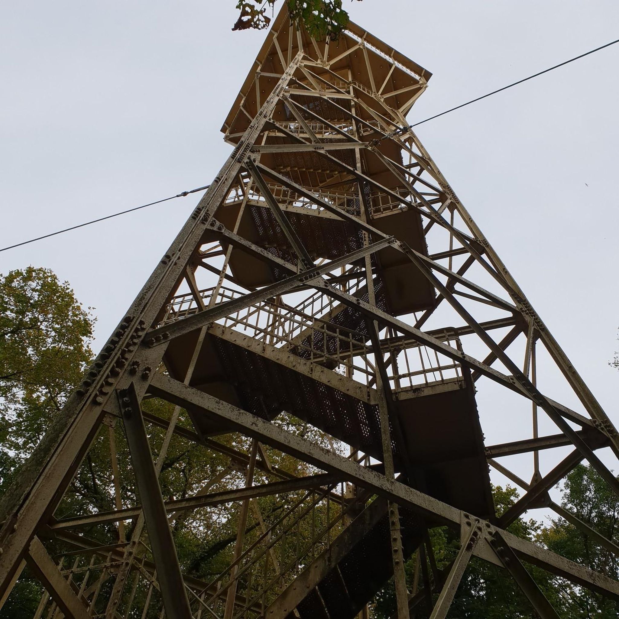
You're absolutely right – the tower in the picture is clearly made of metal, not wood. Thanks for pointing that out. Here's the corrected version: --- 🗼 Observation tower near Pierrevillers – A steel view Rising in the middle of the forest near Pierrevillers, a metal observation tower, with its open structure, offers a panoramic view of the Moselle Valley, the surrounding hills, and, on a clear day, even as far as Luxembourg. 🔩 The solid steel structure is accessible via several platforms and stairs and, despite its height, appears delicately embedded in the natural surroundings. **Tip:** Ideal in good weather – the view from the top is worth every climb and is perfect for a quiet moment or impressive photos.
1
1
🌾 **Étang du Tivoli – Nature Break near Volmerange-les-Mines (Wallingen)** The **Étang du Tivoli** is quietly located on the edge of **Volmerange-les-Mines** (German: **Wallingen**) – a small, natural pond surrounded by meadows, field paths, and sparsely scattered trees. 🐦 The spot is a popular stopover for walkers and cyclists, often visited by herons, ducks, and other waterfowl. A small bench invites you to rest with a view over the water. **Tip:** Ideal for a quiet break on a tour through the Lorraine border region – especially beautiful at sunrise or late evening light.
0
0

Standing 25 metres high and at an altitude of 390 metres, the Drince Tower offers a view of the Metz urban area and its surroundings. In good weather, you can even see the Ardennes, Luxembourg and Belgium. A beautiful view to relax after the climb.
1
0


This tower is essential, even in the race. Take a moment to do some interval training on the steps of the tower and reward yourself with taking in the views from the top of the tower.
4
0
A beautiful pond to explore with a trail to match.
3
0
A tiny but perfectly formed pond. It is a pleasure to visit it and to walk there.
4
0
The view from this tower is breathtaking.
6
0
Frequently Asked Questions
How many running routes are available in Rombach?
Rombach offers a diverse selection of over 20 running routes, catering to various fitness levels. These include 16 moderate trails and 4 more challenging paths, ensuring there's a suitable option for most runners.
What kind of terrain can I expect on Rombach's running trails?
The running trails around Rombach feature varied terrain, including undulating hills, forest paths, and open stretches. Many routes involve elevation changes, with some offering significant climbs, providing a good challenge for those seeking it. You'll also find areas with water features, adding to the scenic diversity.
Are there running routes suitable for beginners in Rombach?
While Rombach's routes are generally categorized as moderate to difficult, many of the moderate trails can be suitable for beginners looking for a gentle challenge. For instance, the La tour de Drince — loop — running from Rombas is a popular moderate option that offers a good introduction to the area's terrain.
What do other runners say about the trails in Rombach?
The running routes in Rombach are highly regarded by the komoot community, with an average rating of 3.2 stars from 5 reviews. Over 390 runners have explored the area using komoot, often praising the varied terrain, from forest paths to hilly sections, and the options available for different ability levels.
Are there circular running routes in Rombach?
Yes, Rombach features several excellent circular running routes. Popular options include the La tour de Drince — loop — running from Rombas and the more challenging Tour de Drince loop from Rombas. These loops allow you to experience the diverse landscapes without retracing your steps.
What interesting sights or landmarks can I see while running in Rombach?
While running in Rombach, you can encounter several interesting sights. The Drince Tower area is a prominent feature on some routes, such as the Drince Tower – Water level loop from Rombas - Clouange. You might also pass by water features like the Plan d'Eau de la Sangsue or the Tivoli Pond, offering scenic views.
Are the running routes in Rombach accessible by public transport?
Rombach itself has public transport connections, and many running routes start directly from the town or nearby villages. It's advisable to check local bus or train schedules to plan your access to specific trailheads, especially for routes that might start a little further out.
Where can I find parking for running routes in Rombach?
Parking is generally available in Rombach and surrounding areas. For routes starting directly from the town, you can often find public parking. For trails located slightly outside, look for designated parking areas near popular trailheads. It's recommended to check the specific route details on komoot for parking suggestions.
Can I bring my dog on the running trails in Rombach?
Many of the natural trails and forest paths around Rombach are suitable for running with dogs, provided they are kept under control, especially in areas with wildlife or other trail users. Always ensure to follow local regulations regarding dogs on trails and clean up after your pet.
Are there family-friendly running options in Rombach?
For families, the moderate routes with less significant elevation changes are generally the most suitable. The La tour de Drince — loop — running from Rombas, for example, offers a manageable distance and moderate challenge that active families might enjoy. Look for routes with smoother paths and fewer steep climbs.
Are there any scenic viewpoints along the running routes in Rombach?
Given the hilly terrain around Rombach, many routes offer opportunities for scenic viewpoints, particularly those that ascend to higher elevations. The Drince Tower area, featured in routes like the Tour de Drince loop from Rombas, is known for its panoramic vistas over the surrounding landscape.
Are there any running routes that pass by water features or lakes?
Yes, Rombach's landscape includes areas with water features. The Drince Tower – Water level loop from Rombas - Clouange explicitly mentions 'water levels' in its description. Additionally, routes like the Étang de la Ballastière loop from Rombas pass by lakes, offering refreshing views and flat sections.
Is Rombach suitable for winter running?
Winter running in Rombach is possible, but conditions can vary. The forest paths might offer some shelter, but hilly sections could become slippery with ice or snow. It's crucial to wear appropriate gear, including trail shoes with good grip, and check local weather conditions before heading out. Some routes, particularly those with less elevation, might be more accessible.
Are there places to stop for refreshments or cafes along the running routes?
While many routes traverse natural areas, some may pass through or near Rombach and surrounding villages where you can find cafes or small shops for refreshments. For longer runs, it's always wise to carry your own water and snacks, especially on trails that venture deeper into the countryside.
Most popular attractions around Rombach

Get inspired with the komoot mobile app


Explore more
Browse the best Running Trails & Routes in other regions.
