The best running trails around Vitrac
4.5
(26)
708
runners
80
runs
Jogging around Vitrac offers diverse landscapes for outdoor enthusiasts, characterized by the winding Dordogne River. The region features scenic paths alongside its waters, limestone cliffs, and lush countryside with ancient trees. The hamlet of Montfort, with its "pierced rock" esplanade, provides panoramic views of the valley and the Dordogne River, offering varied terrain for running. The area's natural features, including the Cingle de Montfort, contribute to a refreshing outdoor experience for runners.
Best jogging routes around Vitrac
- The most popular…
Last updated: October 13, 2026
4.7
(3)
35
runners
4.15km
00:29
90m
80m
Jog the easy 2.6-mile Gour de Tazenat Trail, a circular route around a stunning crater lake in the Parc naturel régional des Volcans d'Auver
20
runners
2.69km
00:20
40m
40m
Easy run. Great for any fitness level. Mostly paved surfaces. Suitable for all skill levels.

3.0
(1)
8
runners
4.76km
00:37
140m
140m
Moderate run. Good fitness required. Mostly paved surfaces. Suitable for all skill levels.
5.0
(1)
6
runners
16.3km
02:05
410m
420m
Hard run. Very good fitness required. Mostly paved surfaces. Suitable for all skill levels.
4
runners
12.3km
01:20
170m
170m
Moderate run. Good fitness required. Mostly paved surfaces. Suitable for all skill levels.
Get access to more routes and recommendations from other explorers.
Already have an account?
Our route recommendations are based on thousands of hikes, rides, and runs completed by other people on komoot.
Start today with a free account
Your next adventure awaits.
Tips from the Community

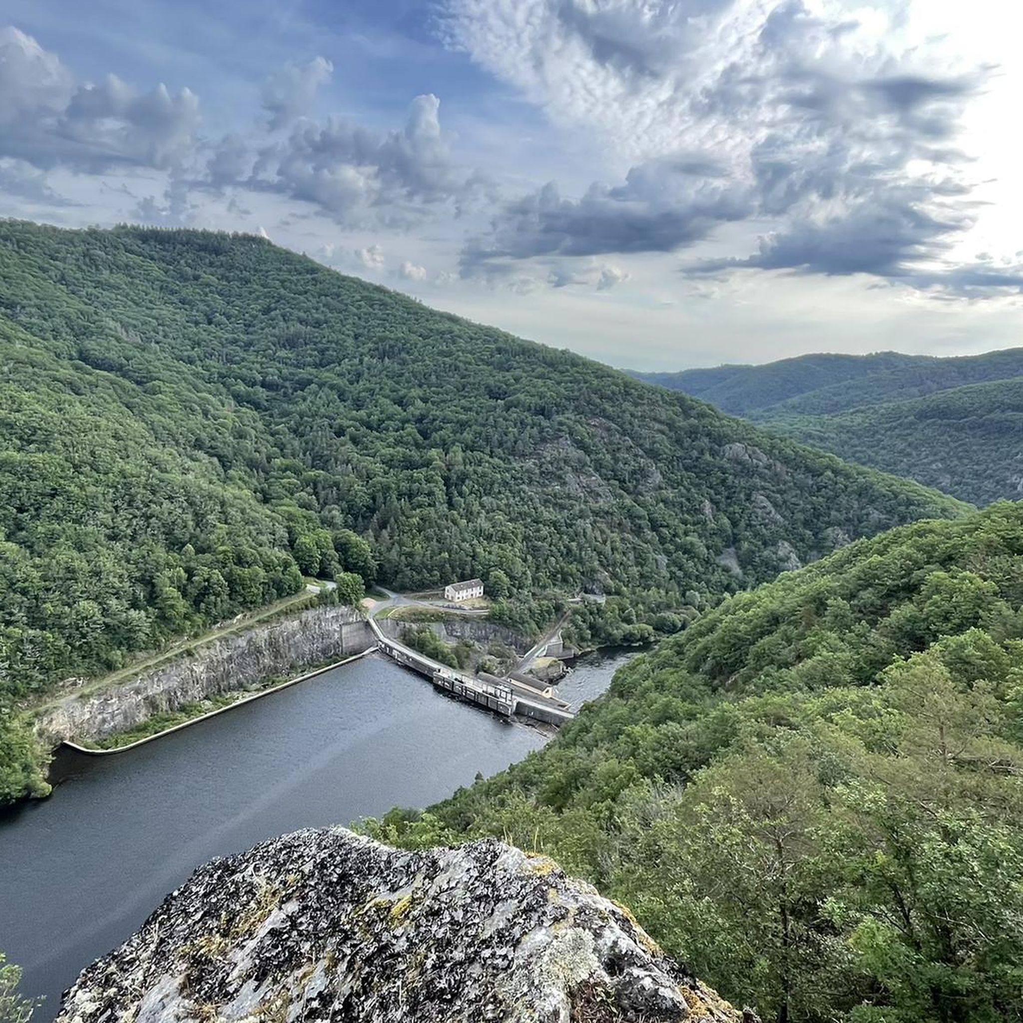
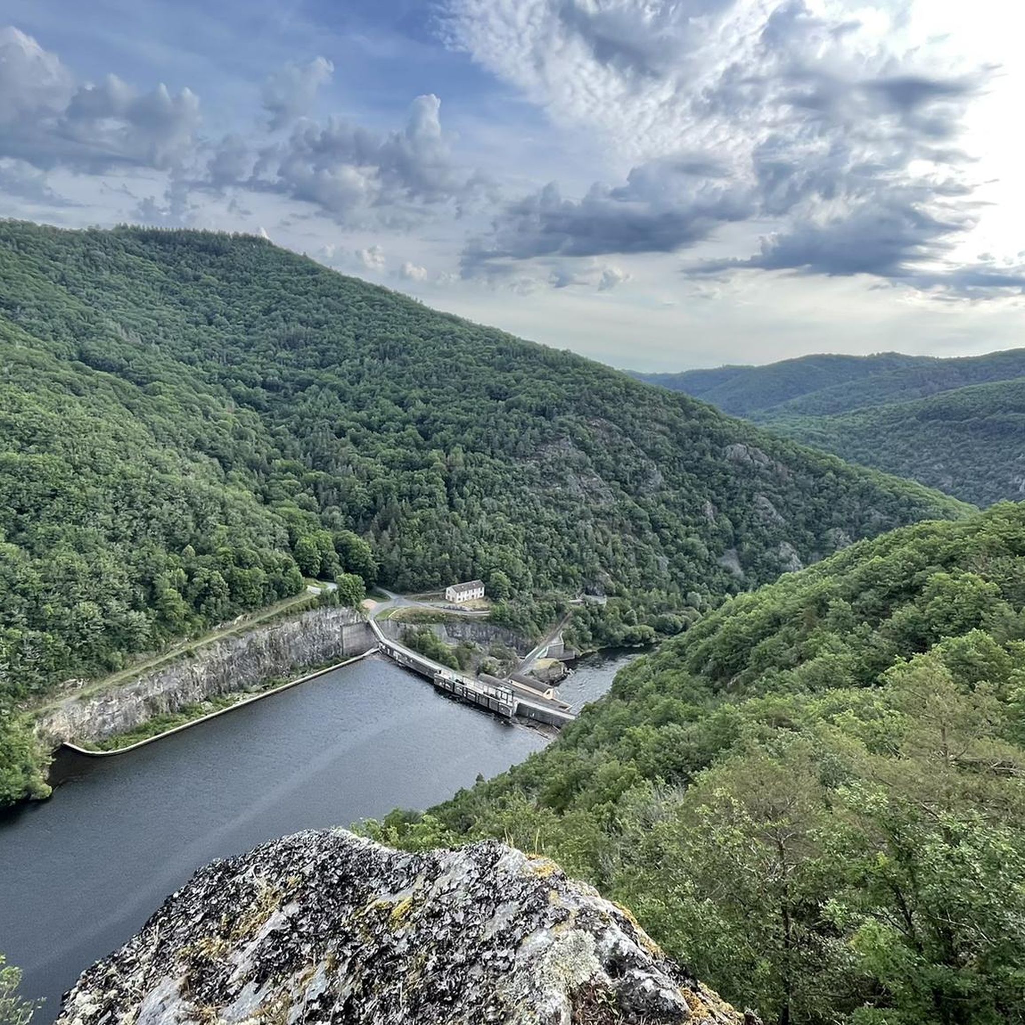
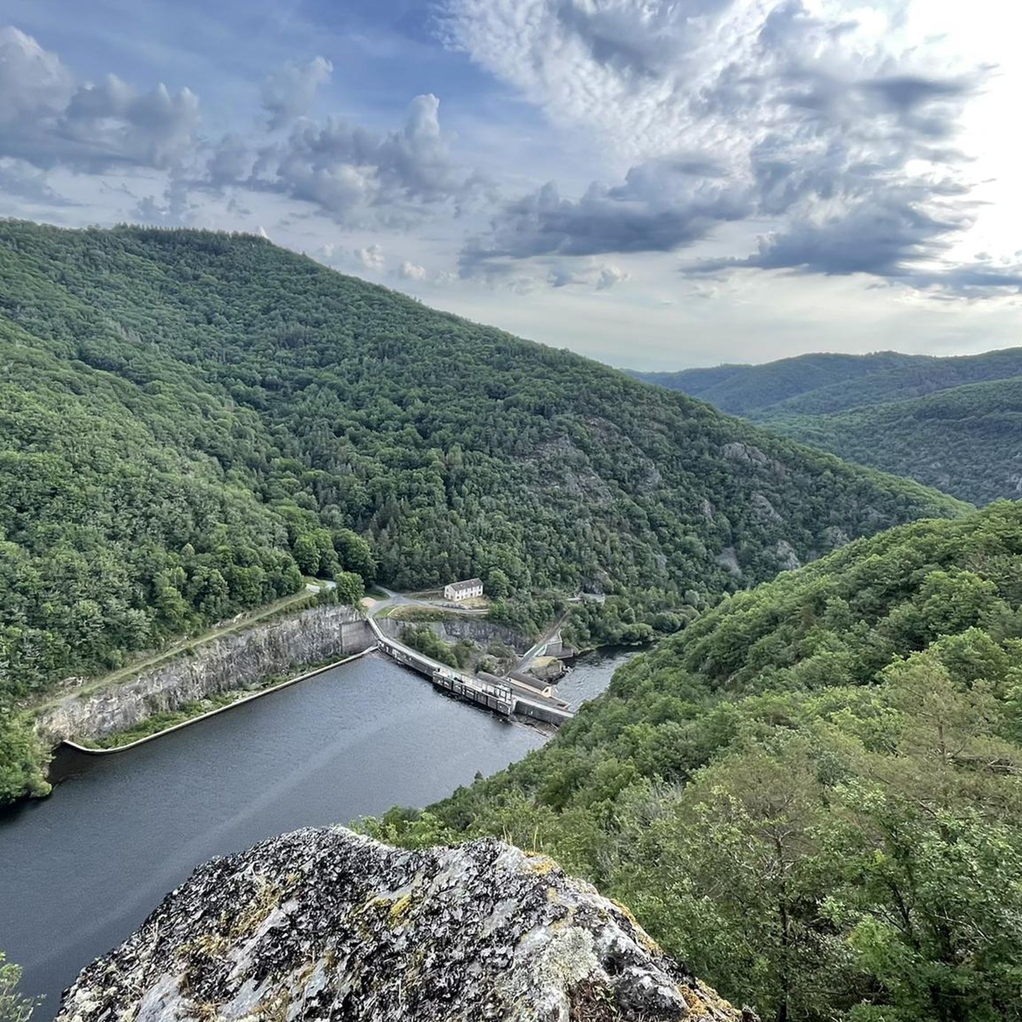
The Queuille meander is one of the most famous panoramas of Auvergne and undoubtedly the most spectacular of Combrailles.
1
0

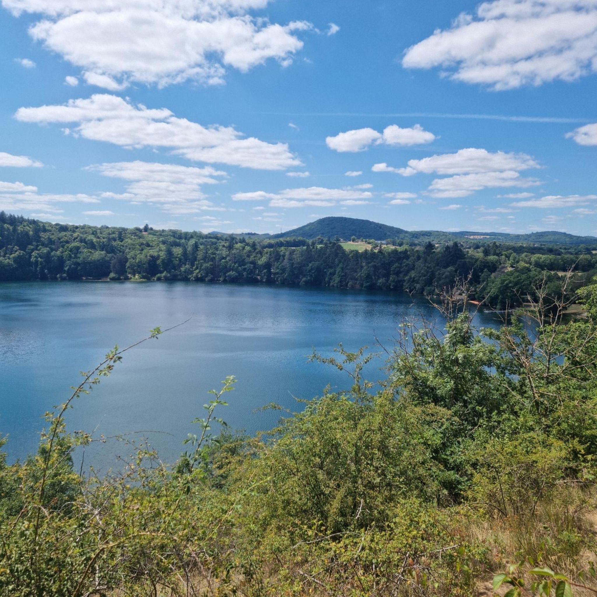
The lake marks the northern limit of the Chaîne des Puys. It is located in Charbonnières-les-Vieilles, near Manzat in the French department of Puy-de-Dôme. It is located 20 kilometers northwest of Riom, 5 kilometers northeast of Manzat and 2.5 kilometers south of Charbonnières-les-Vieilles. The lake has a depth of 66 meters (217 feet). The banks, except in the north and northeast, are wooded and have a height of 50 meters (164 ft). The crater of this volcano is on average 80 meters deep and 700 meters wide. A 2.8 km path can be used to walk around it. Boating on the lake is prohibited.
1
0
The Gour de Tazenat is a volcanic lake in the French department of Puy-de-Dôme. It was formed about 29,000 years ago by a phreatomagmatic eruption.
1
0


Taking a little height on the Côte du Gour allows you to admire this lake of volcanic origin in the north of the Puys chain.
0
0
Small Tower overlooking the lake and which owes its name to the writer Guy de Maupassant who stayed in the area.
0
0
Frequently Asked Questions
How many running routes are available around Vitrac?
There are over 80 dedicated running routes around Vitrac, offering a wide range of options for different fitness levels and preferences. These routes are highly rated by the komoot community, with an average score of 4.4 stars.
What kind of terrain can I expect on the jogging trails in Vitrac?
Jogging around Vitrac offers a diverse landscape. You'll find scenic paths alongside the winding Dordogne River, routes through lush countryside with ancient trees, and trails that incorporate limestone cliffs. Some routes, like those near the hamlet of Montfort, provide panoramic views from elevated points such as the "pierced rock" esplanade.
Are there any easy running routes suitable for beginners in Vitrac?
Yes, Vitrac offers several easy running routes perfect for beginners or those looking for a relaxed jog. For instance, the Tour de Maupassant loop from Charbonnières-les-Vieilles is an easy option, covering about 1.7 miles (2.7 km) with minimal elevation gain.
Can I find running routes with historical landmarks or points of interest in Vitrac?
Absolutely! Many running routes in Vitrac allow you to combine exercise with sightseeing. You can jog past the 12th-century Saint-Martin church or enjoy views of the impressive Château de Montfort, which is often incorporated into longer running circuits. The area's rich history adds a cultural dimension to your run.
Are there any waterfalls or scenic viewpoints along the running trails near Vitrac?
Yes, the region around Vitrac boasts several natural attractions. You can find stunning waterfalls such as the Cascade of the 3 Pools of Chambonnet and the Cascade de la Tine. For breathtaking views, consider routes that pass by the Gour de Tazenat Viewpoint / Chaîne des Puys, offering panoramic vistas of the surrounding landscape.
What do other runners enjoy most about jogging in Vitrac?
The running routes in Vitrac are highly rated by the komoot community, with an average score of 4.4 stars from over 17 reviews. Runners often praise the area's tranquil atmosphere, the stunning scenery along the Dordogne River, and the variety of paths that cater to different abilities, from easy strolls to more challenging runs.
Are there any longer or more challenging running trails for experienced runners?
Yes, for experienced runners seeking a challenge, Vitrac offers several more demanding routes. The Maar de Laty loop from Manzat is a difficult 10.1-mile (16.3 km) trail that leads through varied landscapes and features significant elevation changes, often taking over two hours to complete.
Are there any circular running routes around Vitrac?
Many of the running routes in Vitrac are designed as circular paths, allowing you to start and finish at the same point. For example, the Tour de Maupassant – Sentier Forestier loop from Charbonnières-les-Vieilles is a moderate 8.0-mile (12.9 km) circular path, perfect for a varied run.
What is the best time of year to go running in Vitrac?
Vitrac's diverse landscapes make it suitable for running throughout much of the year. Spring and autumn offer pleasant temperatures and vibrant scenery, while summer provides longer daylight hours. The tranquil atmosphere and natural beauty are enjoyable in most seasons, though checking local weather is always recommended.
Are there any specific running circuits or fitness trails in the Vitrac area?
Beyond the general running routes, Vitrac has established options for physical activity. A campsite near Vitrac, specifically the Lake of Grolejac campsite, features a dedicated fitness trail. Additionally, there are specific running circuits available, such as a 12 km circuit around Vitrac that often incorporates points of interest like the Château de Montfort.
Can I find running routes that offer views of the Dordogne River?
The Dordogne River is a central feature of the Vitrac landscape, and many running paths wind alongside its waters. These routes provide breathtaking scenery with sparkling waters and views of the limestone cliffs that overlook the river, such as those around the Cingle de Montfort.
Are there any moderate running options for those looking for a bit more challenge than an easy route?
Yes, Vitrac offers numerous moderate running routes. The Méandre de Queuille loop from Queuille is a moderate 3.0-mile (4.8 km) route with a good elevation gain, providing a satisfying challenge without being overly strenuous.
Most popular attractions around Vitrac

Get inspired with the komoot mobile app


Explore more
Browse the best Running Trails & Routes in other regions.
