The best MTB trails around Montcabrier
4.5
(64)
481
riders
83
rides
Mountain biking around Montcabrier offers diverse terrain within the natural, sandy, and hilly Bouriane region. This area is characterized by extensive forests of chestnut trees, providing a picturesque backdrop for trails. The broader Lot Valley further enhances the experience with varied landscapes, including limestone plateaus and charming villages. Riders can find a mix of singletrack and doubletrack paths, with many routes suitable for e-bikes.
Best mountain bike trails around Montcabrier
- The most popular mountain bike trail is Belaye – Mtb…
Last updated: October 11, 2026
3
riders
30.9km
02:40
540m
540m
Moderate mountain bike ride. Good fitness required. Advanced riding skills necessary.
3.0
(2)
44
riders
45.1km
03:41
750m
750m
Moderate mountain bike ride. Good fitness required. Suitable for all skill levels.

2.0
(1)
8
riders
42.4km
02:39
420m
430m
Moderate mountain bike ride. Good fitness required. Suitable for all skill levels.
5.0
(2)
9
riders
36.6km
03:06
620m
620m
Moderate mountain bike ride. Good fitness required. Advanced riding skills necessary.
11
riders
Moderate mountain bike ride. Good fitness required. Suitable for all skill levels.
Get access to more routes and recommendations from other explorers.
Already have an account?
Our route recommendations are based on thousands of hikes, rides, and runs completed by other people on komoot.
Start today with a free account
Your next adventure awaits.


Other adventures around Montcabrier

Tips from the Community

The Voie verte et véloroute de la Vallée du Lot (V86) is a major, safe cycling route stretching for approximately 430 to 480 km, connecting La Canourgue in Lozère to Aiguillon in Lot-et-Garonne. The route follows the meanders of the Lot river through varied landscapes of limestone cliffs, vineyards, orchards, and causses.
0
0
The Voie verte et véloroute de la Vallée du Lot (V86) is a large, safe cycling route that stretches for about 430 to 480 km, connecting La Canourgue in Lozère to Aiguillon in Lot-et-Garonne. The route follows the meanders of the Lot river through varied landscapes of limestone cliffs, vineyards, orchards, and causses.
0
0
The Saint-Pierre-ès-Liens church of Cavagnac is a parish church of Romanesque origin located in the locality of Cavagnac in the commune of Soturac. Less known than the Saint-Pierre church in the main town of Soturac, it is listed in the General Inventory of the heritage of the Occitanie region for its preserved architecture and its unique sculptures. (Mid-12th century): The majority of the current structure (the choir and the apse) dates back to the Romanesque period. Works (1777): It is at this date that the single nave is fitted with its current groin vaults, while the south portal is remodeled. Enlargement and Fire (1789–1792): Two side chapels (north and south) are added and blessed in February 1789, just before the building suffered a fire in 1792 during the Revolution, forcing the reconstruction of the vault at a lower level. The church is distinguished by a plan typical of small rural sanctuaries in Quercy: A massive bell tower rising 18 meters high. A choir composed of a straight bay under a barrel vault and terminated by a semi-circular cul-de-four apse. Remarkable sculpted capitals located at the entrance to the choir (on the double arch)
0
0
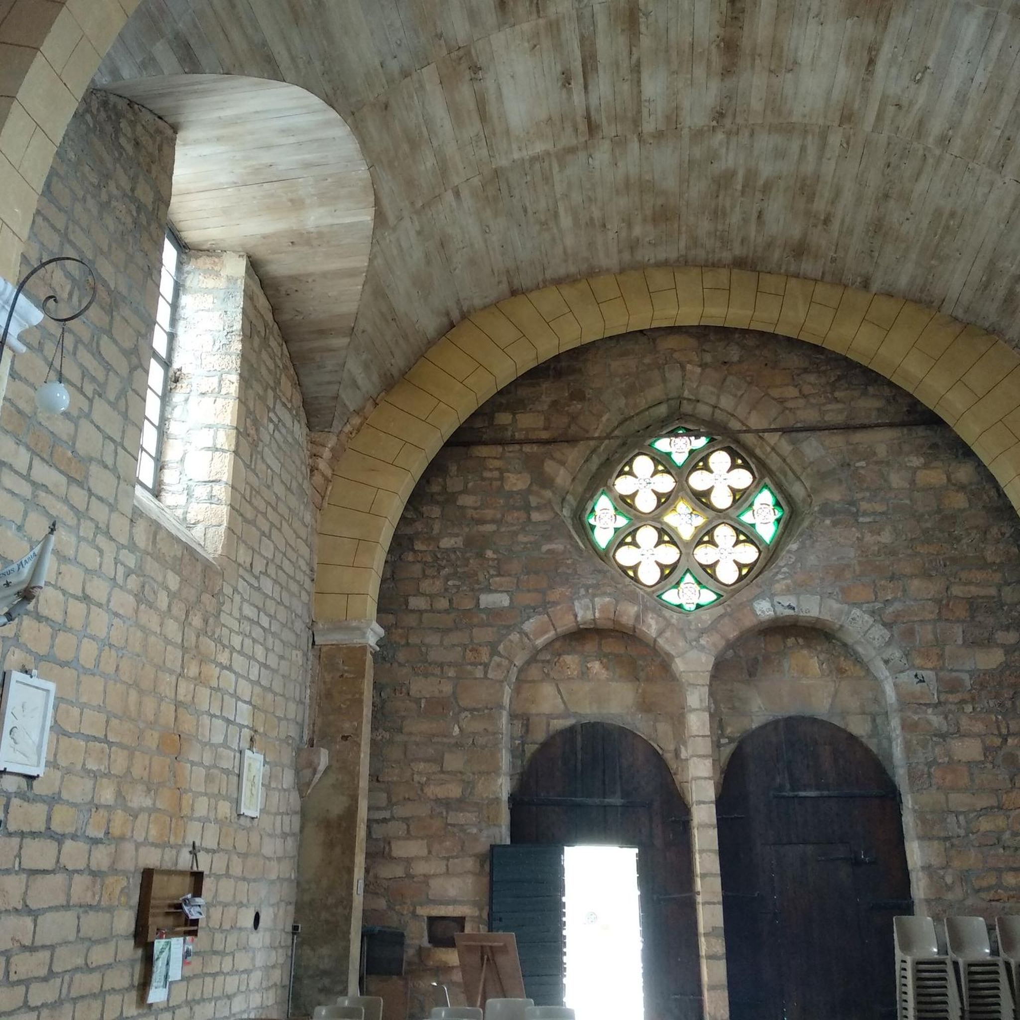
The Saint-Pierre-ès-Liens church of Cavagnac is a parish church of Romanesque origin located in the locality of Cavagnac in the commune of Soturac. Less well-known than the Saint-Pierre church in the main village of Soturac, it is listed in the General Inventory of the Heritage of the Occitanie region for its preserved architecture and its unique sculptures. (Mid-12th century): The majority of the current structure (the choir and the apse) dates back to the Romanesque period. Works (1777): It was at this date that the single nave was fitted with its current groin vaults, while the south portal was remodeled. Enlargement and Fire (1789–1792): Two side chapels (north and south) were added and consecrated in February 1789, just before the building suffered a fire in 1792 during the Revolution, forcing the reconstruction of the vault at a lower level. The church is distinguished by a plan typical of the small rural sanctuaries of Quercy: A massive bell tower rising 18 meters high. A choir composed of a straight bay under a barrel vault and terminated by a semi-circular cul-de-four apse. Remarkable sculpted capitals located at the entrance to the choir (on the double arch).
0
0
Bonaguil's greatest paradox is that it appeared totally obsolete as soon as it was completed (at a time when kings were building the peaceful Loire castles). Located away from major strategic routes, it was never attacked or besieged, which explains why it has come down to us almost intact. A war machine... that never served!
0
0
SauveTerre Museum of Prehistory: A modern space that reconstructs the daily life, environment, and evolution of prehistoric populations following major excavations in the region. Le Site du Martinet: Classified as a historic monument, this open-air archaeological site is located less than a kilometer from the museum and can be discovered independently. Le Château des Rois Ducs: A dominant medieval fortress built at the end of the 13th century by Edward I, a witness to ancient Franco-English rivalries. L'Église Saint-Barthélemy: 12th-century Romanesque building located in the heart of the historic town, of which a magnificent original apse remains. La Croix du Chemin: A remarkable 15th-century wrought iron artwork classified as a Historic Monument.
0
0
The commune has the particularity of encompassing three former distinct market towns or villages: Blanquefort (the main town), nestled around its castle and crossed by the river la Briolance. La Sauvetat, perched on an agricultural plateau, housing a Romanesque church from the 12th/13th centuries with a square bell tower. Saint-Chaliès, a forest sector, also possessing a Romanesque church from the same period as well as an unusual llama farm.
0
0

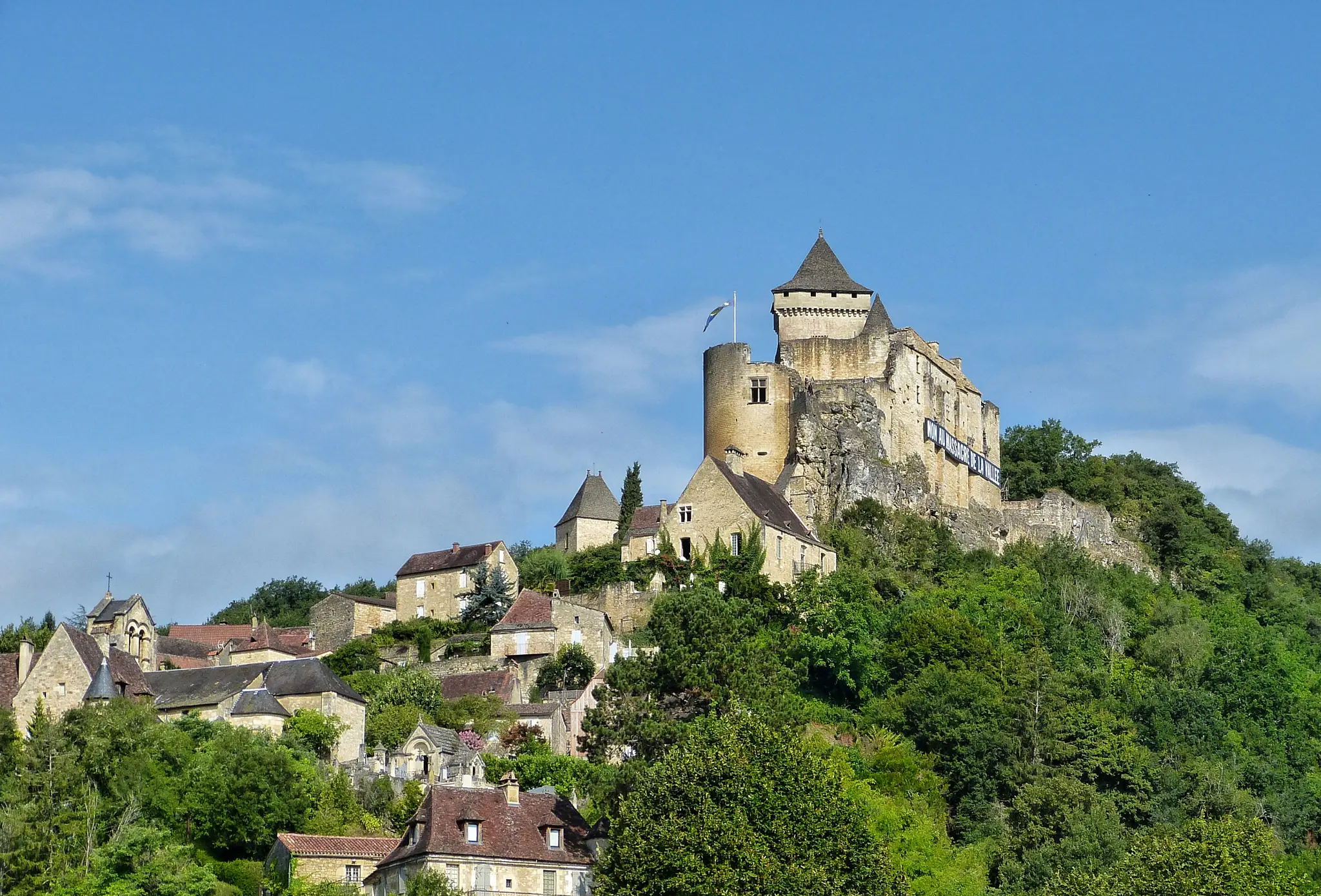
The Château de Bonaguil is one of the most impressive castles in France. Perched on a rocky spur on the border of Lot-et-Garonne and Quercy, it was entirely modernized at the end of the Middle Ages to withstand early artillery. With its drawbridges, towers, moats, and immense keep, this 7,500-square-meter fortress is considered one of the last great masterpieces of medieval military architecture... and remarkably, it has never been taken by storm.
0
0
Frequently Asked Questions
How many mountain bike trails are available around Montcabrier?
The Montcabrier area offers an extensive network of mountain biking trails, with approximately 155 dedicated routes. Additionally, 63 of these trails are suitable for e-bikes, providing a wide range of options for all riders.
What types of terrain can I expect on mountain bike trails near Montcabrier?
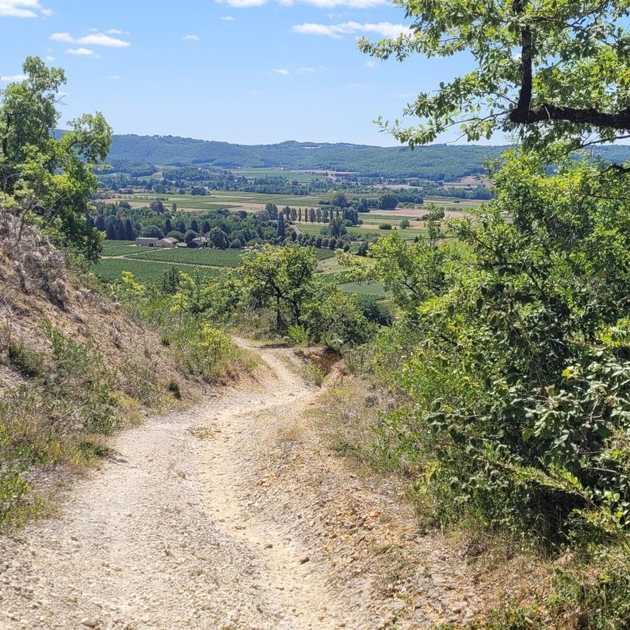
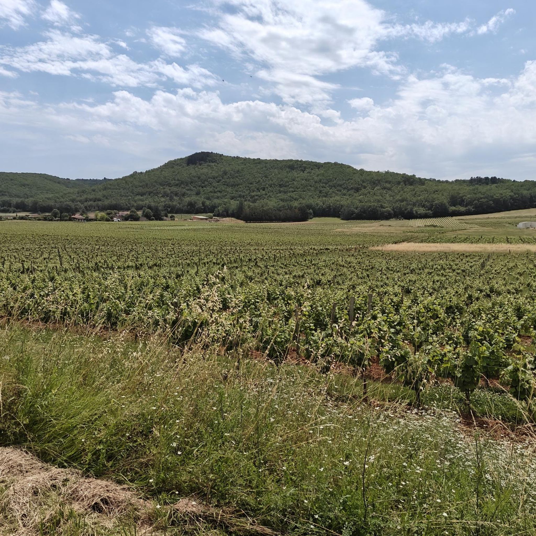
You can expect a diverse mix of terrain, including both singletrack and doubletrack trails. The region is characterized by its natural, sandy, and hilly Bouriane landscape, featuring extensive chestnut forests. The wider Lot Valley adds to this diversity with limestone plateaus, charming villages, and varied authentic landscapes.
Are there mountain bike trails suitable for beginners or families in Montcabrier?
Yes, Montcabrier offers trails suitable for various skill levels, including options for beginners and families. Many routes are multi-use, allowing for a more relaxed experience. While specific easy routes aren't detailed here, the overall network includes paths with varying elevation gains and technical difficulties to accommodate all riders.
What are some scenic highlights or landmarks I can see while mountain biking around Montcabrier?
The trails around Montcabrier offer numerous scenic views and points of interest. You can explore the remnants of the 13th-century Château de Bonaguil, discover old mills along Le Chemin des Moulins, or enjoy the serene Lac de Montcabrier. The routes often traverse dense forests of the Bouriane region and provide views of the Lot River and its valley.
Are there any circular mountain bike routes available?
Yes, many of the mountain bike routes around Montcabrier are designed as loops, allowing you to start and finish in the same location. For example, the Belaye – Mtb loop from Puy-l'Évêque and the Touzac Suspension Bridge – Bridge over the Lot loop from Les Condamines-est are popular circular options.
What do other mountain bikers say about the trails in Montcabrier?
The mountain bike trails around Montcabrier are highly regarded by the komoot community, with an average rating of 4.5 stars from over 50 reviews. Riders often praise the diverse terrain, the picturesque chestnut forests, and the varied landscapes of the Lot Valley.
What is the best time of year to go mountain biking in Montcabrier?
Montcabrier offers enjoyable mountain biking for much of the year. Spring and autumn generally provide the most pleasant conditions with milder temperatures and vibrant scenery. While winter conditions can vary, the region's sandy terrain might be more forgiving than other areas, but always check local weather forecasts before heading out.
Are dogs allowed on the mountain bike trails?
Many trails in the Montcabrier area are multi-use, which often means dogs are permitted, especially if kept on a leash. However, it's always best to check specific trail regulations or local signage, particularly in nature reserves or protected areas, to ensure compliance.
Where can I find parking for mountain biking trails in Montcabrier?
While specific parking locations for every trail are not listed, Montcabrier and surrounding villages like Puy-l'Évêque often have public parking areas. It's advisable to check the starting points of individual routes on komoot for more precise parking information, as many tours begin from accessible village centers or designated trailheads.
Are there any cafes or places to eat along the mountain bike routes?
The Montcabrier area is dotted with charming villages and towns. While specific cafes on every route are not guaranteed, many trails pass through or near settlements like Montcabrier itself, Puy-l'Évêque, or Touzac, where you can find local cafes, restaurants, or shops to refuel and relax. It's always a good idea to carry snacks and water, especially on longer rides.
How long are the mountain bike trails near Montcabrier?
The trails vary significantly in length. For instance, popular routes like the Belaye – Mtb loop from Puy-l'Évêque is approximately 28.4 miles (45.6 km) and takes around 3 hours 40 minutes, while the Cavagnac Church – Touzac Suspension Bridge loop from l'Evasion is about 23.0 miles (37.0 km) and typically takes 3 hours 8 minutes. There are also shorter and longer options available.
What is the elevation gain like on Montcabrier's mountain bike trails?
The elevation gain varies across the trails, reflecting the hilly nature of the Bouriane region and Lot Valley. For example, the Belaye – Mtb loop from Puy-l'Évêque features an elevation gain of over 750 meters, while the Bridge over the Lot – Touzac Suspension Bridge loop from Puy-l'Évêque has a more modest gain of around 170 meters. This variety ensures options for different fitness levels.
Most popular routes around Montcabrier
Most popular attractions around Montcabrier

Get inspired with the komoot mobile app


Explore more
Browse the best MTB trails in other regions.
