The best road cycling routes around Le Gua
4.2
(130)
4,308
riders
200
rides
Road cycling routes around Le Gua traverse a landscape characterized by coastal plains, marshlands, and gently rolling terrain. The region features a network of quiet roads connecting historic villages and offering views of the Seudre estuary. Elevation changes are generally modest, with most routes featuring gradual ascents and descents. This area provides varied options for road cyclists seeking routes through rural and coastal environments.
Best road cycling routes around Le Gua
- The most popular road cycling route is Saujon, Pisany,…
Last updated: July 3, 2026
3.0
(1)
6
riders
57.7km
02:29
170m
170m
Moderate road ride. Good fitness required. Mostly well-paved surfaces and easy to ride.
30
riders
Easy road ride. Great for any fitness level. Mostly well-paved surfaces and easy to ride.

Sign up for free
18
riders
9.59km
00:28
30m
30m
Easy road ride. Great for any fitness level. Mostly well-paved surfaces and easy to ride.
4.0
(1)
16
riders
Moderate road ride. Good fitness required. Some segments of this route may be unpaved and difficult to ride.
5.0
(1)
13
riders
Moderate road ride. Good fitness required. Mostly well-paved surfaces and easy to ride.
Get access to more routes and recommendations from other explorers.
Sign up for free
Already have an account?
Our route recommendations are based on thousands of hikes, rides, and runs completed by other people on komoot.
Start today with a free account
Your next adventure awaits.
Login or Signup

Tips from the Community

Exceptional view, the most beautiful village in France.
0
0

Here you'll find a romantic little lighthouse, and behind it lies a garden with a bench overlooking the sea, a lovely place to stop for a break. Afterwards, you can continue along the cliff to the right until you reach Euro Velo 1 again.
0
0

Perfect beachside bike trail along the boulevard, with several rest stops with seating and beach acces.
0
0

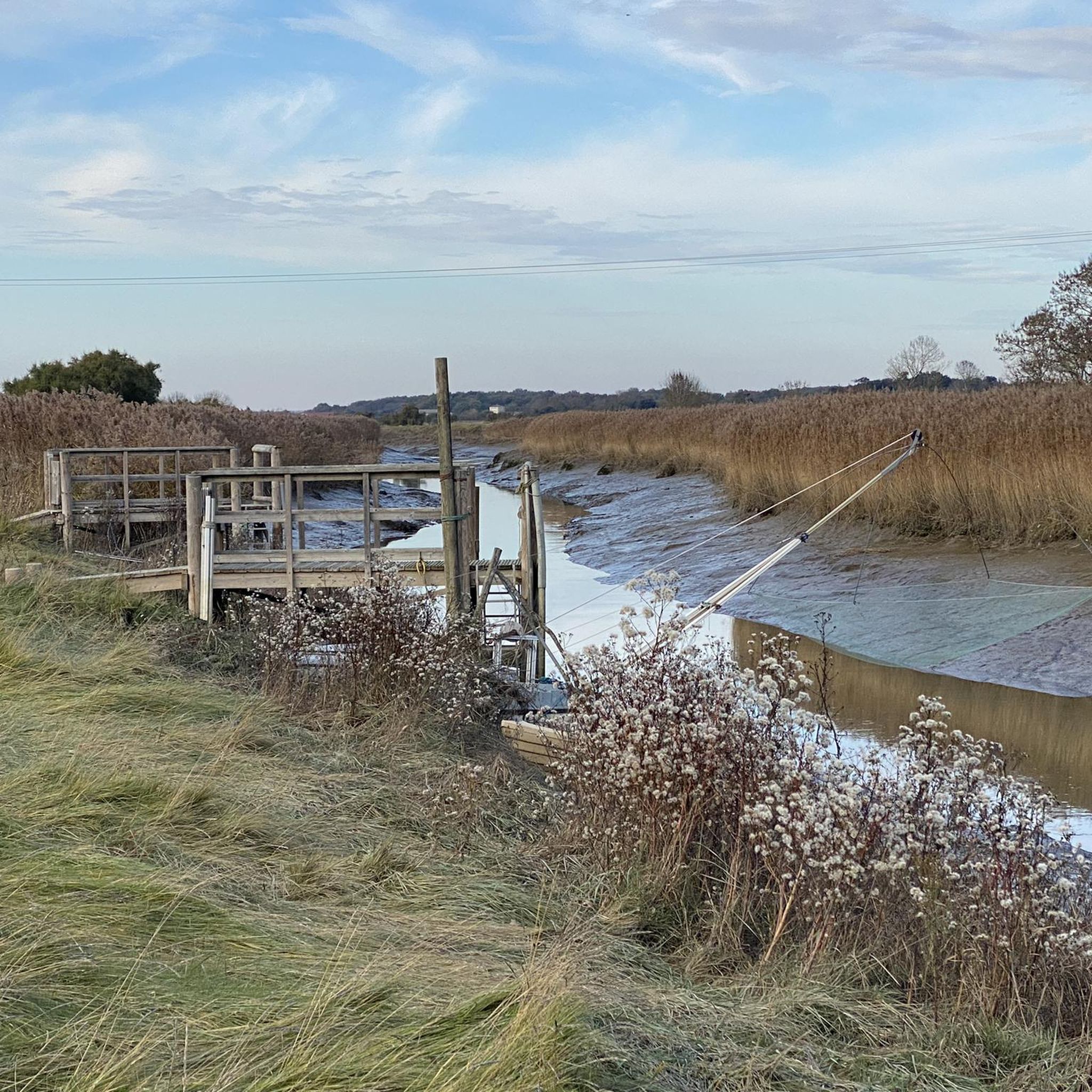
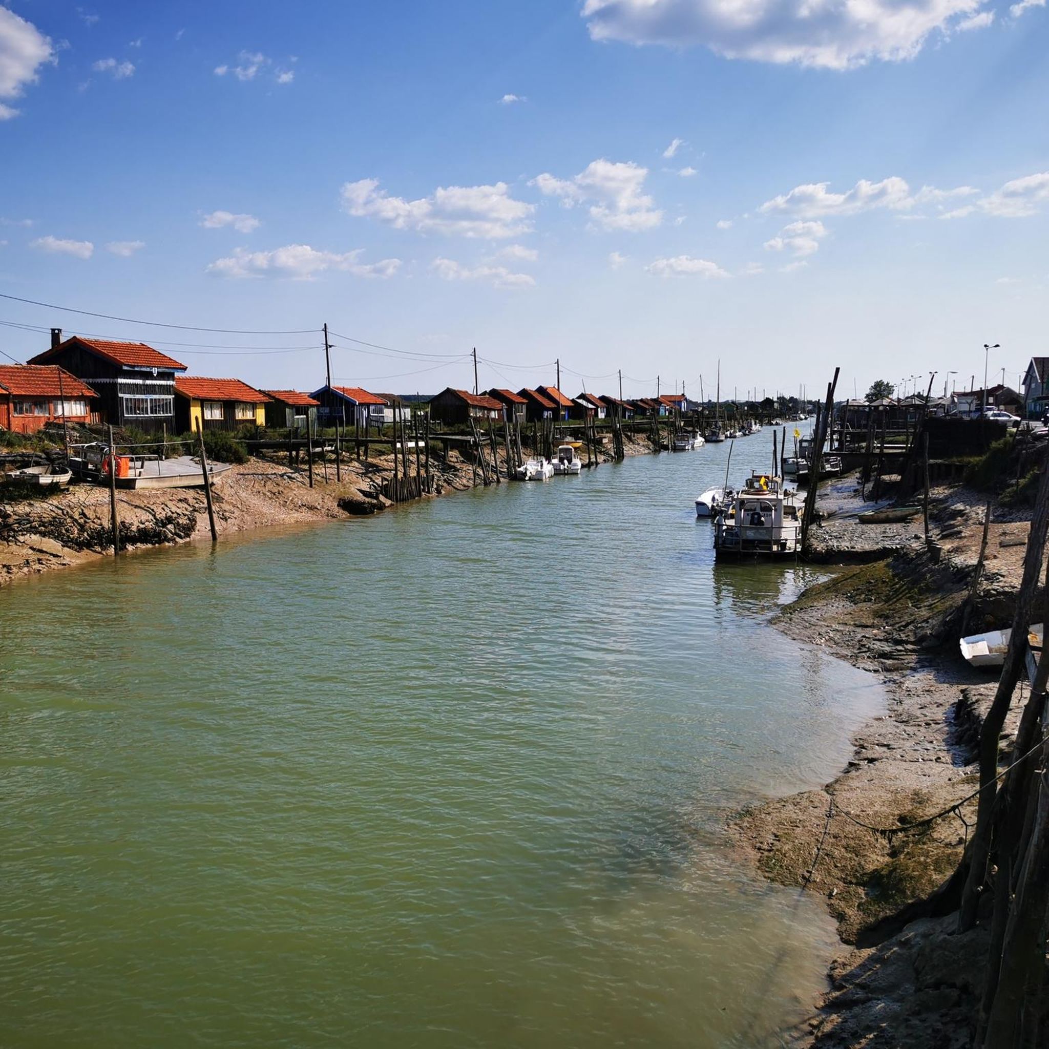
Chaillevette, from the Saintongeais "Chaille" which means "pebble" is a small town in Charente Maritime with 1620 inhabitants, on the Arvert Peninsula. Nestled on the left bank of the Seudre, in a setting of salt marshes, punctuated by "claires" where oysters are refined. The refinement gives them this blue-green color and this typical iodized flavor. Oyster farming by oyster farmers is an essential resource for maintaining two pretty ports: The port of Chatressac, (which almost entered history in the 17th century, having been considered for a time to accommodate the Grand arsenal maritime du Ponant wanted by Louis XIV, which was finally built further north and gave birth to the city of Rochefort), and the port of Chaillevettte. Typical with their oyster huts in various and shimmering colors, bordering the channel and welcoming barges, these two ports have managed to preserve their picturesque character. However, you can enjoy local products in the "tasting huts" and especially the oysters that make our town famous as the "cradle of the oyster". Each of these ports is animated each year by the July 14 festival in Chatressac and the August 15 festival in Chaillevette. In the Chaillevetonne countryside, the cultivation of cereals such as wheat or corn finds its place, without forgetting the vines, which will be used to produce, among other things, the Charente country wine, pineau and cognac.
0
0

On the beach of Royan (20,000 inhabitants). This is where the boat that takes you across the Gironde docks/departs.
0
0
The Terre-Nègre lighthouse is a landmark forming a cylindrical tower a little over 26 meters high. Located on the tip of Terre-Nègre, in the commune of Saint-Palais-sur-Mer, in Charente-Maritime, it is intended to mark the southern pass of the Gironde estuary and to signal the presence of a dangerous sandbank, the "Anglais bar". This building forms a tower-column 3.16 meters in diameter and 26.60 meters high. A spiral staircase with a central core of 143 steps leads to a summit platform equipped with a directional light. The tower is painted in two different colors to make it more visible: the upper part is red, the lower part is white. The base of the lighthouse is hidden by a building that once served as the keeper's accommodation. The installation of a beacon at this location was considered as early as 1763. De Kearney took over the beaconing plan four years later. Construction work on the tower began in 1770 and was completed in 1773, probably under the supervision of the Bordeaux engineer Claude Tardy. In 1807, the tower was raised. However, this work was considered insufficient by some of the estuary's navigators. In 1834, sailors from the nearby port of Royan sent a request to the Ministry of the Navy to study the possibility of equipping the tower with a light. However, this request was postponed the following year due to lack of sufficient funds. A new request from sailors prompted the lighthouse commission to experiment with a first light in 1836. Finally, on October 15, 1838, a fixed white 4th order light was permanently installed. The latter was replaced in 1856 by a fixed white light of the 4th order of a small dioptric model with a reinforced sector of the 5th order catoptric. It was equipped with new lights in 1899 and 1904. In 1939, it was electrified. During the German occupation, the lighthouse served as an observatory for the soldiers of the Wehrmacht. Damaged during the fighting of 1945 (presence of breaches at the top of the tower), it was restored in the immediate post-war period. In March 1947, the lighthouse was operational again. A light with 3 occultations — changing every 12 seconds — was installed. Its colors are white, red and green. Its current range is 18 miles. Listed as a Historic Monument since 2011, the lighthouse is not open to visitors. However, it can be admired from the outside and a pretty passage provides direct access to the coastal path.
0
0

Along the Oysterfields, This is France at its best (when the sun shines!)
0
0
Don't count on making speed here - this is a very busy place in Summer, but always nice things to see.
0
0
Frequently Asked Questions
How many road cycling routes are available around Le Gua?
There are over 190 road cycling routes in the Le Gua region, offering a wide variety of options for different skill levels and preferences.
What kind of terrain can I expect when road cycling in Le Gua?
The Le Gua region is characterized by coastal plains, extensive marshlands, and gently rolling terrain. You'll find a network of quiet roads connecting historic villages, often with views of the Seudre estuary. Elevation changes are generally modest, making it suitable for various cycling abilities.
Are there easy or beginner-friendly road cycling routes in Le Gua?
Yes, Le Gua offers a good selection of easy and beginner-friendly routes. Approximately 58 routes are rated as easy, such as the Sablonceaux Abbey – Too bō loop from Sablonceaux, which is just under 10 km and takes about 30 minutes to complete.
Are there any challenging road cycling routes with climbs around Le Gua?
While the region is generally characterized by modest elevation changes, there are a few routes that offer more challenge. There are 5 routes rated as difficult, providing slightly more demanding ascents compared to the predominantly flat terrain. For a moderate challenge, consider routes like Terre-Nègre Lighthouse – The market halls in Mornac-sur-Seudre loop from Sainte-Gemme - Ferme de Magné, which includes some varied terrain.
What are some scenic viewpoints or attractions I can see along the road cycling routes?
Many routes offer scenic views of the Seudre estuary and marshlands. You can also pass by interesting landmarks such as Riberou Port, the unique Mornac-sur-Seudre Marshes, and historic churches like Saint-Pierre Church in Mornac-sur-Seudre. These routes often connect charming villages, providing a glimpse into local life and architecture.
Are there long-distance road cycling routes available in Le Gua?
Yes, Le Gua has several longer routes for those seeking extended rides. For example, the Brouage Marsh – Seudre Bridge loop from Le Train des Mouettes - Mornac sur seudre is a moderate 77.7 km path that explores the unique marshland environment and crosses the Seudre Bridge.
Are there circular road cycling routes in Le Gua?
Many of the road cycling routes in Le Gua are designed as loops, allowing you to start and finish at the same point. The Saujon, Pisany, and L'Éguille Loop is a popular circular route covering 57.7 km, offering a mix of rural roads and estuary views.
What is the best time of year for road biking in Le Gua?
The best time for road biking in Le Gua is typically during the spring (April to June) and early autumn (September to October). During these periods, the weather is generally mild and pleasant, with less heat and fewer crowds than in the peak summer months. The marshlands and coastal areas are particularly beautiful during these seasons.
What do other road cyclists enjoy the most about road cycling in Le Gua?
The Le Gua region is highly rated by the komoot community, with an average score of 4.1 stars from over 210 reviews. Cyclists often praise the quiet rural roads, the scenic views of the Seudre estuary and marshlands, and the opportunity to explore charming historic villages.
Are there road cycling routes around Le Gua that are approximately 30km in length?
Yes, there are numerous routes around Le Gua that are close to 30km. While not exactly 30km, the Church of Le Gua in Aubin loop from Le Gua is an easy 39.4 km route that can be completed in under 1.5 hours, offering a good option for a ride of that duration.
Are there road cycling routes with cafe stops or places to rest?
Many routes in Le Gua pass through or near small villages and towns where you can find local cafes, bakeries, or restaurants for a refreshment stop. Exploring the historic villages along your chosen route is a great way to discover these local amenities.
Is public transport accessible for road cycling routes in Le Gua?
Public transport options in the Le Gua region are generally limited, especially for reaching the starting points of specific cycling routes. It is advisable to check local bus schedules if you plan to use public transport, as services may be infrequent, particularly in rural areas. Driving to a starting point with parking is often the most convenient option.
Most popular attractions around Le Gua

Get inspired with the komoot mobile app


Explore more
Browse the best Road cycling routes in other regions.
