The best MTB trails around Saint-Porchaire
4.5
(192)
842
riders
67
rides
Mountain biking around Saint-Porchaire offers diverse terrain across a partly wooded limestone plateau, bounded by marshes to the north and agricultural landscapes to the south. This topography provides a mix of trails, from scenic routes through farmlands to more challenging paths within wooded sections. The subsoil, featuring springs and cavities, contributes to varied natural features along the routes. The region's varied landscape supports a network of mountain bike trails suitable for different skill levels.
Best mountain bike trails around Saint-Porchaire
…Last updated: October 14, 2026
4.5
(20)
84
riders
42.3km
03:21
340m
340m
Moderate mountain bike ride. Good fitness required. Advanced riding skills necessary.
4.7
(11)
88
riders
Moderate mountain bike ride. Good fitness required. Advanced riding skills necessary.

4.0
(1)
25
riders
Moderate mountain bike ride. Great for any fitness level. Advanced riding skills necessary.
3.3
(3)
15
riders
24.3km
01:49
180m
180m
Moderate mountain bike ride. Great for any fitness level. Advanced riding skills necessary.
4.0
(1)
9
riders
70.6km
04:07
270m
270m
Moderate mountain bike ride. Good fitness required. Advanced riding skills necessary.
Get access to more routes and recommendations from other explorers.
Already have an account?
Our route recommendations are based on thousands of hikes, rides, and runs completed by other people on komoot.
Start today with a free account
Your next adventure awaits.



Tips from the Community

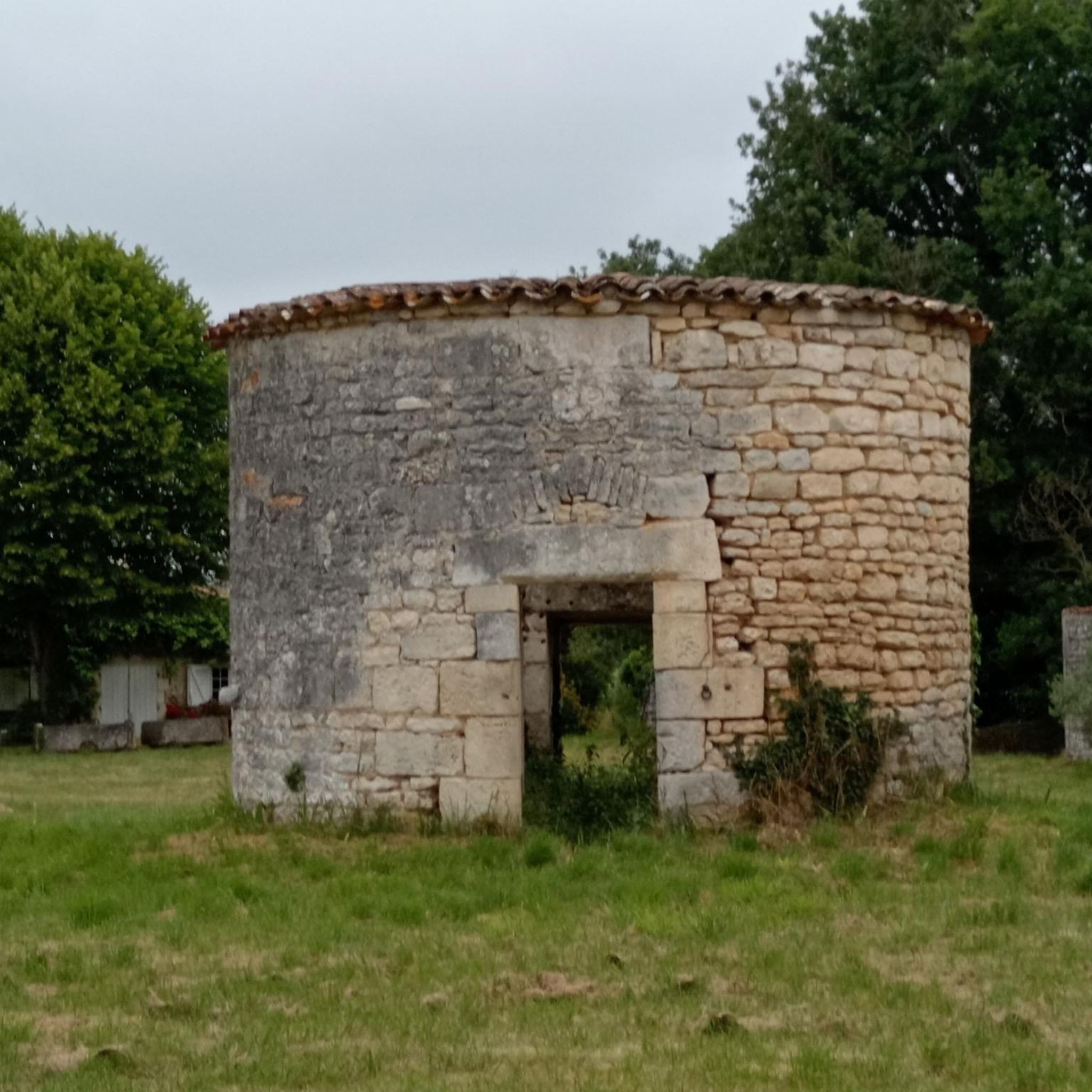
Port-d’Envaux, located on the left bank of the Charente, about 12 km downstream from Saintes, owes a large part of its history to its position on the river. The village was originally a fishing village, but it gradually became an important river port for trade. 1. Origins The Charente is a very ancient waterway. As early as the Gallo-Roman period, the river was used to transport salt from the coast inland. The name Port-d’Envaux refers to its location: the village is situated downstream from Taillebourg and in the middle of several "vaux" or valleys. The former parish was named Saint-Saturnin-de-Séchaud. 2. From the 16th to the 18th century: development of trade From the 16th century onwards, navigation on the Charente became of considerable importance. Port-d’Envaux was notably involved in the trade of: * Crazannes stone; * pottery from La Chapelle-des-Pots; * firewood and cooperage wood; * salt; * and later, wine. In the 17th century, "gabares" (barges) became the main transport vessels on the river. Successive improvements to navigation on the Charente, particularly the work undertaken under Colbert, further boosted this activity. The development of the military port of Rochefort, in particular, led to significant needs for wood and stone. 3. The 19th century: the golden age of Port-d’Envaux It was in the 19th century that Port-d’Envaux experienced its true golden age. The port became an important center for barging and shipbuilding. It housed, among other things: * boat construction yards; * marine carpenters; * sailors and captains; * sailing ships; * rope makers; * merchants. The boats transported, in particular, wine, cognac, stone, wood, and salt between the interior of Saintonge, Saintes, and the estuary of the Charente. This prosperity largely explains the presence of the large bourgeois houses and residences that can still be observed along the river. On the eve of the Revolution, Port-d’Envaux even had a navigation school, a sign of the importance of its maritime activity. 4. Gabares, sloops, and schooners The port was particularly associated with "gabares", but also with sloops and schooners. These boats made it possible to transport goods between the ports of the Charente. The "gabares" could, in particular, load stone from the neighboring quarries of Crazannes, Plassay, and Port-d’Envaux. The municipality also preserves historical documentation specifically dedicated to the "gabares" and sloops with topsails built and equipped in Port-d’Envaux. 5. The commune and its evolution The parish of Saint-Saturnin-de-Séchaud became a commune during the Revolution. Port-d’Envaux only truly became a communal capital in 1852, when the commune had about 1,536 inhabitants. It was also in the 19th century that the center of the village gradually moved closer to the river: the port became the true economic heart of the town. The current urban plan, with its small streets descending towards the Charente, retains traces of this evolution. 6. The decline of the port The situation changed radically at the end of the 19th century with the arrival of the railway. Rail transport, and then road transport in the 20th century, strongly competed with the boats on the Charente. In 1926, the Charente was declassified as a navigable waterway; in 1957, it was permanently removed from the list of navigable waterways. This was practically the end of the port's historic commercial vocation. 7. From commercial port to pleasure port After the disappearance of merchant traffic, Port-d’Envaux gradually turned towards pleasure boating and river tourism. Today, the port accommodates pleasure boats and is a leisure area on the banks of the Charente. However, the village strongly preserves the memory of its maritime past through its quays, its old merchant houses, its streets, and its towpath. An interesting feature The history of Port-d’Envaux is therefore closely linked to that of Crazannes stone. The stone extracted from the neighboring quarries was transported by river, which explains the existence of a real economic chain associating quarries → port → "gabares" → Charente → estuary of Rochefort. It is also this past that helps us understand why the village today has Les Lapidiales, located in old quarries, and why the commune places so much emphasis on "stone and water".
0
0

A very beautiful archway!
2
0
Impressive bridge. Well worth seeing!
1
0
A truly interesting bridge. It's worth a stop.
1
0

Almost obligatory passage to cross the Charente, but it’s worth the detour
0
0


Tonnay-Charente marina and view of the suspension bridge (One of the oldest suspension bridges in Europe - 1842)
0
0

Frequently Asked Questions
How many mountain bike trails are available around Saint-Porchaire?
There are over 70 mountain bike trails around Saint-Porchaire, offering a wide range of options for different skill levels and preferences. The region's diverse landscape, from wooded plateaus to agricultural lands, provides a varied riding experience.
Are there easy mountain bike trails suitable for beginners or families in Saint-Porchaire?
Yes, Saint-Porchaire offers a good selection of easy mountain bike trails. There are 21 routes specifically graded as easy. For example, the On the road to the fortified castle loop from Plassay is an easy 6.8-mile (10.9 km) trail that takes about 45 minutes to complete, perfect for a relaxed ride through the local countryside.
What kind of terrain can I expect on mountain bike trails in Saint-Porchaire?
The terrain around Saint-Porchaire is quite varied. You'll find trails traversing a partly wooded limestone plateau, with sections through marshes to the north and agricultural landscapes to the south. This mix provides everything from scenic routes through farmlands to more challenging paths within wooded areas, often featuring natural springs and cavities.
Are there any challenging mountain bike routes for experienced riders?
While most trails are moderate, there are 2 routes graded as difficult for those seeking a greater challenge. The region's varied topography, including wooded sections and varied ground conditions, can provide engaging rides for experienced mountain bikers.
What are some of the longer mountain bike routes available?
For longer rides, consider the Tonnay-Charente Bridge – White path loop from L'Essert, which spans 39.3 miles (63.2 km) and typically takes around 3 hours 40 minutes. Another substantial option is the Forest Stream – Beware of ruts loop from Miclos, covering 26.0 miles (41.9 km) in about 3 hours 17 minutes.
What do other mountain bikers say about the trails in Saint-Porchaire?
The mountain bike trails in Saint-Porchaire are highly regarded by the komoot community, with an average rating of 4.5 stars from over 160 reviews. Riders often praise the diverse terrain, the mix of wooded and agricultural landscapes, and the well-maintained paths that offer a rewarding experience for various skill levels.
Are there any circular mountain bike routes in the area?
Yes, many of the mountain bike routes around Saint-Porchaire are circular, allowing you to start and end at the same point. Examples include the Château de Nieul-lès-Saintes loop from Miclos and the On the road to the fortified castle loop from Les Essards, which are both popular circular options.
What historical sites or attractions can I see while mountain biking near Saint-Porchaire?
The region is rich in historical sites. You can explore various châteaux and churches along the trails. Notable attractions include Crazannes Castle, the Sainte-Madeleine Church of Crazannes, and the Saint-Savinien Church and Statues of the Apostles. The famous Château de la Roche-Courbon, with its French gardens, is also a significant landmark in the vicinity.
What is the best time of year to go mountain biking in Saint-Porchaire?
Saint-Porchaire's climate makes it suitable for mountain biking for much of the year. Spring and autumn generally offer pleasant temperatures and beautiful scenery, with lush greenery in spring and vibrant colors in autumn. Summer can also be enjoyable, especially in the wooded sections, though it's advisable to ride earlier in the day to avoid the midday heat.
Are there mountain bike trails that pass through scenic natural areas?
Absolutely. Many trails offer scenic views, particularly those that wind through the wooded limestone plateau or along the edges of the marshes. The subsoil, dotted with springs and cavities, also contributes to interesting natural features. The Forest Stream – Beware of ruts loop from Miclos, for instance, navigates through wooded areas featuring streams and varied ground conditions, providing a picturesque ride.
How long do mountain bike trails typically take to complete in Saint-Porchaire?
Trail durations vary significantly based on length and difficulty. Shorter, easy routes like the On the road to the fortified castle loop from Les Essards can be completed in under 30 minutes. Moderate trails, such as the Château de Nieul-lès-Saintes loop from Miclos, typically take around 1 hour 30 minutes. Longer routes can extend to over 3 hours.
Most popular routes around Saint-Porchaire
Most popular attractions around Saint-Porchaire

Get inspired with the komoot mobile app


Explore more
Browse the best MTB trails in other regions.
