The best road cycling routes around Merckeghem
4.2
(38)
2,033
riders
296
rides
Road cycling routes around Merckeghem traverse a distinctive hilly landscape in northern France, situated on an elevated position that offers views of both Inner and Maritime Flanders. The terrain is characterized by undulating landscapes and features notable ascents, providing varied challenges for cyclists. While the immediate area offers steep climbs, proximity to the Marais Audomarois provides access to flatter marshland routes. This combination of features defines the cycling experience in the Cœur de Flandre region.
Best road cycling routes around…
Last updated: August 16, 2026
11
riders
30.2km
01:15
210m
210m
Easy road ride. Great for any fitness level. Mostly well-paved surfaces and easy to ride.
5.0
(1)
9
riders
29.4km
01:13
140m
140m
Moderate road ride. Great for any fitness level. Some segments of this route may be unpaved and difficult to ride.

Sign up for free
5.0
(1)
7
riders
40.5km
01:47
300m
300m
Moderate road ride. Great for any fitness level. Some segments of this route may be unpaved and difficult to ride.
9
riders
50.6km
02:06
290m
290m
Moderate road ride. Good fitness required. Some segments of this route may be unpaved and difficult to ride.
3
riders
31.5km
01:17
140m
140m
Easy road ride. Great for any fitness level. Mostly well-paved surfaces and easy to ride.
Get access to more routes and recommendations from other explorers.
Sign up for free
Already have an account?
Our route recommendations are based on thousands of hikes, rides, and runs completed by other people on komoot.
Start today with a free account
Your next adventure awaits.
Login or Signup



Tips from the Community


Worth the climb up the hill. Small park at the top accesses the mill. Best example I have ever seen
2
0

The Montagne de Watten site is a viewpoint located in Watten, in the Nord department in France. It offers a panoramic view of the city and its surroundings.
10
0
The Watten mill was built in the 18th century on the site of a bastion. It has been restored and in the summer the blades turn as before.
7
0
On the hills are also the ruins of an abbey (private property) with a square Gothic tower. The esplanade in front of the abbey entrance offers a view of the gorge formed by the Aa (canal, railway) and the Forêt Domaniale d'Eperlecques.
7
0
The Euroroute R1 passes here! The French section of the Euroroute R1 is about 97 km long and leads from the channel coast, either from Boulogne-sur-Mer or Calais, through Nord-Pas-de-Calais to the Belgian border. The route from Boulogne-sur-Mer to Watten is 64 km long and is surprisingly hilly, while the route from Calais to Watten is 36 km long and nearly flat. The Euroroute R1 between Watten and the Belgian border at Oost-Cappel is 35 km long and crosses the plane of Yser in French Flanders. The route in France is rather rural and passes through contemplative villages and small towns with worth seeing churches along the way.
5
0
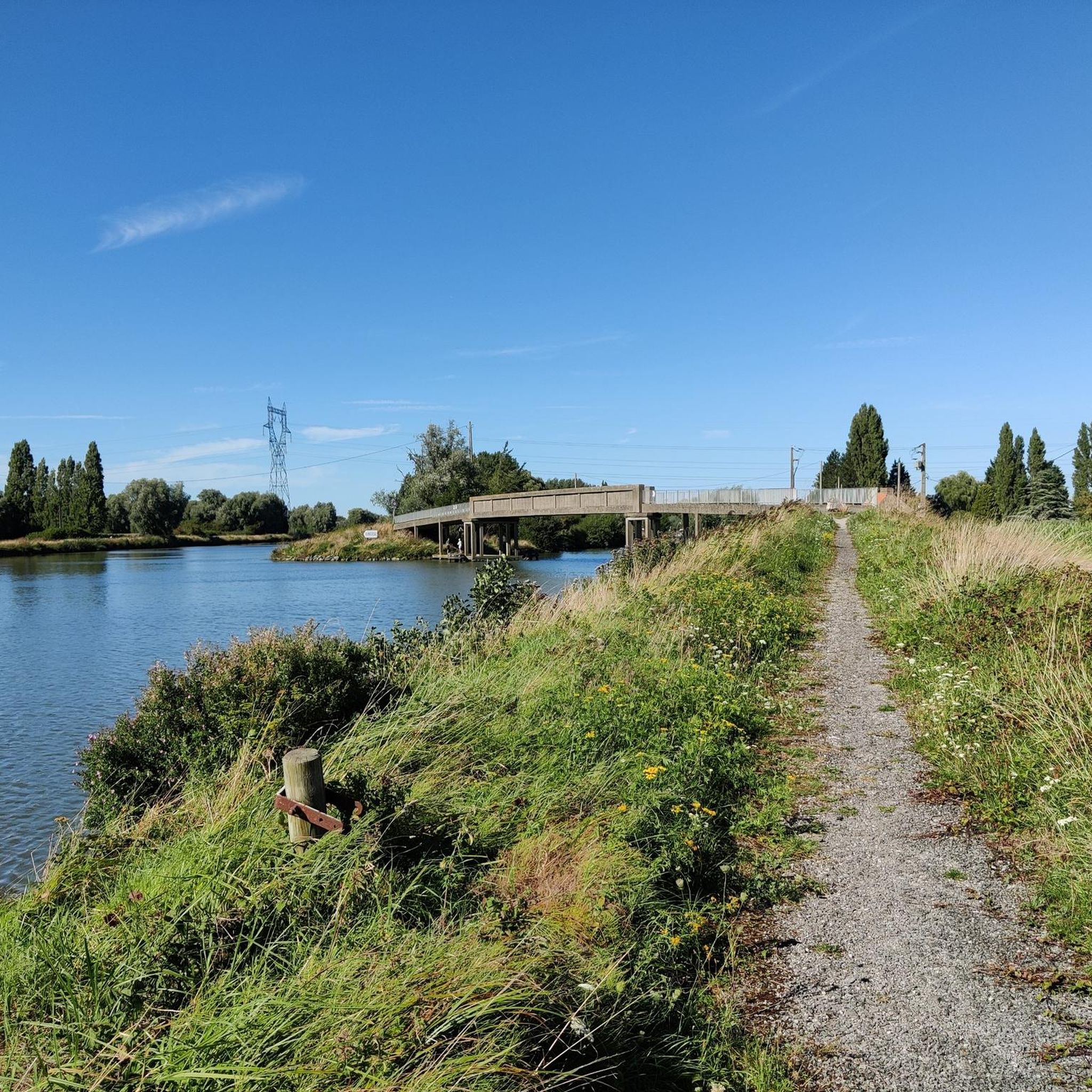
This path leads nowhere, but it does have a nice view of the wide Aa.
9
0
The Mont de Watten is the westernmost extension of the West Flemish Hills. With its 72m it dominates the Aa valley and the Flemish plain. Turenne used the hill as a lookout post for the battle of Dunkirk (1658) and much later the German general Guderian, strategist of the Blitzkrieg, did the same (1940). The Watten mill was built in the 18th century on the site of a bastion. It has been restored and in the summer the blades turn again as before. On the hills are also the ruins of an abbey (privately owned) with a square Gothic tower. The esplanade in front of the entrance to the abbey offers a view of the gorge formed by the Aa (canal, railway) and the Forêt Domaniale d'Eperlecques.
8
0
Frequently Asked Questions
What kind of terrain can I expect when road cycling around Merckeghem?
Road cycling around Merckeghem offers a distinctive hilly landscape with undulating terrain and notable ascents. The village itself is situated on a hill, providing challenging climbs and panoramic views. While the immediate area features steep hills, the proximity to the Marais Audomarois offers access to flatter marshland routes, providing a varied cycling experience.
Are there road cycling options for different skill levels in Merckeghem?
Yes, the Merckeghem area provides a range of road cycling routes suitable for various skill levels. You'll find options from moderate climbs to easier loops. For example, routes like Noordpeene – Montée de Cassel loop from Bollezeele are rated as easy, while others offer significant elevation gain for those seeking more challenge.
How many road cycling routes are available in the Merckeghem area?
There are over 320 road cycling routes available around Merckeghem, catering to a wide range of preferences and fitness levels. This includes approximately 60 easy routes, 237 moderate routes, and 23 difficult routes.
What makes road cycling in Merckeghem unique compared to other regions?
Merckeghem's unique appeal lies in its combination of challenging hilly terrain, scenic country roads, and proximity to diverse natural landscapes. You can experience steep climbs and panoramic views over Inner and Maritime Flanders, and then transition to flatter marshland routes in the nearby Marais Audomarois, offering a dynamic and varied cycling environment.
Are there any scenic viewpoints or natural features to look out for on road cycling routes?
Absolutely. Merckeghem's elevated position provides exceptional panoramic views of the Flemish landscapes. Notable natural features include the Romelaëre Ponds Nature Reserve, a vast marshland offering serene environments, and the challenging ascents of Montagne de Watten, which also provides great vistas. The area is rich with small country roads often bordered by hedges, offering tranquil scenery.
What historical or cultural landmarks can I explore while cycling near Merckeghem?
While cycling near Merckeghem, you can encounter several points of interest. The village itself is known for its unique arrangement of three adjacent mottes (mounds). The nearby Watten Hill is a significant landmark. The broader region also boasts charming villages and heritage sites, including historic belfries in places like Esquelbecq and Saint-Omer, which are UNESCO World Heritage sites.
Are there circular road cycling routes available in Merckeghem?
Yes, many road cycling routes around Merckeghem are designed as loops, allowing you to start and finish in the same location. Examples include the Montée de Merckeghem loop from Volckerinckhove and the Mont de Watten – Montée de Merckeghem loop from Volckerinckhove, which are popular choices among local cyclists.
Where can I find parking for my car when starting a road cycling route?
While specific parking areas for cyclists are not detailed, Merckeghem and surrounding villages like Volckerinckhove and Bollezeele, which serve as common starting points for routes, typically offer public parking options. It's advisable to check local signage upon arrival.
Is public transport an option to reach cycling starting points in Merckeghem?
Merckeghem is a rural commune, and public transport options might be limited. For detailed information on bus services or train connections to nearby larger towns like Saint-Omer, it is recommended to consult local transport authorities or the official tourism website for the region, such as Tourisme Saint-Omer.
Are there places to stop for refreshments or food along the routes?
The road cycling routes often pass through or near charming villages in the Cœur de Flandre region. While specific cafes or pubs are not listed for every route, these villages typically offer local establishments where you can stop for refreshments or a meal. Planning your route with potential village stops in mind is a good approach.
What is the best time of year to go road cycling in Merckeghem?
The best time for road cycling in Merckeghem is generally during the spring, summer, and early autumn months (April to October). During these periods, the weather is typically milder and more conducive to outdoor activities, allowing you to fully enjoy the scenic landscapes and challenging ascents.
What do other road cyclists enjoy most about the routes around Merckeghem?
The road cycling routes around Merckeghem are highly rated by the komoot community, with an average score of 4.3 stars from over 30 reviews. Cyclists often praise the varied terrain, from challenging climbs like Mont de Watten to the tranquil country roads, and the beautiful panoramic views of the Flemish countryside.
Are there any long-distance road cycling routes available from Merckeghem?
While many routes are designed for day trips, the extensive network of country roads and connections to areas like the Marais Audomarois allow for longer rides. You can combine several routes or explore the broader 'Cœur de Flandre' region for extended road cycling adventures, such as the Ascent Route d'Audruicq – Mont de Watten loop from Volckerinckhove which covers over 50 km.
Most popular routes around Merckeghem
Most popular attractions around Merckeghem

Get inspired with the komoot mobile app


Explore more
Browse the best Road cycling routes in other regions.
