The best walks and hikes around Castelmayran
4.3
(54)
457
hikers
50
hikes
Hiking around Castelmayran offers exploration of the Tarn-et-Garonne department in France, characterized by its position within the Garonne River valley. The area features diverse natural landscapes, including rolling hills, agricultural fields, and waterways. Castelmayran is situated within the historical region of Lomagne, often referred to as the "French Tuscany," providing a scenic backdrop for outdoor activities. The commune also encompasses Natura 2000 sites, indicating areas of ecological significance with preserved habitats.
Best hiking trails around Castelmayran
- The most popular hiking…
Last updated: June 26, 2026
5.0
(3)
32
hikers
11.5km
03:10
190m
190m
Moderate hike. Good fitness required. Easily-accessible paths. Suitable for all skill levels.
3.0
(1)
22
hikers
11.1km
02:49
30m
30m
Moderate hike. Good fitness required. Easily-accessible paths. Suitable for all skill levels.

Sign up for free
4.3
(3)
30
hikers
24.2km
06:33
310m
310m
Hard hike. Very good fitness required. Easily-accessible paths. Suitable for all skill levels.
4.6
(7)
50
hikers
Easy hike. Great for any fitness level. Easily-accessible paths. Suitable for all skill levels.
5.0
(2)
32
hikers
14.8km
04:02
200m
200m
Moderate hike. Good fitness required. Easily-accessible paths. Suitable for all skill levels.
Get access to more routes and recommendations from other explorers.
Sign up for free
Already have an account?
Our route recommendations are based on thousands of hikes, rides, and runs completed by other people on komoot.
Start today with a free account
Your next adventure awaits.
Login or Signup
Tips from the Community

Are you a fan of bridges? No? It doesn't matter, go see it anyway, it's very beautiful.
0
0

A very nice route with varied landscapes. Possibility of leaving from Moissac center to exceed 20km.
1
0

The Abbey of Moissac is a UNESCO World Heritage Site, great frescoes in the entrance portal and a unique cloister with many biblical scenes and saints' stories in the capitals
0
0
Great medieval frescoes and a unique cloister
0
0

Beautiful canal bridge overlooking the River Tarn
2
0
Beautiful abbey. There is also a hostel for pilgrims attached, where you can also find the stamp to put on your credentials.
4
0

Frequently Asked Questions
How many hiking trails are available around Castelmayran?
There are over 50 hiking routes available around Castelmayran, catering to various skill levels. You'll find a good mix of easy strolls, moderate paths, and some more challenging long-distance routes, with 21 easy, 25 moderate, and 5 difficult trails.
What kind of terrain can I expect on hikes near Castelmayran?
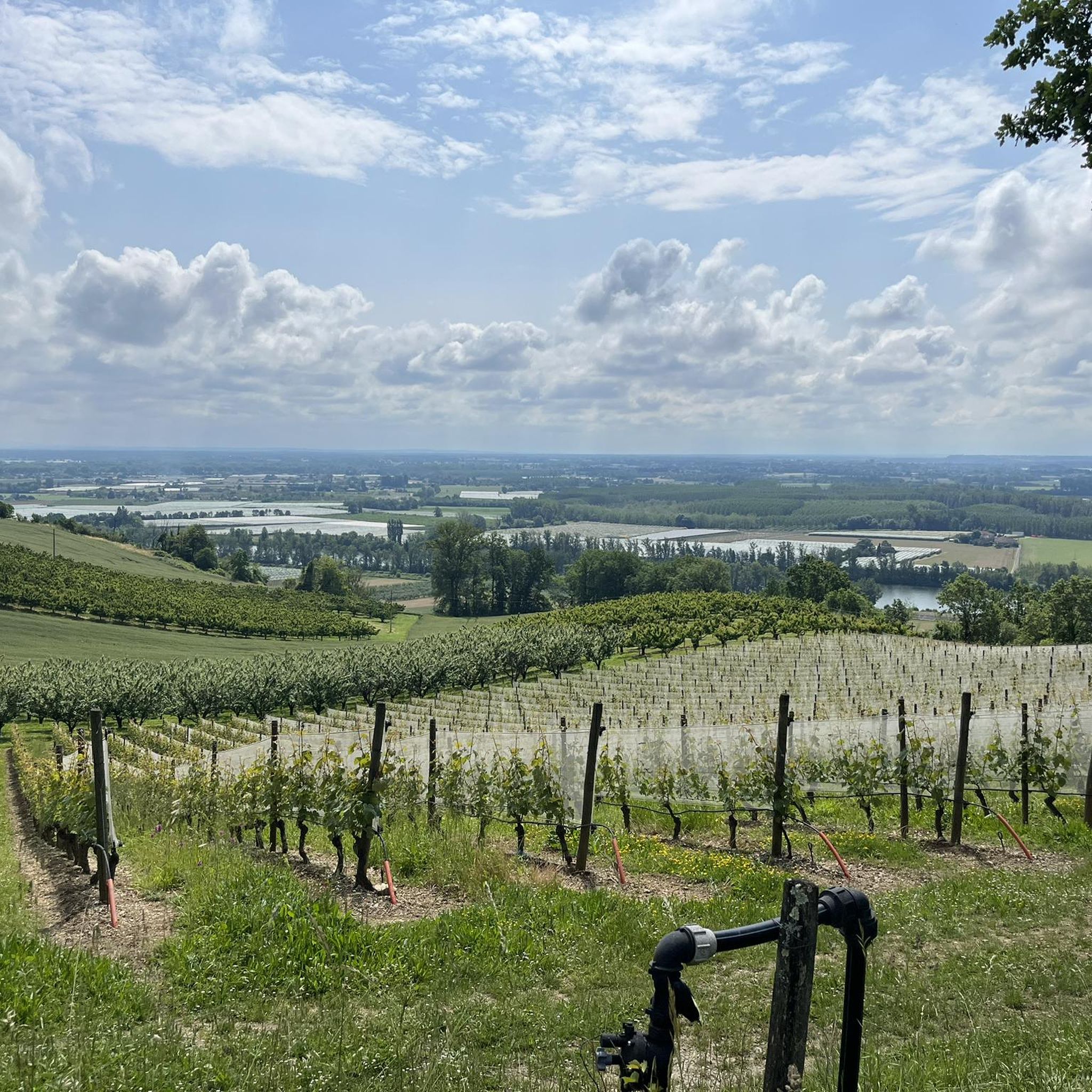
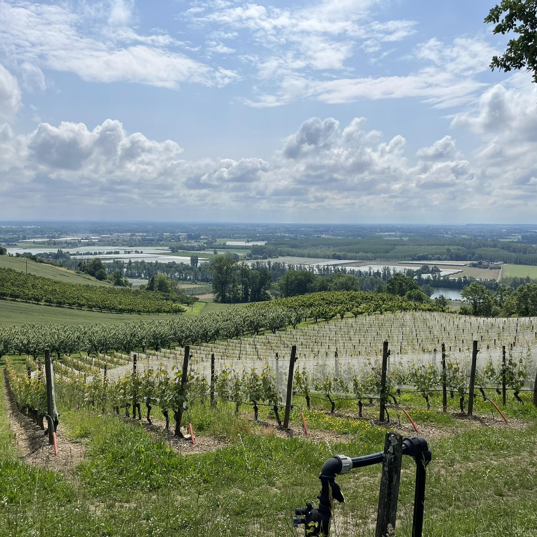
Hikes around Castelmayran primarily feature the verdant Garonne River valley, rolling agricultural fields, and picturesque canal-side paths. The region, often called the 'French Tuscany,' offers a scenic backdrop of sunflower and wheat fields, orchards, and vineyards, providing a tranquil and varied landscape for exploration.
Are there any notable landmarks or natural features to see while hiking?
Yes, the area is rich in natural beauty and historical sites. You can explore the ecologically significant Natura 2000 sites along the Garonne, or integrate charming nearby villages into your hikes. For instance, the route Moissac Canal – Moissac loop from Castelsarrasin takes you along the canal and through the Garonne valley. You can also discover highlights like the Cacor Canal Bridge or the historic town of Moissac with its UNESCO World Heritage Abbey Church.
What is the best time of year to hike in Castelmayran?
The region's pleasant climate makes hiking enjoyable for much of the year. Spring and autumn offer comfortable temperatures and vibrant landscapes, with blooming fields in spring and rich colors in autumn. Summer can be warm, but riverside and canal paths provide cooler options. Winter hiking is also possible, offering a quieter experience of the rural scenery.
Are there family-friendly hiking options around Castelmayran?
Yes, many of the trails are suitable for families. The area offers numerous easy walks with minimal elevation changes, perfect for all ages. For example, the Cacor Canal Aqueduct in Moissac – Cacor Canal Bridge loop from Moissac is an easy 3.9 km route that provides a pleasant outing.
Can I bring my dog on the hiking trails in Castelmayran?
Many of the rural paths and trails around Castelmayran are dog-friendly, allowing you to enjoy the scenery with your canine companion. However, it's always recommended to keep dogs on a leash, especially when passing through agricultural areas or near livestock, and to respect local regulations regarding nature reserves.
Are there circular walks available in the area?
Yes, Castelmayran and its surroundings offer several excellent circular routes. A popular choice is the Boudou Bridge loop from Castelsarrasin, a moderate 11.5 km trail that provides varied terrain and views of the Garonne. Another option is the Hiking loop from Castelsarrasin, a moderate 11.1 km path through the local countryside.
What do other hikers enjoy most about hiking in Castelmayran?
The area is highly rated by the komoot community, with an average score of 4.3 stars from over 50 reviews. Hikers often praise the tranquil rural landscapes, the scenic Garonne River views, and the well-maintained paths along the canals. The diversity of routes, from easy strolls to longer treks, is also frequently highlighted.
Where can I find parking for hiking trails near Castelmayran?
Parking is generally available in and around the villages that serve as starting points for many trails. For routes originating from Castelsarrasin or Moissac, you'll typically find designated parking areas within these towns, often near the canal or town centers. Specific parking details can usually be found on individual route descriptions.
Are there options for public transport to reach hiking trailheads?
While Castelmayran itself is a rural commune, nearby larger towns like Moissac and Castelsarrasin are more accessible by public transport, including regional train services. From these towns, you can often find local bus services or start your hike directly, as many routes begin from these locations. For detailed public transport information, it's best to consult local transport websites like tourisme-tarnetgaronne.fr.
What should I bring for a hike around Castelmayran?
For hiking in Castelmayran, comfortable walking shoes are essential. Depending on the season, bring water, sun protection (hat, sunscreen), and layers of clothing. If you plan to explore the canal paths or rural tracks, a map or GPS device is useful. Snacks and a camera to capture the beautiful 'French Tuscany' landscapes are also recommended.
Most popular attractions around Castelmayran

Get inspired with the komoot mobile app


Explore more
Browse the best Hikes in other regions.
