The best cycling routes around Colombiers
4.3
(163)
1,316
riders
195
rides
Touring cycling routes around Colombiers traverse a diverse landscape in southern France, characterized by historic waterways and varied countryside. The region features the UNESCO World Heritage Canal du Midi with its flat, tree-lined towpaths. Beyond the canal, routes extend into open countryside with expansive vineyards and views of the unique Etang de Montady. While many routes are flat, some areas include gentle hills, offering a mix of terrain.
Best touring cycling routes around Colombiers
- The most popular touring cycling route…
Last updated: October 9, 2026
4.3
(12)
89
riders
Hard bike ride. Very good fitness required. Mostly paved surfaces. Suitable for all skill levels.
4.8
(5)
26
riders
37.0km
02:36
120m
120m
Moderate bike ride. Good fitness required. Mostly paved surfaces. Suitable for all skill levels.

4.0
(1)
22
riders
76.3km
06:05
640m
640m
Hard bike ride. Very good fitness required. Mostly paved surfaces. Suitable for all skill levels.
21
riders
44.9km
03:34
420m
420m
Moderate bike ride. Good fitness required. Mostly paved surfaces. Suitable for all skill levels.
5.0
(3)
25
riders
119km
07:01
570m
570m
Hard bike ride. Very good fitness required. Mostly paved surfaces. Suitable for all skill levels.
Get access to more routes and recommendations from other explorers.
Already have an account?
Our route recommendations are based on thousands of hikes, rides, and runs completed by other people on komoot.
Start today with a free account
Your next adventure awaits.



Tips from the Community

The "Tours" at the beginning of the Henri IV bridge in Châtellerault are indeed a historic complex linked to the city's old fortifications. However, they must be distinguished from the three brick towers of the former Weapons Factory. The towers are located at the end of the Henri IV bridge, on the town side, and are a remnant of the defensive system that protected the crossing of the Vienne. Two round towers remain, on the Châteauneuf side. They once framed a monumental central pavilion, which may explain the name or the impression of a set of three towers. 🏰 The history of the Henri IV bridge towers 1. Towers already existed before the current bridge The crossing of the Vienne at Châtellerault is very old. In the Middle Ages, the bridge had a major strategic and economic function. At the end of the 15th century, a document already mentions two towers built on the Châteauneuf side and connected by a vault or a central structure. They were preceded by a drawbridge. It was therefore a true monumental gate giving access to the bridge. 🏛️ But there was much more than the two current towers This is probably the point that interests us. Originally, the entrance to the bridge on the Châteauneuf side comprised: - a round tower to the north; - a round tower to the south; between them, a central pavilion with - a monumental gate; - and a drawbridge allowing access to be closed. The central pavilion was demolished in 1824. The two towers, however, were preserved. Recent archaeological research has indeed made it possible to find the foundations of the central pavilion. 🔎 And there were also two other towers! The bridge was designed in a much more monumental way than we see today. At the other end of the bridge, on the town side, there were also two square towers. They disappeared later, notably because they hindered traffic. So originally there were four towers, two at each end, to which the central pavilion on the Châteauneuf side was added. 📷 A particularly interesting old photograph The Ministry of Culture holds an old photograph titled "Tour d’entrée" (Entrance Tower), taken by Georges-Louis Arlaud (1869-1944). It shows the complex at a time when both towers still existed with their ancient appearance. See the old photograph from the Ministry of Culture https://pop.culture.gouv.fr/notice/memoire/APHF002200?utm_source=chatgpt.com And here is an old postcard of the southern entrance tower, which allows us to see the towers at the beginning of the 20th century. https://www.geneanet.org/cartes-postales/view/7912977 📍 What can be seen today The two current towers are impressive: cylindrical stone towers, topped with conical slate roofs. They belong to the City of Châtellerault, while the bridge itself is under the jurisdiction of the Department of Vienne. Interesting point: contrary to what their military appearance might suggest, these towers did not primarily have a military defense function. They were notably used for controlling entrances and, at certain periods, for sanitary control or the collection of passage tolls.
0
0
On 30/08/2026, the Francois Mitterand space, right in front of the kiosk, welcomed almost 1400 clarinettists to break the world record held by Hong Kong and entered in the Guinness Book. This has been done and recorded by an official member of the organization who came specifically for this purpose. The objective announced for months by the Poitiers conductor Emmanuel Boulanger has been largely achieved. The old record, set in Hong Kong with 448 clarinettists, has been smashed. Amateurs, music school students and professionals played together, in front of a large audience. The performance should now feature in the Guinness Book of Records. Below is the press article and video published locally. https://share.google/KJQ2WCRdVkkB0aF61
0
0
🏭 1. A museum set up in the former “Manu” Le Grand Atelier - Museum of Art and Industry is located on the site of the former Châtellerault Arms Factory ("Manufacture d’armes"). The Manufacture was created by royal ordinance on July 14, 1819, under Louis XVIII. Construction began in 1820. Its location in Châtellerault was notably due to the presence of the Vienne river, which allowed for the use of hydraulic energy, and the existence of a significant local tradition of cutlery and metallurgy. Initially, it mainly produced edged weapons: sabers, swords, lances, and cuirasses. From the 1830s onwards, production also turned to firearms. The Manufacture gradually became a huge industrial complex, employing several thousand people. It played a considerable role in the economic and social history of Châtellerault. 🔧 2. The museum building The building now occupied by the Grand Atelier is particularly interesting. It is part of the former assembly and finishing workshop, built between 1886 and 1887, notably in the context of the production of the Lebel rifle. It is a characteristic industrial building from the late 19th century, with vast spaces, large glass bays, and saw-tooth roofs allowing for significant natural light. It is now protected as heritage. The Manufacture closed permanently in 1968. 🚗 3. The birth of the automobile museum After the closure of the Manufacture, part of the buildings was reused for cultural purposes. As early as 1969, the site hosted a museum, notably stemming from Bernard de Lassée's vehicle collection. It was first named Musée de la Technique et de l’Automobile, then became Musée Auto-Moto-Vélo. The town of Châtellerault acquired part of Bernard de Lassée's collection and gradually developed the museum. The collections include, in particular, vintage cars, motorcycles, bicycles, engines, posters, and accessories, featuring prestigious brands such as Panhard-Levassor, Delahaye, Talbot, Darracq, or Bugatti. 🏛️ 4. The merger with the former Sully museum This is an important step in understanding why the museum today bears the name “museum of art and industry”. Châtellerault also had another museum, located in the Hôtel Sully, dedicated to the history and heritage of the town: archaeology, fine arts, weapons, cutlery, ethnology, local artists, etc. Gradually, the collections of the two institutions were brought together on the site of the former Manufacture. The Ministry of Culture thus indicates that the collections were regrouped on the Manufacture site, first under the name Musée de la technique et de l’automobile, then Musée Auto-Moto-Vélo, and finally Grand Atelier. 🎭 5. The transformation into “Grand Atelier” After significant renovations, the museum was reorganized and took its current name in 2019: Le Grand Atelier – Musée d’art et d’industrie. It is therefore no longer just a museum dedicated to automobiles. It now offers three main tours: 🚗 Auto-Moto-Vélo: the evolution of transport from the 19th century to the 2000s; 🔫 Manufacture d’armes: the industrial and social history of the “Manu” and its workers; 🎭 Cabaret du Chat Noir: dedicated to Rodolphe Salis, born in Châtellerault and founder of the famous Montmartre cabaret. The museum now covers over 3,000 m² of exhibition space. An important clarification It is therefore necessary to distinguish: - The Arms Factory (“La Manufacture d’armes”) → the large industrial site created in 1819, closed in 1968. - The Grand Atelier building → a former workshop of the Manufacture, built in 1886-1887. - Le Grand Atelier – Museum of Art and Industry → the museum gradually created on this site, whose current name dates from 2019. - And the former Sully museum → a historic museum institution in Châtellerault, part of whose collections have been integrated into the Grand Atelier.
0
0
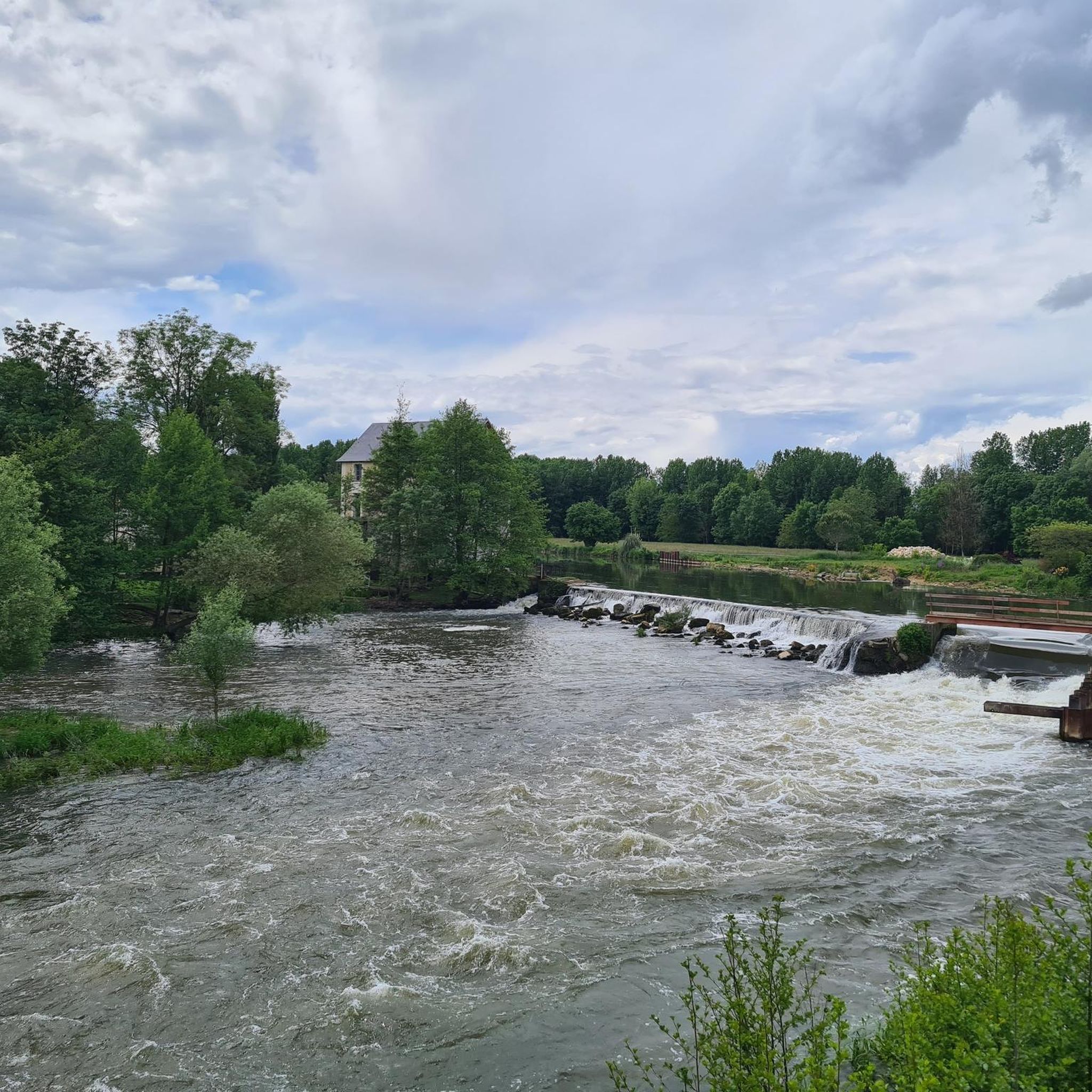
The history of the Châtellerault dam on the Vienne river, located at the site of the former weapons factory (Manufacture d’armes), is particularly interesting as it is directly linked to the industrialization of the town. 1. A first dam for the Manufacture The first structure was built around 1824, shortly after the creation of the Châtellerault weapons factory in 1819-1822. Its primary objective was not to produce electricity: it was to provide hydraulic power to the Manufacture and to regulate the level of the Vienne necessary for its installations. Administrative sources do indicate a dam built in 1824, intended to supply the Manufacture. The presence of this dam is therefore closely linked to the spectacular industrial development of Châtellerault in the 19th century. 2. The dam then plays a role in water supply The dam also gained importance for the town's water supply. After 1864, when the Manufacture no longer opposed the use of the Vienne's water, the town installed a pumping station near the dam. Hydraulic rams and then, from 1879, a steam engine, made it possible to pump water to the reservoirs and fountains of Châtellerault. It is therefore a site where three stories intersect: - the weapons factory; - water supply; - and then electricity production. 3. Transformation into a hydroelectric power plant The major turning point occurred at the beginning of the 20th century. A hydroelectric power plant was built from 1918 and commissioned in 1921, for the Société des Forces Motrices de la Vienne. The associated dam measures approximately 207 m and creates a head of 11.50 m. The power reached about 10,000 hp in 1926. There are also plans preserved at the Defence Historical Service (Service historique de la Défense) concerning precisely the dam, the spillway, the gates, and the hydroelectric power plant, dated notably from 1916 to 1928. 4. Destruction in 1944 The dam and hydroelectric installations were destroyed in 1944, during the fighting and the withdrawal of German forces. They were then rebuilt in 1952. This reconstruction partly explains why the structure we see today does not exactly correspond to the dam of the 1920s. 5. Since 1967: EDF In 1967, EDF took over the operation of the hydraulic power plant. Since then, the dam has mainly served the function of hydroelectric power production. A point of interest: this dam is not a flood control structure Despite its presence on the Vienne, it should not be equated with a large dam intended to protect Châtellerault against floods. Its storage capacity is relatively small and its role is essentially linked to electricity production and maintaining a water level. PPRI (Flood Risk Prevention Plan) documents specify that its influence is negligible during very large floods, such as those of 1913 or 1944. Simplified chronology -1824: Construction of the first dam for the Manufacture -1864-1879: Use for the water supply of Châtellerault -1918: Start of construction of the hydroelectric power plant -1920-1921: Commissioning of the hydroelectric installation -1926: power of approximately 10,000 hp -1944: The history of the Châtellerault dam on the Vienne river, located at the site of the former weapons factory, is particularly interesting as it is directly linked to the industrialization of the town.
0
0

Luxury hotel and restaurant project. From the outside, the castle is interesting to see. It reminds me of the Château de Pierrefonds, in a miniature version. It is classified as a historic monument,
0
0


Frequently Asked Questions
How many touring cycling routes are available around Colombiers?
There are over 180 touring cycling routes in the Colombiers area, offering a wide range of options for different skill levels and preferences. You'll find routes along historic waterways, through rolling countryside, and past unique agricultural landscapes.
What types of terrain can I expect on touring cycling routes in Colombiers?
The terrain around Colombiers is quite varied. You'll find predominantly flat, tree-lined towpaths along the UNESCO World Heritage Canal du Midi. Away from the canal, routes feature views of unique agricultural landscapes like the Etang de Montady and follow the Orb River, with some moderate climbs in the surrounding hills.
Are there any easy touring cycling routes suitable for beginners or families?
Yes, many routes are suitable for beginners and families, especially those along the Canal du Midi. These towpaths are generally flat and well-maintained. For example, the Etang de Montady viewpoint – Colombiers loop is a relatively easy 4.5-mile (7.2 km) trail offering scenic views.
Are there any challenging touring cycling routes for experienced cyclists?
While many routes are moderate, some offer more challenge with moderate climbs in the rolling countryside. For instance, the The Child's Tomb – Le grand Soubis loop from Naintré-les-Barres is rated as difficult, covering nearly 80 km with significant elevation changes.
What historical or natural attractions can I see along the cycling routes?
Cycling around Colombiers offers access to several historical and natural attractions. You can visit the ancient hillfort of Oppidum of Ensérune via routes like the Colombiers – Oppidum of Ensérune loop. The Canal du Midi itself is a UNESCO World Heritage site with remarkable engineering. You can also explore nearby castles such as Château de Dissay or Haut-Clairvaux Keep.
Are there any circular touring cycling routes in the area?
Yes, many routes around Colombiers are designed as loops, allowing you to start and end in the same location. Examples include the Etang de Montady viewpoint – Colombiers loop and the Hillfort – Colombiers loop from Montady, which takes you through rolling countryside.
What is the best time of year for touring cycling in Colombiers?
The region benefits from a Mediterranean climate, making spring and autumn ideal for touring cycling. The weather is generally pleasant, and the landscapes are vibrant. Summer can be warm, especially in July and August, so early morning or late afternoon rides are recommended during those months.
What do other touring cyclists enjoy most about cycling in Colombiers?
The routes in Colombiers are highly rated by the komoot community, with an average score of 4.4 stars from over 100 reviews. Reviewers often praise the picturesque and tranquil experience along the Canal du Midi, the historical sites like Oppidum of Ensérune, and the diverse scenery ranging from flat towpaths to rolling countryside.
Are there any long-distance touring cycling routes near Colombiers?
Yes, for those seeking longer adventures, there are routes that extend further into the region. For example, the Châtellerault – View of the Wild Vienne River loop from Nerpuy is a challenging route spanning over 180 km, offering extensive exploration of the wider area.
Where can I find parking for touring cycling routes in Colombiers?
Colombiers, being a hub along the Canal du Midi, typically offers parking options near the port or in the village center, providing convenient access to the canal towpaths and other local routes. Specific parking details may vary by starting point, so checking local signage is always recommended.
Can I access touring cycling routes in Colombiers using public transport?
Colombiers is generally accessible by local bus services, which may connect to larger towns like Béziers. While public transport can get you to the area, direct access to specific trailheads with a bicycle might require checking local transport policies regarding bikes. The Canal du Midi's accessibility makes it a good starting point from the village itself.
Are there places to stop for refreshments or meals along the cycling routes?
Yes, cycling along the Canal du Midi and through charming towns and villages provides numerous opportunities to experience local culture and gastronomy. You'll find cafes, restaurants, and shops in places like Port de Colombiers and other villages along the way, offering regional specialties and wines.
Most popular routes around Colombiers
Most popular attractions around Colombiers

Get inspired with the komoot mobile app


Explore more
Browse the best Cycling routes in other regions.
