The best walks and hikes around Courcoury
4.5
(136)
835
hikers
149
hikes
Hiking around Courcoury provides access to diverse natural landscapes, characterized by the confluence of the Charente and Seugne rivers. The Seugne valley forms a green corridor with alluvial forests and marshes, recognized for its ecological significance. The area features gentle elevations and is bordered by protected zones, offering a variety of natural environments for exploration.
Best hiking trails around Courcoury
- The most popular hiking route is Étang du Clone Flanquet loop from Les Gonds, a 12.0 miles (19.3 km)…
Last updated: October 14, 2026
4.0
(1)
14
hikers
19.3km
04:59
100m
100m
Moderate hike. Good fitness required. Easily-accessible paths. Suitable for all skill levels.
5.0
(2)
14
hikers
7.99km
02:07
80m
80m
Moderate hike. Good fitness required. Easily-accessible paths. Suitable for all skill levels.

10
hikers
10.1km
02:40
80m
80m
Moderate hike. Good fitness required. Easily-accessible paths. Suitable for all skill levels.
7
hikers
8.45km
02:09
20m
20m
Moderate hike. Good fitness required. Easily-accessible paths. Suitable for all skill levels.
5.0
(1)
10
hikers
9.54km
02:24
10m
10m
Moderate hike. Good fitness required. Easily-accessible paths. Suitable for all skill levels.
Get access to more routes and recommendations from other explorers.
Already have an account?
Our route recommendations are based on thousands of hikes, rides, and runs completed by other people on komoot.
Start today with a free account
Your next adventure awaits.


Tips from the Community

The Chaniers ferry (Charente-Maritime) is one of the last traditional river ferries still in operation in France. It allows crossing the Charente River between Chaniers and Courcoury, a few kilometers downstream from Saintes. A crossing used for centuries History of the Chaniers ferry The ferry crossing at Chaniers is very old: it dates back to the Middle Ages. In the mid-17th century, it was already an important crossing point on the Charente. It was not only used to cross the river: it also allowed residents to access the meadows on the other side, particularly for agricultural activities. In the early 20th century, the Chaniers ferry was part of a much larger network of crossings on the Charente. In 1909, thirteen ferries were still recorded in Charente-Inférieure, including the one in Chaniers. Ferries were essential at the time before the proliferation of bridges. Why "chain ferry"? The principle consists of holding the ferry on a chain connecting the two banks. The ferryman uses this chain to move the boat forward and keep it on its course despite the current. In Chaniers, the current ferry is motorized, unlike the ferry in Dompierre-sur-Charente, which is operated manually. The Tourist Office, however, still describes it as a "chain ferry," and the municipality as the traditional crossing method connecting Chaniers to Courcoury. The ferry today The crossing takes place between Le Communal in Chaniers and the Courcoury bank. It is free and can transport pedestrians, cyclists, and motorized vehicles. Its operation depends in particular on the flow of the Charente River. The municipality of Chaniers officially presents "the port of Chaniers and its chain ferry" as an element of its local heritage. Important point: I am correcting my previous message: the Chaniers ferry is not simply a "19th-century ferry." The crossing has been attested since the Middle Ages; it is its mode of operation and its equipment that have evolved over the centuries.
0
0
🏛️ Construction: 18-19 AD The arch was built around 18-19 AD, during the reign of Emperor Tiberius. It stood at the entrance to the Roman bridge crossing the Charente, at the outlet of the Via Agrippa, which connected Lyon to Saintes. It is therefore not truly a "triumphal arch": it was both a road monument and a monumental gate marking the entrance to Mediolanum Santonum, the capital of Roman Aquitaine. 👤 Who had it built? The arch was financed by Caius Julius Rufus, a Romanized notable from Saintonge. He dedicated it to Tiberius as well as his nephew Germanicus. The inscriptions engraved on the entablature still allow us today to know the figures to whom it was dedicated. The name "Arch of Germanicus" therefore comes from this dedication, and not from the fact that Germanicus personally had the arch built or crossed it. 🏗️ A rather exceptional monument The arch has two bays, likely allowing for the differentiation of traffic flows. It measures approximately 15 m high by 16 m wide. Its Corinthian and composite capitals bear witness to particularly meticulous Roman architecture. It constituted a true demonstration of the power and Romanization of Saintes. ⚠️ The moment the arch almost disappeared This is probably the most interesting episode in its history. For centuries, the arch was always located at the level of the Roman bridge and then the medieval bridge, on the right bank of the Charente. In the 19th century, the old bridge had become dilapidated. When it was decided to demolish it, around 1843, the arch was also threatened with destruction. It was then that Prosper Mérimée, Inspector General of Historical Monuments, intervened. He advocated for its preservation and arranged for its dismantling, relocation, and reassembly on the new bank. Another figure is also associated with this preservation: Victor Hugo, who stayed in Saintes in September 1843 and intervened in favor of the monument's conservation with Mérimée. 📍 Why is the arch no longer exactly in its ancient location? The arch we see today, on Place Bassompierre, is therefore no longer in its original location. It was moved a few dozen meters during the transformation of the quays and the disappearance of the old bridge. It was dismantled stone by stone and then reassembled in order to preserve it. It is now located in the immediate vicinity of the ancient Roman bridge crossing. 🏛️ Protection The Arch of Germanicus was finally classified as a historical monument in July 1905. An interesting detail The Crazannes quarries, located near Saintes, supplied a limestone widely used in the region's ancient constructions. Crazannes stone was notably used for monuments such as the Arch of Germanicus. In summary: 18-19 → construction of the arch at the entrance to the Roman bridge ↓ Antiquity → Middle Ages → the arch remains associated with the crossing of the Charente ↓ 1843 → demolition of the old bridge and threat to the arch ↓ 1843-1844 → Mérimée's intervention and relocation of the arch ↓ 1905 → classified as a Historical Monument
0
0
🏛️ 1. La naissance du musée : 1815 Le Musée archéologique de Saintes est l’un des plus anciens musées archéologiques de France. Son origine remonte à 1815. À cette époque, Saintes connaît de nombreux travaux urbains. On met régulièrement au jour des blocs sculptés, inscriptions, fragments de colonnes et éléments architecturaux antiques, provenant notamment des monuments de la ville gallo-romaine. Le baron Alexandre Chaudruc de Crazannes, érudit et passionné d’archéologie, joue un rôle déterminant dans leur conservation. Avec des érudits locaux et le soutien de la municipalité, les fragments sont rassemblés afin d’éviter leur disparition. Le musée est ainsi créé pour conserver ce patrimoine. À l’origine, le musée est donc essentiellement un musée lapidaire : il conserve surtout des pierres provenant des monuments antiques. 🏺 2. D’où viennent les pierres ? Une particularité remarquable des collections de Saintes est leur relation avec l’ancienne enceinte de la ville. À la fin de l’Antiquité, probablement aux IIIe-IVe siècles, Saintes connaît une période d’insécurité. Une importante enceinte défensive est construite. Pour la bâtir rapidement, les habitants réutilisent les matériaux provenant de bâtiments plus anciens : temples, édifices publics, monuments funéraires et bâtiments monumentaux. Ainsi, des morceaux de monuments qui avaient probablement été magnifiques se retrouvent incorporés dans les murailles. Les fouilles de cette enceinte ont donc permis de récupérer une quantité considérable de sculptures et de blocs architecturaux. C’est une des raisons pour lesquelles le musée a longtemps possédé une exceptionnelle collection lapidaire. 📚 3. Le rôle de Louis Audiat Un autre personnage important est Louis Audiat, érudit et bibliothécaire de Saintes. En 1888, il publie un catalogue détaillé de la collection lapidaire de Saintes. C’est une étape importante : les pièces ne sont plus seulement conservées, elles commencent à être étudiées et documentées scientifiquement. Cela témoigne de l’évolution de la conception du musée : on passe progressivement d’un lieu où l’on conserve des « antiquités » à un véritable établissement consacré à l’étude de l’histoire antique de Saintes. 🏛️ 4. Le bâtiment actuel : 1931 L’étape majeure suivante intervient en 1931. Les collections sont alors installées dans l’ancien bâtiment des abattoirs municipaux, situé aujourd’hui sur l’esplanade André-Malraux. Le bâtiment est réaménagé pour accueillir les collections sous l’impulsion de Charles Dangibeaud, archéologue et érudit, qui est alors conservateur des musées de Saintes. Le choix peut sembler surprenant : un ancien abattoir devient un musée archéologique ! Mais l’aménagement est particulièrement intéressant. La cour et les éléments architecturaux antiques donnent au lieu une apparence volontairement évocatrice de l’Antiquité. 🗿 5. Le grand musée lapidaire Pendant une grande partie du XXe siècle, le musée est surtout célèbre pour son immense collection de blocs antiques. Il s’agit notamment : de fragments de colonnes ; de chapiteaux ; de corniches ; de frises ; de sculptures ; d’inscriptions ; d’éléments provenant de monuments publics ; de fragments provenant de l’enceinte antique. Une partie de ces éléments provenait directement des monuments détruits lors de la construction de l’enceinte de Saintes. La collection comptait plus de 700 blocs de pierre dans la seconde salle du musée. ⚠️ 6. Une transformation importante au XXIe siècle Le musée que l’on visite aujourd’hui est assez différent de celui du XXe siècle. Le bâtiment qui abritait une grande partie de la collection lapidaire a fait l’objet d’un diagnostic révélant des fragilités structurelles. Pour protéger les pièces, la collection lapidaire a été déposée et mise en réserve en 2018. C’est un point important : si vous avez connu le musée autrefois, vous pouvez donc avoir le souvenir d’un musée rempli de grandes pierres antiques ; ce n’est plus sa présentation actuelle. 🏺 7. Le musée actuel : découvrir Mediolanum La présentation actuelle privilégie davantage la compréhension de la vie quotidienne à Mediolanum Santonum, nom antique de Saintes. Les collections permettent notamment d’aborder : la maison et son décor ; les rites domestiques ; les jeux ; l’alimentation et la vaisselle ; la parure ; les soins du corps ; la coiffure ; les vêtements. La présentation est complétée par des restitutions graphiques et une borne interactive, permettant de replacer les objets dans la ville antique. Le musée s’intéresse ainsi davantage à la façon dont vivaient les habitants de Saintes qu’à la seule présentation de monuments. 🏺 8. Un musée lié à toute l’histoire de Mediolanum Le Musée archéologique est particulièrement intéressant parce qu’il faut le considérer avec les autres vestiges de Saintes. Mediolanum Santonum était une ville majeure de la Gaule romaine et la capitale de la civitas des Santons. Le musée se trouve d’ailleurs à proximité immédiate de l’arc de Germanicus, monument qui marquait l’entrée de la ville antique et l’arrivée de la voie romaine venant de Lyon. On peut donc pratiquement faire une lecture de la ville antique en partant du musée : Musée archéologique → Arc de Germanicus → Charente → amphithéâtre → anciens quartiers de Mediolanumun
0
0
The museum is open during high season: - Tuesday to Friday: 10 a.m. – 6 p.m. - Saturday and Sunday: 10 a.m. – 12:30 p.m. and 1:30 p.m. – 6 p.m. Archaeological Museum of Saintes — Esplanade André-Malraux, Saintes. The museum officially obtained the « Musée de France » label in 2003. And current tourist information indicates that after the floods of February 2026, the museum had been temporarily closed for renovation, with a reopening in May 2026 for the occasion of the European Museum Night. Note: the floods nevertheless damaged some collections, particularly wooden elements from the Courbiac shipwrecks, which had to be evacuated for treatment.
0
0

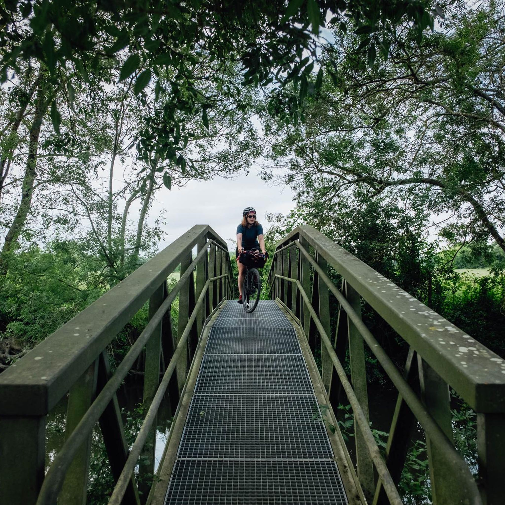
I really enjoyed this ride. I’m 46, I did it on a 40 year old road bike, it’s more suited to a cyclocross bike!
1
0

The Archaeological Museum of Saintes has been redesigned and its permanent exhibition renewed. Visitors are invited to discover the ancient city of Saintes through its urban planning and the lives of its inhabitants 2000 years ago.
5
0
Located in the heart of the city, the public garden is a place of life for the residents of Saintais, to be discovered by walkers. The kiosk, the orangery, the animals or the games. The park was designed in 1925 on the banks of the Charente and forms the connection between the city and the Palu.
5
0

With origins dating back to the Gallo-Roman era, the town of Saintes accumulates sites and monuments like so many layers of a centuries-old history. From the banks of the Charente to the height of the Capitol, there is so much to see along the streets of the city: the Germanicus arch, the thermal baths, the Saint Pierre cathedral, the Jacobins convent, the Musée de l'Echevinage , the Saint Eutrope Basilica, the footbridge over the Charente, etc. The heritage is omnipresent and offers many surprises and viewpoints.
0
0
Frequently Asked Questions
How many hiking trails are available around Courcoury?
There are over 130 hiking routes around Courcoury, offering a wide variety of options for different preferences. These include both easy and moderate trails, ensuring there's something for every skill level.
What kind of terrain can I expect on hikes around Courcoury?
Hiking around Courcoury offers diverse terrain, primarily shaped by the confluence of the Charente and Seugne rivers. You'll find riverside paths, alluvial forests, and marshes, particularly within the ecologically significant Seugne valley. Many routes also traverse open countryside and local villages, with generally gentle elevations.
Are there easy hiking options suitable for beginners in Courcoury?
Yes, Courcoury offers plenty of easy hiking options. Out of the over 130 available routes, more than 60 are classified as easy, making them perfect for beginners or those looking for a relaxed stroll through the local landscape.
What do other hikers say about the trails in Courcoury?
The hiking trails around Courcoury are highly regarded by the komoot community, boasting an average rating of 4.4 stars from over 100 reviews. Hikers often praise the peaceful natural settings, the variety of landscapes from riversides to forests, and the well-maintained paths.
Are there any circular hiking routes near Courcoury?
Yes, many of the trails around Courcoury are circular, allowing you to start and end your hike in the same location. For example, the Étang du Clone Flanquet loop from Les Gonds is a popular moderate circular route exploring local water features, and the Hiking loop from Les Gonds offers varied terrain with minimal elevation.
Can I find family-friendly hikes in the Courcoury area?
Absolutely. The region's gentle elevations and numerous easy trails make it ideal for family outings. Many routes explore the charming countryside and riverbanks, providing accessible and enjoyable experiences for all ages. The 'Saint-Martin Church loop from Courcoury' is noted as a moderate run suitable for all skill levels, covering up to 3 miles.
Are dogs allowed on the hiking trails around Courcoury?
Generally, dogs are welcome on most hiking trails in the Courcoury area, especially in the natural outdoor spaces. However, it's always recommended to keep them on a leash, particularly in protected ecological zones like the Seugne valley, to protect local wildlife and ensure a pleasant experience for everyone.
What natural features can I explore on a hike near Courcoury?
Courcoury is rich in natural features. You can explore the 'green corridor' of the Seugne valley with its alluvial forests and marshes, home to diverse flora. The Charente River also offers scenic paths. Further afield, you can discover forests like the Forêt de Pons, or the striking turquoise waters of the Blue Lake of Guizengeard, which has a 3.2 km loop trail.
Are there any historical or cultural landmarks to see while hiking?
Yes, the area around Courcoury features several interesting landmarks. You can encounter historical sites such as the Abbaye de Fontdouce or the Saint-Martin Church. The nearby city of Saintes also offers significant religious buildings like the Abbaye aux Dames de Saintes and Saint-Pierre Cathedral, which can be incorporated into longer excursions.
What is the best time of year to go hiking in Courcoury?
The Charente-Maritime region, including Courcoury, generally enjoys a mild climate, making hiking pleasant for much of the year. Spring and autumn offer comfortable temperatures and beautiful scenery, with blooming wildflowers or vibrant fall foliage. Summer can be warm, so early morning or late afternoon hikes are often preferred. Winter hikes are also possible, especially on the less exposed trails.
Are there any specific trails that highlight the rivers in the area?
Yes, many trails in Courcoury emphasize its unique position between the Charente and Seugne rivers. The Seugne valley, a recognized ecological zone, offers paths through its 'green corridor' of alluvial forests and marshes. You can also find numerous scenic routes along the Charente River, showcasing vineyards and historical architecture.
Where can I find parking for hiking trails in Courcoury?
While specific parking details for every trail are not always listed, most trailheads in and around Courcoury, especially those starting from villages like Les Gonds or Chaniers, will have designated or informal parking areas. It's advisable to check local signage or komoot tour details for specific starting points like the Hiking loop from Chaniers.
Most popular routes around Courcoury
Most popular attractions around Courcoury

Get inspired with the komoot mobile app


Explore more
Browse the best Hikes in other regions.
