The best cycling routes around Les Gonds
4.4
(206)
1,369
riders
141
rides
Touring cycling routes around Les Gonds traverse a landscape characterized by tranquil marshlands, verdant countryside, and historical towns. The region offers access to La Flow Vélo, a major cycling route, providing a serene environment for cyclists. Terrain primarily consists of gentle gradients, with some routes featuring moderate elevation changes. The area's natural features include the Marais des Gonds and picturesque villages.
Best touring cycling routes around Les Gonds
- The most popular touring cycling route is View of the Arch of Germanicus – Cathedral of Saintes loop from Les Gonds, a 32.3 miles (52.0 km) trail that takes 3 hours 53 minutes to complete, offering views of historical landmarks.
- Another top favourite among local touring cyclists is Bois des Graves – Bois de Thénac loop from Les Gonds, a difficult 32.7 miles (52.7 km) path through wooded areas and open countryside.
- Local touring cyclists also love the Chaniers chain bin – View of the Arch of Germanicus loop from Saintes, a 12.5 miles (20.2 km) trail leading through historical sites, often completed in about 1 hour 19 minutes.
- Touring cycling around Les Gonds is defined by picturesque countryside, tranquil marshlands, and historical towns. The network offers options for different ability levels, from easy loops to more challenging routes.
- The routes in Les Gonds are highly rated by the komoot community with an average score of 4.4 stars from over 250 reviews. More than 1,800 touring cyclists have used komoot to explore Les Gonds's varied terrain.
Last updated: August 26, 2026
5.0
(1)
38
riders
51.0km
03:46
470m
470m
Hard bike ride. Very good fitness required. Mostly paved surfaces. Suitable for all skill levels.
5.0
(2)
25
riders
16.9km
01:14
30m
30m
Easy bike ride. Great for any fitness level. Mostly paved surfaces. Suitable for all skill levels.

Sign up for free
5.0
(1)
18
riders
10.5km
00:39
60m
60m
Easy bike ride. Great for any fitness level. Mostly paved surfaces. Suitable for all skill levels.
5.0
(3)
19
riders
Easy bike ride. Great for any fitness level. Mostly paved surfaces. Suitable for all skill levels.
5.0
(1)
14
riders
Easy bike ride. Great for any fitness level. Mostly paved surfaces. Suitable for all skill levels.
Get access to more routes and recommendations from other explorers.
Sign up for free
Already have an account?
Our route recommendations are based on thousands of hikes, rides, and runs completed by other people on komoot.
Start today with a free account
Your next adventure awaits.
Login or Signup


Tips from the Community

The Chaniers ferry (Charente-Maritime) is one of the last traditional river ferries still in operation in France. It allows crossing the Charente River between Chaniers and Courcoury, a few kilometers downstream from Saintes. A crossing used for centuries History of the Chaniers ferry The ferry crossing at Chaniers is very old: it dates back to the Middle Ages. In the mid-17th century, it was already an important crossing point on the Charente. It was not only used to cross the river: it also allowed residents to access the meadows on the other side, particularly for agricultural activities. In the early 20th century, the Chaniers ferry was part of a much larger network of crossings on the Charente. In 1909, thirteen ferries were still recorded in Charente-Inférieure, including the one in Chaniers. Ferries were essential at the time before the proliferation of bridges. Why "chain ferry"? The principle consists of holding the ferry on a chain connecting the two banks. The ferryman uses this chain to move the boat forward and keep it on its course despite the current. In Chaniers, the current ferry is motorized, unlike the ferry in Dompierre-sur-Charente, which is operated manually. The Tourist Office, however, still describes it as a "chain ferry," and the municipality as the traditional crossing method connecting Chaniers to Courcoury. The ferry today The crossing takes place between Le Communal in Chaniers and the Courcoury bank. It is free and can transport pedestrians, cyclists, and motorized vehicles. Its operation depends in particular on the flow of the Charente River. The municipality of Chaniers officially presents "the port of Chaniers and its chain ferry" as an element of its local heritage. Important point: I am correcting my previous message: the Chaniers ferry is not simply a "19th-century ferry." The crossing has been attested since the Middle Ages; it is its mode of operation and its equipment that have evolved over the centuries.
0
0
🏛️ Construction: 18-19 AD The arch was built around 18-19 AD, during the reign of Emperor Tiberius. It stood at the entrance to the Roman bridge crossing the Charente, at the outlet of the Via Agrippa, which connected Lyon to Saintes. It is therefore not truly a "triumphal arch": it was both a road monument and a monumental gate marking the entrance to Mediolanum Santonum, the capital of Roman Aquitaine. 👤 Who had it built? The arch was financed by Caius Julius Rufus, a Romanized notable from Saintonge. He dedicated it to Tiberius as well as his nephew Germanicus. The inscriptions engraved on the entablature still allow us today to know the figures to whom it was dedicated. The name "Arch of Germanicus" therefore comes from this dedication, and not from the fact that Germanicus personally had the arch built or crossed it. 🏗️ A rather exceptional monument The arch has two bays, likely allowing for the differentiation of traffic flows. It measures approximately 15 m high by 16 m wide. Its Corinthian and composite capitals bear witness to particularly meticulous Roman architecture. It constituted a true demonstration of the power and Romanization of Saintes. ⚠️ The moment the arch almost disappeared This is probably the most interesting episode in its history. For centuries, the arch was always located at the level of the Roman bridge and then the medieval bridge, on the right bank of the Charente. In the 19th century, the old bridge had become dilapidated. When it was decided to demolish it, around 1843, the arch was also threatened with destruction. It was then that Prosper Mérimée, Inspector General of Historical Monuments, intervened. He advocated for its preservation and arranged for its dismantling, relocation, and reassembly on the new bank. Another figure is also associated with this preservation: Victor Hugo, who stayed in Saintes in September 1843 and intervened in favor of the monument's conservation with Mérimée. 📍 Why is the arch no longer exactly in its ancient location? The arch we see today, on Place Bassompierre, is therefore no longer in its original location. It was moved a few dozen meters during the transformation of the quays and the disappearance of the old bridge. It was dismantled stone by stone and then reassembled in order to preserve it. It is now located in the immediate vicinity of the ancient Roman bridge crossing. 🏛️ Protection The Arch of Germanicus was finally classified as a historical monument in July 1905. An interesting detail The Crazannes quarries, located near Saintes, supplied a limestone widely used in the region's ancient constructions. Crazannes stone was notably used for monuments such as the Arch of Germanicus. In summary: 18-19 → construction of the arch at the entrance to the Roman bridge ↓ Antiquity → Middle Ages → the arch remains associated with the crossing of the Charente ↓ 1843 → demolition of the old bridge and threat to the arch ↓ 1843-1844 → Mérimée's intervention and relocation of the arch ↓ 1905 → classified as a Historical Monument
0
0
The history of the Louisiana red swamp crayfish (Procambarus clarkii) in the Charente river and its tributaries is quite recent. 🦞 An arrival linked to farming The species is native to the southern United States and northern Mexico. It was introduced to France from 1976, mainly for farming and consumption. Imports particularly concerned the western regions, including Charente and Charente-Maritime. The first introductions were therefore not intended for the wild: it was about developing a new economic resource. But farming quickly became a problem. The crayfish is particularly adept at digging burrows, leaving the water, and withstanding difficult conditions. Individuals escaped from certain farms and bodies of water, allowing them to acclimatize in the natural environment. As early as the beginning of the 1980s, specialists were already reporting risks of establishment in Charente. 🌊 Colonization of the Charente basin The crayfish then gradually spread to the marshes, canals, ponds, and watercourses of the Charente basin. Today, it is well established in the department of Charente: the Charente Fishing Federation lists it among the main crayfish species present. It is particularly adapted to warm, oxygen-poor environments that can undergo periods of drying out. Communes located along the Charente river and its tributaries also report its presence today. ⚠️ Why has it thrived so much? It is a true "champion" of adaptation: it is omnivorous; it tolerates relatively oxygen-poor waters; it withstands periods of drying out; it can move on land to reach a new environment; it reproduces rapidly; it digs burrows in the banks. It has therefore become an invasive alien species. Its development poses several problems: competition with native crayfish, consumption of plants and small aquatic animals, disruption of food chains, and weakening of banks by burrows. It can also be a carrier of aphanomycosis, a disease that affects European crayfish. 📍 And in Charente-Maritime? The situation there is particularly marked. The Charente-Maritime Fishing Federation indicates that the Louisiana crayfish is currently the most present crayfish species in the department, particularly in marshes, slow-flowing waters, and temporarily flooded areas. There is also an interesting historical link with your area of Saintes and the Charente: the species was introduced into the Charente regions for farming before gradually spreading to natural environments. A FAO document from the 1980s already reported that crayfish farmers in Charente had stocked Louisiana crayfish, with the risk that escaped animals would acclimatize.
0
0

Guided tours possible from April 2026! These two fountains were developed by the inhabitants in the 18th and 19th centuries, using the water source of the aqueduct built by the Romans in the 1st century BC. A washhouse and a mill were built there. At the bottom of the mill, restored in 1993 by the village inhabitants, you can discover the "Roman slab" pipeline. The water no longer flows through this aqueduct but disappears into a fault to join the natural underground conduit. Until around 1935, this fountain was owned by a miller who, at his will, prohibited access to the inhabitants, which forced the municipality at the time to build another washhouse upstream in an old quarry.
0
0

beautiful passages along the Charente with pretty monuments and small waterfront cafés in Port d’Envaux and Saintes.
0
0

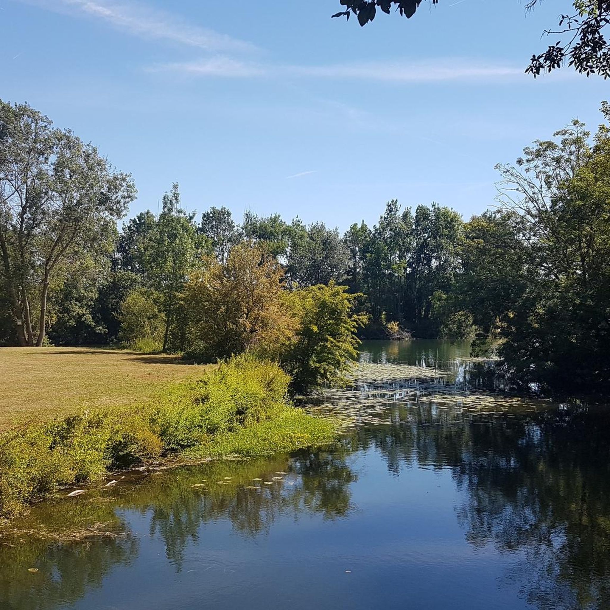
Courcoury is a natural island surrounded by the Charente and Seugne rivers, giving it a unique landscape setting between marshes and waterways, conducive to biodiversity and outdoor activities. It is also the only village in Charente-Maritime to have been awarded 4 stars by the "Villes et villages étoilés" label, recognizing its efforts to reduce light pollution through intelligent and environmentally friendly public lighting.
1
0
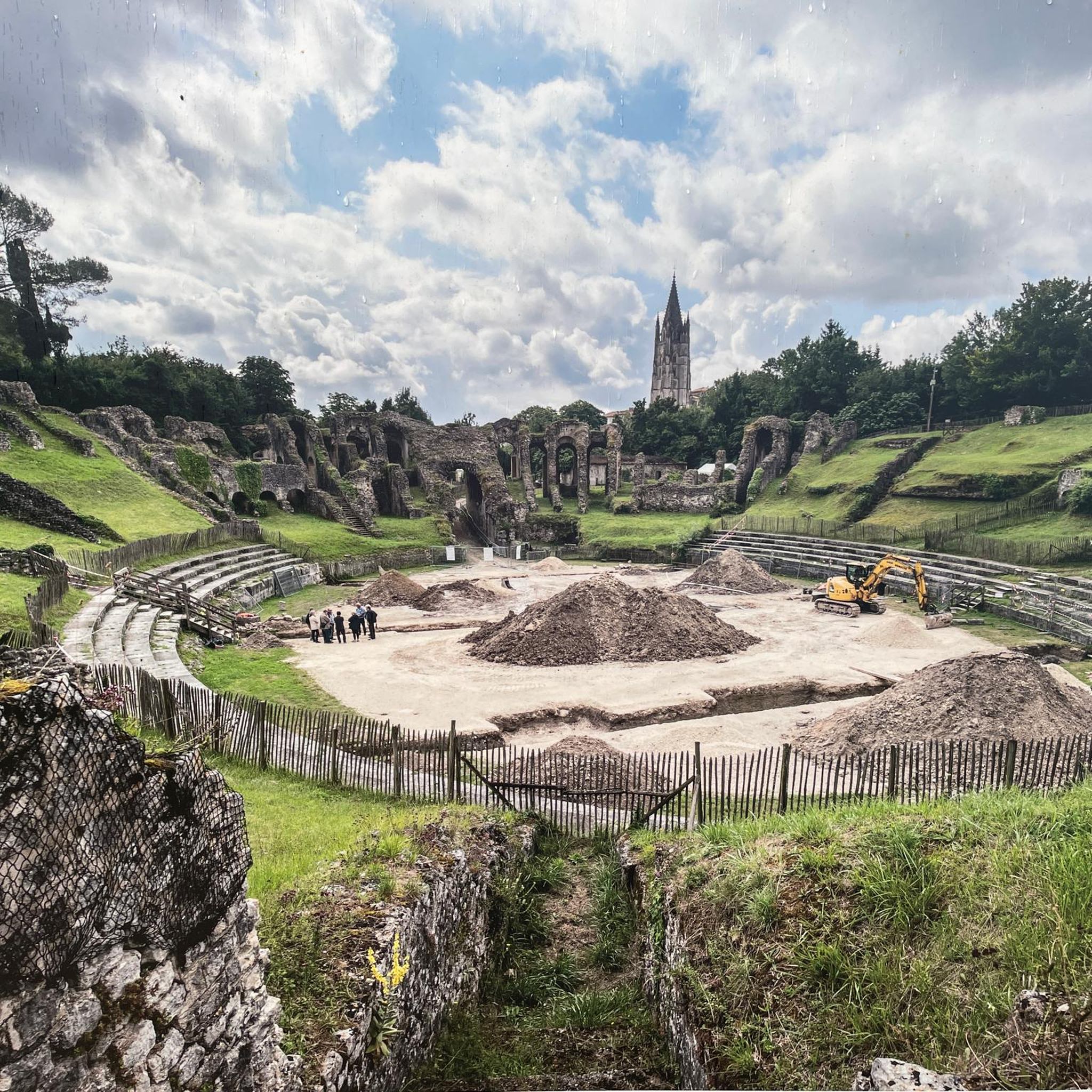
The Gallo-Roman amphitheater of Sainte, also called the Arena of Saintes, is an elliptical monument built between 40 and 50 AD, probably during the reigns of Tiberius and Claudius. It measures approximately 126 meters by 102 meters and could accommodate between 12,000 and 15,000 spectators, making it one of the largest and oldest amphitheaters in Gaul. Located in a natural valley called the "Arènes valley," it takes advantage of the topography to limit construction work, with stands backing onto the hill. The site has two monumental gates, the "Gate of the Living" to the east and the "Gate of the Dead" to the west, and has been the subject of a major restoration project since 2021 to preserve this exceptional heritage. Accessible on foot from the city center, it offers an immersion in Roman history with an educational trail and activities for families
1
0

I really enjoyed this ride. I’m 46, I did it on a 40 year old road bike, it’s more suited to a cyclocross bike!
1
0
Frequently Asked Questions
How many touring cycling routes are available around Les Gonds?
There are over 120 touring cycling routes around Les Gonds, offering a wide variety of options for different preferences and skill levels.
What are the general difficulty levels of touring cycling routes in Les Gonds?
The routes in Les Gonds cater to various abilities. You'll find approximately 50 easy routes, 50 moderate routes, and around 25 more challenging routes, ensuring there's something for every touring cyclist.
What makes touring cycling in Les Gonds unique?
Touring cycling in Les Gonds is unique due to its integration with La Flow Vélo, a scenic 350-kilometer route, and its tranquil environment. Cyclists can explore picturesque countryside, charming villages, and the serene Marais des Gonds, often encountering historical sites along the way.
What do other cyclists say about the routes in Les Gonds?
The touring cycling routes in Les Gonds are highly regarded by the komoot community, with an average rating of 4.4 stars from over 250 reviews. Cyclists frequently praise the region's picturesque scenery, tranquil paths, and the opportunity to discover historical towns.
Are there any easy touring cycling routes suitable for beginners or families?
Yes, there are several easy routes perfect for beginners or families. An excellent option is the Chaniers chain bin – View of the Arch of Germanicus loop from Saintes, which is 20.2 km long and leads through historical sites. Another family-friendly choice is the Cathedral of Saintes loop from Les Gonds, a shorter 10.5 km route.
Can I find challenging touring cycling routes in Les Gonds?
For those seeking a challenge, Les Gonds offers more difficult routes. Consider the Bois des Graves – Bois de Thénac loop from Les Gonds, a 52.7 km path that takes you through wooded areas and open countryside with moderate elevation changes.
Are there circular touring cycling routes available?
Many touring cycling routes around Les Gonds are circular, allowing you to start and end in the same location. An example is the Saint-Martin Church – Chaniers chain bin loop from Les Gonds, a moderate 39.4 km route.
What kind of landscapes can I expect on a touring cycling route in Les Gonds?
You can expect a diverse landscape featuring tranquil marshlands, particularly the Marais des Gonds, verdant countryside, and charming villages. Many routes follow the 'chic and bucolic' path of La Flow Vélo, offering scenic views along waterways and through rural settings.
What historical landmarks or attractions can I see along the touring cycling routes?
Les Gonds is rich in history. Along the routes, you might encounter significant sites such as the Saint-Martin Church, the Saint-Césaire Church, or the impressive Saint-Pierre Cathedral (Saintes). The region is also part of the historic Camino de Santiago route, the Via Turonensis.
Are there any natural features to explore while cycling in Les Gonds?
Absolutely. The most prominent natural feature is the Marais des Gonds (Gonds Marsh), a 'veritable écrin de verdure' (true green setting). You can access the Flow Vélo directly from here, and there's a renovated pontoon and shaded picnic area for relaxation. The routes also traverse picturesque countryside and verdant areas.
Is there a specific route that combines historical sites and natural beauty?
Yes, the View of the Arch of Germanicus – Cathedral of Saintes loop from Les Gonds is a difficult 52.0 km route that offers views of historical landmarks like the Arch of Germanicus and the Cathedral of Saintes, while also showcasing the region's natural beauty.
Are there any interactive outdoor activities near the cycling routes?
Yes, Les Gonds offers a Terra Aventura geocaching course. This 4.5 km route, which takes about 2 hours, allows you to playfully discover the village, local heritage, and the marsh, revealing anecdotes about the area's fauna, flora, and history.
Most popular routes around Les Gonds
Most popular attractions around Les Gonds

Get inspired with the komoot mobile app


Explore more
Browse the best Cycling routes in other regions.
