The best walks and hikes around Saint-Ciers-Du-Taillon
4.5
(33)
141
hikers
19
hikes
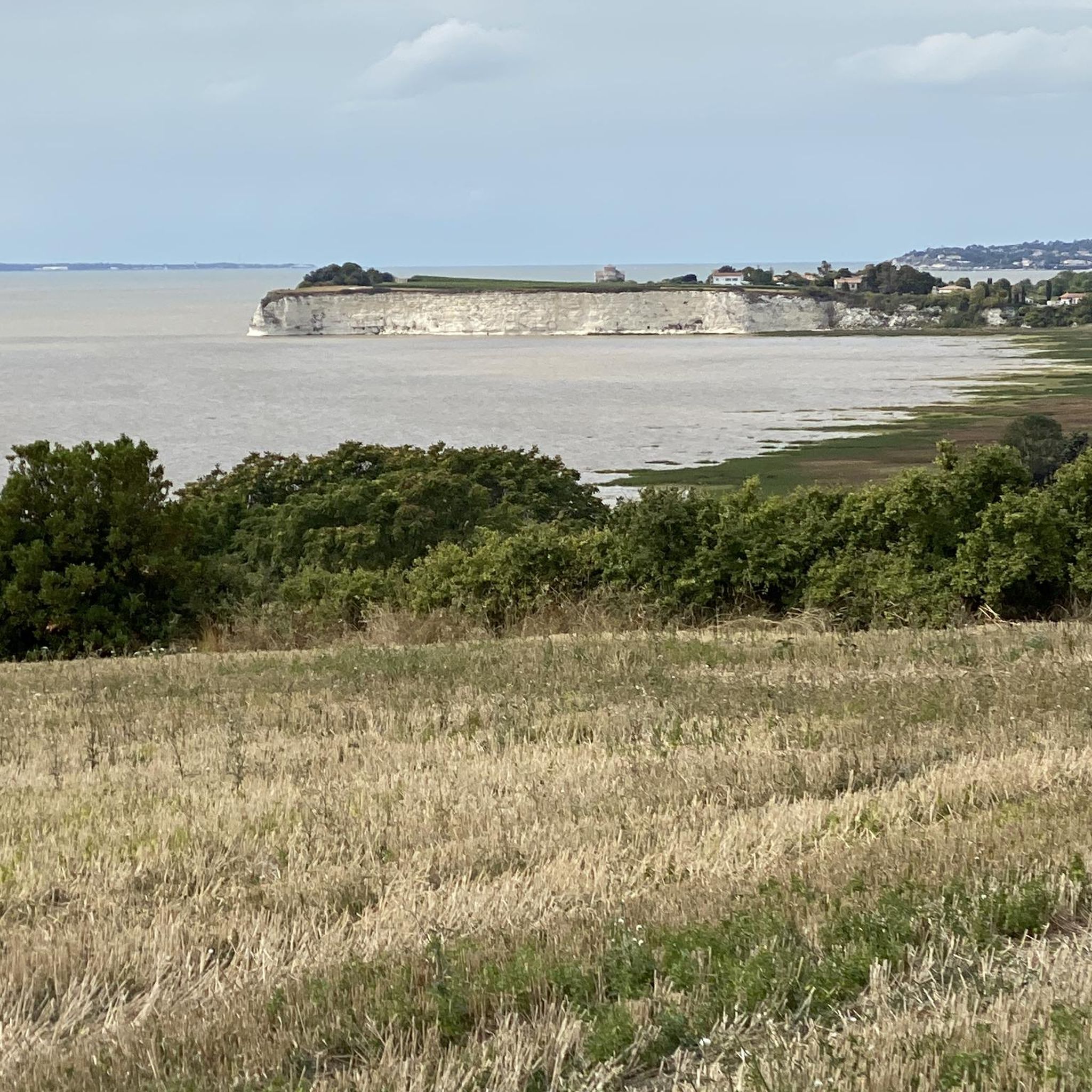
Hiking around Saint-Ciers-Du-Taillon offers diverse landscapes, including extensive vineyards and agricultural plains. The region features small wooded sections and benefits from its proximity to the Gironde estuary, providing opportunities for coastal walks. Several forests, such as Forêt de la Lande and Forêt de Pons, are also within reach, contributing to varied hiking terrain.
Best hiking trails around Saint-Ciers-Du-Taillon
- The most popular hiking route is Beaulon Loop, a 5.1 miles (8.2 km) trail that takes 2 hours 8 minutes to…
Last updated: June 30, 2026
4.3
(7)
13
hikers
8.17km
02:08
60m
60m
Moderate hike. Good fitness required. Easily-accessible paths. Suitable for all skill levels.
4.5
(6)
9
hikers
7.34km
01:56
60m
60m
Easy hike. Great for any fitness level. Easily-accessible paths. Suitable for all skill levels.

Sign up for free
9
hikers
9.41km
02:32
120m
120m
Moderate hike. Good fitness required. Easily-accessible paths. Suitable for all skill levels.
5.0
(1)
7
hikers
12.3km
03:17
140m
140m
Moderate hike. Good fitness required. Easily-accessible paths. Suitable for all skill levels.
5.0
(2)
5
hikers
8.43km
02:18
130m
130m
Moderate hike. Good fitness required. Easily-accessible paths. Suitable for all skill levels.
Get access to more routes and recommendations from other explorers.
Sign up for free
Already have an account?
Our route recommendations are based on thousands of hikes, rides, and runs completed by other people on komoot.
Start today with a free account
Your next adventure awaits.
Login or Signup


Tips from the Community

Even more beautiful after its restoration
0
0

This park is private and is therefore payable. 9 euros per person and free for children under 15. Magnificent to see.
3
0

As you walk through this 13 ha park, you will find the legendary "Blue Fountains", and the mysterious "Blue Fountains", natural springs whose calm waters have a mystical dark blue color.
3
0

Nice place to refuel: bakery, cafe and very quiet and relaxed.
1
0

Walk for VTC or VTT because more than 25 kms on dirt roads (in the 28th km it is even necessary to dismount for 200 m) .... to do in sunny weather and dry ground !!!!. On the other hand an enchantment as for the calm and the little traffic. Bucolic seaside landscape on the first half, then more vineyards and countryside on the second half. Note midway in the small village of St. Dizan du Gua a marvel of wooded garden with its Castle (former residence of the bishops of Bordeaux) and its dovecote where you can comfort yourself with a small tasting of pinault and cognac !! !
0
0
A French-style garden and an English park on 13 hectares, the ensemble labeled "remarkable garden" (433 in France) where a thousand trees of different species grow, including a three hundred year old oak. Several ponds with mysterious "Blue fountains", these are artesian exsurgences whose turquoise blue color is due to the presence of microscopic algae. Green lawns, shaded areas, paths to relax and appreciate the admirable work of gardeners and nature. And finally, the beautiful castle of Beaulon whose north facade was built in 1480 (former residence of the bishops of Bordeaux), a dovecote from 1740 (with 1500 nests called cells or boulins) and to finish the visit a tasting of Pinault and Homemade cognac in the rules of the art ...... with a sublime taste and most of the production of which is sold for export !!!
0
0

A young church: Notre-Dame de l'Assomption (19th century). But a good landmark. To the east of the church is the mayor's office. There is a pilgrim temple there.
0
0
The 8-hectare park is open to the public. The large 5-star hotel is part of Relais & Châteaux, which owns 500 houses worldwide.
0
0
Frequently Asked Questions
What kind of terrain can I expect on hiking trails around Saint-Ciers-Du-Taillon?
The hiking trails around Saint-Ciers-Du-Taillon offer a diverse landscape. You'll primarily encounter extensive vineyards and agricultural plains, providing scenic views of the local cultivation. There are also small wooded sections offering shaded paths, and some routes benefit from proximity to the Gironde estuary, allowing for coastal walks with panoramic views. The terrain is generally gentle, with moderate elevation changes.
Are there many hiking trails available in Saint-Ciers-Du-Taillon?
Yes, Saint-Ciers-Du-Taillon offers a good selection of hiking opportunities. There are 18 recorded hiking routes in the area, catering to various preferences and fitness levels. These include 8 easy trails and 10 moderate trails, ensuring options for most hikers.
What are some notable landmarks or attractions I can see while hiking in the area?
While hiking, you can discover several historical and charming points of interest. These include the 12th-century Saint Paul Chapel, the ancient Gallo-Roman era "Pas de la Mule" Bridge on the Seugne river, and the distinctive Saint-Ciers-Du-Taillon Church with its unique "pine cone" spire. You might also encounter the charming coastal village of Port Maubert, which has a recreational port and picnic spots.
Are there any easy hiking routes suitable for beginners or a relaxed walk?
Absolutely. For an easy and relaxed walk, consider the Hiking loop from Saint-Dizant-du-Gua. This 4.6-mile (7.3 km) path explores rural landscapes and small wooded areas, making it ideal for those seeking a less strenuous experience.
What do other hikers say about the trails in Saint-Ciers-Du-Taillon?
The trails in Saint-Ciers-Du-Taillon are highly regarded by the komoot community, with an average rating of 4.5 stars from over 30 reviews. Hikers often praise the varied terrain, which includes vineyards, agricultural plains, and small woods, as well as the proximity to the Gironde estuary for scenic views.
Are there any circular hiking routes in Saint-Ciers-Du-Taillon?
Yes, many of the routes in the area are circular, offering convenient starting and ending points. A popular example is the Beaulon Loop, which is 5.1 miles (8.2 km) long and takes about 2 hours 8 minutes to complete, traversing vineyards and agricultural plains.
What is the best time of year to go hiking in Saint-Ciers-Du-Taillon?
The region's diverse landscapes, including vineyards and woodlands, make it enjoyable for hiking across multiple seasons. Spring and autumn offer pleasant temperatures and beautiful scenery, with blooming flowers or vibrant fall foliage. Summer can also be suitable, especially on routes with shaded sections or coastal breezes near the estuary.
Are there longer, more challenging hikes available for experienced hikers?
While there are no trails classified as 'difficult' in the immediate area, several moderate routes offer longer distances and more varied elevation. For example, the Sea view – Fountain with Basins loop from Floirac is a moderate 7.6-mile (12.3 km) hike that takes around 3 hours 17 minutes, providing a good workout with scenic rewards.
Can I find trails that offer views of the Gironde Estuary?
Yes, the proximity of Saint-Ciers-Du-Taillon to the Gironde Estuary means several trails offer coastal views. The Saint-Fort-sur-Gironde Church loop from Saint-Fort-sur-Gironde is a 5.8-mile (9.4 km) trail that leads through varied terrain near the estuary, providing opportunities to see its expansive waters and traditional fishing huts.
Are there any forests nearby for hiking?
While Saint-Ciers-Du-Taillon itself features small wooded sections, several larger forests are within a reasonable distance. The Forêt de la Lande is only 5 km away, and the Forêt de Pons is about 19 km, offering more extensive woodland hiking experiences. Further afield, the Forêt domaniale de la Coubre is known for its maritime pines and coastal viewpoints.
What are the typical durations for hikes in this region?
Hiking durations vary depending on the route's length and your pace. Many popular trails, like the Beaulon Loop, can be completed in about 2 hours. Longer moderate routes, such as the Sea view – Fountain with Basins loop from Floirac, might take over 3 hours. There are options for both quick strolls and half-day excursions.
Is there parking available at the trailheads?
While specific parking details for every trailhead are not provided, hiking routes in rural areas like Saint-Ciers-Du-Taillon typically have designated parking areas in or near villages, or at popular starting points. It's advisable to check the route details on komoot for specific parking recommendations for your chosen trail.
Most popular routes around Saint-Ciers-Du-Taillon
Most popular attractions around Saint-Ciers-Du-Taillon

Get inspired with the komoot mobile app


Explore more
Browse the best Hikes in other regions.
