The best cycling routes around Bazoges-En-Paillers
4.3
(135)
861
riders
20
rides
Touring cycling routes around Bazoges-En-Paillers traverse a varied landscape within the Vendée region of France. The area features rolling countryside, extensive woodlands, and a network of rivers such as the Grand Lay and Mère. This "bocage" landscape, characterized by meadows and hedges, provides a scenic backdrop for cycling. A notable natural feature is the Lac de la Bultière, an artificial lake offering routes around its perimeter.
Best touring cycling routes around Bazoges-En-Paillers
- The most popular touring cycling route is Lac de la Bultière loop from Bazoges-en-Paillers, a 12.6 miles (20.3 km) trail that takes 1 hour 48 minutes to complete. This easy route circles the Lac de la Bultière, offering views of the lake and surrounding nature.
- Another top favourite among local touring cyclists is Lake Chausselière – Lac de la Bultière loop from Bazoges-en-Paillers, a moderate 23.8 miles (38.3 km) path. This route connects two lakes, providing diverse scenery through the Vendée countryside.
- Local touring cyclists also love the Parc de La Godelinière loop from La Brossardière, an 9.0 miles (14.4 km) trail leading through wooded countryside, often completed in about 1 hour 1 minute.
- Touring cycling around Bazoges-En-Paillers is defined by rolling landscapes, wooded countryside, and river valleys. The regional network offers options for various ability levels, from easy loops around lakes to longer routes through the bocage.
- The routes in Bazoges-En-Paillers are highly rated by the komoot community with an average score of 4.3 stars from over 100 reviews. More than 800 touring cyclists have used komoot to explore Bazoges-En-Paillers's varied terrain.
Last updated: July 15, 2026
4.1
(7)
39
riders
20.3km
01:49
150m
150m
Easy bike ride. Great for any fitness level. Mostly paved surfaces. Suitable for all skill levels.
12
riders
29.3km
02:21
230m
230m
Hard bike ride. Good fitness required. You may need to push your bike for some segments of this route.

Sign up for free
4.3
(3)
8
riders
37.0km
02:12
150m
150m
Moderate bike ride. Good fitness required. Mostly paved surfaces. Suitable for all skill levels.
2
riders
19.8km
01:23
110m
110m
Easy bike ride. Great for any fitness level. Mostly paved surfaces. Suitable for all skill levels.
4.0
(2)
5
riders
19.1km
01:09
80m
80m
Easy bike ride. Great for any fitness level. Mostly paved surfaces. Suitable for all skill levels.
Get access to more routes and recommendations from other explorers.
Sign up for free
Already have an account?
Our route recommendations are based on thousands of hikes, rides, and runs completed by other people on komoot.
Start today with a free account
Your next adventure awaits.
Login or Signup


Tips from the Community

La Roche-Pépin, a village in Saint-Georges and its abandoned chapel—this could have been the headline in the newspaper Ouest-France in May 1992. Indeed, in the heart of the Saint-Georges hamlet stands the Chapel of the Blessed Virgin, located on the pilgrims' route to Santiago de Compostela. A chapel with the distinction of belonging to the village's inhabitants. The construction of this building began in 1858, without the bishop's authorization. Its founders, Eugène Jaunet (mayor of Saint-Georges in 1857) and his sisters Victorine and Elisa, were a wealthy family who fed the poor. On May 16, 1859, Monsignor Delamare blessed the chapel. A building that, after their deaths, would gradually fall into disrepair. But the month of Mary continued to be celebrated there until 1952. Miss Gris, who looked after the chapel, said, "When I was young, we celebrated the month of Mary there, avoiding standing under the dangerous areas." The upper part of the chapel deteriorated, and in 1970, the slate roof finally collapsed. Father Jagueneau, who had attempted repairs, gave up due to the scale and cost of the work. The bell that rang the Angelus and for funerals was almost taken down in 1972. Only the sacred stone of the altar was removed. In 1986, a stone falling from the top of the building hit a car, creating controversy and tension among the villagers, some of whom reinforced the upper part of the walls. Michel Bonnet, the mayor, gathered the villagers to discuss a crucial question: should the chapel be razed, as some local residents suggested, or should funds be raised to restore the building? In 1992, under the leadership of Marc Jaulin, the Association for the Preservation of Heritage was founded and raised funds for two years to restore the chapel. The restoration took place from May 1993 to May 1997, requiring 545 hours of volunteer work, at a total cost of €42,662, of which €32,342 was funded by the association and municipal and departmental grants. Today, the restored and flower-bedecked chapel is open to visitors, and the month of Mary is celebrated there in May. Léone Epaulais, who arranges flowers and maintains the chapel, also recalls a legend: "More than a hundred years ago, the crown of the Blessed Virgin was thrown onto the flames of a fire, and the fire went out."
0
0
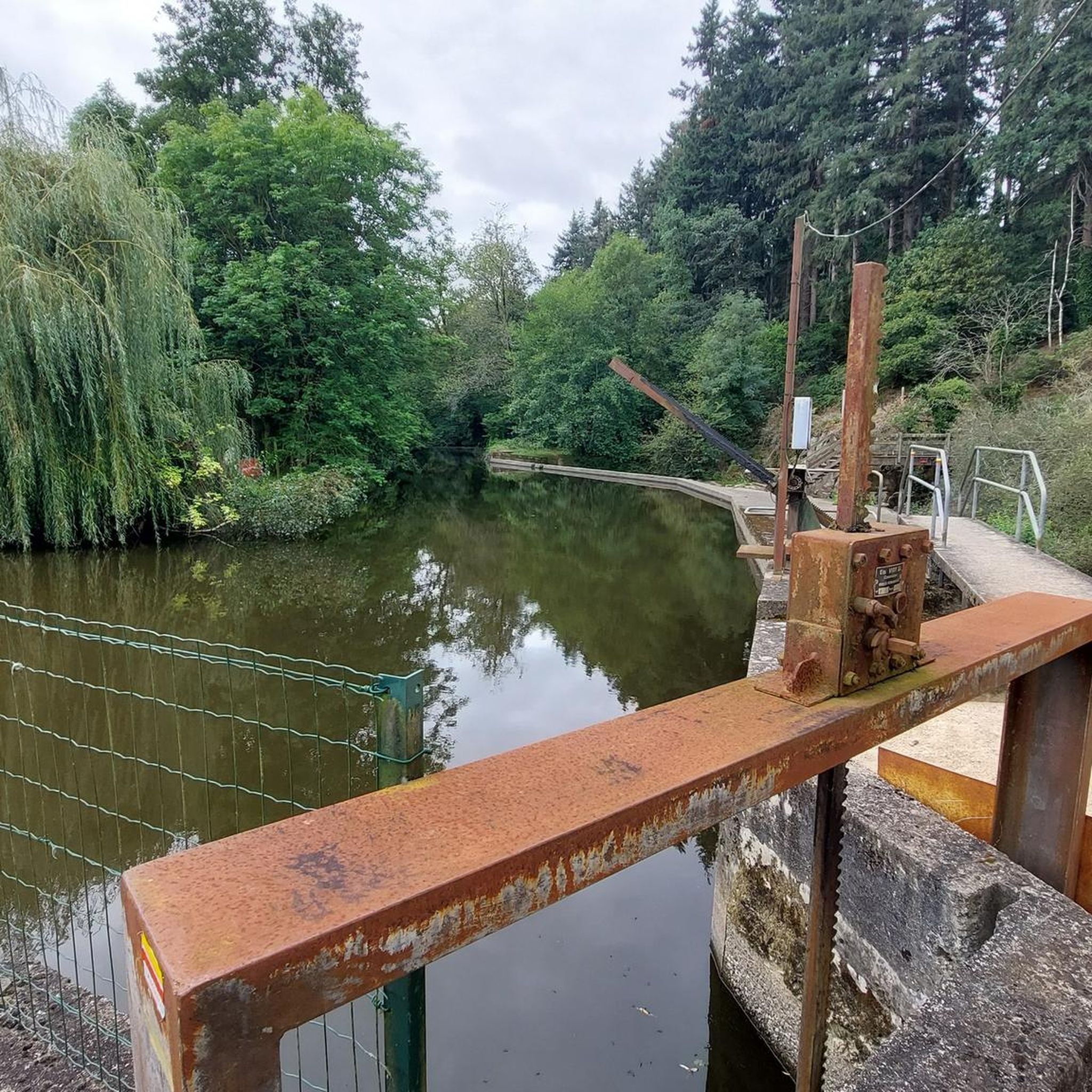
Bultière Lake is an artificial reservoir. The Bultière Dam was built in 1994. It is located in the commune of Chavagne en paillers. It supplies the drinking water network. Its surface area is 72 hectares and contains 5.2 million cubic meters of water. It is possible to walk around the lake via a 15-km trail. This lake, with its exceptionally rich fish population, awaits you with almost every type of fish (perch, pike, zander, catfish, carp, roach, bream, tench, etc.). You can go predator fishing from the shore or from a boat to catch zander, pike, and catfish. It is, of course, possible to still fish for roach, bleak, or bream. Carp are also present in this lake. A night carp fishing route located on the right bank in the Maurosière sector will delight those who love a good catch.
0
0

This vast body of water, popular for fishing and nature walks, offers an ideal setting for a bike ride along its banks. The trails surrounding the lake reveal superb views of the calm water and the surrounding hills.
0
0

Lake Bultière is an artificial water reservoir. The Bultière dam was built in 1994. It is located in the town of Chavagne en strawlers. It supplies the drinking water network. Its surface area is 72 hectares containing 5.2 million m3 of water. it is possible to go around the lake via a 15 km path. This lake of exceptional fish wealth awaits you with almost all kinds of fish (perch, pike, zander, catfish, carp, roach, bream, tench, etc.). You can practice predator fishing from the shore or with a boat to catch zander or pike, catfish.
0
0

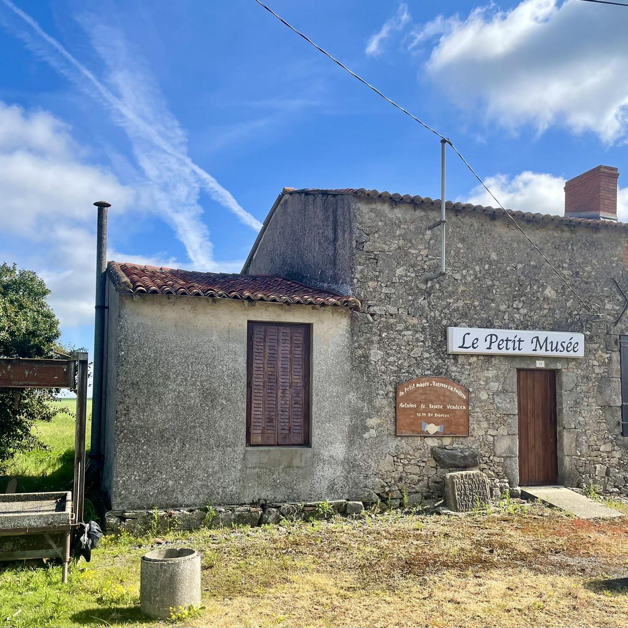
Created by an individual, now managed by an association of volunteers, this small museum brings together a whole bric a brac of objects, tools and old agricultural machinery to bear witness to life in the past in the Vendée Bocage.
0
0
Castle built from the 15th to the 18th century and listed as a Historic Monument
0
0

Recreation area with bird sanctuary http://www.sitesnaturels.vendee.fr/citedesoiseaux.html
0
0
Frequently Asked Questions
How many touring cycling routes are available around Bazoges-En-Paillers?
There are over 140 touring cycling routes around Bazoges-En-Paillers, offering a wide range of options for different skill levels and preferences.
What kind of landscapes will I encounter on touring cycling routes in Bazoges-En-Paillers?
You'll experience the characteristic 'bocage' landscape of the Vendée, featuring rolling countryside, extensive woodlands, and river valleys such as the Grand Lay and Mère. The routes often provide scenic views of meadows, hedges, and forests, offering a peaceful and authentic rural setting.
Are there easy touring cycling routes suitable for beginners or families in Bazoges-En-Paillers?
Yes, Bazoges-En-Paillers offers many easy routes. For instance, the Lac de la Bultière loop from Bazoges-en-Paillers is an easy 20.3 km trail that circles the scenic Lac de la Bultière. Another gentle option is the Bike loop from Bazoges-en-Paillers, which is just 7.3 km.
Are there any challenging touring cycling routes for experienced cyclists?
While many routes are easy to moderate, the region's rolling terrain provides opportunities for more intense rides. There are 13 routes classified as difficult, offering more elevation gain and longer distances for experienced touring cyclists looking for a challenge within the Vendée's diverse landscape.
Are there circular touring cycling routes available?
Yes, many of the touring cycling routes around Bazoges-En-Paillers are circular, allowing you to start and end your journey in the same location. Examples include the popular Lac de la Bultière loop from Bazoges-en-Paillers and the Lake Chausselière – Lac de la Bultière loop from Bazoges-en-Paillers.
What are some notable attractions or landmarks I can see along the touring cycling routes?
The routes often pass by natural and historical points of interest. You can cycle around the beautiful Lac de la Bultière, an artificial lake covering 72 hectares. Other nearby attractions include the historic Tiffauges Castle and the Mont des Alouettes with its windmills and chapel.
What do other touring cyclists enjoy most about cycling in Bazoges-En-Paillers?
The area is highly rated by the komoot community, with an average score of 4.3 stars from over 120 reviews. Cyclists often praise the peaceful, varied landscapes, the well-maintained paths, and the opportunity to explore the authentic Vendée countryside, especially around natural features like the Lac de la Bultière.
Is it possible to cycle with dogs on the routes around Bazoges-En-Paillers?
While specific 'dog-friendly cycling trails' are not explicitly designated, many of the routes traverse natural areas and quiet country roads. If your dog is accustomed to cycling alongside you or in a trailer, you may find suitable paths. Always ensure your dog is under control and respect local regulations regarding pets in public spaces and nature reserves.
What is the best time of year for touring cycling in Bazoges-En-Paillers?
The Vendée region generally offers pleasant cycling conditions from spring through autumn. Spring brings blooming landscapes, while summer provides warm weather ideal for lake activities. Autumn offers cooler temperatures and beautiful foliage. Always check the local weather forecast before heading out.
Are there routes that connect multiple lakes or significant natural features?
Yes, for a diverse experience, consider the Lake Chausselière – Lac de la Bultière loop from Bazoges-en-Paillers. This moderate 38.3 km route connects two lakes, offering varied scenery through the Vendée countryside and showcasing different natural features of the region.
Where can I find parking for touring cycling routes in Bazoges-En-Paillers?
As Bazoges-En-Paillers is integrated into the broader Vendée cycling network, parking is generally available in or near the village center, and at popular starting points for routes, such as near the Lac de la Bultière. Look for designated parking areas or consult local maps for specific recommendations.
Are there any routes that go through wooded areas or forests?
Absolutely. The region is known for its 'bocage' landscape, which includes extensive woodlands and forests. The Parc de La Godelinière loop from La Brossardière, for example, is an easy 14.4 km trail that leads directly through wooded countryside, providing a shaded and scenic ride.
Most popular routes around Bazoges-En-Paillers
Most popular attractions around Bazoges-En-Paillers

Get inspired with the komoot mobile app


Explore more
Browse the best Cycling routes in other regions.
