The best walks and hikes around Beaurepaire
4.4
(552)
2,571
hikers
139
hikes
Hiking around Beaurepaire offers routes primarily centered around Lac des Bultières, providing a landscape characterized by water features and surrounding countryside. The terrain features gentle elevation changes, making it accessible for various activity levels. These trails often traverse open fields and woodlands adjacent to the lake. The region's natural setting provides opportunities for outdoor exploration with minimal steep ascents.
Best hiking trails around Beaurepaire
- The most popular hiking route is Lac des Bultières — loop from Bazoges-en-Palliers, a 9.8…
Last updated: August 15, 2026
4.7
(9)
42
hikers
15.8km
04:07
110m
110m
Moderate hike. Good fitness required. Easily-accessible paths. Suitable for all skill levels.
4.0
(1)
4
hikers
6.10km
01:34
20m
20m
Hike an easy 3.8-mile loop around Lac de la Tricherie and through Bois du Défend from Mesnard-la-Barotière, enjoying lake views and shaded f

Sign up for free
4.9
(18)
80
hikers
5.19km
01:22
40m
40m
Easy hike. Great for any fitness level. Easily-accessible paths. Suitable for all skill levels.
4.8
(74)
261
hikers
Moderate hike. Good fitness required. Easily-accessible paths. Suitable for all skill levels.
4.7
(22)
71
hikers
18.4km
04:46
110m
110m
Moderate hike. Good fitness required. Easily-accessible paths. Suitable for all skill levels.
Get access to more routes and recommendations from other explorers.
Sign up for free
Already have an account?
Our route recommendations are based on thousands of hikes, rides, and runs completed by other people on komoot.
Start today with a free account
Your next adventure awaits.
Login or Signup


Tips from the Community

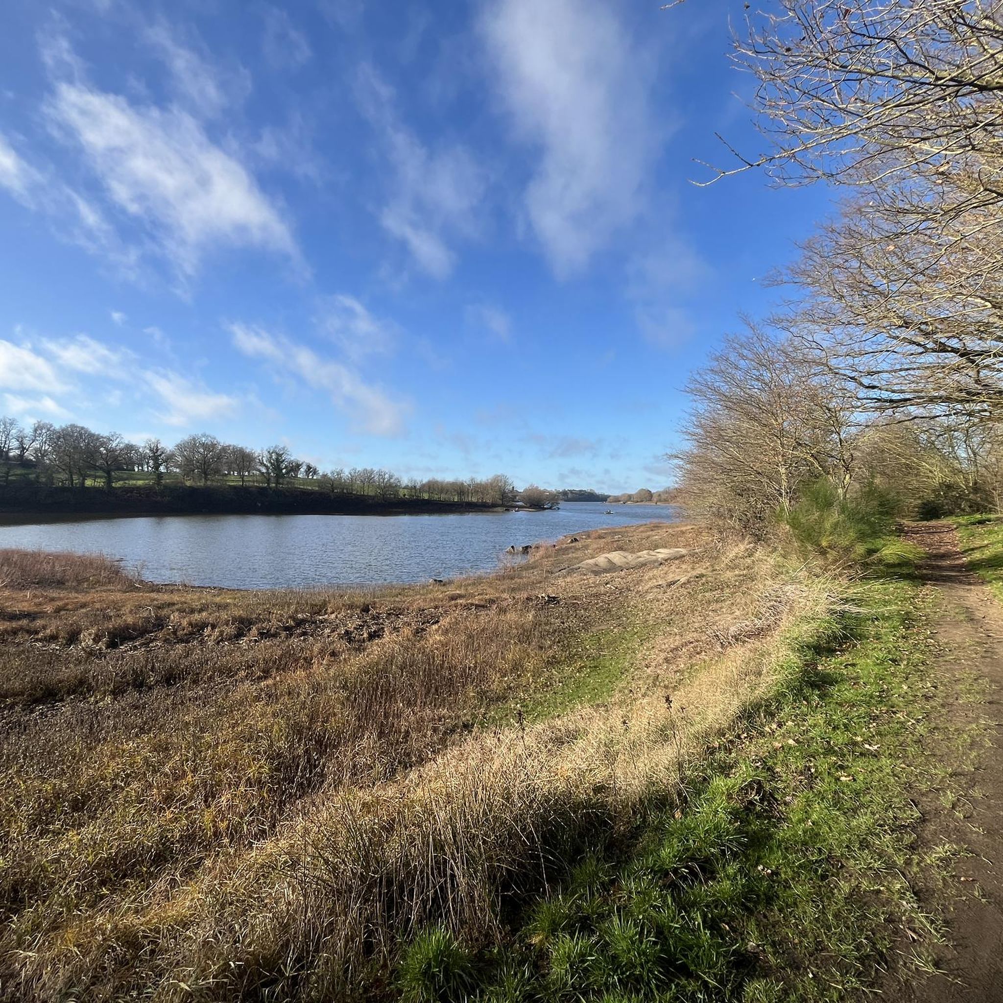
Bultière Lake is an artificial reservoir. The Bultière Dam was built in 1994. It is located in the commune of Chavagne en paillers. It supplies the drinking water network. Its surface area is 72 hectares and contains 5.2 million cubic meters of water. It is possible to walk around the lake via a 15-km trail. This lake, with its exceptionally rich fish population, awaits you with almost every type of fish (perch, pike, zander, catfish, carp, roach, bream, tench, etc.). You can go predator fishing from the shore or from a boat to catch zander, pike, and catfish. It is, of course, possible to still fish for roach, bleak, or bream. Carp are also present in this lake. A night carp fishing route located on the right bank in the Maurosière sector will delight those who love a good catch.
0
0

superb place, to see and see again while hiking or mountain biking
0
0

This vast body of water, popular for fishing and nature walks, offers an ideal setting for a bike ride along its banks. The trails surrounding the lake reveal superb views of the calm water and the surrounding hills.
0
0

Lake Bultière is an artificial water reservoir. The Bultière dam was built in 1994. It is located in the town of Chavagne en strawlers. It supplies the drinking water network. Its surface area is 72 hectares containing 5.2 million m3 of water. it is possible to go around the lake via a 15 km path. This lake of exceptional fish wealth awaits you with almost all kinds of fish (perch, pike, zander, catfish, carp, roach, bream, tench, etc.). You can practice predator fishing from the shore or with a boat to catch zander or pike, catfish.
0
0

This wooded area is crossed by trails that allow you to explore and take a forest bath.
2
0
The leisure base of Lac de la Tricherie is a real summer hive, but it is always possible to find a quiet place by walking around the lake itself. A beautiful place with a trail right next to the water.
2
0


A remarkable private property. A site of great natural wealth
0
0
Frequently Asked Questions
How many hiking trails are available around Beaurepaire?
There are over 150 hiking routes around Beaurepaire. These include a variety of options, with approximately 57 easy trails, 86 moderate trails, and 9 more challenging routes, ensuring choices for different fitness levels.
What kind of terrain can I expect on hikes around Beaurepaire?
The hiking terrain around Beaurepaire is primarily characterized by gentle elevation changes, making it accessible for various activity levels. You'll find trails traversing open fields and woodlands, especially around Lac des Bultières, with minimal steep ascents.
Are there any circular hiking routes around Beaurepaire?
Yes, many of the trails around Beaurepaire are circular. For example, the Hiking loop from Bazoges-en-Paillers offers a moderate 10 km circuit. Another popular option is the Hiking loop from Le Moulin de la Templerie, covering about 11.5 km.
What are the main natural features or landmarks to see while hiking in Beaurepaire?
The central natural feature is Lac de la Bultière, which many trails encircle, offering picturesque lake views. Beyond the lake, you can explore the Mont des Alouettes, known for its windmills and chapel, and the Mont des Alouettes viewpoint for panoramic vistas. The historic Tiffauges Castle is also a notable nearby attraction.
What do other hikers say about the trails in Beaurepaire?
The trails in Beaurepaire are highly rated by the komoot community, with an average score of 4.4 stars from over 500 reviews. Hikers often praise the tranquil atmosphere, the beautiful lake views, and the well-maintained paths that are suitable for various activity levels.
Are there family-friendly hiking options in Beaurepaire?
Yes, the gentle terrain and numerous easy to moderate trails around Beaurepaire make it suitable for families. Many routes around Lac des Bultières are relatively flat and offer pleasant walks through woodlands and open countryside, perfect for outings with children.
Can I bring my dog on the hiking trails in Beaurepaire?
While specific regulations can vary, generally, dogs are welcome on many of the outdoor trails in the Beaurepaire area, especially those through open fields and woodlands. It's always recommended to keep them on a leash, particularly near wildlife or livestock, and to clean up after them.
What is the best time of year to go hiking in Beaurepaire?
The best time to hike in Beaurepaire is typically during spring, summer, and early autumn. These seasons offer pleasant weather for exploring the lake and surrounding countryside. Spring brings blooming flora, while autumn showcases vibrant foliage. Winter hikes are possible, but trails may be muddy, and daylight hours are shorter.
Are there any facilities like cafes or restaurants near the hiking trails?
While the immediate vicinity of Lac des Bultières is more natural, you can find cafes, restaurants, and accommodation options in the nearby towns and villages surrounding Beaurepaire. These services provide convenient stops before or after your hike.
What is the typical duration for hikes around Lac des Bultières?
Hikes around Lac des Bultières vary in duration. For instance, the Lac des Bultières — loop from Bazoges-en-Palliers typically takes around 4 hours and 7 minutes to complete its 15.8 km. Shorter loops are also available, while longer routes like the Tour of Lac de la Bultière – Lac de la Bultière loop from Bazoges-en-Paillers can take about 4 hours and 40 minutes for 18.1 km.
Is there parking available at the trailheads in Beaurepaire?
Yes, parking is generally available at common starting points for trails around Beaurepaire, especially near Lac des Bultières and in the surrounding villages. Specific parking information can often be found on individual route pages on komoot.
Most popular routes around Beaurepaire
Most popular attractions around Beaurepaire

Get inspired with the komoot mobile app


Explore more
Browse the best Hikes in other regions.
