The best MTB trails around Juicq
4.4
(151)
692
riders
60
rides
Mountain biking around Juicq, located in the Charente-Maritime department of France, offers diverse landscapes for riders. The region features a mix of wooded areas, with forests like Forêt de Pons and Forêt de Suzac providing natural environments for trails. While not directly coastal, Juicq's proximity to estuaries and coastal influences contributes to varied scenery. Riders can expect terrain that transitions between agricultural lands, historical sites, and natural woodlands.
Best mountain bike trails around Juicq
- The most popular mountain bike trail…
Last updated: October 4, 2026
4.0
(5)
24
riders
27.3km
02:08
270m
270m
Moderate mountain bike ride. Good fitness required. Suitable for all skill levels.
4.7
(7)
15
riders
32.2km
02:02
180m
180m
Moderate mountain bike ride. Good fitness required. Suitable for all skill levels.

4.3
(4)
13
riders
51.9km
03:24
310m
310m
Moderate mountain bike ride. Good fitness required. Suitable for all skill levels.
3.0
(3)
3
riders
35.0km
02:30
300m
300m
Moderate mountain bike ride. Good fitness required. Advanced riding skills necessary.
4.3
(4)
20
riders
40.8km
03:13
340m
340m
Moderate mountain bike ride. Good fitness required. Advanced riding skills necessary.
Get access to more routes and recommendations from other explorers.
Already have an account?
Our route recommendations are based on thousands of hikes, rides, and runs completed by other people on komoot.
Start today with a free account
Your next adventure awaits.


Tips from the Community

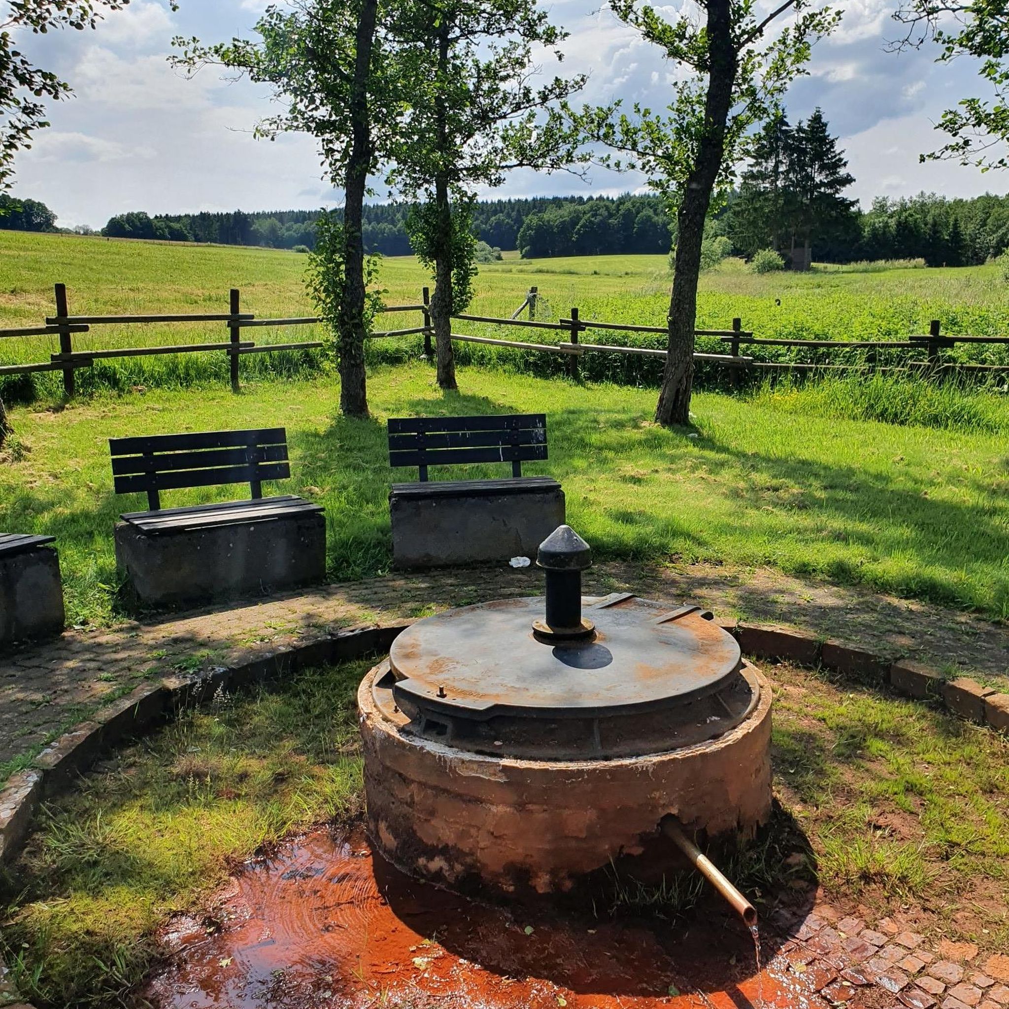
Port-d’Envaux, located on the left bank of the Charente, about 12 km downstream from Saintes, owes a large part of its history to its position on the river. The village was originally a fishing village, but it gradually became an important river port for trade. 1. Origins The Charente is a very ancient waterway. As early as the Gallo-Roman period, the river was used to transport salt from the coast inland. The name Port-d’Envaux refers to its location: the village is situated downstream from Taillebourg and in the middle of several "vaux" or valleys. The former parish was named Saint-Saturnin-de-Séchaud. 2. From the 16th to the 18th century: development of trade From the 16th century onwards, navigation on the Charente became of considerable importance. Port-d’Envaux was notably involved in the trade of: * Crazannes stone; * pottery from La Chapelle-des-Pots; * firewood and cooperage wood; * salt; * and later, wine. In the 17th century, "gabares" (barges) became the main transport vessels on the river. Successive improvements to navigation on the Charente, particularly the work undertaken under Colbert, further boosted this activity. The development of the military port of Rochefort, in particular, led to significant needs for wood and stone. 3. The 19th century: the golden age of Port-d’Envaux It was in the 19th century that Port-d’Envaux experienced its true golden age. The port became an important center for barging and shipbuilding. It housed, among other things: * boat construction yards; * marine carpenters; * sailors and captains; * sailing ships; * rope makers; * merchants. The boats transported, in particular, wine, cognac, stone, wood, and salt between the interior of Saintonge, Saintes, and the estuary of the Charente. This prosperity largely explains the presence of the large bourgeois houses and residences that can still be observed along the river. On the eve of the Revolution, Port-d’Envaux even had a navigation school, a sign of the importance of its maritime activity. 4. Gabares, sloops, and schooners The port was particularly associated with "gabares", but also with sloops and schooners. These boats made it possible to transport goods between the ports of the Charente. The "gabares" could, in particular, load stone from the neighboring quarries of Crazannes, Plassay, and Port-d’Envaux. The municipality also preserves historical documentation specifically dedicated to the "gabares" and sloops with topsails built and equipped in Port-d’Envaux. 5. The commune and its evolution The parish of Saint-Saturnin-de-Séchaud became a commune during the Revolution. Port-d’Envaux only truly became a communal capital in 1852, when the commune had about 1,536 inhabitants. It was also in the 19th century that the center of the village gradually moved closer to the river: the port became the true economic heart of the town. The current urban plan, with its small streets descending towards the Charente, retains traces of this evolution. 6. The decline of the port The situation changed radically at the end of the 19th century with the arrival of the railway. Rail transport, and then road transport in the 20th century, strongly competed with the boats on the Charente. In 1926, the Charente was declassified as a navigable waterway; in 1957, it was permanently removed from the list of navigable waterways. This was practically the end of the port's historic commercial vocation. 7. From commercial port to pleasure port After the disappearance of merchant traffic, Port-d’Envaux gradually turned towards pleasure boating and river tourism. Today, the port accommodates pleasure boats and is a leisure area on the banks of the Charente. However, the village strongly preserves the memory of its maritime past through its quays, its old merchant houses, its streets, and its towpath. An interesting feature The history of Port-d’Envaux is therefore closely linked to that of Crazannes stone. The stone extracted from the neighboring quarries was transported by river, which explains the existence of a real economic chain associating quarries → port → "gabares" → Charente → estuary of Rochefort. It is also this past that helps us understand why the village today has Les Lapidiales, located in old quarries, and why the commune places so much emphasis on "stone and water".
0
0
The Chaniers ferry (Charente-Maritime) is one of the last traditional river ferries still in operation in France. It allows crossing the Charente River between Chaniers and Courcoury, a few kilometers downstream from Saintes. A crossing used for centuries History of the Chaniers ferry The ferry crossing at Chaniers is very old: it dates back to the Middle Ages. In the mid-17th century, it was already an important crossing point on the Charente. It was not only used to cross the river: it also allowed residents to access the meadows on the other side, particularly for agricultural activities. In the early 20th century, the Chaniers ferry was part of a much larger network of crossings on the Charente. In 1909, thirteen ferries were still recorded in Charente-Inférieure, including the one in Chaniers. Ferries were essential at the time before the proliferation of bridges. Why "chain ferry"? The principle consists of holding the ferry on a chain connecting the two banks. The ferryman uses this chain to move the boat forward and keep it on its course despite the current. In Chaniers, the current ferry is motorized, unlike the ferry in Dompierre-sur-Charente, which is operated manually. The Tourist Office, however, still describes it as a "chain ferry," and the municipality as the traditional crossing method connecting Chaniers to Courcoury. The ferry today The crossing takes place between Le Communal in Chaniers and the Courcoury bank. It is free and can transport pedestrians, cyclists, and motorized vehicles. Its operation depends in particular on the flow of the Charente River. The municipality of Chaniers officially presents "the port of Chaniers and its chain ferry" as an element of its local heritage. Important point: I am correcting my previous message: the Chaniers ferry is not simply a "19th-century ferry." The crossing has been attested since the Middle Ages; it is its mode of operation and its equipment that have evolved over the centuries.
0
0


beautiful passages along the Charente with pretty monuments and small waterfront cafés in Port d’Envaux and Saintes.
0
0

I really enjoyed this ride. I’m 46, I did it on a 40 year old road bike, it’s more suited to a cyclocross bike!
1
0

Be careful, there is a very busy road right next door.
0
0

Small town with a special charm along the Charente.
0
0
Frequently Asked Questions
How many mountain bike trails are available around Juicq?
There are over 50 mountain bike routes around Juicq, offering a diverse range of experiences. These include 18 easy trails, 33 moderate trails, and 1 challenging route, catering to various skill levels.
What kind of terrain can I expect on mountain bike trails near Juicq?
Mountain biking around Juicq features a varied landscape. You'll encounter wooded areas, particularly in forests like Forêt de Pons and Forêt de Suzac, alongside agricultural lands and historical sites. The terrain transitions, offering a dynamic riding experience.
Are there any easy mountain bike trails suitable for beginners or families in Juicq?
Yes, Juicq offers 18 easy mountain bike trails, which are great for beginners or families looking for a more relaxed ride. These routes typically have less elevation gain and are suitable for those with good basic fitness.
What historical landmarks can I see while mountain biking near Juicq?
Many trails incorporate historical landmarks. For instance, you can explore routes that pass by the Crazannes Castle, the Sainte-Madeleine Church of Crazannes, or the Saint-Césaire Church. Some routes even feature remnants of a Roman aqueduct near Fontcouverte, such as the Remains of a Roman aqueduct – Ancient Washhouse loop from Fontcouverte.
Are there any challenging mountain bike routes for experienced riders?
While most routes are moderate, there is one challenging mountain bike trail available around Juicq. More advanced riders can also find sections on longer moderate routes that require good fitness and advanced skills, sometimes involving over 3,000 feet of elevation gain.
What do other mountain bikers say about the trails in Juicq?
The mountain bike trails in Juicq are highly rated by the komoot community, with an average score of 4.5 stars from over 100 reviews. Riders often praise the varied terrain, the mix of natural woodlands and historical sites, and the well-maintained paths.
Can I find mountain bike routes that are circular or loop trails?
Yes, many of the mountain bike routes around Juicq are designed as loops. Examples include the Church Square loop from Fontcouverte and Le Douhet loop from Saint-Hilaire-Brizambourg, allowing you to start and finish at the same point.
Are there any routes that connect to larger towns or cities?
Yes, some routes extend towards nearby towns. For instance, the Chaniers chain bin – Cathedral of Saintes loop from Fontcouverte leads through the countryside towards the historic city of Saintes, offering a chance to see landmarks like the Saint-Pierre Cathedral and Abbaye aux Dames de Saintes.
What natural features can I expect to see on the trails?
The region is characterized by its natural woodlands, with trails often passing through forests like Forêt de Pons and Forêt de Suzac. While not directly coastal, Juicq's proximity to estuaries and coastal influences contributes to diverse scenery, offering a blend of forest and open landscapes.
Are there any specific routes that highlight the natural beauty of the area?
Many routes showcase the natural beauty, particularly those winding through the local forests. For a good mix of natural settings and historical points, consider the The Washhouse of Chez Thoreau – Saint-Césaire Church loop from Fontcouverte, which combines natural elements with local heritage.
What is the best time of year for mountain biking in Juicq?
The diverse landscapes around Juicq, including forests and open countryside, make it suitable for mountain biking across multiple seasons. Spring and autumn generally offer pleasant temperatures and vibrant scenery, while summer can be enjoyable, especially on shaded forest trails. Winter conditions are typically mild, allowing for year-round riding, though some trails might be muddier after rain.
Most popular attractions around Juicq

Get inspired with the komoot mobile app


Explore more
Browse the best MTB trails in other regions.
