The best cycling routes around Fenioux
4.5
(87)
538
riders
68
rides
Touring cycling routes around Fenioux traverse a varied landscape within France's Nouvelle-Aquitaine region. The area features unspoiled, green, and wooded countryside, with some sections offering a more hilly terrain. Cyclists can explore areas characterized by ancient quarries, lush vegetation, and small streams. The region also provides access to wider networks of flat, canal-laced paths in nearby natural parks.
Best touring cycling routes around Fenioux
- The most popular touring cycling route is Port of the Lys – Crazannes Castle loop from…
Last updated: October 5, 2026
4.4
(9)
71
riders
Hard bike ride. Very good fitness required. Mostly paved surfaces. Suitable for all skill levels.
13
riders
41.5km
03:31
340m
340m
Hard bike ride. Good fitness required. You may need to push your bike for some segments of this route.

4
riders
29.5km
01:45
200m
200m
Moderate bike ride. Good fitness required. Mostly paved surfaces. Suitable for all skill levels.
4
riders
9.16km
00:33
70m
70m
Easy bike ride. Great for any fitness level. Mostly paved surfaces. Suitable for all skill levels.
4
riders
8.75km
00:32
70m
70m
Easy bike ride. Great for any fitness level. Mostly paved surfaces. Suitable for all skill levels.
Get access to more routes and recommendations from other explorers.
Already have an account?
Our route recommendations are based on thousands of hikes, rides, and runs completed by other people on komoot.
Start today with a free account
Your next adventure awaits.


Tips from the Community

The Chaniers ferry (Charente-Maritime) is one of the last traditional river ferries still in operation in France. It allows crossing the Charente River between Chaniers and Courcoury, a few kilometers downstream from Saintes. A crossing used for centuries History of the Chaniers ferry The ferry crossing at Chaniers is very old: it dates back to the Middle Ages. In the mid-17th century, it was already an important crossing point on the Charente. It was not only used to cross the river: it also allowed residents to access the meadows on the other side, particularly for agricultural activities. In the early 20th century, the Chaniers ferry was part of a much larger network of crossings on the Charente. In 1909, thirteen ferries were still recorded in Charente-Inférieure, including the one in Chaniers. Ferries were essential at the time before the proliferation of bridges. Why "chain ferry"? The principle consists of holding the ferry on a chain connecting the two banks. The ferryman uses this chain to move the boat forward and keep it on its course despite the current. In Chaniers, the current ferry is motorized, unlike the ferry in Dompierre-sur-Charente, which is operated manually. The Tourist Office, however, still describes it as a "chain ferry," and the municipality as the traditional crossing method connecting Chaniers to Courcoury. The ferry today The crossing takes place between Le Communal in Chaniers and the Courcoury bank. It is free and can transport pedestrians, cyclists, and motorized vehicles. Its operation depends in particular on the flow of the Charente River. The municipality of Chaniers officially presents "the port of Chaniers and its chain ferry" as an element of its local heritage. Important point: I am correcting my previous message: the Chaniers ferry is not simply a "19th-century ferry." The crossing has been attested since the Middle Ages; it is its mode of operation and its equipment that have evolved over the centuries.
0
0
🏛️ Construction: 18-19 AD The arch was built around 18-19 AD, during the reign of Emperor Tiberius. It stood at the entrance to the Roman bridge crossing the Charente, at the outlet of the Via Agrippa, which connected Lyon to Saintes. It is therefore not truly a "triumphal arch": it was both a road monument and a monumental gate marking the entrance to Mediolanum Santonum, the capital of Roman Aquitaine. 👤 Who had it built? The arch was financed by Caius Julius Rufus, a Romanized notable from Saintonge. He dedicated it to Tiberius as well as his nephew Germanicus. The inscriptions engraved on the entablature still allow us today to know the figures to whom it was dedicated. The name "Arch of Germanicus" therefore comes from this dedication, and not from the fact that Germanicus personally had the arch built or crossed it. 🏗️ A rather exceptional monument The arch has two bays, likely allowing for the differentiation of traffic flows. It measures approximately 15 m high by 16 m wide. Its Corinthian and composite capitals bear witness to particularly meticulous Roman architecture. It constituted a true demonstration of the power and Romanization of Saintes. ⚠️ The moment the arch almost disappeared This is probably the most interesting episode in its history. For centuries, the arch was always located at the level of the Roman bridge and then the medieval bridge, on the right bank of the Charente. In the 19th century, the old bridge had become dilapidated. When it was decided to demolish it, around 1843, the arch was also threatened with destruction. It was then that Prosper Mérimée, Inspector General of Historical Monuments, intervened. He advocated for its preservation and arranged for its dismantling, relocation, and reassembly on the new bank. Another figure is also associated with this preservation: Victor Hugo, who stayed in Saintes in September 1843 and intervened in favor of the monument's conservation with Mérimée. 📍 Why is the arch no longer exactly in its ancient location? The arch we see today, on Place Bassompierre, is therefore no longer in its original location. It was moved a few dozen meters during the transformation of the quays and the disappearance of the old bridge. It was dismantled stone by stone and then reassembled in order to preserve it. It is now located in the immediate vicinity of the ancient Roman bridge crossing. 🏛️ Protection The Arch of Germanicus was finally classified as a historical monument in July 1905. An interesting detail The Crazannes quarries, located near Saintes, supplied a limestone widely used in the region's ancient constructions. Crazannes stone was notably used for monuments such as the Arch of Germanicus. In summary: 18-19 → construction of the arch at the entrance to the Roman bridge ↓ Antiquity → Middle Ages → the arch remains associated with the crossing of the Charente ↓ 1843 → demolition of the old bridge and threat to the arch ↓ 1843-1844 → Mérimée's intervention and relocation of the arch ↓ 1905 → classified as a Historical Monument
0
0


I really enjoyed this ride. I’m 46, I did it on a 40 year old road bike, it’s more suited to a cyclocross bike!
1
0


Crazannes Castle is a castle located in the commune of Crazannes in the Charente-Maritime department of France. It is known for its medieval watchtower, which was built in the 12th century. Crazannes Castle was built in the 12th century and has been owned by several noble families over the centuries. It has been expanded and modified over time, and its architecture is a mix of medieval, Renaissance and classical styles. Crazannes Castle is also home to underground caves dug into the limestone rock, which have been used as wine cellars and to store food supplies over the centuries. Visitors can explore the caves and learn about their history through guided tours. Crazannes Castle is open to the public during the summer season and offers guided tours, contemporary art exhibitions and cultural events throughout the year. It is also possible to rent rooms for private events such as weddings or receptions.
0
0

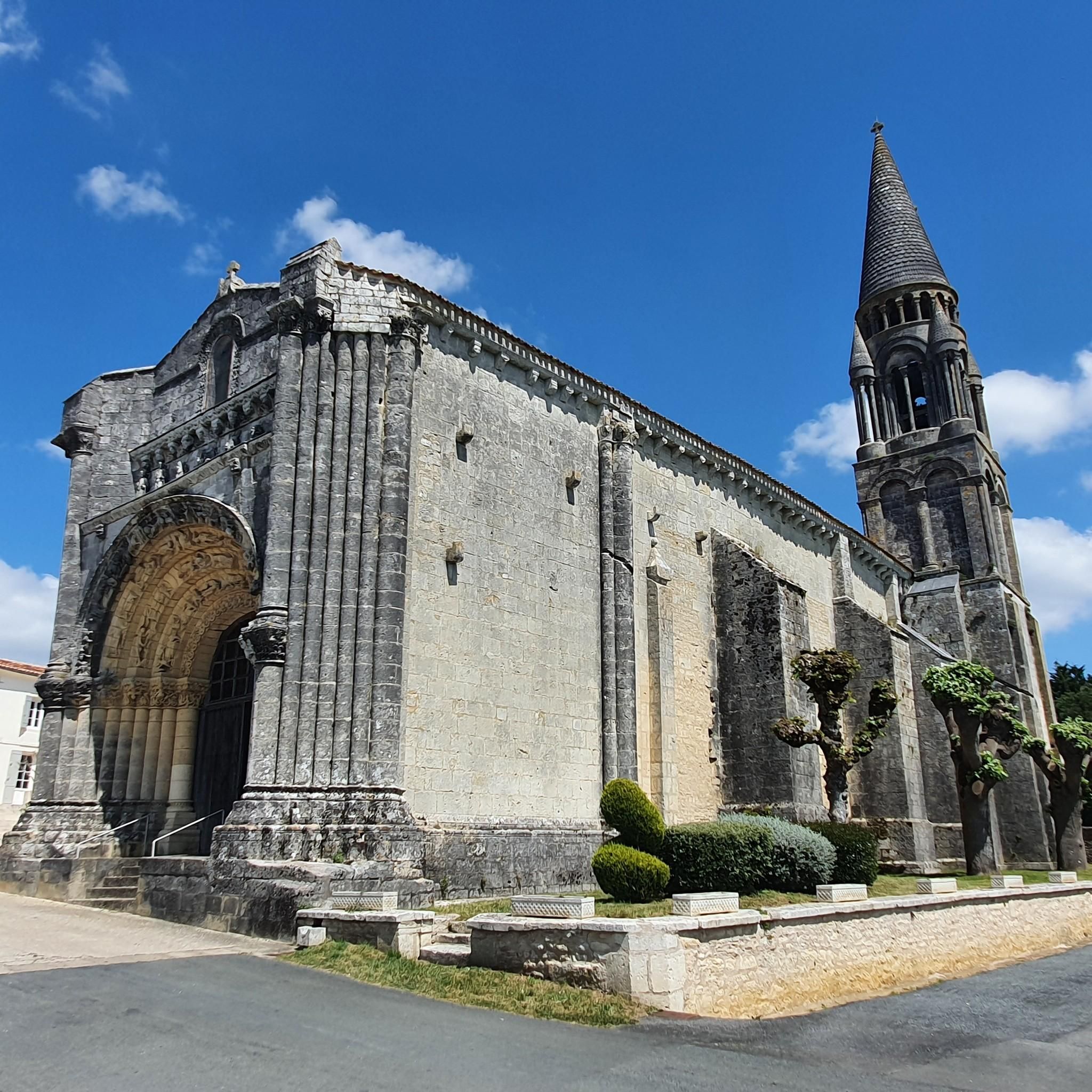
Small picturesque town of about 700 inhabitants. The 12th century Saint-Martial church and the castle are worth the detour!
1
0

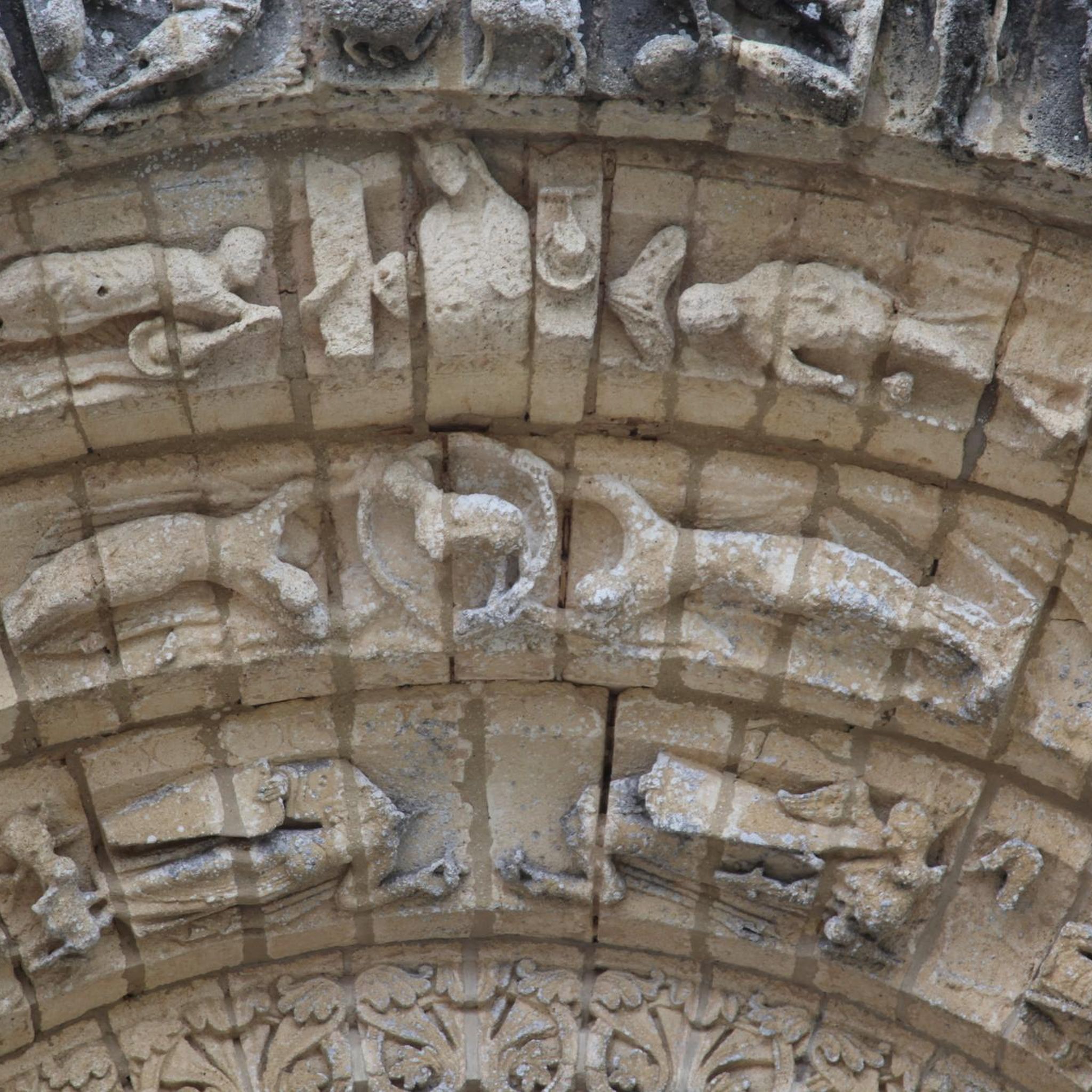
The Church of Saint-Martin de Coucoury was built around the 11th century. It is a pretty example of a Romanesque church.
1
0
Frequently Asked Questions
What kind of terrain can I expect on touring cycling routes around Fenioux?
The terrain around Fenioux is quite varied. In the Deux-Sèvres department, particularly near the Marais Poitevin, you'll find extensive networks of flat, canal-laced paths, ideal for relaxed cycling. However, the Fenioux in Charente-Maritime offers a more preserved, hilly, green, and wooded landscape. Routes like the difficult Port of the Lys – Crazannes Castle loop from Saint-Hilaire-Brizambourg feature significant elevation changes, while easy routes like the Taillebourg loop from Juicq are relatively flat.
Are there family-friendly touring cycling routes in the Fenioux area?
Yes, the region offers several options suitable for families. The Marais Poitevin Regional Natural Park, accessible from Fenioux in Deux-Sèvres, is known for its extensive network of over 850 kilometers of cycle paths, many of which are flat, secure, and suitable for all skill levels. These routes provide a peaceful and picturesque experience through canals and lush ecosystems. For shorter, easier rides directly around Fenioux, consider routes like the Taillebourg loop from Juicq or the Mare loop from Saint-Hilaire-Brizambourg, both rated easy.
What are some notable landmarks or points of interest to see while cycling around Fenioux?
The Fenioux area is rich in historical and natural attractions. You can cycle past the historic Crazannes Castle, which is featured on routes like the Port of the Lys – Crazannes Castle loop from Saint-Hilaire-Brizambourg. In Fenioux (Charente-Maritime), you'll find significant Romanesque architecture, including the Saint-Pierre church and a rare *lanterne des morts*. The nearby Carrières de Crazannes also offer a unique natural site with lush vegetation covering old stone quarries. For religious heritage, consider visiting the Sainte-Madeleine Church of Crazannes or the Saint-Savinien Church and Statues of the Apostles.
Are there any circular touring cycling routes available?
Yes, many of the touring cycling routes around Fenioux are designed as loops, offering convenient starting and ending points. Examples include the challenging Port of the Lys – Crazannes Castle loop from Saint-Hilaire-Brizambourg, the moderate Sunflowers loop from Beaufief, and the easy Mare loop from Saint-Hilaire-Brizambourg. These circular routes allow you to explore the diverse landscapes without retracing your steps.
What is the best time of year for touring cycling in Fenioux?
The Fenioux area benefits from a mild oceanic climate, making it pleasant for cycling year-round. However, spring (April-June) and early autumn (September-October) are particularly ideal. During these seasons, the weather is generally comfortable, and the natural landscapes, such as the Marais Poitevin or the sunflower fields, are at their most vibrant. Summer can also be enjoyable, but it's advisable to cycle in the mornings or late afternoons to avoid the midday heat.
How many touring cycling routes are there in Fenioux?
There are over 60 touring cycling routes available around Fenioux. These routes cater to various skill levels, with approximately 28 easy, 28 moderate, and 10 difficult options, ensuring there's a suitable ride for every touring cyclist.
What do other touring cyclists enjoy most about cycling in Fenioux?
The area is highly rated by the komoot community, with an average score of 4.47 stars from over 79 reviews. Cyclists often praise the varied terrain, from the flat, tranquil canals of the Marais Poitevin to the more challenging, wooded hills of Charente-Maritime. The presence of historical landmarks like Crazannes Castle and the peaceful, unspoiled countryside are also frequently highlighted as enjoyable aspects.
Are there options for challenging touring cycling routes in the Fenioux area?
Yes, for experienced touring cyclists seeking a challenge, there are several difficult routes. For instance, the Crazannes Castle – Chemin de la Charente loop from Saint-Hilaire-Brizambourg covers over 168 kilometers with significant elevation gain, offering a demanding yet rewarding experience through varied landscapes. The Port of the Lys – Crazannes Castle loop from Saint-Hilaire-Brizambourg is another difficult option, spanning over 106 kilometers.
Can I access touring cycling routes in Fenioux using public transport?
While direct public transport options to the immediate Fenioux communes might be limited, the broader Nouvelle-Aquitaine region, particularly the Deux-Sèvres and Charente-Maritime departments, is well-connected. Major cycling routes like the Vélodyssée and Vélo Francette pass through the Marais Poitevin, which can be accessed via regional train services to towns like Niort. From these larger towns, local transport or cycling connections can lead you to the Fenioux area. It's recommended to check local transport schedules for specific connections to smaller villages.
Are there any long-distance cycling routes that pass through or near Fenioux?
Yes, the Fenioux area benefits from its proximity to major European and national cycling routes. The Vélodyssée, a long-distance route connecting Norway to Portugal, has sections passing through the Marais Poitevin and Charente-Maritime. The Vélo Francette links Ouistreham to La Rochelle, crossing the Marais Poitevin. Additionally, the Flow Vélo, a 400 km national route, traverses Charente-Maritime along the Charente river. These routes offer extensive touring opportunities beyond the immediate Fenioux vicinity.
What are the options for easy or beginner-friendly touring cycling routes?
Beginners and those looking for relaxed rides will find several easy options. The Taillebourg loop from Juicq is a short, easy 9.2 km route, typically completed in about 33 minutes. Another accessible option is the Mare loop from Saint-Hilaire-Brizambourg, which is 8.8 km long and also rated easy. These routes offer gentle terrain through the local countryside, perfect for a leisurely cycle.
Where can I find information on cycling infrastructure and more routes in the wider Deux-Sèvres region?
For more detailed information on cycling infrastructure, itineraries, and additional routes within the Deux-Sèvres department, you can consult the local tourism board's resources. They provide comprehensive guides on various cycling paths, including those along waterways, vineyards, and near castles. You can find more details at tourisme-deux-sevres.com.
Most popular attractions around Fenioux

Get inspired with the komoot mobile app


Explore more
Browse the best Cycling routes in other regions.
