The best running trails around La Pisseure
4.8
(4)
73
runners
26
runs
Jogging routes around La Pisseure offer access to the natural landscapes of the Haute-Saône department in the Burgundy-Franche-Comté region of France. The area features an extensive network of trails suitable for running, traversing diverse natural settings. These include forests and pastures, characteristic of the region's varied terrain. The presence of specific points of interest, such as the Source de Planey, adds to the appeal of the running trails.
Best jogging routes around La Pisseure
- The most popular jogging route is…
Last updated: July 5, 2026
4.7
(3)
6
runners
8.95km
01:00
100m
100m
Moderate run. Good fitness required. Mostly paved surfaces. Suitable for all skill levels.
8
runners
8.44km
00:53
50m
50m
Moderate run. Good fitness required. Mostly paved surfaces. Suitable for all skill levels.

Sign up for free
5.0
(1)
7
runners
16.7km
01:54
100m
100m
Hard run. Very good fitness required. Mostly paved surfaces. Suitable for all skill levels.
8
runners
8.55km
00:54
10m
10m
Moderate run. Good fitness required. Mostly paved surfaces. Suitable for all skill levels.
3
runners
15.8km
01:46
110m
110m
Hard run. Very good fitness required. Mostly paved surfaces. Suitable for all skill levels.
Get access to more routes and recommendations from other explorers.
Sign up for free
Already have an account?
Our route recommendations are based on thousands of hikes, rides, and runs completed by other people on komoot.
Start today with a free account
Your next adventure awaits.
Login or Signup


Tips from the Community

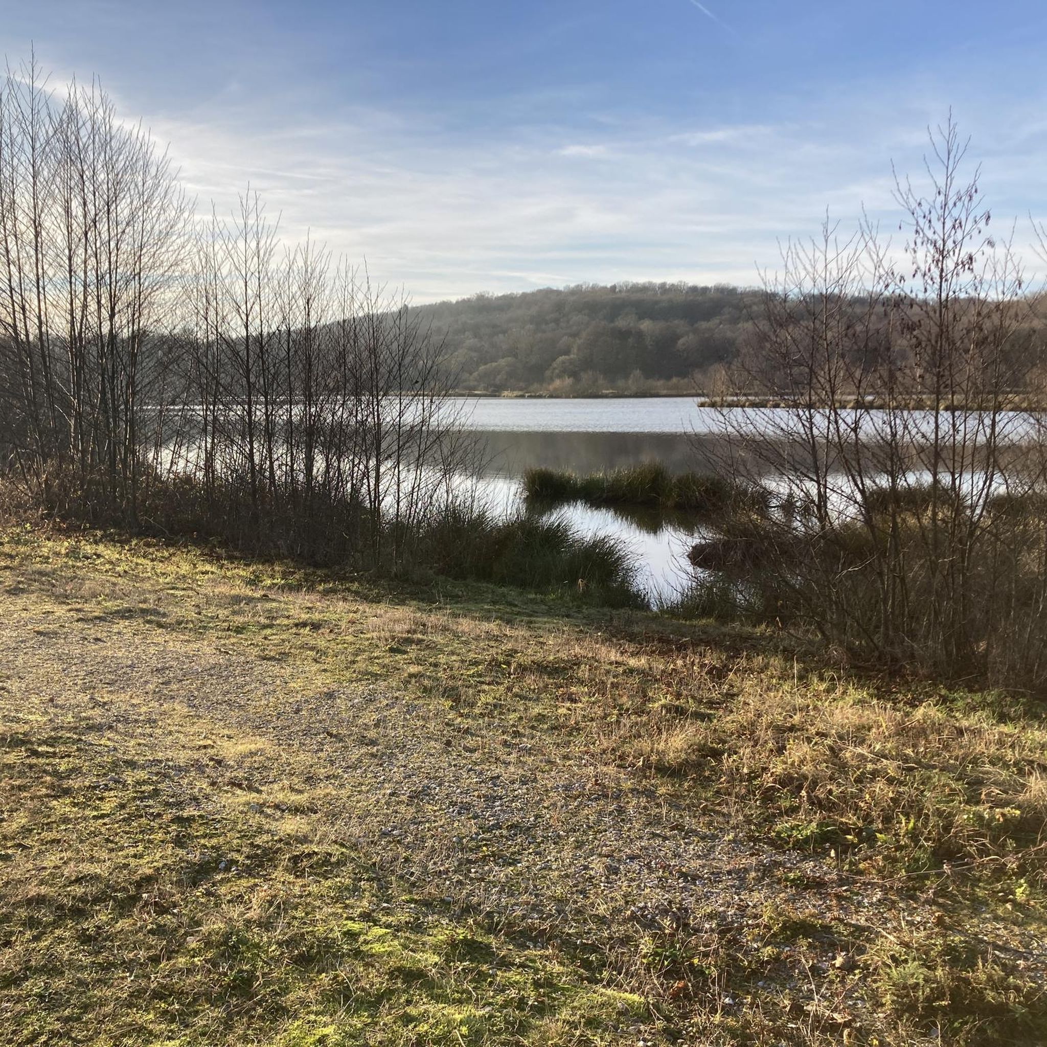
The closer you get to the actual source, the stronger the blue color of the crystal clear water becomes!
7
0

Fantastic to enjoy this piece of nature quietly!
1
0

A true mystery of life. This pond is actually a sinkhole, but instead of being bottomless, it is only 35m deep. Its crystalline turquoise hues hide a mystery: the water remains at a mild temperature of 11°c, summer and winter alike.
2
0
A true mystery of life. This pond is actually a sinkhole, but instead of being bottomless, it is only 35m deep. Its crystalline turquoise hues hide a mystery: the water remains at a mild temperature of 11°c, summer and winter alike.
4
0


Frequently Asked Questions
How many running routes are available around La Pisseure?
There are over 25 dedicated running routes around La Pisseure, offering a variety of options for different preferences and fitness levels.
Are there running routes suitable for all fitness levels in La Pisseure?
Yes, the area around La Pisseure caters to various fitness levels. You'll find a few easy routes perfect for beginners, over 20 moderate trails, and a handful of more challenging options for experienced runners.
What natural features or sights can I expect to see on the running trails near La Pisseure?
The running trails around La Pisseure often traverse diverse natural settings, including forests and pastures characteristic of the Haute-Saône region. A notable natural feature you can explore is the Source de Planey, which is part of routes like the Source du Planey — loop — running from Bouligney.
Are there circular running routes available?
Absolutely. Many of the running paths around La Pisseure are designed as loops, allowing you to start and finish at the same point. Examples include the popular Running loop from Magnoncourt and the longer Le Planey – Source of the Planey loop from Magnoncourt.
What do other runners enjoy most about jogging in La Pisseure?
The running routes in La Pisseure are highly rated by the komoot community, with an average score of 4.6 stars from 5 reviews. Runners often praise the diverse natural settings, including quiet forests and open pastures, and the well-maintained trails that offer a refreshing outdoor experience.
Are there any family-friendly jogging paths in the area?
While specific 'family-friendly' designations aren't always given, the easier and moderate routes with less elevation gain are generally suitable for families. Look for routes described as 'easy' to find paths that might be more comfortable for a family outing.
Can I bring my dog on the running trails around La Pisseure?
Many outdoor trails in the Haute-Saône region are dog-friendly, especially if your dog is well-behaved and kept on a leash. It's always a good idea to check local signage or specific route details for any restrictions, but generally, the natural environment welcomes canine companions.
What is the typical duration for a running route in La Pisseure?
The duration varies significantly depending on the route's distance and your pace. For example, the Source du Planey — loop — running from Bouligney typically takes about 1 hour, while the longer Le Planey – Source of the Planey loop from Magnoncourt can take nearly 2 hours.
Are there running routes with significant elevation changes for a more challenging workout?
Yes, for those seeking a more challenging run, there are routes with noticeable elevation gains. For instance, the Running loop from Betoncourt-Saint-Pancras features over 120 meters of ascent, providing a good workout amidst scenic surroundings.
Where can I find parking for the running trails?
Parking availability often depends on the specific trailhead. Many routes start from villages or designated parking areas. For example, routes like the Running loop from Magnoncourt typically have parking options available in or near the starting village.
What kind of terrain can I expect on the running trails?
The terrain around La Pisseure is diverse, ranging from well-trodden paths through forests to open trails across pastures. You can expect a mix of natural surfaces, which makes for an engaging and varied running experience.

Get inspired with the komoot mobile app


Explore more
Browse the best Running Trails & Routes in other regions.
