The best running trails around Marcilloles
3.9
(36)
749
runners
116
runs
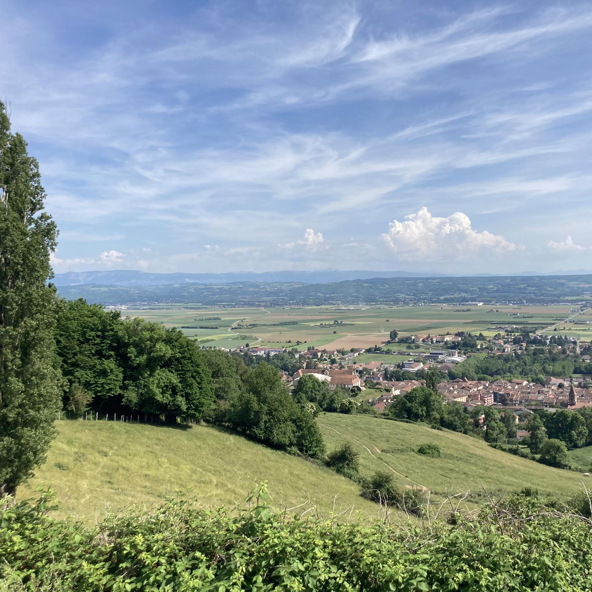
Jogging routes around Marcilloles offer diverse terrain within the Isère department of France's Auvergne-Rhône-Alpes region. The area is characterized by the tranquil Bièvre plain, providing green and peaceful settings for running. Beyond the plains, the region includes varied landscapes from lush forests to hills, with higher ground offering panoramic views of the Alpine foothills, including the Chartreuse and Vercors massifs. This network of running trails Marcilloles France caters to different skill levels, from easy local walks to more challenging routes…
Last updated: July 1, 2026
5.0
(1)
6
runners
11.5km
01:16
180m
180m
Moderate run. Good fitness required. Mostly paved surfaces. Suitable for all skill levels.
5
runners
14.5km
01:42
210m
210m
Moderate run. Good fitness required. Mostly paved surfaces. Suitable for all skill levels.

Sign up for free
5
runners
5.16km
00:34
60m
60m
Moderate run. Good fitness required. Mostly paved surfaces. Suitable for all skill levels.
5
runners
15.1km
01:47
290m
290m
Hard run. Very good fitness required. Mostly accessible paths. Some sure footedness required.
4
runners
9.79km
01:04
100m
100m
Moderate run. Good fitness required. Mostly paved surfaces. Suitable for all skill levels.
Get access to more routes and recommendations from other explorers.
Sign up for free
Already have an account?
Our route recommendations are based on thousands of hikes, rides, and runs completed by other people on komoot.
Start today with a free account
Your next adventure awaits.
Login or Signup



Frequently Asked Questions
How many running routes are available around Marcilloles?
There are over 110 dedicated running routes around Marcilloles. These trails offer a wide range of options, including easy, moderate, and more challenging paths, catering to all fitness levels.
What kind of terrain can I expect on jogging trails near Marcilloles?
The jogging trails around Marcilloles offer diverse terrain. You'll find peaceful, green paths across the tranquil Bièvre plain, ideal for leisurely runs. Further afield, routes can lead through lush forests, gentle hills, and even offer more challenging sections with elevation changes, especially as you approach the Alpine foothills within the Isère department.
Are there any easy or beginner-friendly running routes in Marcilloles?
Yes, Marcilloles offers several easy running routes, particularly within the Bièvre plain, which is known for its flat and calm environment. These paths are perfect for beginners or those looking for a relaxed run. The wider Isère department also has many marked trails suitable for all skill levels.
Can I find circular running routes around Marcilloles?
Absolutely. Many of the running paths around Marcilloles are designed as loops, allowing you to start and finish in the same location. For example, the popular Étang des Nénuphars loop from Viriville is a moderate 11.5 km circular route exploring the local countryside.
What do other runners enjoy most about jogging in Marcilloles?
The running routes in Marcilloles are highly rated by the komoot community, with an average score of 4.4 stars. Runners often praise the tranquil rural landscapes, the variety of terrain from flat plains to gentle hills, and the peaceful atmosphere that makes for an enjoyable outdoor experience.
Are there any scenic running routes with good views?
Yes, the region around Marcilloles offers stunning vistas. On clear days, joggers on higher ground or along ridges between the Bièvre and Liers plains can enjoy panoramic views of the Alpine foothills, including the majestic Chartreuse and Vercors massifs, and even the distant summit of Mont Blanc.
Are there any interesting landmarks or attractions I can see while running near Marcilloles?
While jogging near Marcilloles, you might encounter various local points of interest. These can include historical sites like the Château Louis XI or the Château de Montgontier, as well as charming local structures like the Revel washhouse or the old market hall. Many routes also pass through picturesque villages and tranquil countryside.
Are there any challenging running trails for experienced runners?
Yes, for experienced runners seeking more challenge, the Isère department, which encompasses Marcilloles, offers routes with more significant elevation changes. An example of a more difficult route is the Étang Berger loop from Thodure, which covers 15.4 km with notable ascents and descents.
What is a popular running route that features varied scenery?
A top favourite among local runners for its varied scenery is the Étang Berger – Souterrain du Château loop from Beaufort. This moderate 14.7 km path features a mix of open fields and wooded sections, providing a diverse and engaging running experience.
Is there a good running route that passes through local villages?
Yes, the Running loop from Viriville is a great option. This 5.2 km moderate trail leads through local villages and quiet paths, offering a pleasant run with glimpses of local life and architecture.
What is the best time of year for running in Marcilloles?
The region around Marcilloles is generally pleasant for running throughout much of the year. Spring and autumn offer mild temperatures and beautiful scenery. Summer can be warm, so early morning or late evening runs are often preferred. Even in winter, many trails remain accessible, especially those on the flatter Bièvre plain.
Are there any running routes that are particularly long for endurance training?
For longer endurance runs, you can explore routes like the Étang Berger loop from Thodure, which is 15.4 km. The extensive network of trails in the Isère department also allows for combining shorter loops to create longer distances, offering ample opportunities for extended training.
Most popular attractions around Marcilloles

Get inspired with the komoot mobile app


Explore more
Browse the best Running Trails & Routes in other regions.
