The best running trails around Saint-Germain-De-Prinçay
4.4
(45)
2,920
runners
244
runs
Jogging around Saint-Germain-De-Prinçay offers diverse landscapes for runners. The commune features varied terrain with elevations ranging from 51 to 98 meters, providing subtle inclines and descents. Ecologically significant wooded areas and wetlands characterize the northern part, offering shaded trails. Several streams and rivers, part of the Petit Lay and Grand Lay river basins, traverse the area, suggesting scenic routes alongside water.
Best jogging routes around Saint-Germain-De-Prinçay
- The most popular jogging route is Tomb of Georges Clémenceau loop from Mouchamps,…
Last updated: October 9, 2026
14
runners
34.1km
03:51
300m
300m
Hard run. Very good fitness required. Mostly paved surfaces. Suitable for all skill levels.
4.0
(1)
7
runners
13.8km
01:33
140m
140m
Moderate run. Good fitness required. Mostly paved surfaces. Suitable for all skill levels.

6
runners
18.3km
02:03
170m
170m
Hard run. Very good fitness required. Mostly paved surfaces. Suitable for all skill levels.
4
runners
10.9km
01:09
90m
90m
Moderate run. Good fitness required. Mostly paved surfaces. Suitable for all skill levels.
5.0
(1)
7
runners
9.11km
01:00
70m
70m
Moderate run. Good fitness required. Mostly paved surfaces. Suitable for all skill levels.
Get access to more routes and recommendations from other explorers.
Already have an account?
Our route recommendations are based on thousands of hikes, rides, and runs completed by other people on komoot.
Start today with a free account
Your next adventure awaits.



Tips from the Community

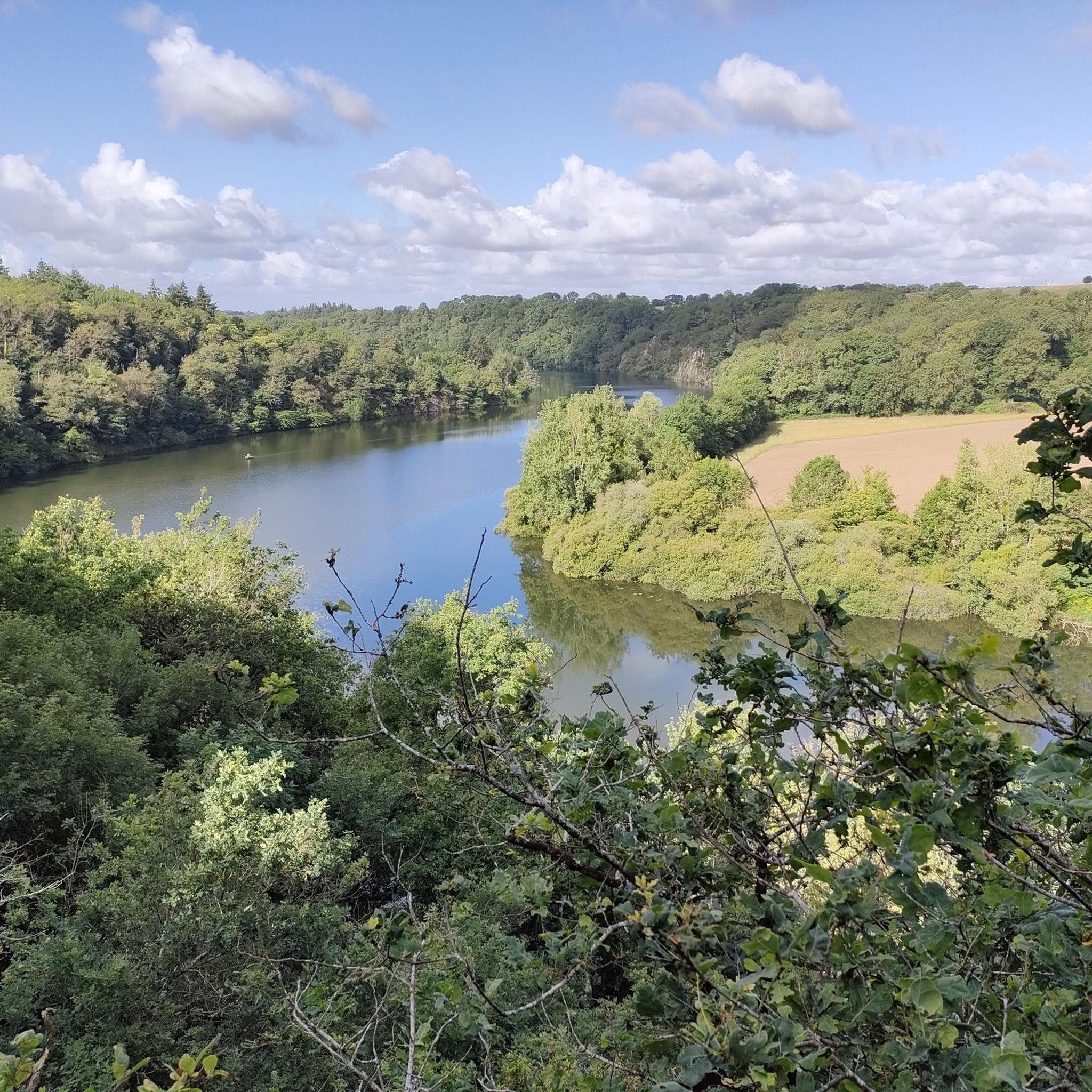
Rochereau Lake, with an area of 125 hectares, is the largest drinking water reserve in the Grand Lay Valley, fed by the Le Maine River. It has good fishing conditions and is home to a rich fish diversity in white fish, predatory fish and common and mirror carp of intermediate size.
1
0

It is a fun experience to walk on this floating bridge.
2
0

At the end of the 19th century, the owners of this estate razed the old house of La Bobinière to build a more comfortable castle. In 1892, Ernest Masson, the owner, very attached to the development of agriculture in his region and founder of several agricultural unions, showed this interest in the outbuildings of his castle. The volumes, materials used and the layout of the buildings represent the perfect example of a model farm.
0
0
Frequently Asked Questions
How many running routes are available around Saint-Germain-de-Prinçay?
There are over 220 running routes available in and around Saint-Germain-de-Prinçay, offering a wide variety of options for all skill levels.
What kind of terrain can I expect on the jogging trails in Saint-Germain-de-Prinçay?
The terrain around Saint-Germain-de-Prinçay is quite varied, with elevations ranging from 51 to 98 meters, providing subtle inclines and descents. You'll find ecologically significant wooded areas, wetlands, and scenic routes alongside streams and rivers belonging to the Petit Lay and Grand Lay river basins.
Are there running routes suitable for beginners in Saint-Germain-de-Prinçay?
Yes, Saint-Germain-de-Prinçay offers 21 easy running routes, perfect for beginners or those looking for a more relaxed jog. These paths are generally flatter and shorter, allowing for a comfortable introduction to the area's natural beauty.
What do other runners say about the trails in Saint-Germain-de-Prinçay?
The running routes in Saint-Germain-de-Prinçay are highly rated by the komoot community, with an average score of 4.4 stars from over 30 reviews. More than 2000 runners have explored the varied terrain, often praising the peaceful atmosphere and well-maintained paths.
Are there any marked trails or dedicated running circuits in the area?
Yes, the municipality actively promotes outdoor exploration with marked trails ranging from 7 to 10 kilometers. The wider Communauté de Communes offers 39 loop itineraries, covering over 350 kilometers of paths. Specific loops within the commune include the "Boucle du Breillet" (11.4 km) and the "Boucle des Terres Noires" (11.7 km), both starting from the Place de la Mairie.
Can I find circular running routes in Saint-Germain-de-Prinçay?
Absolutely. Many of the trails in the region are designed as loops, including the popular "Boucle du Breillet" and "Boucle des Terres Noires". The broader Communauté de Communes also features 39 loop itineraries, providing ample choice for circular runs.
Are there running paths that follow rivers or pass by water features?
Yes, several streams and rivers traverse the commune, offering scenic routes alongside water. You can also explore routes around Lake Rochereau, such as the challenging Lake Rochereau – Floating Bridge loop from Chantonnay, which explores varied terrain around the lake.
What natural sights or landmarks can I see while jogging around Saint-Germain-de-Prinçay?
While jogging, you might encounter charming natural features like the numerous springs and wells in the village heart. For historical sights, consider routes near Boistissandeau Castle or Manoir de Ponsay. The Lake Rochereau is also a prominent natural landmark.
Are there any family-friendly running routes in Saint-Germain-de-Prinçay?
While specific 'family-friendly' routes aren't explicitly marked, the 21 easy routes available are generally suitable for families. The "Coulée Verte" natural site, with its picnic tables, suggests a pleasant green space that could be ideal for a family jog.
Can I bring my dog on the running trails in Saint-Germain-de-Prinçay?
Many natural trails in France are dog-friendly, especially if your dog is kept on a leash. Given the rural ambiance and extensive network of paths, it's generally possible to bring your dog. However, always be mindful of local regulations and private property signs.
Are there any routes that offer a more challenging running experience?
Yes, for those seeking a greater challenge, there are 31 difficult routes available. A notable option is the Lake Rochereau – Floating Bridge loop from Chantonnay, a 34.1 km path that explores varied terrain and offers a significant workout.
Where can I find parking near the running trails?
Many of the marked trails and loops, such as the "Boucle du Breillet" and "Boucle des Terres Noires", start from the Place de la Mairie in Saint-Germain-de-Prinçay, where parking is typically available. For other routes, parking can often be found in nearby village centers or designated trailheads.
What is a popular moderate running route in the area?
A popular moderate option is the Tomb of Georges Clémenceau loop from Mouchamps. This 12.4 km trail offers a balanced challenge and takes approximately 1 hour 23 minutes to complete.
Most popular routes around Saint-Germain-De-Prinçay
Most popular attractions around Saint-Germain-De-Prinçay

Get inspired with the komoot mobile app


Explore more
Browse the best Running Trails & Routes in other regions.
