The best road cycling routes around Aspremont
4.5
(668)
34,369
riders
145
rides
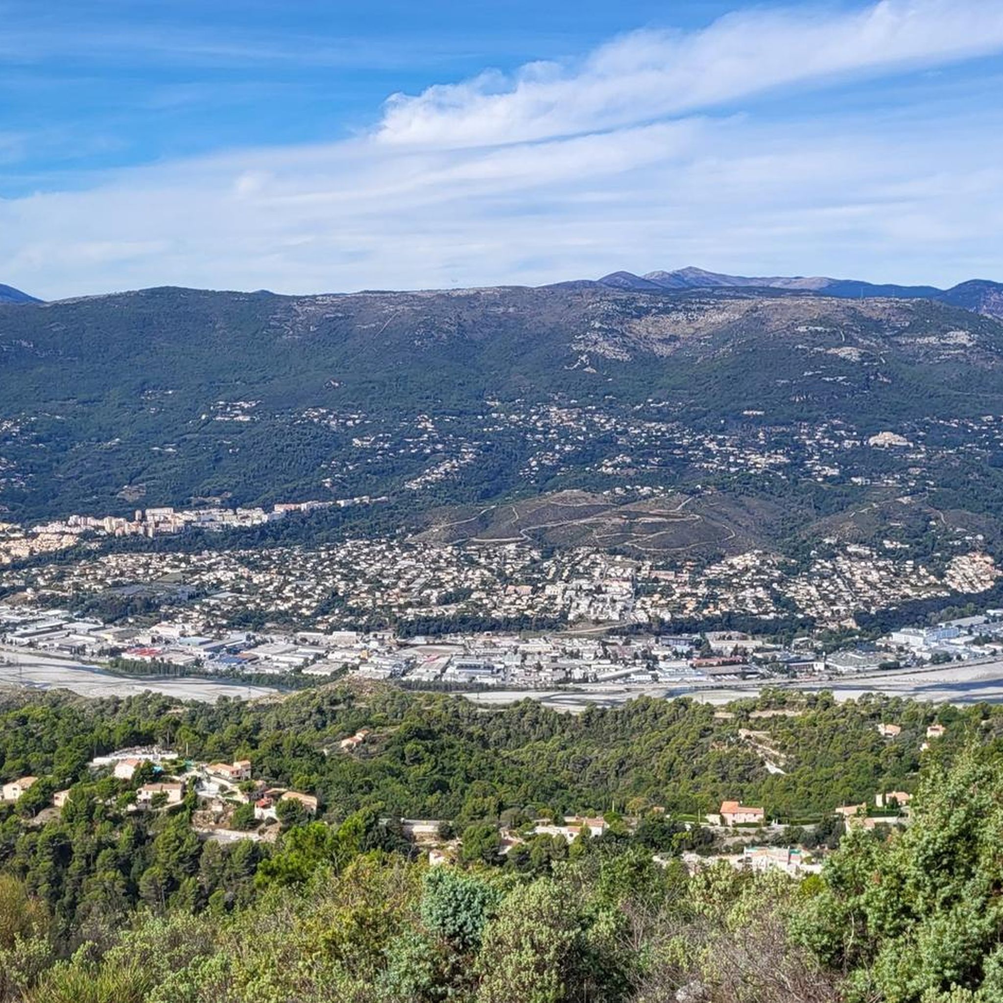
Road cycling routes around Aspremont navigate a hilly environment characterized by a "perched village" setting and surrounding natural features. The terrain includes significant ascents towards landmarks like Mont Chauve and Mont Cima, offering varied elevation. Cyclists can expect routes through wooded areas, olive groves, and terraced fields, often providing panoramic vistas of the Var plain and the Mediterranean Sea. The region's subsoil supports a green landscape of shrubby areas and forests.
Best road cycling routes around Aspremont
- The most popular…
Last updated: July 10, 2026
5.0
(2)
197
riders
106km
06:00
2,370m
2,370m
Hard road ride. Very good fitness required. Mostly well-paved surfaces and easy to ride.
4.5
(2)
355
riders
135km
07:42
3,010m
3,010m
Hard road ride. Very good fitness required. Some segments of this route may be unpaved and difficult to ride.

Sign up for free
5.0
(1)
206
riders
149km
08:37
3,360m
3,360m
Hard road ride. Very good fitness required. Mostly well-paved surfaces and easy to ride.
4.8
(13)
802
riders
114km
06:06
2,110m
2,110m
Hard road ride. Very good fitness required. Some segments of this route may be unpaved and difficult to ride.
5.0
(1)
83
riders
27.8km
01:27
500m
500m
Moderate road ride. Good fitness required. Mostly well-paved surfaces and easy to ride.
Get access to more routes and recommendations from other explorers.
Sign up for free
Already have an account?
Our route recommendations are based on thousands of hikes, rides, and runs completed by other people on komoot.
Start today with a free account
Your next adventure awaits.
Login or Signup
Other adventures around Aspremont

Tips from the Community


Corniche road. Magnificent views of the Mediterranean, Nice... At the Col du Farguet, views of the Mercantour. To reach the Col de Braus, gravel road accessible to classic electric bikes (not mountain bikes)
0
0

The Col d'Èze, located between Nice and Monaco, near La Turbie in the Alpes-Maritimes department, peaks at 507 m. Located less than 5 km from the coast, it offers a remarkable panorama of the Côte d'Azur: Cap Ferrat to the west, and Italy to the east. It is part of the Route des Grandes Alpes route. Despite its modest altitude, it is important to remember that the climbs all start at sea level and that the elevation gain is therefore quite significant at nearly 500 m. There are many options for accessing the Col d'Èze...
1
0
The Col d'Èze, located between Nice and Monaco, near La Turbie in the Alpes-Maritimes department, peaks at 507 m. Located less than 5 km from the coast, it offers a remarkable panorama of the Côte d'Azur: Cap Ferrat to the west, and Italy to the east. It is part of the Route des Grandes Alpes route. Despite its modest altitude, it is important to remember that the climbs all start at sea level and that the elevation gain is therefore quite significant at nearly 500 m. There are many options for accessing the Col d'Èze...
0
0
An exceptional site, located between Sospel and Moulinet, on the Route des Grands Alpes. This sanctuary with its vertiginous staircase (listed as a Historic Monument in 1937) overlooks the Piaon Gorges in the Bévéra Valley.
0
0

Frequently Asked Questions
How many road cycling routes are available around Aspremont?
There are over 150 road cycling routes around Aspremont, offering a wide range of options for different skill levels. You'll find everything from easier rides to very challenging ascents through the region's hilly terrain.
What is the typical terrain like for road cycling near Aspremont?
The terrain around Aspremont is characterized by a hilly environment, featuring a "perched village" setting. Cyclists can expect varied elevation, with routes traversing wooded areas, olive groves, and terraced fields. Many rides offer significant ascents towards landmarks like Mont Chauve and Mont Cima, often starting at sea level and providing rewarding climbs.
Are there routes suitable for advanced road cyclists seeking challenges?
Yes, Aspremont is well-known for its challenging routes, some of which have been part of professional races like Paris-Nice. Advanced cyclists can tackle routes with significant elevation gains, such as the Braus Pass – Col de Turini loop from Castagniers, which features multiple mountain passes and extensive climbs. Another demanding option is the Col de Turini – Castillon Pass loop from Castagniers, leading through high mountain passes.
What kind of views or natural features can I expect on these routes?
Many routes offer splendid panoramic vistas of the Mediterranean Sea and the Var plain. You'll cycle through a largely unspoiled hinterland, past olive groves, terraced fields, and wooded areas. The dramatic setting of Aspremont, flanked by Mont Chauve and Mont Cima, provides a stunning backdrop to your rides.
Are there any historical or cultural attractions to see along the way?
Absolutely. The village of Aspremont itself is a well-preserved medieval gem with cobbled streets and historic churches like the 13th-century St Jacques Le Majeur. High above, you can find the Fort du Mont Chauve d'Aspremont, and to the north, the ruins of an older medieval village on Mont Cima. These offer glimpses into the region's rich past and often provide breathtaking views.
What is the best season for road cycling in Aspremont?
The region's Mediterranean climate generally offers pleasant conditions for cycling for much of the year. Spring and autumn are often ideal, with milder temperatures and beautiful landscapes. Summer can be warm, but early morning rides are still very enjoyable. The varied elevation means you can find routes suitable for different weather conditions.
Are there options for parking when starting a road cycling route?
While specific parking details for every trailhead aren't listed, Aspremont and nearby villages like Castagniers, which serve as starting points for many routes, typically offer public parking facilities. It's advisable to check local parking availability in the specific starting village for your chosen route.
What do other cyclists say about road cycling in Aspremont?
The road cycling routes around Aspremont are highly rated by the komoot community, with an average score of 4.5 stars from over 600 reviews. Cyclists often praise the diverse terrain, the challenging climbs, and the stunning panoramic views of the Mediterranean Sea and the Var plain. Over 36,000 road cyclists have used komoot to explore this region.
Are there any routes that pass by waterfalls or other natural monuments?
Yes, the area around Aspremont features several natural highlights. You can find routes that pass near the Castle Waterfall or offer views from Castle Hill. The Vinaigrier Departmental Natural Park is another natural monument in the vicinity that offers a green environment.
How long do road cycling routes typically take around Aspremont?
Route durations vary significantly based on distance and difficulty. For instance, a challenging route like the Col des Ferres - Cheiron directed biological reserve, which is over 100 km, typically takes around 6 hours. Longer, more demanding loops through high mountain passes can take 8 hours or more, while easier routes will be considerably shorter.
Are there any cafes or places to stop for refreshments along the routes?
Many road cycling routes in the Aspremont region pass through or near picturesque villages. These villages, including Aspremont itself, often have local cafes, bakeries, or small restaurants where you can stop for refreshments, refuel, and enjoy the local atmosphere. It's a great way to experience the charm of the Niçois hinterland.
What are some moderate road cycling options around Aspremont?
While many routes are challenging, there are also moderate options available. The region offers a network of routes suitable for various skill levels. You can find rides that provide a good workout without the extreme elevation gains of the most difficult mountain passes. Komoot's route planner can help you filter for moderate difficulty levels to find suitable paths.
Are there any circular road cycling routes available?
Yes, many of the road cycling routes around Aspremont are designed as loops, allowing you to start and end in the same location. Examples include the Gorges du Loup – Gourdon loop from Colomars - La Manda or the Col de la Couillole – Col à Utelle loop from Castagniers. These circular routes are popular for exploring the diverse landscapes and returning to your starting point conveniently.
Most popular attractions around Aspremont

Get inspired with the komoot mobile app


Explore more
Browse the best Road cycling routes in other regions.
