The best walks and hikes around Saint-Clair-Sur-Galaure
4.4
(159)
881
hikers
77
hikes
Hiking around Saint-Clair-Sur-Galaure provides access to rural landscapes within the Isère department of the Auvergne-Rhône-Alpes region. The area features a mix of wooded areas and watercourses, including the Galaveyson, a tributary of the Galaure river. Trails often lead through forests and past historical sites such as the ruins of the 14th-century Château de Montfalcon and the Chapelle du Serrein. The topography includes gentle elevation changes, making it suitable for various hiking experiences.
Best hiking trails around Saint-Clair-Sur-Galaure
- The most popular…
Last updated: October 10, 2026
4.5
(2)
17
hikers
12.5km
03:24
190m
190m
Hike the moderate 7.7-mile Saint Clair sur Galaure, le Montclair — loop through woodlands to the Château de Montfalcon ruins.
7
hikers
Moderate hike. Good fitness required. Easily-accessible paths. Suitable for all skill levels.

10
hikers
4.76km
01:17
60m
60m
Easy hike. Great for any fitness level. Easily-accessible paths. Suitable for all skill levels.
5
hikers
6.43km
01:50
150m
150m
Easy hike. Great for any fitness level. Easily-accessible paths. Suitable for all skill levels.
2
hikers
Moderate hike. Good fitness required. Easily-accessible paths. Suitable for all skill levels.
Get access to more routes and recommendations from other explorers.
Already have an account?
Our route recommendations are based on thousands of hikes, rides, and runs completed by other people on komoot.
Start today with a free account
Your next adventure awaits.


Tips from the Community

The packaging was beautiful, https://scarfring.store/ and the craftsmanship of the bracelet is top-notch.
0
0

Near the village of Roybon there is a series of landscaped ponds where it is possible to fish all year round.
0
0
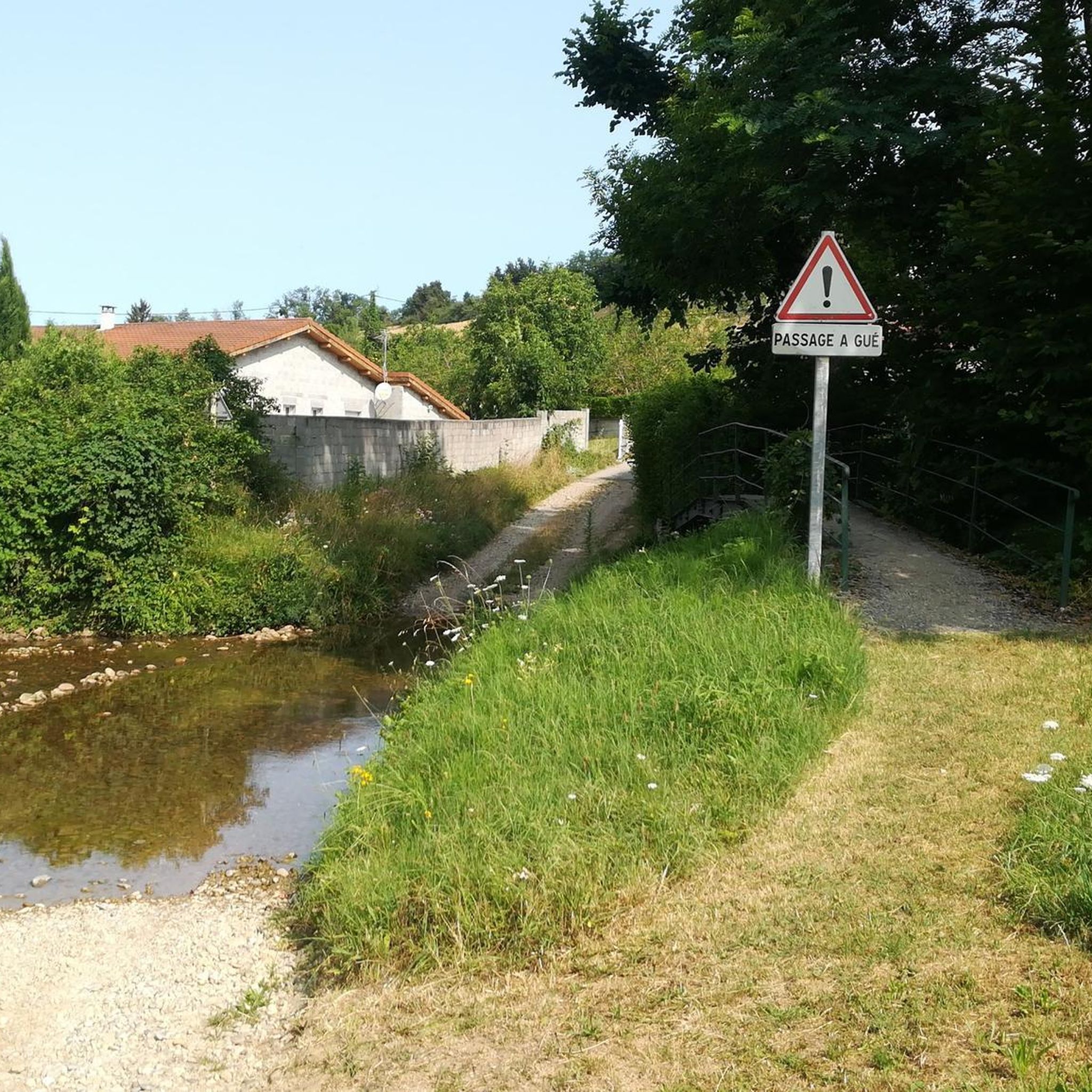
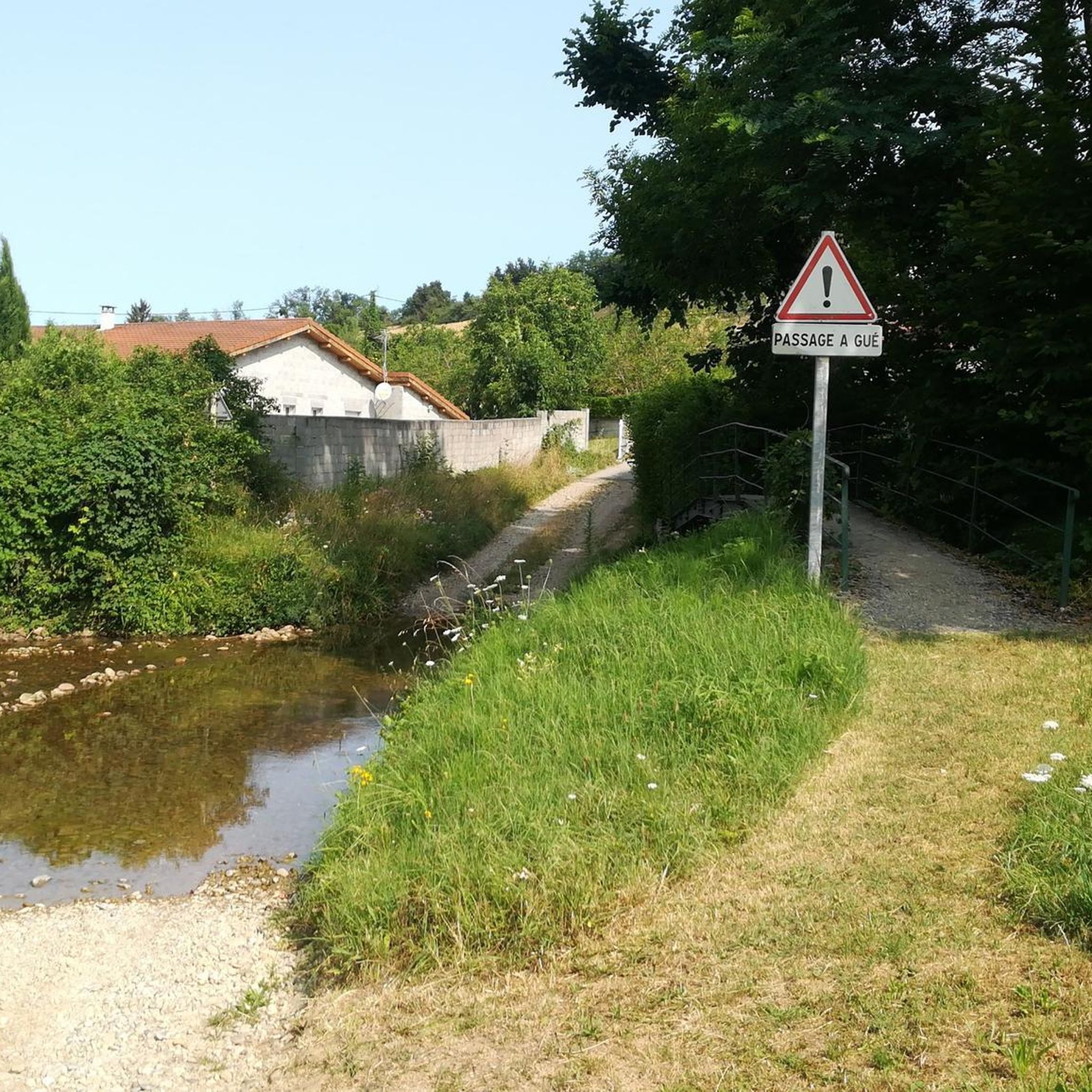
The Galaure is a tributary of the Rhône river. A ford has been installed to cross it at this point. When the water level is too high, it is always possible to cross using the raised metal bridge.
0
0
Nice view of the surrounding hills, on a path in the middle of meadows.
0
0
The Château de Montfalcon was built in the 14th century to protect the population from the clashes between partisans of Dauphiné and partisans of Savoy. From the initial building we still recognize the polygonal enclosure, a square Romanesque keep and half of a round tower.
0
0

Beautiful dinosaur park with 4 labyrinths
0
0

Small ford of the Galaure at the exit of Hauterives. The Galaure is a tributary of the Rhône, which originates in the commune of Roybon. It is possible to take the metal bridge when the water level is too high.
0
0
Small fishing pond in the heart of the municipal forest of Montrigaud offers a very bucolic setting. This place is ideal for taking a short break. A shaded picnic area is located right next to the pond. You will find, along the pond, information panels on the surrounding flora and fauna.
0
0
Frequently Asked Questions
How many hiking trails are available in Saint-Clair-Sur-Galaure?
There are over 70 hiking trails around Saint-Clair-Sur-Galaure, offering a variety of experiences from easy strolls to more challenging routes. The komoot community has explored these trails over 700 times.
What kind of landscape can I expect on the trails around Saint-Clair-Sur-Galaure?
The landscape around Saint-Clair-Sur-Galaure is characterized by rural scenery, wooded areas, and watercourses. You'll often find trails following tributaries like the Galaveyson river, leading through forests and past historical sites.
Are there family-friendly hiking options in Saint-Clair-Sur-Galaure?
Yes, Saint-Clair-Sur-Galaure offers several easy trails suitable for families. For example, the Etangs loop from Marnans is a shorter, 3-mile (4.8 km) route that explores a landscape featuring ponds, ideal for a leisurely family walk.
Can I bring my dog on the hiking trails in this region?
Many trails in the Saint-Clair-Sur-Galaure area are suitable for dogs, especially those that traverse wooded areas and rural paths. It's always recommended to keep your dog on a leash, especially near livestock or in protected natural areas, and to check local regulations for specific routes.
What historical sites can I discover while hiking in Saint-Clair-Sur-Galaure?
Hiking in Saint-Clair-Sur-Galaure often combines natural beauty with historical exploration. Trails can lead you to the ruins of the 14th-century Château de Montfalcon and the historic Chapelle du Serrein. Further afield, you might explore the medieval village of Saint-Antoine-l'Abbaye or the impressive Château de Bressieux.
Are there any circular hiking routes in Saint-Clair-Sur-Galaure?
Yes, several circular routes are available. A popular option is the Saint Clair sur Galaure, le Montclair — loop, which is a moderate 7.7-mile (12.5 km) trail following the Galaveyson river. Another is the Etangs loop from Marnans, a shorter 3-mile (4.8 km) option.
What is the best time of year to go hiking in Saint-Clair-Sur-Galaure?
The region is generally pleasant for hiking from spring through autumn. Spring brings blooming flora, while autumn offers vibrant fall colors in the wooded areas. Summers are typically warm, making early mornings or late afternoons ideal for longer hikes. Winters can be cold, but some trails may still be accessible depending on snow conditions.
Are there options for easy, short walks in the area?
Absolutely. Saint-Clair-Sur-Galaure has 17 easy trails, many of which are shorter and have minimal elevation gain. The Etangs loop from Marnans is a good example, taking about 1 hour 17 minutes to complete.
What do other hikers say about the trails in Saint-Clair-Sur-Galaure?
The trails in Saint-Clair-Sur-Galaure are highly rated by the komoot community, with an average score of 4.5 stars from over 100 reviews. Hikers often praise the quiet woodlands, the scenic river paths, and the opportunity to discover historical landmarks along the way.
Are there any trails that follow watercourses or feature ponds?
Yes, the region is known for its watercourses. The Saint Clair sur Galaure, le Montclair — loop follows the Galaveyson river. Additionally, the Etangs loop from Marnans is specifically designed around a landscape featuring ponds.
What are the typical difficulty levels of hikes in this area?
The trails around Saint-Clair-Sur-Galaure cater to various fitness levels. You'll find 17 easy routes, 46 moderate routes, and 7 more difficult options, including longer trails like the Loop in the Chambaran forest.
Most popular routes around Saint-Clair-Sur-Galaure
Most popular attractions around Saint-Clair-Sur-Galaure

Get inspired with the komoot mobile app


Explore more
Browse the best Hikes in other regions.
