The best walks and hikes around Vulaines-Sur-Seine
4.6
(3401)
16,438
hikers
618
hikes
Hiking around Vulaines-Sur-Seine offers a network of trails through varied landscapes. The region is characterized by its proximity to the Seine River, providing scenic river views and riverside paths. Hikers can expect to encounter forested areas, gentle hills, and occasional viewpoints that overlook the surrounding countryside. The terrain generally consists of well-maintained paths suitable for a range of abilities.
Best hiking trails around Vulaines-Sur-Seine
- The most popular hiking route is Viewpoint – Calvary Cross loop from Samoreau, a 9.8…
Last updated: August 18, 2026
4.7
(30)
82
hikers
15.9km
04:12
140m
140m
Moderate hike. Good fitness required. Easily-accessible paths. Suitable for all skill levels.
4.5
(17)
43
hikers
9.65km
02:34
100m
100m
Moderate hike. Good fitness required. Easily-accessible paths. Suitable for all skill levels.

Sign up for free
4.9
(7)
29
hikers
26.1km
06:47
170m
170m
Hard hike. Very good fitness required. Easily-accessible paths. Suitable for all skill levels.
5.0
(5)
28
hikers
21.5km
05:44
230m
230m
Hard hike. Very good fitness required. Easily-accessible paths. Suitable for all skill levels.
4.8
(11)
48
hikers
20.7km
05:27
180m
180m
Hard hike. Very good fitness required. Easily-accessible paths. Suitable for all skill levels.
Get access to more routes and recommendations from other explorers.
Sign up for free
Already have an account?
Our route recommendations are based on thousands of hikes, rides, and runs completed by other people on komoot.
Start today with a free account
Your next adventure awaits.
Login or Signup

Other adventures around Vulaines-Sur-Seine

Tips from the Community

Viewpoint overlooking the surroundings, a must-see
0
0

The origins of this imposing wayside cross are said to date back to the 17th century; it has been destroyed several times since – including during the French Revolution – but always rebuilt. The crossing, i.e. the intersection of the longitudinal and transverse beams of the cross, is designed as a closed circle, the transverse beam bears the inscription „Croix de Calvaire“. The name refers to Calvary Hill, in memory of the crucifixion of Jesus Christ on Golgotha (this Aramaic word means – just like Calvaire, derived from Latin – „skull place“) near Jerusalem.
2
0

Footbridge which provides access to the Cradle Island from lower Bréau.
0
0
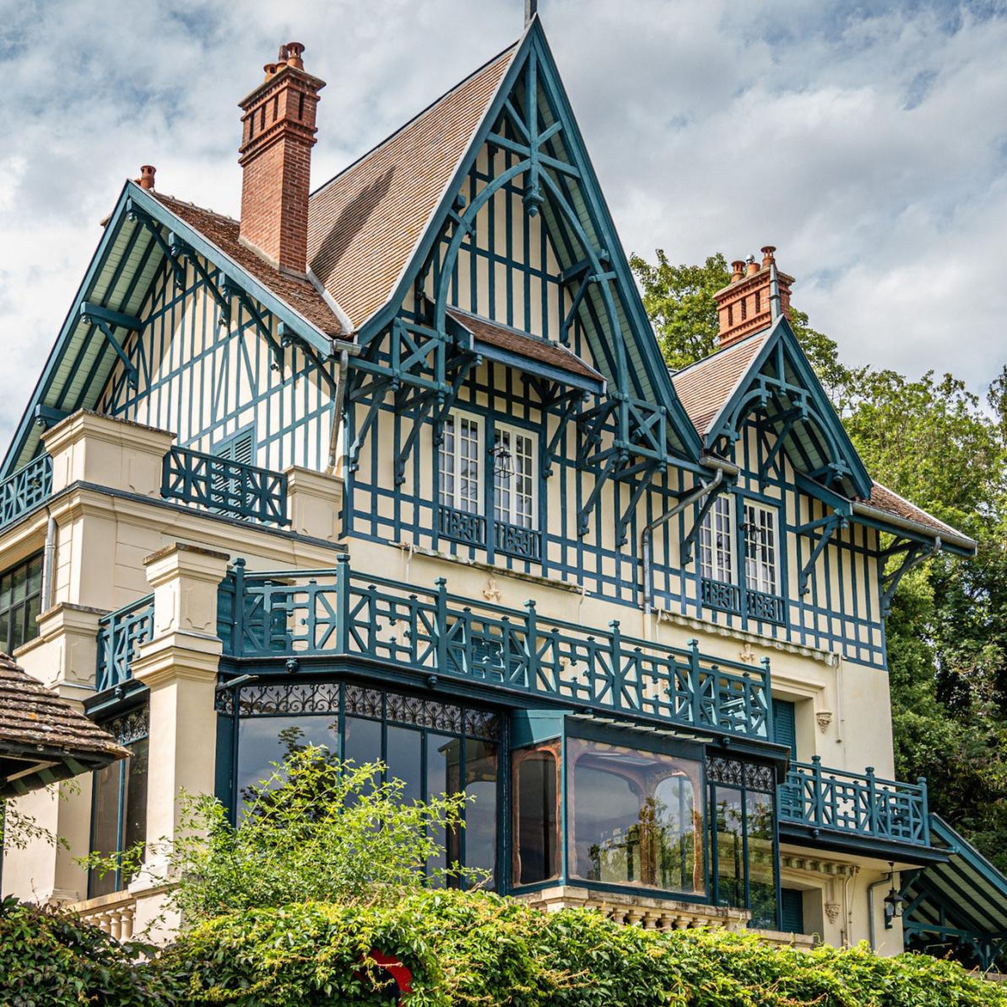
This villa became a historic monument in 2002.
0
0
The origins of this impressive crossroads are said to date back to the 17th century; since then it has been destroyed several times - including during the French Revolution - but has always been rebuilt. The crossing, i.e. the intersection of the longitudinal and cross beams of the cross, is designed as a closed circle; the cross beam bears the inscription "Croix de Calvaire". The name refers to Calvary, in memory of the crucifixion of Jesus Christ on Golgotha (this Aramaic word - like Calvaire, which is derived from Latin - means "place of the skull") near Jerusalem.
3
0

Samois was not on Thibaut de Champagne's itinerary. It seemed useful to me to leave this village to have a view of the hillside opposite Héricy-Vulaines-Samorau. We regret that the old Roman bridge between Samois-sur-Seine and Héricy no longer exists, Louis XVIII decides to rebuild one, between these two communes. Built from wood provided by the surrounding forests, its location further upstream of the village, near Samoreau, is more favorable thanks to a narrowing of the Seine. In 1811 work began, but it was only in 1825 that the first Valvins bridge was inaugurated. To be more solid and adapted to modern life, in 1866 the bridge was rebuilt as a metal structure. After the Second World War, the bridge, completely destroyed by the German army, was entirely rebuilt in reinforced concrete, wider and asphalted, to facilitate the ever-increasing traffic] (Wikipedia has shortened the history of this bridge: The army American having crossed the Seine on a boat bridge, a temporary bridge in metal structure with wooden floor then bitumen was rebuilt to replace the one destroyed by the Germans. The current concrete bridge dates from 1977). The plateau of La Brosse and Fontaineroux, which is part of the commune, has been inhabited since the Neolithic period but the village of Héricy has its origins in the warehouses built by the Senon nautes, opposite the port of Samois-sur-Seine, the most important between Sens and Lutetia. Under Louis between Melun and Montereau-Fault-Yonne. It has been said to be Roman, but in 1177 it was already there, flanked by its mills. It was probably in the 14th century that it was equipped with towers and that the city was surrounded by walls and moats. With its large fortified gates to the south and north, Héricy then had the title of town. She suffered greatly from the Hundred Years' War. There were battles there several times and it was occupied from 1419 to 1430. The first written mention of the name is villa Velcina. This refers to “villa”, a large farm with farm buildings. The villa is a Roman creation whose name was given to later foundations (from the 6th to the 12th century). In relation to the other surrounding villages or hamlets, Samoreau, Héricy and La Brosse in the 12th century and even Fontaineroux in 1279. All this means that a large Gallo-Roman or Merovingian property may have existed on the site of the village. Samoreau was already occupied during the Neolithic period: numerous cut flints (chisels, scrapers, drills, saws, etc.) testify that peoples were “attracted there by the river where they found both the water necessary for their needs and fish in these waters, game on these banks, finally the very raw material of their weapons and their tools, the precious flint. » In 1177 the abbey of Saint-Germain-des-Prés acquired part of the village territory. In 1520 François I bought the hillsides where he built the Château des Pressoirs du Roy. From 1592 to 1597, Henri IV stayed at the Pressoirs du Roy in the company of the beautiful Gabrielle d’Estrées. In 1679 the royal water coach was created between Paris and Valvins (the village closest to Samoreau, on the banks of the Seine).
0
0

legendary stop in the middle of the forest. Only trains departing from Gare de Lyon at 8:16 a.m. and 9:16 a.m. on weekends.
3
0

Ideal for the picnic under shelter.
0
0
Frequently Asked Questions
How many hiking trails are available around Vulaines-Sur-Seine?
There are over 600 hiking trails in the Vulaines-Sur-Seine area, offering a wide variety of options for different skill levels and preferences. The komoot community has explored these routes over 14,000 times.
Are there easy hiking options suitable for beginners or casual walkers?
Yes, Vulaines-Sur-Seine offers plenty of easy hiking options, with over 300 routes categorized as easy. An example is the Samois Tower – View of the Seine loop from Héricy, which is 6.6 km long and features gentle elevation changes, perfect for a relaxed outing.
What kind of terrain can I expect on hikes around Vulaines-Sur-Seine?
The terrain around Vulaines-Sur-Seine is characterized by its proximity to the Seine River, offering scenic riverside paths. You can expect to encounter pleasant forested areas, gentle hills, and occasional viewpoints overlooking the surrounding countryside. Paths are generally well-maintained and suitable for a range of abilities.
Are there any challenging hikes for experienced trekkers?
For those seeking a more strenuous adventure, there are nearly 60 difficult routes around Vulaines-Sur-Seine. A challenging option is the Samois Tower – View of the Seine loop from Vulaines-sur-Seine - Samoreau, a 26.8 km trail with significant elevation gain, typically taking around 7 hours to complete.
Are there circular walks available in the area?
Many of the trails around Vulaines-Sur-Seine are designed as circular routes, allowing you to start and end at the same point without retracing your steps. For instance, the Denecourt Tower – View of the Seine loop from Samois-sur-Seine is a popular 9.6 km circular path offering river views and historical landmarks.
Can I bring my dog on the hiking trails?
Yes, many trails in the Vulaines-Sur-Seine region are dog-friendly. It's always advisable to keep your dog on a leash, especially in forested areas or near wildlife, and to check local regulations for specific routes. The natural environment with its forests and riverbanks provides a great setting for walks with your canine companion.
Are there family-friendly hiking options around Vulaines-Sur-Seine?
Absolutely. The region's gentle hills and well-maintained paths make it suitable for families. Many of the easy and moderate routes are perfect for children. Look for shorter loops or trails that feature points of interest like the riverbanks or open fields for a pleasant family outing.
What are some scenic viewpoints or landmarks to look out for?
The region offers several scenic spots and landmarks. You can find beautiful views of the Seine River along many paths. Notable attractions include the Calvary Cross, which is part of the popular Viewpoint – Calvary Cross loop from Samoreau, and the Grotte du Serment. The Mont Ussy Rocks – Denecourt Tower loop from Vulaines-sur-Seine - Samoreau also passes by interesting rock formations.
What is the best time of year to hike in Vulaines-Sur-Seine?
The best time to hike in Vulaines-Sur-Seine is typically during spring, summer, and autumn. Spring brings blooming flora, summer offers warm weather for riverside strolls, and autumn provides stunning foliage colors in the forested areas. While winter hiking is possible, some paths might be muddy or slippery, so appropriate footwear is recommended.
What do other hikers enjoy most about the trails in Vulaines-Sur-Seine?
The trails in Vulaines-Sur-Seine are highly rated by the komoot community, with an average score of 4.6 stars from over 2,600 reviews. Hikers often praise the diverse landscapes, including the picturesque Seine River views and tranquil forested sections. The well-maintained paths and variety of route lengths also receive positive feedback.
Is public transport available to access hiking trailheads?
Vulaines-Sur-Seine is served by local public transport, which can provide access to various points in the region. While specific trailhead access varies, checking local bus routes or regional train lines connecting to nearby towns like Samois-sur-Seine or Héricy can help you reach starting points for many hikes.
Are there parking facilities near the hiking trails?
Yes, parking is generally available in and around Vulaines-Sur-Seine, particularly in the villages and near popular trailheads. Many routes start from areas with designated parking spaces, making it convenient for those traveling by car. It's always a good idea to check specific starting points for parking availability before your hike.
Most popular routes around Vulaines-Sur-Seine
Most popular attractions around Vulaines-Sur-Seine

Get inspired with the komoot mobile app


Explore more
Browse the best Hikes in other regions.
