The best running trails around Pégairolles-De-Buèges
4.8
(23)
1,800
runners
33
runs
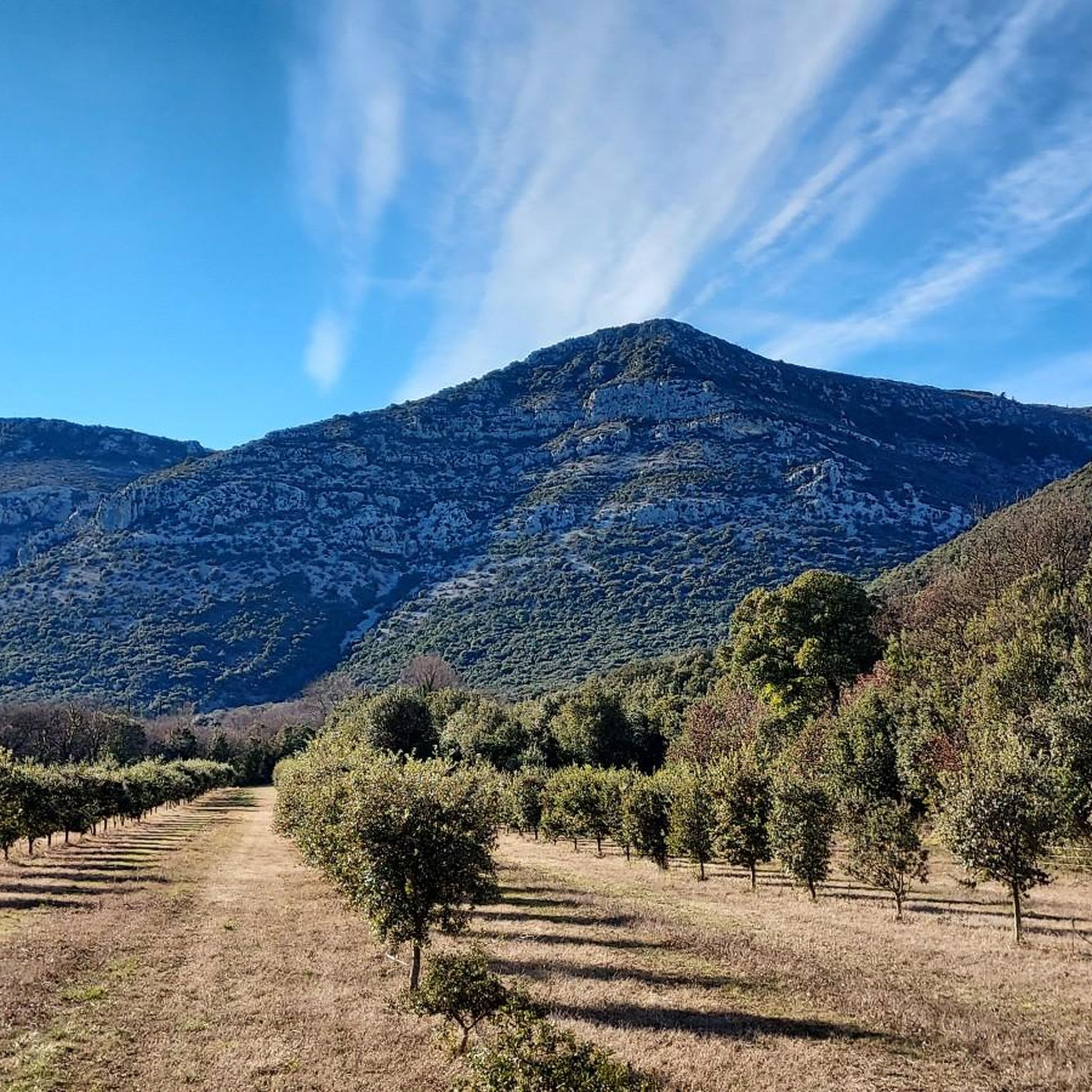
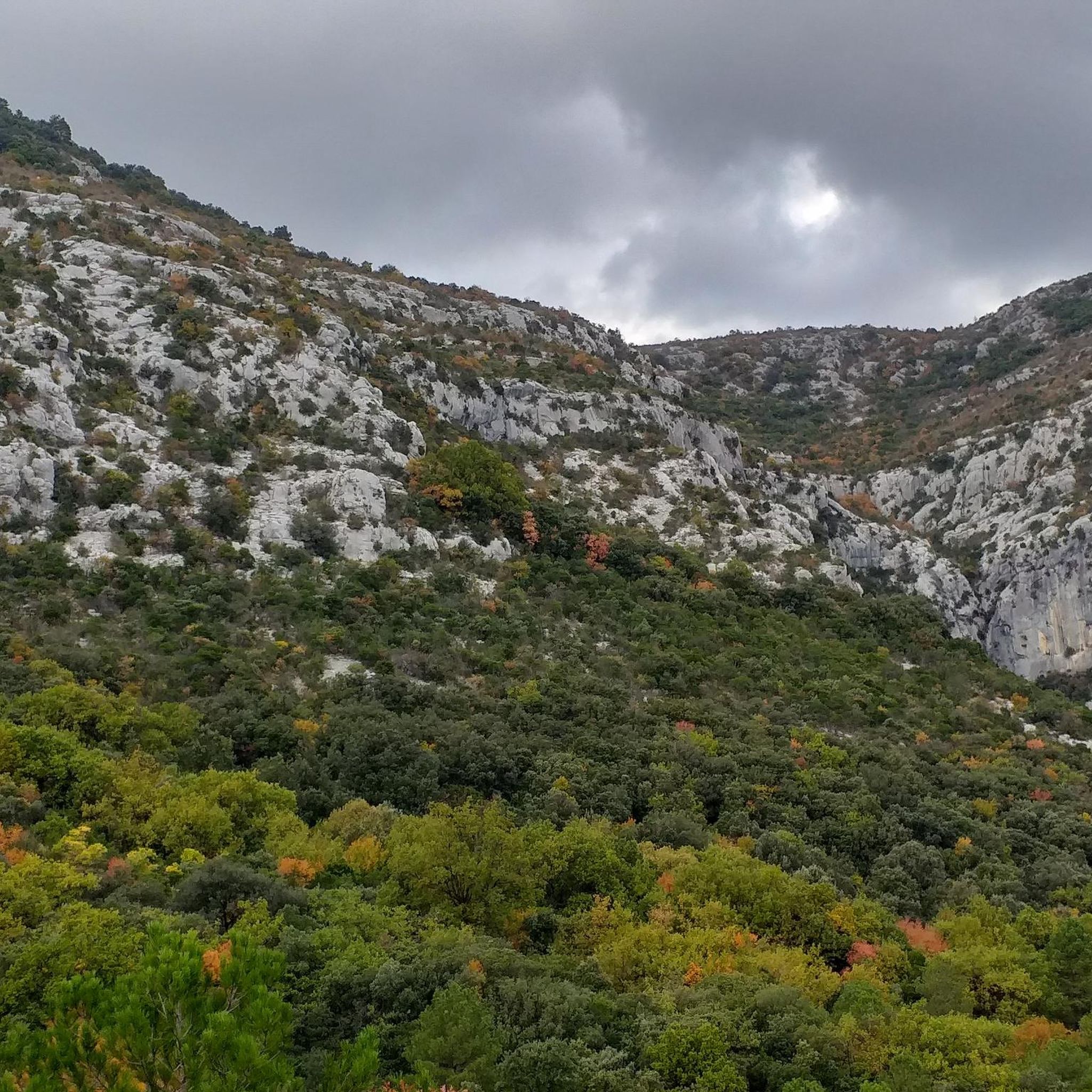
Jogging routes around Pégairolles-De-Buèges traverse a diverse landscape within the Buèges Valley and at the foot of the Séranne Massif. The region features varied terrain, including garrigue, vineyards, olive groves, and woods, alongside the meandering Buèges river. Altitudes vary significantly, offering routes through dolomitic cliffs, limestone bars, and pine forests, providing a range of challenges for runners. This area is part of the "Causses et Cévennes" UNESCO World Heritage site, known for its Mediterranean agro-pastoral cultural landscape.
Best jogging routes…
Last updated: June 26, 2026
50
runners
16.1km
02:12
840m
840m
Jog the difficult Peyre Martine Trail, a 10.0-mile route with 2756 feet of elevation gain and panoramic views from its summit.
60
runners
25.3km
03:52
1,370m
1,370m
Hard run. Very good fitness required. Mostly paved surfaces. Suitable for all skill levels.

Sign up for free
36
runners
Hard run. Very good fitness required. Mostly paved surfaces. Suitable for all skill levels.
21
runners
11.5km
01:47
620m
620m
Hard run. Very good fitness required. Mostly paved surfaces. Suitable for all skill levels.
16
runners
17.4km
02:29
680m
680m
Hard run. Very good fitness required. Mostly paved surfaces. Suitable for all skill levels.
Get access to more routes and recommendations from other explorers.
Sign up for free
Already have an account?
Our route recommendations are based on thousands of hikes, rides, and runs completed by other people on komoot.
Start today with a free account
Your next adventure awaits.
Login or Signup
Tips from the Community

A great village, with winding alleyways where it's pleasant to get lost.
0
0
A magical place, ideal for taking a break by the water.
0
0


magnificent waterfalls, a must-see
1
0

A really nice spot. Not as high as the ROC BLANC, but almost prettier, with a much more pleasant hike. The path to get there is nice, although steep, with a good difference in altitude! The descent is moderately gentle, but few surprises. In short, a pleasant summit, where it is good to spend time! BE CAREFUL, once at the top, to get to the "cornice", an 8/10m hole is almost at the edge of the path. Watch your feet.
2
0
A pretty little village at the foot of the Séranne!
1
0

Beautiful... the surface is a bit rough, but you certainly don't need a gravel bike, just good legs :-) Nice climbs on both sides, in the evenings you are usually alone, but you rarely see cars.
2
0

The perfect place for a picnic. There are public toilets at the end of the street opposite.
2
0
Frequently Asked Questions
How many running routes are available in Pégairolles-De-Buèges?
There are over 40 running routes around Pégairolles-De-Buèges, offering a wide range of options for exploring the diverse landscapes of the Buèges Valley and the Séranne Massif.
What kind of terrain can I expect on the running trails around Pégairolles-De-Buèges?
The terrain is remarkably varied, ranging from the intimate Buèges Valley with its garrigue, vineyards, olive groves, and woods, to the dramatic Séranne Massif featuring dolomitic cliffs, white limestone bars, and pine forests. You'll encounter significant altitude changes, making for engaging and challenging runs.
Are there running routes suitable for beginners in Pégairolles-De-Buèges?
While many routes in the area are rated as difficult due to significant elevation changes, there are also moderate options available. Currently, komoot lists 8 moderate routes, which can be a good starting point for those new to trail running in the region.
Can I find circular running routes in the Pégairolles-De-Buèges area?
Yes, the region is well-suited for circular running routes. For example, the Buèges Spring – Saint-Jean-de-Buèges loop from Pégairolles-de-Buèges is a popular option that takes you through the valley and back to your starting point.
Are there any scenic running trails with great viewpoints?
Absolutely! The area is known for its exceptional perspectives. Routes like the Peyre Martine Trail offer superb views of the surrounding valley and the Séranne massif. The trail to Peyre Martine Summit is particularly noted for its panoramic vistas.
Are there running routes that pass by water features like springs or waterfalls?
Yes, you can find routes that incorporate water features. The Peyre Martine – Source of the Buèges loop from Saint-Jean-de-Buèges leads towards the peaceful Méjanel Spring, the source of the Buèges river. Additionally, the La Vis Waterfall in Navacelles is a notable natural monument nearby.
What natural landmarks or attractions can I see while jogging in Pégairolles-De-Buèges?
While running, you can encounter several natural wonders. The Buèges Spring is a serene spot. For dramatic scenery, the Cirque de Navacelles and the Cirque de l'Infernet offer breathtaking views. You might also pass by significant peaks like Peyre Martine Summit or Montagne de la Seranne.
Are there any historical or cultural sites to explore along the running paths?
Pégairolles-De-Buèges is a picturesque medieval village, so as you jog, you can discover its narrow alleys, stone houses, the medieval castle overlooking the village, and the 12th-century parish church. The entire area is also part of the "Causses et Cévennes" UNESCO World Heritage site, recognized for its rich agro-pastoral cultural landscape.
What do other runners enjoy the most about jogging in Pégairolles-De-Buèges?
The running routes in Pégairolles-De-Buèges are highly rated by the komoot community, with an average score of 4.5 stars from over 20 reviews. Runners often praise the stunning natural beauty, the diverse and challenging terrain, and the peaceful atmosphere of the Buèges Valley.
Is Pégairolles-De-Buèges a good destination for trail running with significant elevation gain?
Yes, Pégairolles-De-Buèges is an excellent destination for trail runners seeking significant elevation gain. The region's varied topography, including the Séranne Massif, means many routes feature substantial climbs. For instance, the Lavagnes Pass loop from Pégairolles-de-Buèges includes over 670 meters of ascent.
What is the best time of year to go jogging in Pégairolles-De-Buèges?
Given its Mediterranean climate, spring and autumn generally offer the most pleasant conditions for jogging, with milder temperatures and beautiful scenery. Summer can be hot, so early morning or late afternoon runs are advisable. Winter can also be suitable, though some higher elevation trails might be cooler.
Are the running trails around Pégairolles-De-Buèges suitable for families?
While many routes are rated difficult, the diverse network of trails means there are options for various fitness levels. Families might find shorter, less strenuous sections along the Buèges river or in the valley floor more suitable. Always check the route's difficulty and elevation profile before heading out with children.
Most popular routes around Pégairolles-De-Buèges
Most popular attractions around Pégairolles-De-Buèges

Get inspired with the komoot mobile app


Explore more
Browse the best Running Trails & Routes in other regions.
