The best road cycling routes around Valflaunès
4.5
(125)
4,423
riders
119
rides
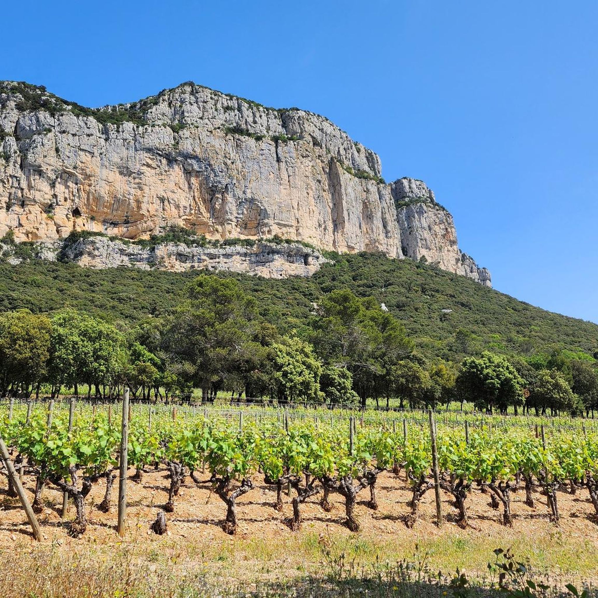
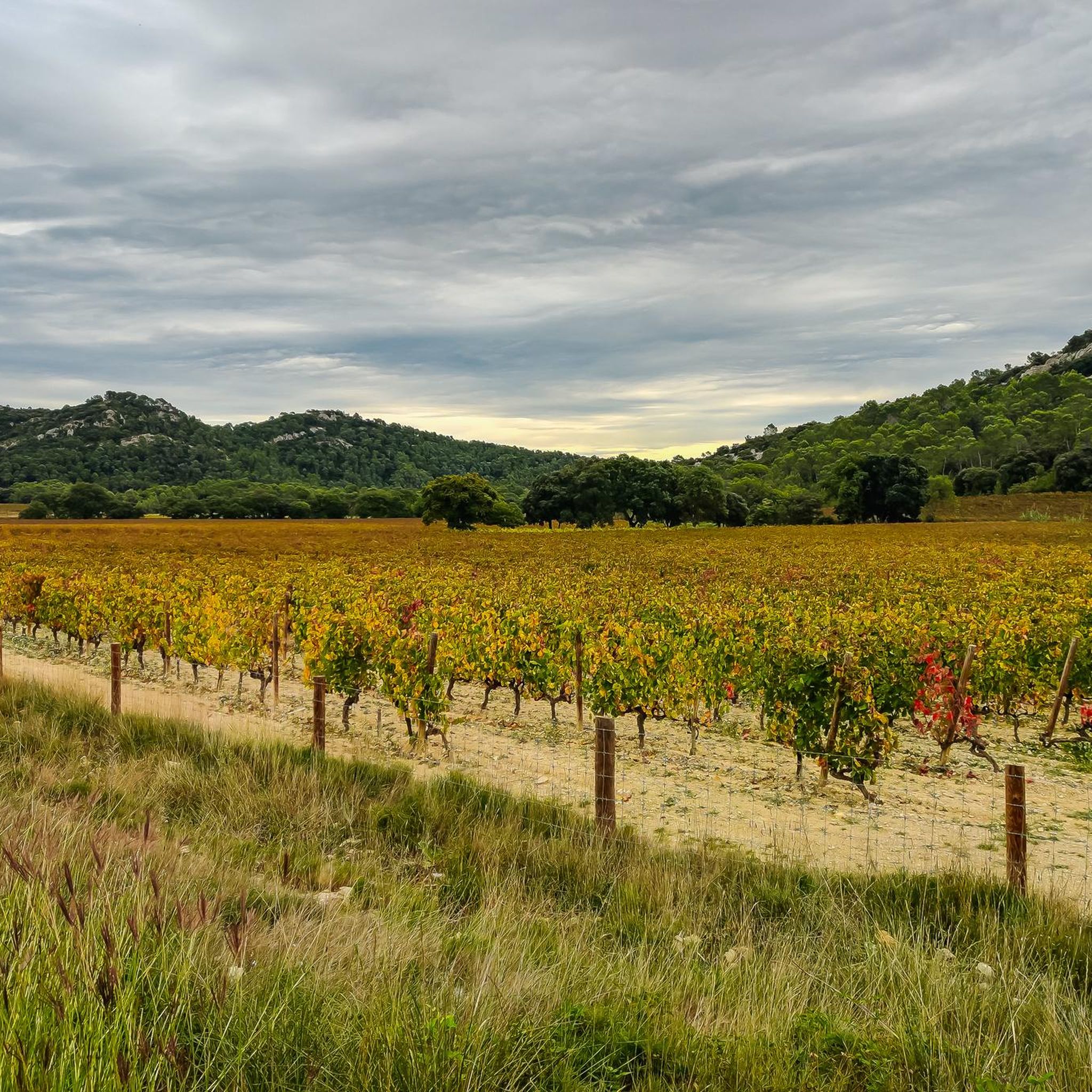
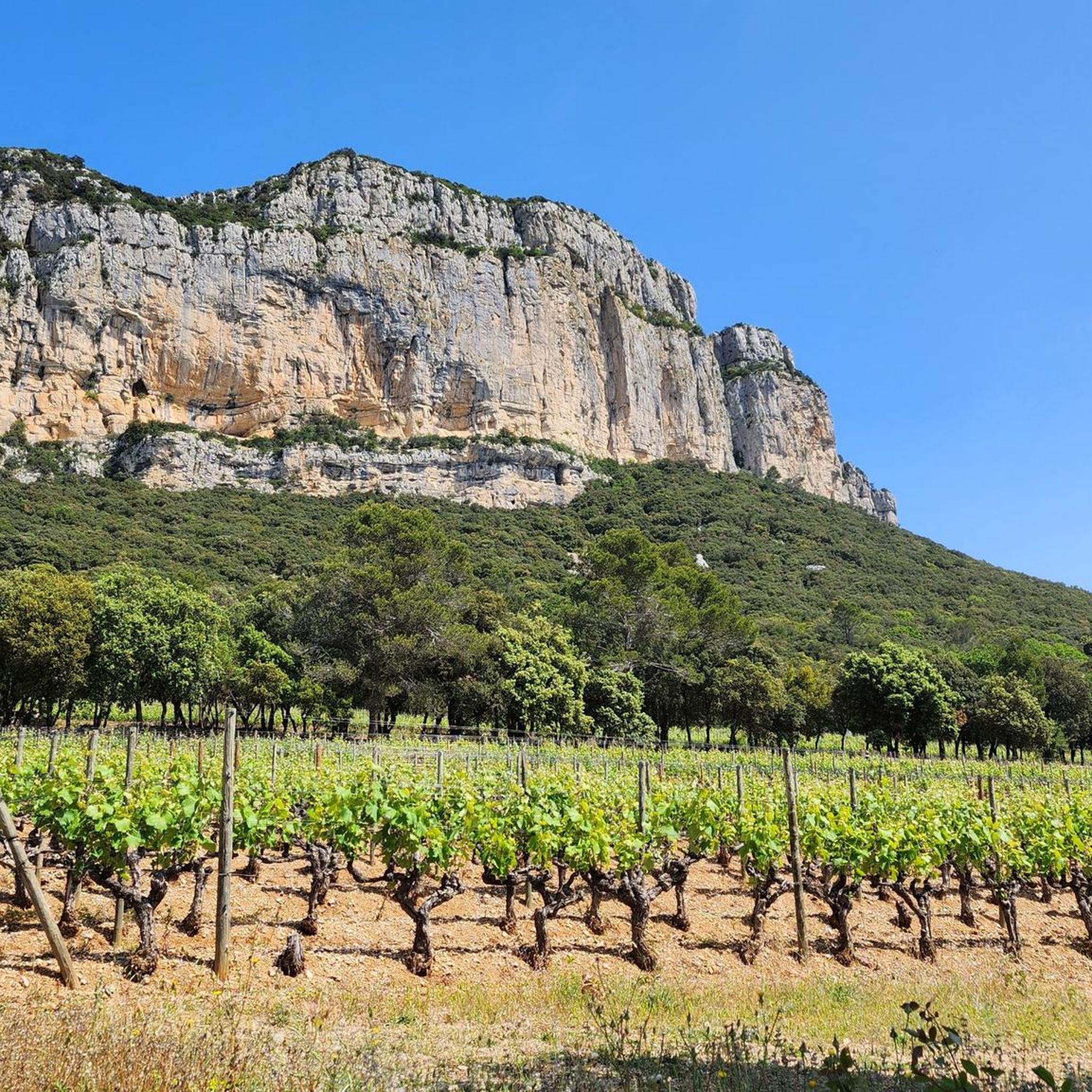
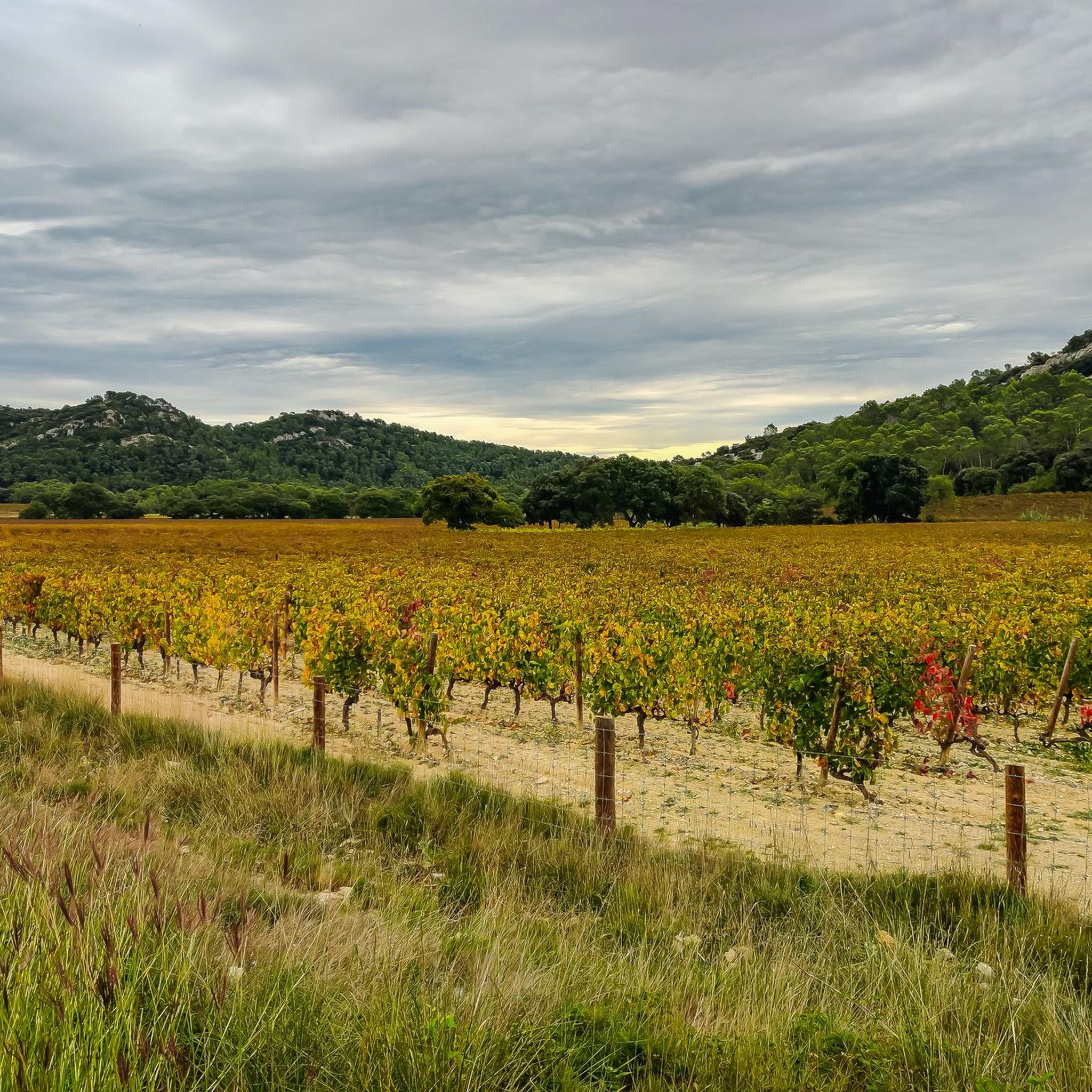
Road cycling around Valflaunès offers diverse landscapes, characterized by agricultural areas, forests, and scrubland. The region is framed by the Pic Saint-Loup to the west and the Hortus mountain to the north, providing scenic backdrops. Cyclists can find mostly well-paved surfaces, with routes offering significant elevation gain. This area provides varied terrain suitable for different fitness levels.
Best road cycling routes around Valflaunès
- The most popular road cycling route is Causse de la Selle – Devil's Bridge loop from Saint-Mathieu-de-Tréviers…
Last updated: July 11, 2026
4.3
(3)
121
riders
78.3km
03:43
1,020m
1,020m
Hard road ride. Very good fitness required. Mostly well-paved surfaces and easy to ride.
3.0
(2)
104
riders
66.3km
02:49
540m
540m
Moderate road ride. Good fitness required. Mostly well-paved surfaces and easy to ride.

Sign up for free
5.0
(5)
85
riders
60.7km
02:51
790m
790m
Moderate road ride. Good fitness required. Mostly well-paved surfaces and easy to ride.
5.0
(6)
82
riders
49.3km
02:28
780m
780m
Moderate road ride. Good fitness required. Mostly well-paved surfaces and easy to ride.
4.5
(4)
77
riders
78.3km
03:46
1,120m
1,120m
Hard road ride. Very good fitness required. Mostly well-paved surfaces and easy to ride.
Get access to more routes and recommendations from other explorers.
Sign up for free
Already have an account?
Our route recommendations are based on thousands of hikes, rides, and runs completed by other people on komoot.
Start today with a free account
Your next adventure awaits.
Login or Signup
Tips from the Community

From Anduze about 10 km of fine gravel (dusty bike) then nice smooth and well-running asphalt, also flat. To Saint Hippolyte du Fort also asphalt with some up and down. afterwards via another route back to Anduze with quite a few altitude meters, good condition is required.
0
0

Great for refueling in the summer
0
0
Beautiful road, just as described. Relatively little traffic, beautiful views, good asphalt!
1
0

A magnificent place. A pass allows you to slip between these two foothills.
2
0
Qissac has a lovely picturesque architecture
0
0
A picturesque town center and riverfront. I didn't take the time to find out if it offered any food.
0
0
A beautiful road, very popular with cyclists. A must-see if you're in the Pic Saint-Loup area. Thanks again to the cyclist who let me take her wheel to save me a little.
1
0
Frequently Asked Questions
What kind of terrain and elevation can I expect when road cycling around Valflaunès?
Road cycling around Valflaunès offers a diverse landscape, characterized by agricultural areas, forests, and scrubland. The region is framed by the prominent Pic Saint-Loup to the west and the Hortus mountain to the north, providing scenic backdrops. You'll find mostly well-paved surfaces, with routes offering significant elevation gain, catering to various fitness levels. For example, the Causse de la Selle – Devil's Bridge loop from Saint-Mathieu-de-Tréviers features over 1000 meters of elevation gain.
Are there road cycling routes suitable for beginners in Valflaunès?
Yes, Valflaunès offers road cycling routes suitable for various skill levels, including beginners. Out of 127 available routes, 27 are classified as easy, providing a gentler introduction to the region's beautiful landscapes. These routes typically feature less elevation gain and shorter distances, allowing for a more relaxed cycling experience.
What options are available for experienced road cyclists seeking a challenge in Valflaunès?
Experienced road cyclists will find plenty of challenging options around Valflaunès. The region features routes with significant elevation changes and longer distances. For instance, the Mountain road – Causse de la Selle loop from Saint-Mathieu-de-Tréviers is a difficult 78.3 km route with over 1100 meters of ascent, providing a demanding ride through varied terrain.
What natural features and scenic views can I expect to see while cycling in Valflaunès?
While cycling in Valflaunès, you'll be treated to stunning views of the Pic Saint-Loup and Hortus mountains, which dramatically frame the landscape. The routes wind through preserved rural environments, including agricultural areas, forests, and scrubland. You might also encounter natural features like the Gornies Spring or the challenging Ravin des Arcs, offering diverse scenery.
Are there any historical landmarks or points of interest along the road cycling routes?
Yes, the area around Valflaunès offers several points of interest. You can explore historical sites such as castles, including the impressive Viviourès Castle or Montferrand Castle. The village of Valflaunès itself has ancient roots, providing a cultural context to your ride. Additionally, there are numerous caves in the vicinity, such as the grotte-abri du Lamalou n°2, offering unique exploration opportunities off the bike.
Where can I find parking when planning a road cycling trip to Valflaunès?
While specific parking locations for cyclists are not detailed for Valflaunès, many routes, such as the Pont de Quissac – Planque viaduct loop, originate from designated 'Parking Visiteurs' or similar starting points in nearby towns like Saint-Mathieu-de-Tréviers. It's advisable to check the starting point details of your chosen route on komoot for specific parking recommendations.
Is Valflaunès accessible by public transport for cyclists?
The region of Valflaunès is approximately 25 km north of Montpellier. While direct public transport options specifically for cyclists bringing their bikes might be limited, Montpellier serves as a major hub. From there, local bus services or regional trains might offer connections to towns closer to Valflaunès, though it's recommended to verify bike carriage policies with the respective transport providers.
What is the best time of year to go road cycling in Valflaunès?
The Hérault department, where Valflaunès is located, generally enjoys a Mediterranean climate. Spring and autumn are often considered ideal for road cycling, offering pleasant temperatures and less extreme weather than the peak summer months. During summer, routes can provide benches for resting and a fountain within Valflaunès for hydration stops, but temperatures can be high. Winter cycling is possible, but conditions will be cooler.
Are there any circular road cycling routes around Valflaunès?
Yes, many of the road cycling routes around Valflaunès are designed as loops, offering circular journeys. For example, the Col de la taillade – The London Step loop from Saint-Mathieu-de-Tréviers is a popular circular route that takes you through rolling hills and scenic views, bringing you back to your starting point.
What do other road cyclists enjoy the most about road cycling in Valflaunès?
The road cycling experience in Valflaunès is highly rated by the komoot community, with an average score of 4.5 stars from over 100 reviews. Cyclists often praise the diverse landscapes, ranging from agricultural areas to forests, and the dramatic backdrop provided by the Pic Saint-Loup and Hortus mountains. The variety of routes, catering to different fitness levels, is also a frequently appreciated aspect.
How many road cycling routes are available around Valflaunès?
There are over 120 road cycling routes available around Valflaunès on komoot. This extensive network provides a wide range of options, from easy rides to challenging climbs, ensuring there's something for every road cyclist.
Can I find places to rest or picnic along the road cycling routes in Valflaunès?
Yes, the region is known for its cyclist-friendly amenities. Some routes around Valflaunès provide benches specifically for resting or picnicking, allowing you to take a break and enjoy the scenic surroundings. Additionally, the village of Valflaunès itself has a fountain, which can be a welcome stop for hydration, especially during warmer months.
Most popular routes around Valflaunès
Most popular attractions around Valflaunès

Get inspired with the komoot mobile app


Explore more
Browse the best Road cycling routes in other regions.
