The best walks and hikes around Hauterive
4.5
(56)
344
hikers
60
hikes
Hiking around Hauterive offers a variety of routes through the French countryside, characterized by gentle river valleys and agricultural landscapes. The terrain typically features low elevation changes, making many trails accessible for different fitness levels. The region's network of paths often follows waterways and passes through small villages, providing a mix of natural scenery and local charm.
Best hiking trails around Hauterive
- The most popular hiking route is Hiking loop from Pontigny, a 4.2 miles (6.8 km) trail that…
Last updated: July 4, 2026
4.3
(3)
29
hikers
6.84km
01:47
50m
50m
Easy hike. Great for any fitness level. Easily-accessible paths. Suitable for all skill levels.
3.0
(2)
9
hikers
8.64km
02:12
30m
30m
Moderate hike. Good fitness required. Easily-accessible paths. Suitable for all skill levels.

Sign up for free
5.0
(2)
6
hikers
5.34km
01:27
70m
70m
Easy hike. Great for any fitness level. Easily-accessible paths. Suitable for all skill levels.
1
hikers
Moderate hike. Good fitness required. Easily-accessible paths. Suitable for all skill levels.
7
hikers
10.0km
02:33
30m
30m
Moderate hike. Good fitness required. Easily-accessible paths. Suitable for all skill levels.
Get access to more routes and recommendations from other explorers.
Sign up for free
Already have an account?
Our route recommendations are based on thousands of hikes, rides, and runs completed by other people on komoot.
Start today with a free account
Your next adventure awaits.
Login or Signup



Tips from the Community

A small section of the route was a bit difficult due to storm damage, but still doable
0
0

Now that the 3 wash houses have been restored, there is a magnificent circuit to do.
1
0

beautiful point of view
0
0

Resting place for many passing birds...
0
0

In this area, the cycle path along the Yonne is paved with asphalt which is in excellent condition. It is a dream to drive here, because you can enjoy the surroundings without having to constantly pay attention to catching the best line on the way, as is necessary elsewhere.
1
0
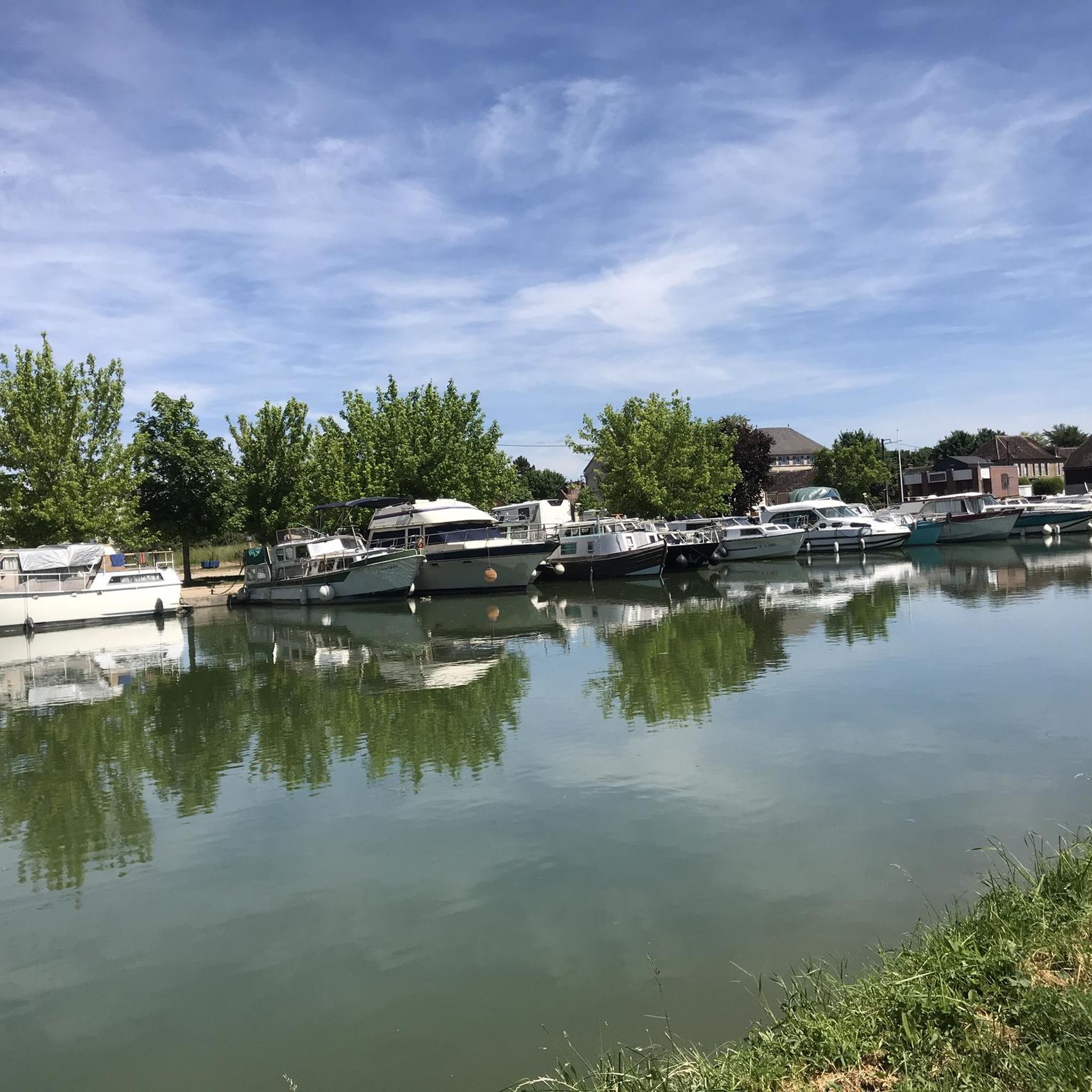
The Dérivation de Gurgy is a short stretch of canal which makes some loops of the Yonne navigable and shortens it. the cycle path along the Yonne leads along it.
0
0
Frequently Asked Questions
How many hiking trails are available in Hauterive?
There are over 50 hiking routes around Hauterive, offering a variety of experiences through the French countryside. The komoot community has contributed 55 tours in total, with options ranging from easy strolls to moderate excursions.
What is the typical terrain like for hiking in Hauterive?
The terrain in Hauterive is generally characterized by gentle river valleys and agricultural landscapes, with low elevation changes. Many paths follow waterways like the Serein river and the Canal de Bourgogne, and often pass through charming small villages. You can expect a mix of natural scenery and local charm.
Are there easy hiking options suitable for beginners or families in Hauterive?
Yes, Hauterive is very welcoming for beginners and families. Out of the 55 available routes, 19 are classified as easy. An excellent option is the Lavoir de la Doué – Mont Washhouse loop from Mont-Saint-Sulpice, which is 3.3 miles (5.3 km) long and typically takes about 1 hour 27 minutes to complete.
Can I find circular hiking routes in Hauterive?
Yes, many of the hiking routes in Hauterive are circular, allowing you to start and end at the same point. For example, the Hiking loop from Rebourseaux is an easy 6.8 km route, and the View of the Serein loop from Bassou offers a moderate 8.6 km experience along the river.
Are there any specific natural features or landmarks to look out for on the trails?
Absolutely! The trails often feature picturesque waterways and historical elements. You can explore the Canal de Bourgogne at Brienon-sur-Armançon, discover the Start of the Gurgy diversion, or admire the Monetau Bridge and Flower Garden. Many routes also follow the scenic Serein river.
What do other hikers say about the trails in Hauterive?
The hiking trails in Hauterive are highly regarded by the komoot community, with an average rating of 4.6 stars from over 40 reviews. Hikers often praise the quiet rural paths, the gentle riverside walks, and the charming village scenery that makes for a relaxing outdoor experience.
Are the hiking trails in Hauterive suitable for dogs?
While specific regulations can vary, the general nature of the trails in Hauterive – featuring open countryside, river paths, and rural areas – often makes them suitable for dogs, especially on a leash. It's always a good idea to check local signage and be mindful of agricultural land and wildlife.
What is the best time of year to go hiking in Hauterive?
Hauterive's rolling countryside and river valleys offer pleasant hiking conditions throughout much of the year. Spring and autumn provide mild temperatures and beautiful scenery with blooming flowers or vibrant fall foliage. Summer is also enjoyable, especially for walks along the waterways, though it can be warmer. Winter hikes are possible, but some paths might be muddy.
Are there any longer, more challenging hikes available in Hauterive?
While there are no routes classified as 'difficult' in Hauterive, there are 36 moderate trails for those seeking a longer outing. The Beaumont Municipal Pond – View of the Serein loop from Chemilly - Appoigny is a moderate 10.3 km route, and the Gurgy diversion lock loop from Beaumont is another moderate option of similar length, offering extended exploration of the area's waterways.
Are there opportunities for wildlife spotting along the trails?
Given the region's agricultural landscapes, river valleys, and wooded areas, hikers may encounter various local wildlife. Birdwatching is particularly rewarding along the Serein river and Canal de Bourgogne. Keep an eye out for common birds, small mammals, and insects that thrive in these diverse habitats.
How accessible are the trails in Hauterive by public transport or car?
Hauterive and its surrounding villages are generally well-connected by road, making car access straightforward for reaching trailheads. While specific public transport details for each trailhead are not provided, the region's network of paths often connects villages, suggesting some routes may be accessible via local bus services. Parking is typically available in or near the villages where trails begin.
Most popular routes around Hauterive
Most popular attractions around Hauterive

Get inspired with the komoot mobile app


Explore more
Browse the best Hikes in other regions.
