Routes

Planner

Features

Updates

App

Login or Signup

Get the App

Login or Signup

Routes
MTB trails
France
Occitania
Carcassonne

Trausse

The best MTB trails around Trausse

4.6

(128)

1,250

riders

88

rides

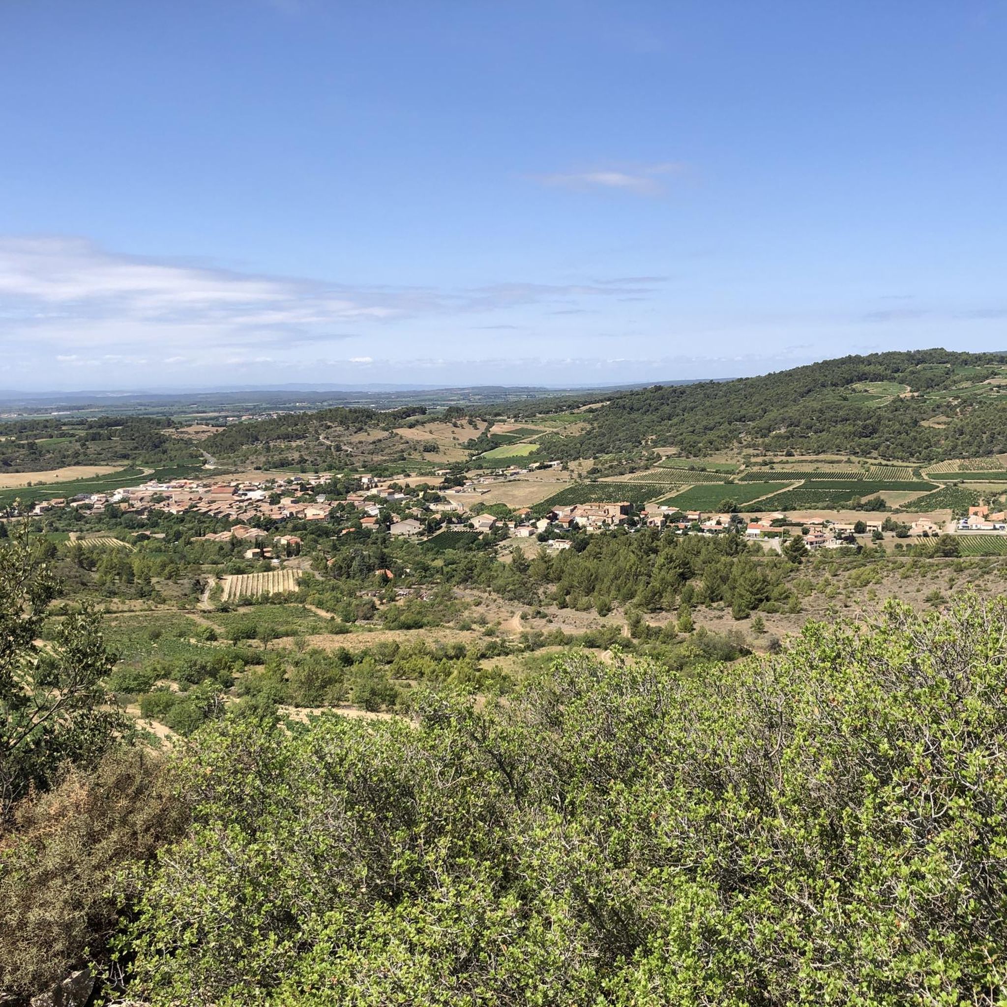
Mountain biking around Trausse offers diverse terrain in the Minervois region of Occitanie, France. The area is characterized by vineyards, open scrubland, and the foothills of the Montagne Noire, providing a mix of gentle paths and more challenging ascents. Riders can explore routes alongside the Canal du Midi or venture into the "carrigue" paths leading towards higher elevations. This varied landscape supports a range of mountain biking experiences.

Best mountain bike trails around Trausse

  • The most popular mountain bike trail…

Last updated: July 4, 2026

4.0

(2)

6

riders

#1.

Barrière Dam – Villeneuve-Minervois loop from Caunes-Minervois

35.5km

02:58

510m

510m

Moderate mountain bike ride. Good fitness required. Advanced riding skills necessary.

Navigate with device

Send to Phone

Save

Moderate

Hard mountain bike ride. Very good fitness required. Advanced riding skills necessary. Some portions of the route may require you to push your bike.

Hard
guide_signup
Let us show you the way with the komoot mobile app
With a free komoot account, you can easily find, customize, and navigate endless outdoor adventures.

Sign up for free

Moderate mountain bike ride. Good fitness required. Advanced riding skills necessary.

Moderate

Hard mountain bike ride. Very good fitness required. Advanced riding skills necessary. Some portions of the route may require you to push your bike.

Hard

Moderate mountain bike ride. Good fitness required. Suitable for all skill levels.

Moderate
Sign up for free to see 84 more rides around Trausse.

Get access to more routes and recommendations from other explorers.

Sign up for free

Already have an account?

Our route recommendations are based on thousands of hikes, rides, and runs completed by other people on komoot.

Start today with a free account

Your next adventure awaits.
Login or Signup

Popular around Trausse

Road Cycling Routes around Trausse

Running Trails around Trausse

Hiking around Trausse

Cycling around Trausse

Gravel biking around Trausse

Tips from the Community

Ragnar Gunnerson
September 26, 2025, Brücke über den Kanal Midi

The bridge is in Homps

Translated by Google

0

0

superb mountain bike outing 👍

Translated by Google

0

0

Carole Meyer
September 18, 2025, Col de Salettes

Passing the mountain pass between Aude and Hérault

Translated by Google

0

0

Max
August 29, 2025, Étang de Marseillette

Naudy Tunnel This is the centerpiece of the pond's irrigation canals. On October 20, 1849, the construction of a water intake was authorized for irrigation and sealing the pond's soil. Work began the same year. The tunnel was inaugurated on November 19, 1851. The canal measures 2,135 meters. The passage under the Canal du Midi has not required any repairs to this day. Less than a year after the tunnel was dug, on April 28, 1852, the estate was sold to a private company. The new owners attempted large-scale rice cultivation and achieved good results, but this crop was abandoned in 1860 because malaria fever led to petitions, protests from the mayors of the surrounding villages, and successive lawsuits. More information on the website: http://aiguesvives11.org/etang_marseillette/carac_etang.htm (Puichéric Town Hall)

Translated by Google

0

0

Max
August 29, 2025, Étang de Marseillette

Second Period In 1759, Roudil de Berriac, Lord of Ranchin and Mayor of Carcassonne, committed to draining the Marseillette Pond within eight years. In 1760, he obtained exclusive rights to drain the pond through a decree of King Louis XV's Council. The pond was acquired in 1778 by an engineer and member of the Toulouse Academy of Sciences, Monsieur de Garipuy, who had traveled to Holland to study the drainage project. Upon his death, the pond was purchased by Madame Riquet de Caraman on behalf of the owners of the Canal du Languedoc. In 1789, the pond became state property. Map of the Marseillette Pond Third Period In 1804, the pond was resold on the condition that the drainage be completed within four years. It was then acquired by Mrs. Lawless, an Irish woman. She had the Aiguille channel re-dug and widened and the Plains aqueduct rebuilt over three arches. Three other channels were opened inside the pond, together forming a length of 8,977 meters. These drainage channels are the ones that still exist today. Mrs. Lawless had 18 farmsteads built on the 2,000 hectares. In 1834, wheat, oats, and barley were harvested in the pond, but the owner was ruined. In 1844, the estate was expropriated in favor of the French Mortgage Fund. Saline efflorescence was killing the vegetation. Water was lacking; the land would have to be submerged to desalinate it. The idea was to divert some of the water from the Aude River, which flows two kilometers away, into the pond. But the Aude and the pond are separated by a plateau 30 to 45 meters high and this obstacle seems insurmountable.

Translated by Google

0

0

Max
August 29, 2025, Étang de Marseillette

The dried-up pond of Marseillette is an atypical site in our region. To learn about and understand it, we must go back to the Tertiary period. At that time, the sea covered the area. As it retreated, it left ponds behind. This one must have been particularly important, as it would still exist if it hadn't been drained by humans during the 19th century. Irrigation canals run through the pond, giving it a unique character. Today, the pond's main crops are vines, apples, and rice, crops celebrated at the annual Aigues-Vives fair in October. It is even said that the salt, always present underground, contributes to giving these products the subtle flavor that makes them unique... Near the Canal du Midi, its paths will lead you to the Aiguille Lock (Puichéric), a remarkable site where you can admire the sculptures of Joël Barthes. The Marseillette Pond ASA manages the maintenance work necessary for the proper functioning of the kilometers of irrigation canals and the Naudy tunnel. The pond covers the territory of the municipalities of Marseillette, Puichéric, Aigues-Vives, and Saint Frichoux. Drainage, First Period In 1585, the first attempt to drain the 2,000 hectares of stagnant water, where mosquitoes, vectors of many diseases, were teeming, failed (due to wars). In 1605, on the advice of Sully and Olivier de Serres, the first agricultural encyclopedist, the royal decree mandating the drainage of the pond was issued. Work did not truly begin until 1628, under the reign of Louis XIII, advised by Richelieu. A trench running through Puichéric allowed the water to drain into the Aude River: this was the Rigole de l'Étang. In 1638, Théophile Ranchin completed the drainage of this lower part of the basin, but maintenance of the canals was neglected and cultivation was abandoned following a plague epidemic and a war, and most of the land was once again flooded. Between 1644 and 1647, the Ranchins built the Château de Fonfile on the banks of the pond, where they settled to oversee the simultaneous drainage and cultivation work. The dried-up pond was partially cultivated, but a supply of fresh water other than rainwater would have been necessary to make the land truly cultivable. In 1677, Daniel de Ranchin had virtually abandoned the pond.

Translated by Google

0

0

easy but hot this season

Translated by Google

0

0

The pond covers an area of 2,000 hectares and is shared between the communes of Marseillette, Aigues-Vives, Saint-Frichoux, and Puichéric. It once supplied the region with fish. As early as the 12th century, talk began of draining this stagnant body of water, a source of death and misery for Marseillette and the surrounding villages, which were becoming depopulated. In 1605, Henry IV issued a royal decree to drain the pond. But it wasn't until 1804, when it was purchased by an Irish woman, Madame de Lawless, that it was drained, thanks to a vast project. The pond was then cultivated and developed to utilize the waters of the Aude River, with an original irrigation system consisting of perpendicular canals allowing the flooding of the land. Today, vines, apples, and rice are the main crops grown there. Its calm and flat paths are very pleasant for hiking or cycling, in a typical landscape.

Translated by Google

0

0

Frequently Asked Questions

How many mountain bike trails are there around Trausse?

There are over 70 mountain bike trails available around Trausse, offering a wide range of options for different skill levels and preferences.

What kind of terrain can I expect on mountain bike trails near Trausse?

The terrain around Trausse is quite diverse. You'll find paths winding through vineyards, open 'carrigue' scrubland, and more challenging routes in the foothills of the Montagne Noire. For flatter rides, sections along the Canal du Midi are also accessible.

Are there mountain bike trails suitable for beginners in Trausse?

Yes, Trausse offers 14 easy mountain bike trails. These often follow vineyard paths or sections of the Canal du Midi, providing a gentler introduction to the region's cycling opportunities.

Are there any challenging mountain bike routes for experienced riders?

Absolutely. For experienced riders, there are 16 difficult mountain bike trails. Routes like Peyremaux Rock – Pic de Nore Summit loop from Caunes-Minervois, with over 1300 meters of elevation gain, offer significant challenges in the Montagne Noire foothills.

What do other mountain bikers enjoy the most about mountain biking in Trausse?

The mountain biking experience around Trausse is highly rated by the komoot community, with an average score of 4.7 stars from nearly 100 reviews. Riders often praise the varied terrain, from scenic vineyard paths to the more demanding climbs in the Montagne Noire, and the overall natural beauty of the Minervois region.

Are there any family-friendly mountain bike trails in the Trausse area?

While specific 'family-friendly' designations aren't always explicit, the easier trails, particularly those along the Canal du Midi or through the vineyards, are generally suitable for families. These paths tend to be less technical and have gentler gradients.

Can I bring my dog on the mountain bike trails around Trausse?

Many trails in the Trausse area, especially those through vineyards and open scrubland, are suitable for dogs, provided they are well-behaved and kept under control. Always ensure your dog is fit enough for the chosen route and be mindful of local regulations, especially concerning livestock or protected areas.

Are there any circular mountain bike routes available?

Yes, many of the mountain bike trails around Trausse are designed as loops. For example, the popular Jean Jaurés fountain – Les Bessous, Marbrières. loop from Trausse is a 34.4 km circular route, and the Notre-Dame du Cros Church – Viewpoints loop from Caunes-Minervois is another excellent option.

What interesting landmarks or attractions can I see while mountain biking near Trausse?

The region offers several points of interest. You might encounter historical sites like the Notre-Dame du Cros Church. The nearby Canal du Midi features engineering marvels such as the Argent-Double aqueduct and spillway and the Aiguille Lock. Natural features like the Roc de l'Aigle viewpoint also offer stunning views.

Is there parking available near the mountain bike trailheads in Trausse?

Yes, parking is generally available in Trausse village and in nearby towns like Caunes-Minervois, which serve as common starting points for many routes. Specific trailheads may have designated parking areas, or you can often find street parking in the villages.

What is the best time of year for mountain biking around Trausse?

The spring and autumn months are generally ideal for mountain biking in Trausse. The weather is typically milder, making for more comfortable rides. Summers can be very hot, especially in the open vineyards, while winters can be cooler and wetter, though still rideable on many days.

Are there any specific mountain biking trails along the Canal du Midi near Trausse?

While not exclusively mountain bike trails, the towpaths and smaller trails alongside the Canal du Midi are popular for cycling. A mountain bike offers enhanced comfort on these paths, which can be accessed within about 15 minutes from Trausse. You can explore sections featuring landmarks like the Argent-Double aqueduct.

Most popular routes around Trausse

Road Cycling Routes around Trausse

Most popular attractions around Trausse

Places to see

Store rating

Get inspired with the komoot mobile app

With a free komoot account, you can easily find, customize, and navigate endless outdoor adventures.

or

Join komoot Now

Store rating

Explore more

Browse the best MTB trails in other regions.

Les BrunelsBerriacLauracVentenac-CabardèsSallèles-CabardèsFraisse-CabardèsVillasavarySalsignePennautierLespinassièreMonzeMalves-En-MinervoisMontiratMoussoulensLaurabucCavanacFendeilleMouxLastoursCazalrenouxVillardonnelLa PomarèdeCazilhacVillalierVillarzel-CabardèsVilleglyVillespyLaure-MinervoisGenervillePuginierVilledubertSaint-Michel-De-LanèsGourvieilleFanjeauxOrsansRieux-MinervoisAragonSouilheMireval-LauragaisPexioraAzilleVillepinteBelflouLac De L'Estrade (La Ganguise)Salles-Sur-L'HersPeyrensLeucPalajaLasbordesBagnolesBaraignePépieuxTrassanelLacombeSaint-PauletMontferrandCastelnaudarySaint-FrichouxSaint-PapoulSaint-Martin-Le-VieilBramVilleneuve-La-ComptalCuxac-CabardèsIsselLapradeÉtang De JouarresVilleneuve-MinervoisDouzensBassin de Saint-FerréolLabécède-LauragaisMontolieuSaint-Couat-D'AudeVerdun-En-LauragaisLa ForceFontiers-CabardèsVillemagneMontauriolCumièsBlomacCenne-MonestiésVillesèquelandeFloureCarlipaAlzonneSaint-Martin-LalandeFonters-Du-RazèsMontmaurRaissac-Sur-LampyBarbairaCaux-Et-SauzensRustiquesSainte-EulalieAigues-VivesLabastide-D'AnjouLes IlhesPlaigneSoupexSaint-Julien-De-BriolaSaissacLac De La Galaube Ou De L'AlzeauRicaudLes CassésTrévilleRoquefèrePreixanComigneGaja-La-SelvePezensRoquecourbe-MinervoisBassin du Lampy NeufPayra-Sur-L'HersSaint-AmansCapenduMarseilletteConques-Sur-OrbielLes MartysTrèbesMas-Saintes-PuellesMiraval-CabardesCitouMarqueinPeyriac-MinervoisVilleneuve-Lès-MontréalLa RedorteVillanièreSouilhanelsMontclarAirouxAlairacMas-CabardèsRouffiac-D'AudeSaint-GaudéricFontiès-D'AudeMollevilleCaunes-MinervoisBrousses-Et-VillaretMontréalBadensArzensLimousisCouffoulensPuichéricRoullensLa Tourette-CabardèsVillemoustaussouBelpechVillesiscleLa CassaigneLavaletteVillegailhencVillautouLac De Laprade BasseSaint-DenisSainte-CamelleRibouissePlavillaLabastide-EsparbairenqueCaudebrondeMézervilleLafagePradelles-CabardèsFournes-CabardèsSaint-SerninCastansCabrespineLa Louvière-LauragaisPeyrefitte-Sur-L'HersBouilhonnacMolandierPécharic-Et-Le-PyMayrevillePech-LunaFajac-La-RelenqueCahuzac

Nearby adventure guides

Things to Do around Peyriac-Minervois

background

Get ready to conquer new peaks

Sign up for Free

Explore
RoutesRoute plannerFeaturesHikesMTB TrailsRoad cycling routesBikepackingSitemap
Download the app
Follow Us on Socials

© komoot GmbH

Privacy Policy