The best walks and hikes around Mauzun
4.2
(217)
1,008
hikers
75
hikes
Hiking around Mauzun offers access to the varied landscapes of the Livradois-Forez regional natural park, characterized by rolling hills, dense woodlands, and scenic valleys. The region features a mix of agricultural land and natural areas, providing diverse hiking environments. Trails often follow ancient paths, offering views of the surrounding countryside and local villages. Elevation changes are generally moderate, making the area accessible for various fitness levels.
Best hiking trails around Mauzun
- The most popular hiking route is The chaos of the three stones - loop starting from Fayet le Château - Livradois-Forez regional natural park, an easy 2.9 miles (4.6 km) trail that takes 1 hour 24 minutes to complete, featuring unique rock formations within the natural park.
- Another top favourite among local hikers is Madet Valley Trail, a moderate 5.1 miles (8.1 km) path. This route explores the natural beauty of the Madet Valley, offering views of its landscapes and waterways.
- Local hikers also love the Le Ricochet loop from Fayet-le-Château, a 6.3 miles (10.2 km) trail leading through rural countryside and local paths, often completed in about 3 hours 0 minutes.
- Hiking around Mauzun is defined by its forested hills, tranquil valleys, and open agricultural landscapes. The network offers options for different ability levels, from easy strolls to more challenging ascents.
- The routes in Mauzun are highly rated by the komoot community with an average score of 4.3 stars from over 190 reviews. More than 800 hikers have used komoot to explore Mauzun's varied terrain.
Last updated: July 3, 2026
4.4
(59)
160
hikers
Easy hike. Great for any fitness level. Easily-accessible paths. Suitable for all skill levels.
4.8
(28)
92
hikers
8.13km
02:26
260m
250m
Moderate hike. Good fitness required. Mostly accessible paths. Sure-footedness required.

Sign up for free
4.7
(9)
34
hikers
9.46km
02:46
260m
260m
Moderate hike. Good fitness required. Easily-accessible paths. Suitable for all skill levels.
4.8
(8)
56
hikers
5.18km
01:31
140m
140m
Easy hike. Great for any fitness level. Easily-accessible paths. Suitable for all skill levels.
4.5
(6)
12
hikers
14.1km
04:09
400m
400m
Moderate hike. Good fitness required. Easily-accessible paths. Suitable for all skill levels.
Get access to more routes and recommendations from other explorers.
Sign up for free
Already have an account?
Our route recommendations are based on thousands of hikes, rides, and runs completed by other people on komoot.
Start today with a free account
Your next adventure awaits.
Login or Signup


Tips from the Community

Whether it's a waterfall or a cascade, it doesn't matter; it's a welcome way to cool off.
0
0
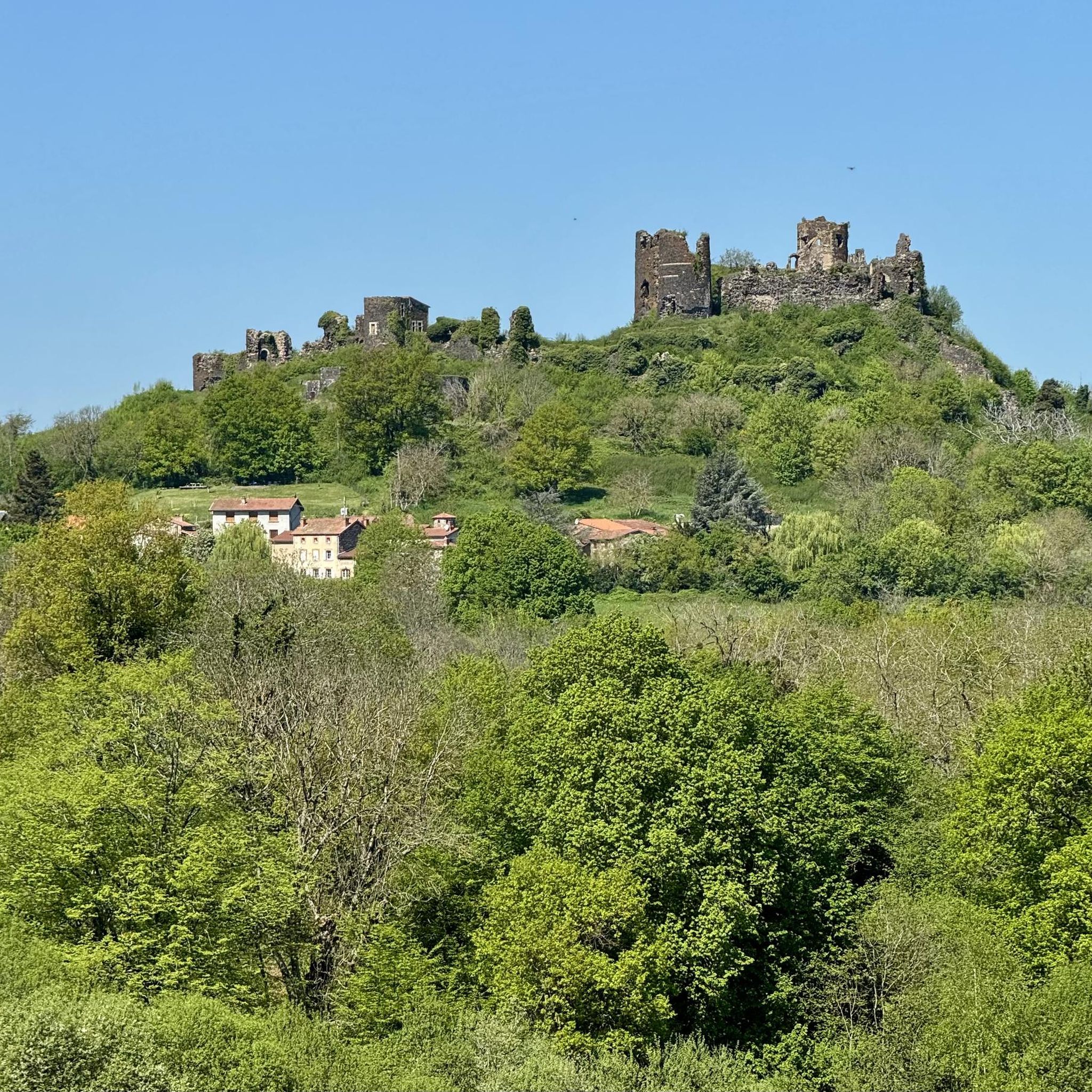
The ancients knew how to build. The Madet Valley at this time of year is exceptional.
0
0

With its orientation table, the Butte de Méraille offers a 360° view of the surrounding castles and the Sancy and Forez mountains.
0
0
The Madet is a stream where many vestiges of human activity remain since the valley had many mills.
0
0
The path along the Ricochet stream allows you to discover some remains of old mills.
0
0
This site allows you to discover a series of quite intriguing blocks of granite and chaos.
2
0

beautiful course beautiful course beautiful course with many landscape changes
0
0
Frequently Asked Questions
How many hiking trails are there around Mauzun?
There are over 60 hiking trails available around Mauzun, catering to various skill levels. This includes 20 easy routes, 39 moderate trails, and 1 more challenging option, ensuring a diverse range of experiences for hikers.
What kind of terrain can I expect on hikes around Mauzun?
Hiking around Mauzun offers a varied landscape within the Livradois-Forez regional natural park. You'll encounter rolling hills, dense woodlands, tranquil valleys, and open agricultural land. Trails often follow ancient paths, providing scenic views of the countryside and local villages.
Are there any circular hiking routes near Mauzun?
Yes, many routes around Mauzun are circular. For example, the popular The chaos of the three stones is an easy loop trail. Another option is the Le Ricochet loop from Fayet-le-Château, which takes you through rural countryside.
Are the hiking trails around Mauzun suitable for families?
Yes, there are many family-friendly options. The region has 20 easy trails, which are generally suitable for families. The The chaos of the three stones loop, at 2.9 miles (4.6 km) and taking about 1 hour 24 minutes, is a great choice for a family outing, featuring unique rock formations.
Can I bring my dog on the hiking trails?
Generally, dogs are welcome on trails in the Livradois-Forez regional natural park, but it's always advisable to keep them on a leash, especially in areas with livestock or protected wildlife. Please respect local signage regarding pet access.
What are the typical lengths and durations of hikes in this area?
Hikes around Mauzun vary in length and duration. Easy trails like The chaos of the three stones are around 2.9 miles (4.6 km) and take about 1.5 hours. Moderate routes, such as the Madet Valley Trail, are about 5.1 miles (8.1 km) and can take around 2.5 hours. Longer, more challenging routes can extend up to 12.6 miles (20.3 km) and take over 5 hours.
Are there challenging hiking trails for experienced hikers?
While the majority of trails are easy to moderate, there is at least one difficult route for those seeking a challenge. The Château de Montmorin loop from Égliseneuve-près-Billom is a demanding 12.6 miles (20.3 km) hike with significant elevation changes, offering a more strenuous experience.
What can I see along the hiking trails around Mauzun?
Beyond the natural beauty of the Livradois-Forez park, you can discover historical sites and charming villages. Notable attractions include the impressive Château de Montmorin, the historic Medieval Center of Billom, and the picturesque Ruins and Stone Bridge of Le Madet.
What do other hikers enjoy most about hiking in Mauzun?
The area is highly rated by the komoot community, with an average score of 4.3 stars from over 190 reviews. Hikers often praise the diverse landscapes, from dense forests to open agricultural fields, and the well-maintained paths that offer a peaceful escape into nature.
Is there parking available at the trailheads?
While specific parking details vary by trailhead, many routes around Mauzun, especially those starting from villages like Fayet-le-Château or Égliseneuve-près-Billom, typically have designated parking areas nearby. It's always a good idea to check the route details on komoot for specific parking information before you go.
When is the best time of year to hike around Mauzun?
The best time to hike around Mauzun is generally from spring through autumn (April to October). During these months, the weather is mild and pleasant, and the natural park is vibrant with foliage. Summer offers warm days, while spring and autumn provide cooler temperatures and beautiful seasonal colors.
Is it possible to hike in Mauzun during winter?
Winter hiking is possible, but conditions can vary. While some lower elevation trails may remain accessible, higher areas might experience snow or ice. It's essential to check local weather forecasts and trail conditions, and to be prepared with appropriate winter gear if planning a hike during this season.
Most popular attractions around Mauzun

Get inspired with the komoot mobile app


Explore more
Browse the best Hikes in other regions.
