The best walks and hikes around Saint-Vincent-De-Salers
4.5
(245)
2,033
hikers
71
hikes
Hiking around Saint-Vincent-De-Salers offers routes through a landscape shaped by ancient volcanic activity within the Parc Naturel Régional des Volcans d'Auvergne. The region features diverse terrain, including forested areas, high plateaus, and glacial valleys, with the iconic Puy Mary rising to 1,787 meters. This area is part of the Cantal Massif, one of Europe's largest stratovolcanoes, providing varied elevation and natural features for outdoor exploration.
Best hiking trails around Saint-Vincent-De-Salers
- The most popular hiking route is Shadow Rock – Enfloquet…
Last updated: July 13, 2026
4.8
(5)
44
hikers
7.36km
02:06
170m
170m
Moderate hike. Good fitness required. Easily-accessible paths. Suitable for all skill levels.
4.8
(5)
36
hikers
5.91km
01:43
160m
160m
Easy hike. Great for any fitness level. Easily-accessible paths. Suitable for all skill levels.

Sign up for free
4.0
(1)
16
hikers
6.93km
02:05
210m
210m
Moderate hike. Good fitness required. Easily-accessible paths. Suitable for all skill levels.
4.3
(4)
7
hikers
4.36km
01:11
70m
60m
Easy hike. Great for any fitness level. Easily-accessible paths. Suitable for all skill levels.
4.5
(2)
9
hikers
11.3km
03:41
510m
510m
Moderate hike. Good fitness required. Easily-accessible paths. Suitable for all skill levels.
Get access to more routes and recommendations from other explorers.
Sign up for free
Already have an account?
Our route recommendations are based on thousands of hikes, rides, and runs completed by other people on komoot.
Start today with a free account
Your next adventure awaits.
Login or Signup
Tips from the Community


Near the road and the huts of Cotteughes, the Marilhou falls in a pretty waterfall that can be observed from above as well as below. Refreshing!
0
0
The huts of Cotteughes are still visible witnesses of the existence of a medieval village until the end of the 14th century in what is now the Marilhou forest. Their condition varies, but the structure of these huts often remains clearly visible. These basic huts, half buried, were probably built at the end of the 10th century and allow us to better understand how the inhabitants of these high plateaus lived.
0
0
Frequently Asked Questions
How many hiking trails are available in Saint-Vincent-De-Salers?
The Saint-Vincent-De-Salers area offers a wide variety of hiking opportunities, with over 50 trails available. These routes cater to different skill levels, including easy, moderate, and difficult options.
What kind of terrain can I expect on hikes around Saint-Vincent-De-Salers?
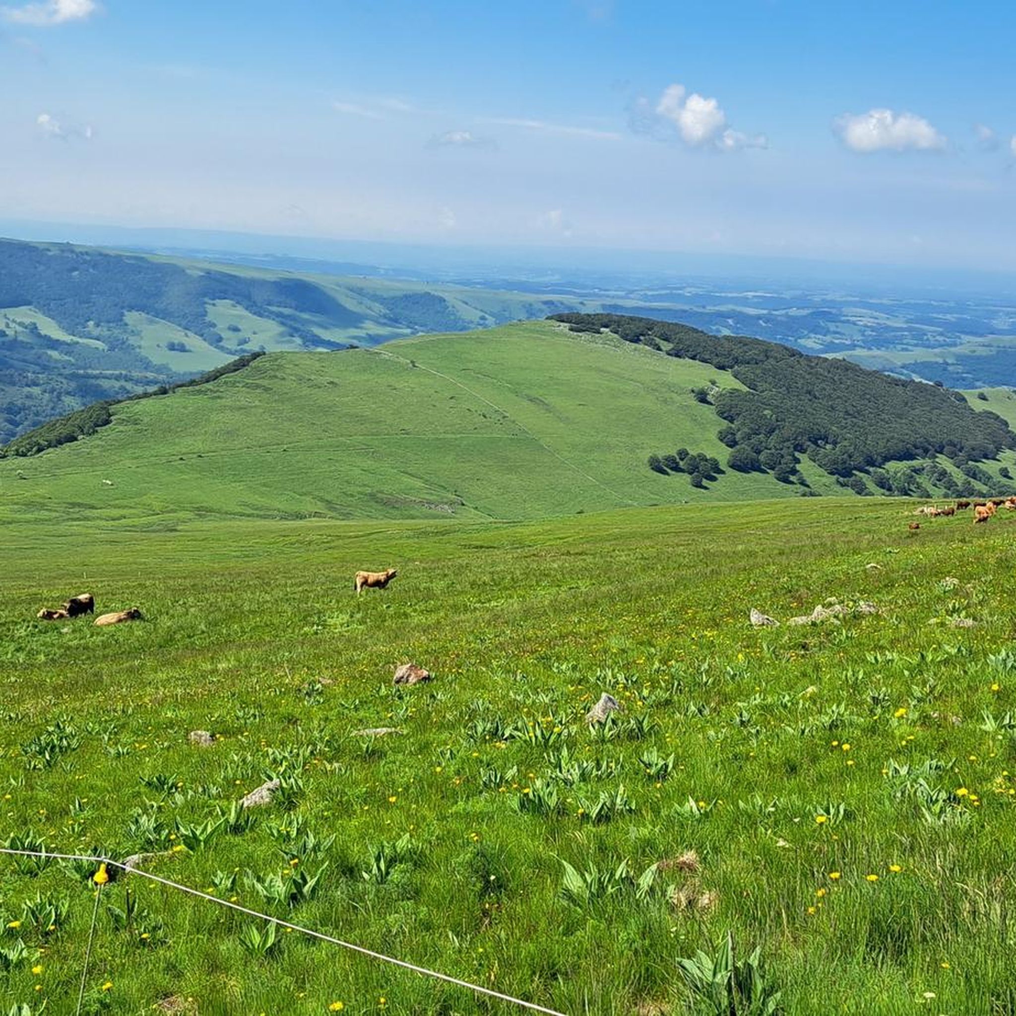
Hikes around Saint-Vincent-De-Salers are characterized by dramatic volcanic landscapes within the Parc Naturel Régional des Volcans d'Auvergne. You'll encounter diverse terrain, including forested areas, high plateaus known as 'planèzes', and deep glacial valleys. The iconic Puy Mary, Europe's largest stratovolcano, dominates the scenery, offering varied elevation and stunning views.
Are there easy hiking trails suitable for families in Saint-Vincent-De-Salers?
Yes, there are approximately 20 easy hiking trails in the Saint-Vincent-De-Salers region, many of which are suitable for families. These routes often traverse pastoral landscapes and offer gentle ascents, allowing for enjoyable outings with children. For example, The Cotteughes huts loop from Le Vaulmier is an easy 4.4 km trail.
Are there challenging long-distance hikes in the Saint-Vincent-De-Salers area?
For experienced hikers seeking a challenge, the region offers several difficult routes, including sections of the GR400, a 140 km long-distance trail across the Cantal Massif. This trail includes five loops, with three passing through Puy Mary and the Pays de Salers region, taking hikers through altitudes ranging from 750 to 1855 meters. The ascent to Puy Mary's summit from the Col du Pas de Peyrol also provides a rewarding challenge.
Can I find circular hiking routes in Saint-Vincent-De-Salers?
Yes, many of the hiking routes in Saint-Vincent-De-Salers are circular, allowing you to start and end at the same point. Examples include the Shadow Rock – Enfloquet Notch loop from Le Falgoux, a moderate 13.2 km trail, and the Marilhou Waterfall – The Cotteughes huts loop from Saint-Vincent-de-Salers, a moderate 7.8 km path.
Are there any waterfalls to see on hikes in this region?
Yes, the region is home to several beautiful waterfalls. You can explore routes that lead past natural cascades, such as the Marilhou Waterfall – The Cotteughes huts loop from Saint-Vincent-de-Salers, which takes you past the Marilhou Waterfall (Marilhou Waterfall). Another option is the Neronne Pass – Biaguin Waterfall loop from Col de Néronne, which features the Biaguin Waterfall.
What are some notable landmarks or attractions to explore near the hiking trails?
Beyond the trails, the area offers several points of interest. The medieval village of Salers, classified as one of France's 'Most Beautiful Villages', is just 8 km away. You can also visit the Neronne Pass, or explore the area around Route du Puy Mary, which offers stunning views of the volcanic landscape.
What is the best time of year to go hiking in Saint-Vincent-De-Salers?
The best time for hiking in Saint-Vincent-De-Salers is generally from late spring to early autumn (May to October). During these months, the weather is typically mild, and the trails are clear. Summer offers lush green landscapes, while autumn brings vibrant colors to the volcanic terrain. Some higher altitude trails, especially around Puy Mary, may have snow well into spring.
Are there any specific routes that offer the best panoramic views?
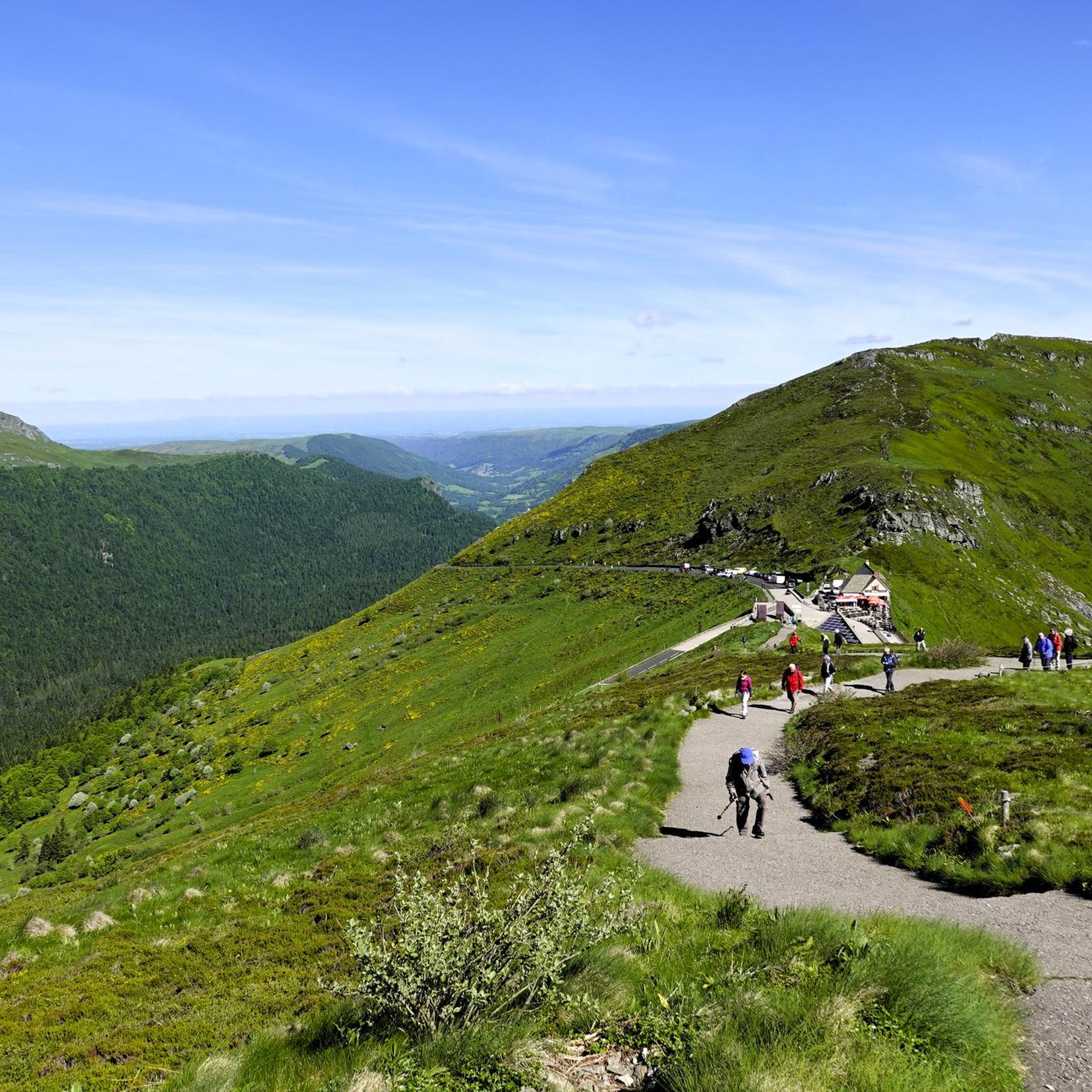
For breathtaking panoramic views, the ascent to Puy Mary is highly recommended. Typically accessed from the Col du Pas de Peyrol, the highest road pass in Auvergne, the marked trail to the summit offers 360-degree vistas of the surrounding glacial valleys and volcanic ridges. Other high points and passes like Neronne Pass also provide excellent viewpoints.
What do other hikers enjoy the most about hiking in Saint-Vincent-De-Salers?
The hiking routes in Saint-Vincent-De-Salers are highly rated by the komoot community, with an average score of 4.6 stars from over 200 reviews. Hikers frequently praise the region's diverse volcanic landscapes, the well-maintained trails, and the stunning views, particularly around Puy Mary. The blend of challenging ascents and peaceful pastoral walks also receives positive feedback.
Are there options for parking at trailheads in Saint-Vincent-De-Salers?
Yes, many trailheads in the Saint-Vincent-De-Salers region, especially those leading to popular areas like Puy Mary or starting points for circular routes, offer designated parking facilities. It's advisable to check specific route details for parking availability and any potential fees, particularly during peak season.
Can I bring my dog on the hiking trails in Saint-Vincent-De-Salers?
Most hiking trails in the Parc Naturel Régional des Volcans d'Auvergne, including those around Saint-Vincent-De-Salers, are generally dog-friendly. However, it is crucial to keep your dog on a leash, especially in areas with livestock or protected wildlife. Always check local signage for any specific restrictions or regulations that may apply to certain trails or natural reserves.
Most popular routes around Saint-Vincent-De-Salers
Most popular attractions around Saint-Vincent-De-Salers

Get inspired with the komoot mobile app


Explore more
Browse the best Hikes in other regions.
