The best MTB trails around Les Ventes
4.3
(131)
584
riders
74
rides
Mountain biking around Les Ventes offers a variety of routes through the region's characteristic dense woodlands and rolling terrain. The landscape features a mix of forest paths and open areas, providing diverse riding experiences. With moderate elevation changes, the area is suitable for mountain bikers seeking engaging trails without extreme climbs. The routes often traverse historical sites and natural features, adding to the exploration.
Best mountain bike trails around Les Ventes
- The most popular mountain bike trail is Forest Trail…
Last updated: October 5, 2026
4.5
(23)
62
riders
29.2km
02:25
270m
270m
Moderate mountain bike ride. Good fitness required. Advanced riding skills necessary.
5.0
(2)
21
riders
66.5km
05:16
620m
620m
Hard mountain bike ride. Very good fitness required. Suitable for all skill levels.

3.7
(6)
33
riders
40.2km
03:09
450m
450m
Moderate mountain bike ride. Good fitness required. Suitable for all skill levels.
5.0
(2)
13
riders
40.5km
03:01
330m
330m
Moderate mountain bike ride. Good fitness required. Suitable for all skill levels.
4.7
(3)
8
riders
36.0km
02:44
340m
340m
Moderate mountain bike ride. Good fitness required. Suitable for all skill levels.
Get access to more routes and recommendations from other explorers.
Already have an account?
Our route recommendations are based on thousands of hikes, rides, and runs completed by other people on komoot.
Start today with a free account
Your next adventure awaits.


Tips from the Community


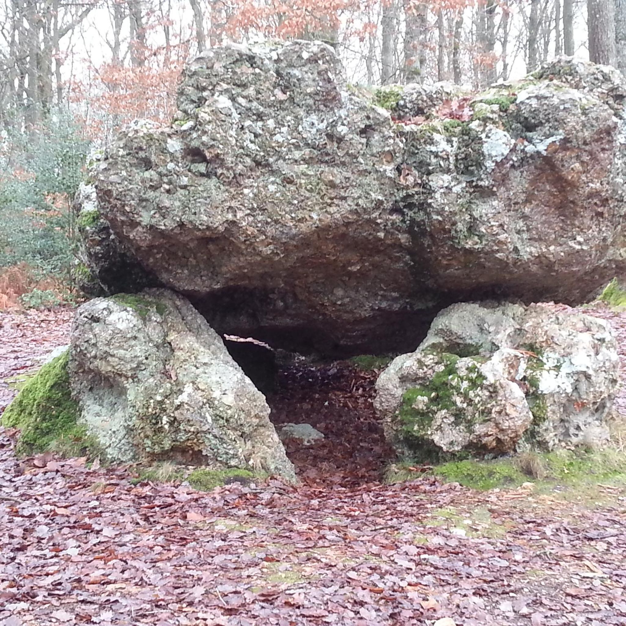
If you are interested in ancient history and megalithic monuments, you can visit the Dolmen de la Pierre Courcoulée, a stone tomb dating from the Neolithic period. You can admire the impressive puddingstone slab that covers the dolmen, measuring more than 4 meters long and weighing about 10 tons. The slab rests on four pillars of the same material, forming a chamber which was probably used for funerary rituals. The dolmen is one of the oldest and best preserved in Normandy, it has been listed as a historical monument since 1889. The Pierre Courcoulée Dolmen is a privileged place to get some fresh air and discover the local heritage.
2
0
The Grotte de Gaudreville is a natural cave and geological wonder that was formed by the erosion of limestone by water over millions of years. The cave has several rooms and galleries, adorned with stalactites, stalagmites, columns and calcite curtains. The cave is also home to various species of bats, spiders and insects. You can visit the cave by booking a guided tour with the Association Spéléologique de l'Eure, which regularly organizes excursions to the site.
3
0

The town of Goms is rather pretty, too bad it is populated by inbreds
0
1

Nowadays, the Sec Iton plays an important role as a limiter during flood episodes, due to its ability to store surface water underground. Added to this are many legends linked, among other things, to its partly aerial and partly underground journey.
1
0
Very pretty typical residence on the edge of the Iton River. To have!
0
0

Built at the end of the 11th century by Roger III de Tosny, Lord of Conches. The thickness of the walls is 2.60m. The walls and window embrasures were coated with a layer of mortar mixed with lime and fine sand in order to give a more noble appearance to this flint construction. On the ground floor: it was the food reserve, there were no windows. 1st floor: A central well was used to supply the Château with drinking water. It was emptied in 1849. A fireplace was in each room. It was around 1417, when Conches was in English hands, that the defensive power of the keep was increased under the orders of Captal de Buch. He built an additional tower with the particularity of starting on a square base. Main seats of the castle: 1093: War of the Beautiful Ladies (fight between the Lords of Tosny and the Lords of Breteuil, Beaumont and Evreux) 1199: Philippe Auguste is king of France and he makes the domain of Conches available to his cousin Robert de Courtenay in 1202. 1364: first English occupation. 1371: 100 years war, Bertrand Dugesclin, captain of King Charles V, seizes Conches. 1420: Conquest of Normandy by the English, Henry V, King of England seizes Conches. The castle was taken over in 1440 by Charles VII, King of France. 1441: New English occupation. 1449: The French under the command of Robert de Floques, bailiff of Evreux storm the town of Conches.
0
0
Ruin of the Saint Médard church.
0
1
Frequently Asked Questions
How many mountain bike trails are available around Les Ventes?
There are over 65 mountain bike trails around Les Ventes. These routes cater to various skill levels, with 20 easy trails, 43 moderate trails, and 2 more challenging options.
Are there mountain bike trails suitable for beginners in Les Ventes?
Yes, Les Ventes offers 20 easy mountain bike trails, perfect for beginners or those looking for a relaxed ride. These routes typically feature moderate elevation changes and well-maintained paths through woodlands.
What kind of terrain can I expect on mountain bike trails in Les Ventes?
The terrain around Les Ventes is characterized by dense woodlands and rolling hills. You'll find a mix of forest paths and open areas, with moderate elevation changes that provide engaging rides without extreme climbs. Many routes also pass by historical sites and natural features.
Are there any circular mountain bike routes in Les Ventes?
Yes, many mountain bike routes in Les Ventes are circular. For example, the Conches Town Centre Park – Conches-en-Ouche Keep loop from Gaudreville-la-Rivière is a moderate 20.9-mile (33.7 km) loop that takes you past historical landmarks.
What historical landmarks or attractions can I see while mountain biking in Les Ventes?
Many trails in Les Ventes incorporate historical sites and natural features. You might encounter the Pierre Courcoulée Dolmen, the Ruins of Saint Médard Church, or the Conches-en-Ouche Keep. These points of interest add a cultural dimension to your ride.
What is the best time of year for mountain biking in Les Ventes?
The best time for mountain biking in Les Ventes is generally during spring, summer, and early autumn when the weather is mild and the trails are dry. The dense woodlands offer good shade during warmer months, and the autumn colors can be particularly beautiful.
Are there any long-distance mountain bike trails around Les Ventes?
Yes, there are several longer routes. The Forest Path – Forest Trail loop from La Bonneville-sur-Iton is a moderate 22.7-mile (36.6 km) trail, offering a substantial ride through the region's characteristic forests.
What do other mountain bikers say about the trails in Les Ventes?
The mountain bike trails in Les Ventes are highly rated by the komoot community, with an average score of 4.5 stars from over 100 reviews. Many riders praise the diverse terrain, the scenic forest paths, and the opportunity to combine nature with historical exploration.
Are there any advanced or difficult mountain bike routes in Les Ventes?
While most trails are easy to moderate, there are 2 routes classified as difficult for those seeking more of a challenge. These trails will feature steeper climbs, more technical descents, or rougher terrain compared to the region's typical rolling landscape.
Can I find mountain bike trails that pass near cafes or places to rest in Les Ventes?
Many routes in the Les Ventes area pass through or near villages and towns where you can find cafes or places to rest and refuel. Planning your route with komoot allows you to identify such points of interest along your chosen trail.
What kind of wildlife might I encounter on the mountain bike trails?
Given the dense woodlands around Les Ventes, you might encounter various forest wildlife such as deer, wild boar, and a variety of bird species. Riding quietly and respectfully increases your chances of spotting animals in their natural habitat.
What is the longest mountain bike trail available in Les Ventes?
The longest mountain bike trail listed is the Grotte de Gaudreville – Pierre Courcoulée Dolmen loop from Les Ventes, which spans 29.4 miles (47.4 km) and is typically completed in about 3 hours 52 minutes. This moderate route offers a comprehensive tour of the area's varied terrain.
Most popular routes around Les Ventes
Most popular attractions around Les Ventes

Get inspired with the komoot mobile app


Explore more
Browse the best MTB trails in other regions.
