The best road cycling routes around Saint-Priest-La-Prugne
4.7
(25)
856
riders
13
rides
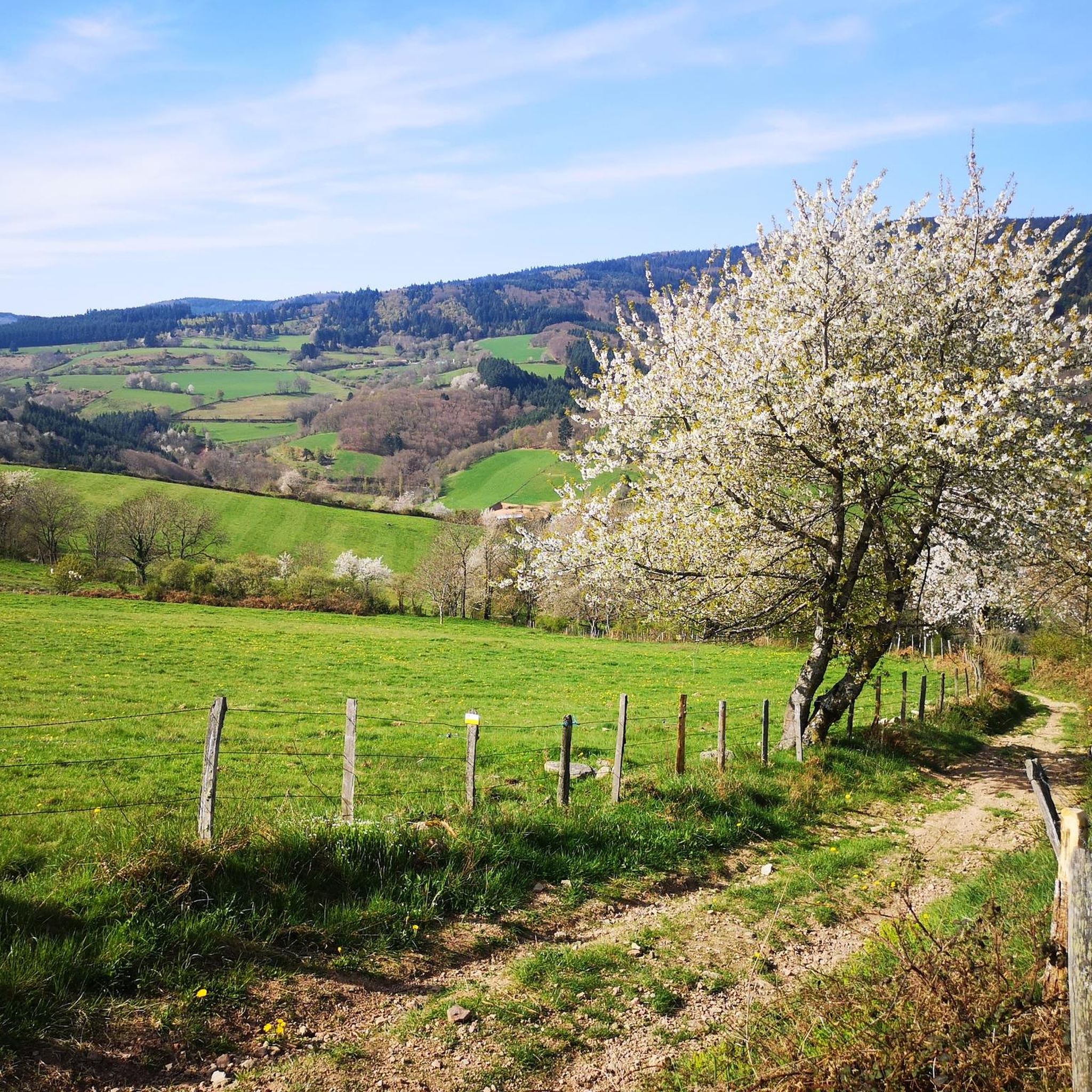
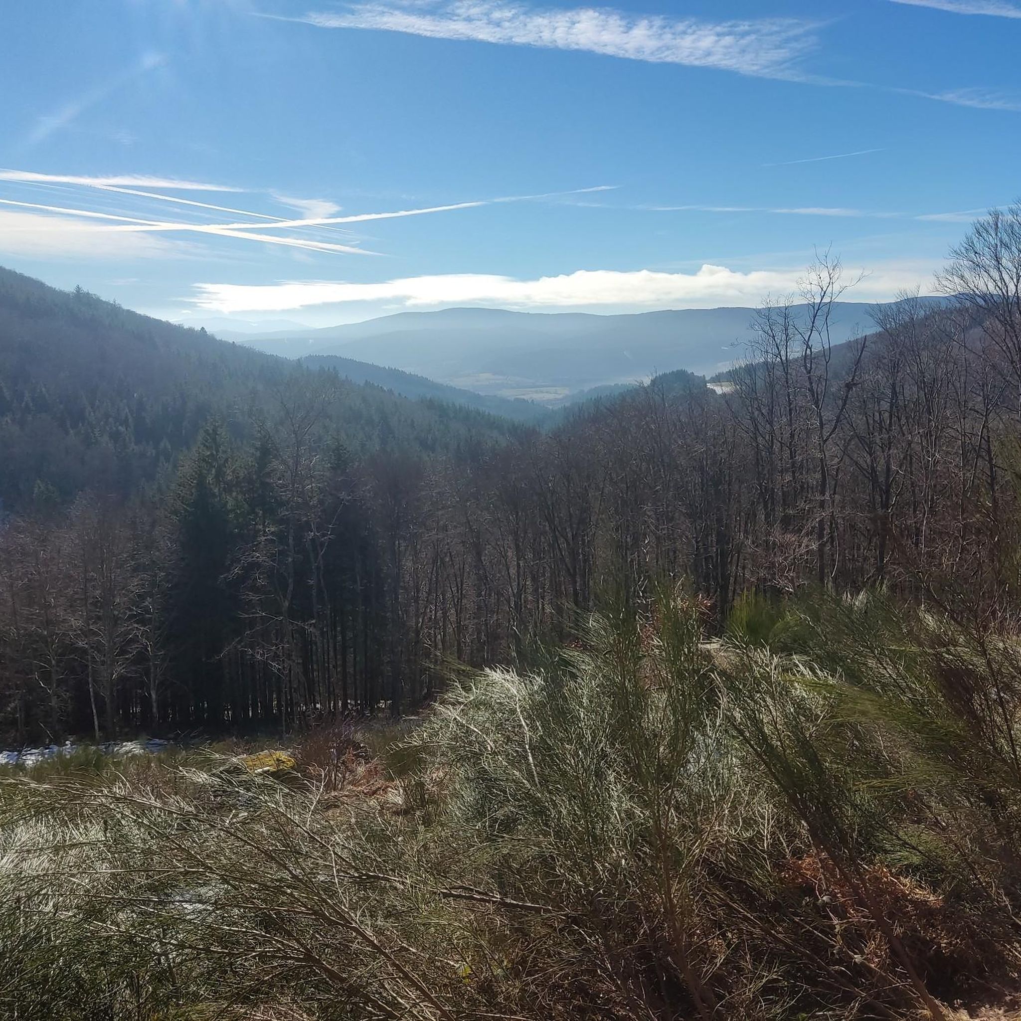
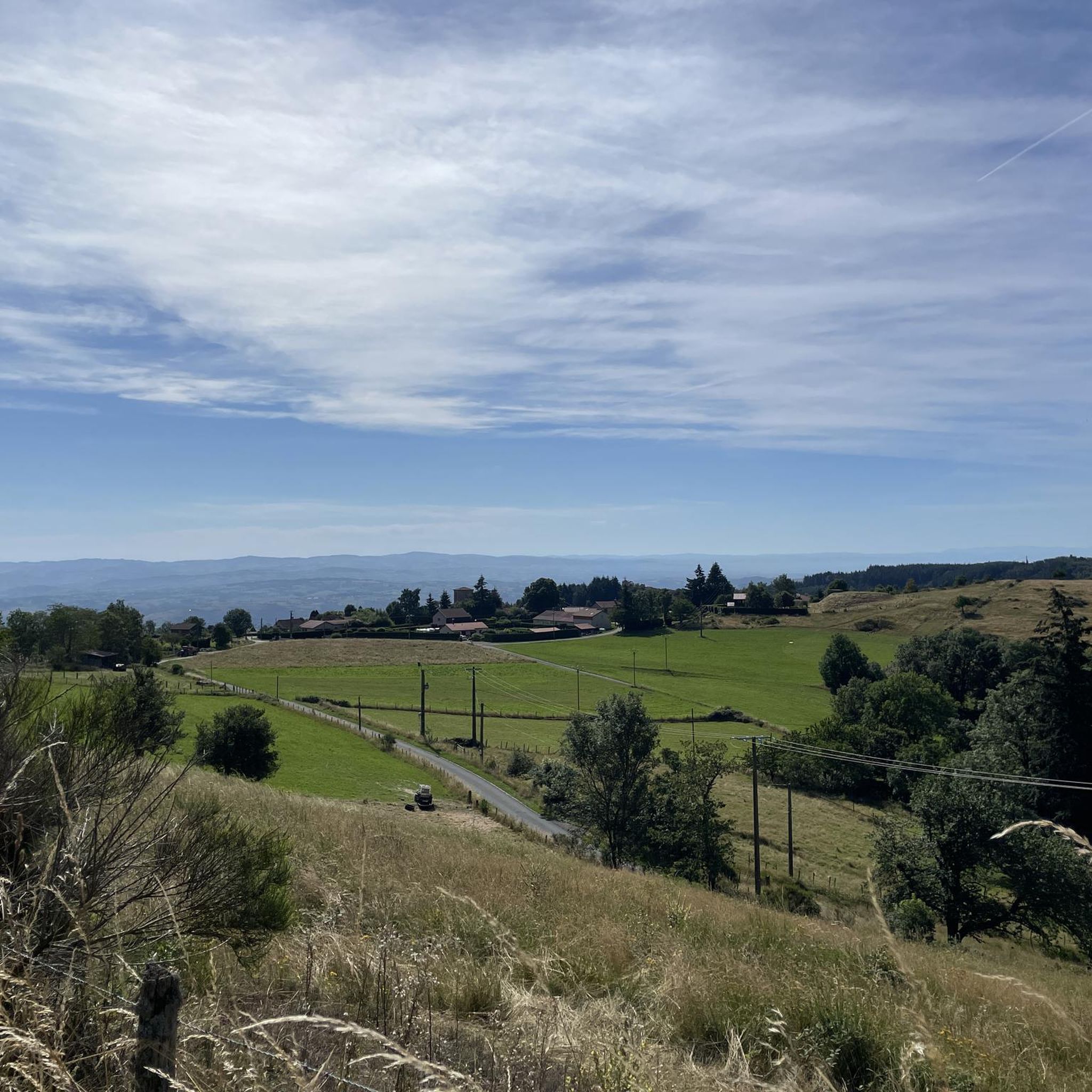
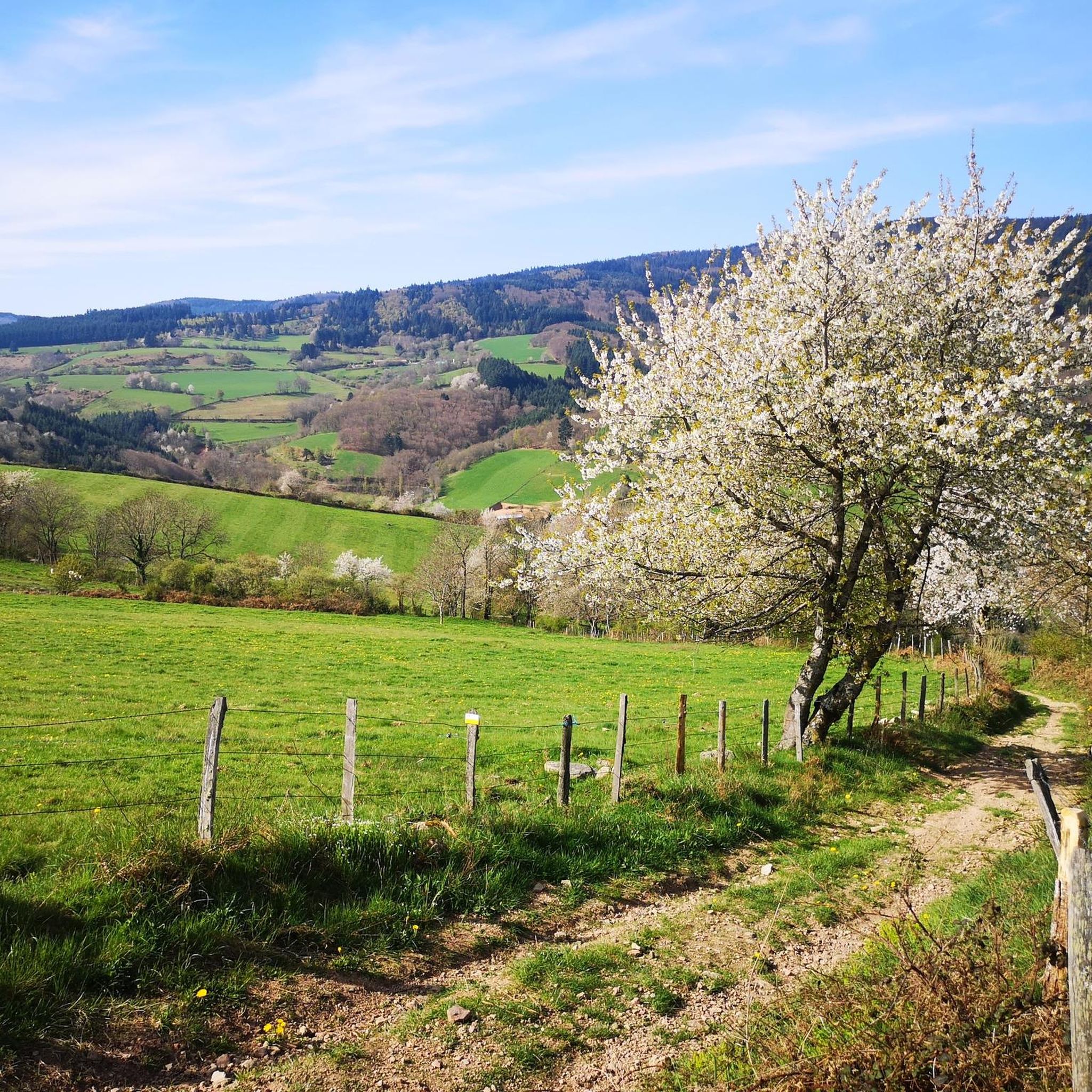
Road cycling routes around Saint-Priest-La-Prugne are characterized by varied and challenging topography within the Auvergne-Rhône-Alpes region of France. The landscape features hilly and steep terrain, with elevations ranging from 610 to 1287 meters, offering significant elevation gains. Cyclists navigate through dense forests, open meadows, and agricultural areas, with the Bois Noirs massif to the west and the Monts de la Madeleine to the east providing numerous opportunities for demanding climbs. This region is well-suited for vigorous road cycling, presenting a diverse backdrop for rides.
Best road cycling routes around Saint-Priest-La-Prugne
- The most popular road cycling route is Col de la Loge des Gardes loop from Saint-Priest-la-Prugne, a 16.4 miles (26.4 km) trail that takes 1 hour 26 minutes to complete. This moderate route features over 1,867 feet (569 meters) of elevation gain.
- Another top favourite among local road cyclists is View of Mont Blanc loop from Saint-Priest-la-Prugne, a moderate 24.2 miles (39.0 km) path. This route offers panoramic views and includes 2,090 feet (637 meters) of climbing.
- Local road cyclists also love the Col de la Loge des Gardes – Arcon loop from Saint-Priest-la-Prugne, a 41.9 miles (67.5 km) trail leading through mountainous terrain, often completed in about 4 hours 11 minutes. This difficult route includes over 5,292 feet (1,613 meters) of elevation gain.
- Road cycling around Saint-Priest-La-Prugne is defined by hilly terrain, dense forests, and challenging mountain passes. The network offers options for different ability levels, from moderate loops to difficult climbs.
- The routes in Saint-Priest-La-Prugne are highly rated by the komoot community with an average score of 4.6 stars from over 15 reviews. More than 800 road cyclists have used komoot to explore Saint-Priest-La-Prugne's varied terrain.
Last updated: October 20, 2026
4.0
(1)
16
riders
26.4km
01:26
570m
570m
Moderate road ride. Good fitness required. Mostly well-paved surfaces and easy to ride.
7
riders
39.0km
01:55
640m
640m
Moderate road ride. Good fitness required. Mostly well-paved surfaces and easy to ride.

14
riders
77.5km
04:15
1,400m
1,400m
Hard road ride. Very good fitness required. Mostly well-paved surfaces and easy to ride.
4
riders
14.5km
01:02
340m
340m
Moderate road ride. Good fitness required. Mostly well-paved surfaces and easy to ride.
4
riders
29.4km
01:26
390m
390m
Moderate road ride. Good fitness required. Mostly well-paved surfaces and easy to ride.
Get access to more routes and recommendations from other explorers.
Already have an account?
Our route recommendations are based on thousands of hikes, rides, and runs completed by other people on komoot.
Start today with a free account
Your next adventure awaits.
Tips from the Community

a pass that culminates at about 1,070 meters above sea level, little traffic, a steady climb from the Gitenay mill over 7 km with an average gradient of 7%, very pleasant climb in nature, with plenty of shade.
0
0

A very nice and pleasant pass with several climbs more or less accessible depending on the level and distance. Each side offers its share of landscapes and small villages. If you want to climb it for the beauty of the landscapes, I recommend the ascent via Les Noës or via Charrier, and for those seeking a difficult climb, Charrier also serves as the hardest side.
1
0

A long, steady climb. Almost no cars, wide roads and beautiful surroundings! Hard to find a coffee or lunch place though.
0
0

One of the beautiful passes in the area. Little traffic
0
0

Beautiful Romanesque church in small "mountain" village
0
0

A corner of paradise and an air of Provence due to its vegetation and its full sun exposure. After driving under the tall fir trees, the landscape opens up on this plateau and offers us a completely different setting.
0
0

The Col La Rivière Noire from Les Villards is 14.19km long with a total drop of 631m. The average gradient is 4.45% with maximum gradients of 7%.
1
0
The Glassworks Plateau is located at an altitude of 1,015 meters. It is a large open plateau in the Magdalen Mountains. The landscape is wild and relatively unspoiled.
0
0
Frequently Asked Questions
How many road cycling routes are available around Saint-Priest-La-Prugne?
There are over 10 road cycling routes available around Saint-Priest-La-Prugne, offering a variety of experiences for different skill levels. These routes are highly rated by the komoot community, with an average score of 4.6 stars from over 15 reviews.
What kind of terrain can I expect when road cycling in Saint-Priest-La-Prugne?
The region is characterized by a varied and challenging topography, featuring hilly and steep terrain with elevations ranging from 610 to 1287 meters. You'll cycle through dense forests, open meadows, and agricultural areas, with the Bois Noirs massif to the west and the Monts de la Madeleine to the east providing numerous opportunities for demanding climbs and rewarding descents.
Are there challenging climbs for experienced road cyclists?
Absolutely. Saint-Priest-La-Prugne is well-suited for vigorous road cycling, offering significant elevation gains. You can tackle ascents like the Puy de Montoncel, which peaks at 1,287 meters, or mountain passes such as Col St Thomas, known for its maximum gradient of 16% in its last kilometer. Routes like Col de la Loge des Gardes – Arcon loop from Saint-Priest-la-Prugne feature over 5,292 feet (1,613 meters) of elevation gain.
What scenic viewpoints or landmarks can I discover along the road cycling routes?
The area offers breathtaking views and interesting landmarks. From the Plateau de la Verrerie, a Natura 2000 protected site, you can enjoy panoramic views of the Roannais, the Alps, and the Auvergne region. The Rocher Saint-Vincent, an imposing volcanic rock formation, also provides expansive views. You might also pass by the ruins of the 13th-century Château de Montgilbert.
Are there any waterfalls or natural features to see?
Yes, the region boasts natural beauty. You can find the Creux de Saillant Waterfall, offering a picturesque stop. Additionally, the Puy de Montoncel, an extinct volcano, is the highest point in the area and provides demanding ascents with rewarding views.
Are there any moderate road cycling routes suitable for intermediate riders?
Yes, there are several moderate routes. For example, the Col de la Loge des Gardes loop from Saint-Priest-la-Prugne is a 16.4-mile (26.4 km) trail with over 1,867 feet (569 meters) of elevation gain, typically completed in about 1 hour 26 minutes. Another popular moderate option is the View of Mont Blanc loop from Saint-Priest-la-Prugne.
Can I find long-distance or difficult road cycling routes in the area?
Absolutely. For those seeking longer and more challenging rides, routes like the Pertuis Pass – Plantade Pass loop from Saint-Priest-la-Prugne cover over 45 miles (72.9 km) with significant elevation. These routes often traverse multiple cols, providing a demanding experience for seasoned cyclists.
Are there circular road cycling routes available?
All the road cycling routes listed for Saint-Priest-La-Prugne are designed as loops, allowing you to start and finish at the same point. This makes planning your ride and return journey straightforward.
What are the road surface conditions like on the cycling routes?
The road cycling routes generally feature paved surfaces suitable for road bikes. However, given the hilly and mountainous terrain, some sections, especially on less-trafficked mountain passes like Col du Bouchet or Col St Thomas, may have varying pavement quality. It's always advisable to check recent tour reports on komoot for the most up-to-date surface conditions.
Is there parking available for road cyclists in Saint-Priest-La-Prugne?
While specific designated cyclist parking areas are not detailed, Saint-Priest-La-Prugne, as a commune, typically offers public parking options within the village or near popular starting points for outdoor activities. It's recommended to check local signage upon arrival for the most convenient parking.
What do other road cyclists enjoy most about the routes around Saint-Priest-La-Prugne?
The routes around Saint-Priest-La-Prugne are highly rated by the komoot community, with an average score of 4.6 stars. Cyclists frequently praise the challenging climbs, the diverse landscapes ranging from dense forests to open meadows, and the rewarding panoramic views from points like the Plateau de la Verrerie. The variety of routes, from moderate loops to difficult mountain passes, is also a key highlight.
What are the best times of year for road cycling in Saint-Priest-La-Prugne?
The spring and autumn months generally offer the most pleasant conditions for road cycling in Saint-Priest-La-Prugne, with milder temperatures and beautiful scenery. Summer can also be excellent, though some of the steeper climbs might be more challenging in warmer weather. Winter can bring colder temperatures and potential snow at higher elevations, making some routes less accessible.
Most popular routes around Saint-Priest-La-Prugne
Most popular attractions around Saint-Priest-La-Prugne

Get inspired with the komoot mobile app


Explore more
Browse the best Road cycling routes in other regions.
