The best running trails around Verneuil-Sur-Avre
4.0
(13)
727
runners
33
runs
Jogging routes around Verneuil-Sur-Avre offer varied terrain, from riverside paths along the Avre River to trails through extensive forestland. The region is characterized by rolling hills and the Bois Francs Greenway, a converted railway line providing a flat, asphalt surface. Adjacent to the Perche Regional Natural Park, the area features ancient oak and beech forests, offering diverse environments for running.
Best jogging routes around Verneuil-Sur-Avre
- The most popular jogging route is Bois Francs Greenway – Château des Bois-Francs loop from Verneuil-sur-Avre, a 9.5 miles (15.2 km) trail that takes 1 hour 35 minutes to complete. This route utilizes the Bois Francs Greenway, offering views of fields and forests.
- Another top favourite among local runners is Route des Roches loop from Verneuil d'Avre et d'Iton, a moderate 6.0 miles (9.7 km) path. This route explores the local landscape, including sections through wooded areas.
- Local runners also love the Route des Roches loop from Mandres, a 5.2 miles (8.3 km) trail leading through the local countryside, often completed in about 53 minutes.
- Jogging around Verneuil-Sur-Avre is defined by the Avre River, the Bois Francs Greenway, and the surrounding forests and rolling hills of the Perche Regional Natural Park. The network offers options for easy, moderate, and difficult ability levels.
- The routes in Verneuil-Sur-Avre are highly rated by the komoot community with an average score of 4.6 stars from over 10 reviews. More than 600 runners have used komoot to explore Verneuil-Sur-Avre's varied terrain.
Last updated: October 8, 2026
5.0
(1)
22
runners
9.69km
01:01
30m
30m
Moderate run. Good fitness required. Mostly paved surfaces. Suitable for all skill levels.
21
runners
8.31km
00:53
30m
30m
Moderate run. Good fitness required. Mostly paved surfaces. Suitable for all skill levels.

33
runners
Moderate run. Good fitness required. Mostly paved surfaces. Suitable for all skill levels.
74
runners
Hard run. Very good fitness required. Mostly paved surfaces. Suitable for all skill levels.
6
runners
8.98km
00:57
40m
40m
Moderate run. Good fitness required. Mostly paved surfaces. Suitable for all skill levels.
Get access to more routes and recommendations from other explorers.
Already have an account?
Our route recommendations are based on thousands of hikes, rides, and runs completed by other people on komoot.
Start today with a free account
Your next adventure awaits.




Other adventures around Verneuil-Sur-Avre

Tips from the Community

Nice road for inline skating or rollerblading (with children)
0
0
Very nice for taking photos, but you can't go inside
0
0


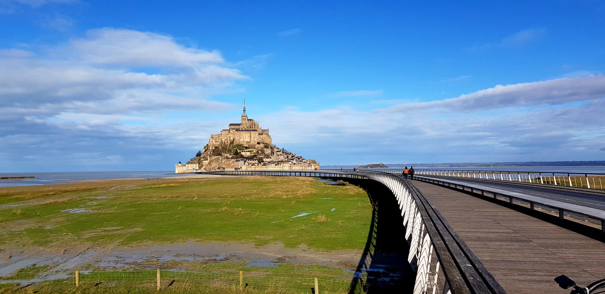
Château des Bois Francs, in Normandy, is a 19th century castle surrounded by 310 hectares of forest and 15 hectares of lakes. You can admire the architecture of the castle, the French gardens and the wildlife that inhabits the region. Château des Bois Francs is an ideal place to relax and discover the beauty of the Normandy countryside.
3
0
This greenway is a former railway line that has been converted into an asphalt path for cyclists, roller skaters and walkers. It extends for approximately 9 km from Verneuil-sur-Avre to the Center Parc des Bois-Francs, a leisure resort with a lake and spa. Along the route, you can admire views of fields, forests and villages, and learn about the history and culture of the region thanks to the information panels.
3
0

The Greenway of Bois Francs, one of the seven Greenways of the Eure department, has been developed on rural roads and forest roads. It connects Verneuil-sur-Avre to Center Parc des Bois-Francs, and is suitable for family practice.
0
1
The Château des Bois-Francs is located in the Center Parcs "Les Bois-Francs" area in Les Barils.
0
1
Frequently Asked Questions
How many running routes are available around Verneuil-sur-Avre?
There are over 25 dedicated running routes around Verneuil-sur-Avre listed on komoot, offering a variety of distances and difficulty levels to suit different preferences.
Are there any easy jogging routes for beginners in Verneuil-sur-Avre?
Yes, Verneuil-sur-Avre offers a few easy jogging routes perfect for beginners. These typically feature flatter terrain, such as sections along the Avre River or parts of the Bois Francs Greenway. You'll find 2 easy routes among the total available.
Can I find circular running routes in the Verneuil-sur-Avre area?
Absolutely. Many of the running paths around Verneuil-sur-Avre are designed as circular loops, allowing you to start and finish in the same location. For example, the Bois Francs Greenway – Château des Bois-Francs loop from Verneuil-sur-Avre is a popular circular option.
What kind of landscapes can I expect on the running trails near Verneuil-sur-Avre?
The running trails around Verneuil-sur-Avre offer a diverse range of landscapes. You can expect peaceful riverside paths along the Avre River, extensive forestland, and the rolling hills characteristic of the adjacent Perche Regional Natural Park. The Bois Francs Greenway loop from Pullay, for instance, takes you through fields and forests.
Are there any scenic viewpoints or historical landmarks along the running routes?
Yes, several routes offer scenic views and pass by interesting landmarks. The region is rich in history, and you might encounter sights like the medieval town center of Verneuil-sur-Avre or various castles. For example, the Bois Francs Greenway – Château des Bois-Francs loop from Verneuil-sur-Avre provides views of the Château des Bois Francs. You can also explore highlights like the La Madeleine Church or the Medieval town centre of Verneuil-sur-Avre.
What do other runners say about the trails in Verneuil-sur-Avre?
The running routes in Verneuil-sur-Avre are highly rated by the komoot community, with an average score of 4.6 stars from over 10 reviews. Runners often praise the varied terrain, from the flat, asphalt Bois Francs Greenway to the more challenging forest paths, and the overall natural beauty of the area.
Are there any running routes that are particularly suitable for families?
For families, the flatter sections of the Bois Francs Greenway are ideal. This former railway line, now an asphalt path, offers a smooth surface away from traffic, making it a safe and enjoyable option for a family run or walk. Consider routes that utilize this greenway, such as the Bois Francs Greenway – Château des Bois-Francs loop from Verneuil-sur-Avre.
Are the running trails around Verneuil-sur-Avre dog-friendly?
Many natural trails and forest paths in the Verneuil-sur-Avre area, especially within the Perche Regional Natural Park, are generally dog-friendly. However, it's always recommended to keep dogs on a leash, especially in protected areas or near wildlife, and to check local regulations for specific routes. The quieter, wooded sections of routes like the Route des Roches loop from Verneuil d'Avre et d'Iton could be suitable.
What is the longest running route available in Verneuil-sur-Avre?
Among the featured routes, the Bois Francs Greenway loop from Pullay is one of the longer options, covering approximately 16 kilometers (10 miles). This route offers a substantial challenge for those looking for a longer run.
Are there any running routes that explore the Perche Regional Natural Park?
Verneuil-sur-Avre is situated right at the edge of the Perche Regional Natural Park, meaning many routes naturally extend into or offer views of this beautiful area. The park itself is known for its rolling hills and deep forests, providing an excellent backdrop for running. While specific routes within the park are not detailed here, the general landscape of routes like the Route des Roches loop from Mandres will give you a taste of the park's natural environment.
What is the Bois Francs Greenway and how can I run on it?
The Bois Francs Greenway is a notable feature in the area, a former railway line that has been converted into an asphalt path. It spans approximately 9 km and offers a flat, smooth surface, making it excellent for running. You can access sections of it through routes like the Bois Francs Greenway – Château des Bois-Francs loop from Verneuil-sur-Avre, which incorporates parts of this scenic greenway.
Are there any running routes with minimal elevation gain?
Yes, if you prefer flatter runs, routes that primarily follow the Avre River or utilize the Bois Francs Greenway will have minimal elevation gain. The Bois Francs Greenway, being a converted railway line, is particularly flat and offers an easy-going experience.
Most popular routes around Verneuil-Sur-Avre
Most popular attractions around Verneuil-Sur-Avre

Get inspired with the komoot mobile app


Explore more
Browse the best Running Trails & Routes in other regions.
