The best road cycling routes around Arville
4.8
(7)
128
riders
60
rides
Road cycling routes around Arville are situated within the diverse landscapes of the Gâtinais Français Regional Natural Park, characterized by alternating forests, agricultural plains, and rolling hills. The region's topography, shaped by the sedimentary Paris basin, includes varied soils and features valleys carved by rivers like the Seine and Essonne. These physical features provide a mix of flat and moderately challenging terrain, ideal for road cyclists seeking varied routes.
Best road cycling routes around Arville
- The most popular road cycling…
Last updated: July 15, 2026
2
riders
47.1km
02:08
390m
400m
This moderate 29.3-mile (47.1 km) road cycling loop from Saint-Agil explores the scenic Perche Natural Park, passing Château de Montmirail.
7
riders
82.3km
03:40
750m
750m
Moderate road ride. Good fitness required. Mostly well-paved surfaces and easy to ride.

Sign up for free
4.5
(2)
6
riders
Moderate road ride. Good fitness required. Some segments of this route may be unpaved and difficult to ride.
3
riders
45.1km
02:01
330m
330m
Moderate road ride. Good fitness required. Mostly well-paved surfaces and easy to ride.
5.0
(4)
3
riders
53.4km
02:20
350m
350m
Moderate road ride. Good fitness required. Mostly well-paved surfaces and easy to ride.
Get access to more routes and recommendations from other explorers.
Sign up for free
Already have an account?
Our route recommendations are based on thousands of hikes, rides, and runs completed by other people on komoot.
Start today with a free account
Your next adventure awaits.
Login or Signup



Tips from the Community

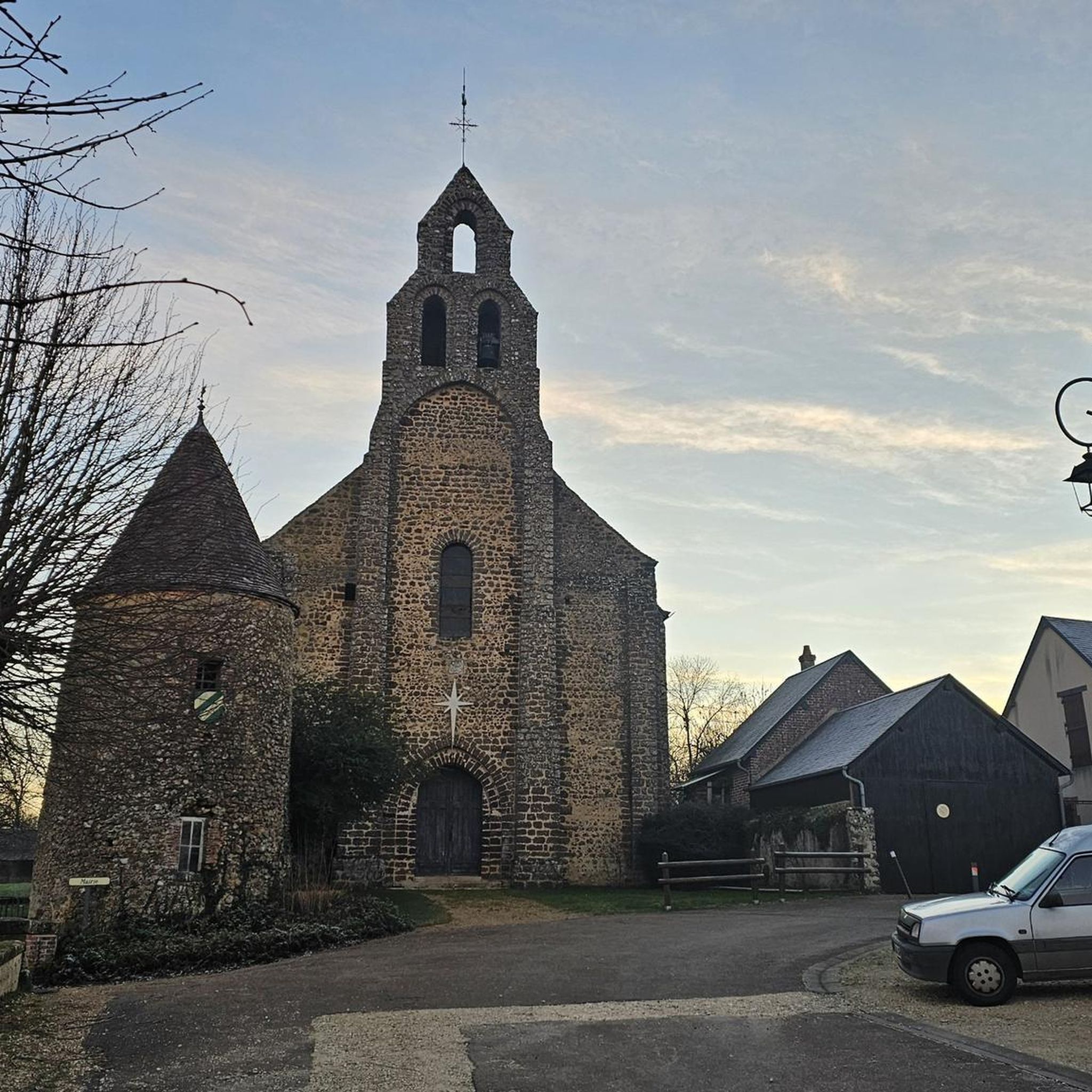
This is a church dating from the 12th and 15th centuries. The nave of the church was paneled in the 15th century. A statue representing Saint Martin on horseback, sharing his cloak, was placed in a niche above the portal.
0
0
In 1133, Geoffroi, Viscount of Châteaudun, founded a priory dependent on the abbey of Tiron, in the diocese of Chartres, in this place. When he died, his wife, Helvise de Mondoubleau, built the church around 1140. The church is formed of a long nave ending in a semicircular apse. It has retained several narrow bays, with a semicircular arch, very flared towards the inside. In the 16th century, a chapel was added to the south of the church, a paneling with exposed tie beams above the nave and the choir, and a mass of carpentry to the west which supports the spire of the bell tower on pointed arches. The choir has a trefoiled piscina from the 14th century. In 1660, Jean Gry, a carpenter from Vendôme, executed the altarpiece and the following year, Pierre Janvier, a painter from Mondoubleau, painted the Resurrection which decorates it. The church houses two funerary slabs, one of a priest who died in 1658, the other of François Leboulx, Lord of Chauvellières, who died in 1691.
0
0
This church contains 14th century wall paintings. These paintings were discovered in 1895. They formerly occupied the entire width of the western wall of the nave. The central part was destroyed following the renovation of the door. The left side represented paradise. Of the bust of Christ, in a trilobed medallion, which occupied the center, there remains only a fragment of the cruciform halo. The rest of the composition is divided into rectangular compartments, each enclosing, in the surviving part, a figure of a crowned chosen one. On the right, hell is represented by a cauldron in which several characters are immersed, including a pope, a bishop, a monk, a king, a queen. Above, a woman with her legs apart. On the right, an enormous horned demon sticks out its tongue. On the left, another carries a basket filled with the damned and is about to plunge a woman into the cauldron. Construction periods: 14th century
0
0
The church, which remained in the diocese of Chartres in the 18th century, belonged to the Abbey of Saint-Calais. Built in the 12th century, it consists of a single nave continued by a semicircular apse. The semicircular portal is surmounted by a consecration cross. Several pointed bays were pierced in the 15th century. In the 16th century, the church was enriched with paneling with exposed beams. In the sacristy behind the high altar, a beam sculpted with nails, crowns of thorns, fighters, monsters and coats of arms supports the altarpiece. It dates from the 16th century and most likely comes from a half-timbered house.
0
0
In the Middle Ages, Saint-Avit-au-Perche was a priory of the abbey of Saint-Calais, founded by Avit's companion. Today's church dates from the very beginning of the 12th century. It consists of a five-bay nave ending in a semicircular apse. It is covered with chestnut shingles. Several original windows remain; others have been reworked (including the first window, on the north side). This can be seen in the shape of the keystones. A walled-up side door to the south can be seen from the outside. It has an enormous mitre lintel. Inside, it has been transformed into a niche housing Our Lady of Lourdes. The apse is flanked by projecting buttresses. Those at the corners of the façade are from the 15th century. The western portal in a pointed arch is a 15th-century renovation that was completely redone at the end of the 20th century.
0
0
From its source to its confluence with the Ozanne, the Sainte-Suzanne covers 19.2 km and crosses 5 communes. From upstream to downstream: Authon-du-Perche; Beaumont-les-Autels; Coal pits; Les Altars-Villevillon; A glass.
0
0
Building built in the 15th century, ribbed vaulted, with straight apse; beginning of the 16th century, c. 1530, construction of the Sainte-Barbe chapel on the south side; Renaissance stained glass, not. Tree of Jesse (surviving fragments); 17th century altarpiece and high altar. History of protection: the classification order of April 25, 2003 replaces the classification order of February 11, 1911 and the registration orders on the supplementary inventory of historic monuments of January 20, 1926 and February 4, 2002.
0
0
the Saint-André church dates from the 11th century; it was a priory then dependent on the abbey of St.-Calais, but the current building was completely rebuilt around the walls and framework of the old building. The project was carried out in 1877. The construction of a transept, enlarged windows and a stone bell tower completely modified the old monument. The environment has also changed a lot. All traces of the old cemetery, transferred outside the village at the beginning of the 18th century, have disappeared. The furniture includes a stone baptistery, a statue of the Virgin and Child, a confessional and a Louis XV period bench. The beautiful wooden tabernacle decorated with a statue of Saint Lubin comes from the church which was located a few kilometers away, in Saint-Lubin-des-Cinq-Fonts, and of which only the choir, which has become a chapel, remains today. .
0
0
Frequently Asked Questions
How many road cycling routes are available around Arville?
There are over 65 road cycling routes around Arville, offering a wide range of options for different skill levels. You'll find 19 easy routes, 45 moderate routes, and 1 more challenging route.
What kind of terrain can I expect on road cycling routes near Arville?
The region around Arville, part of the Gâtinais Français Regional Natural Park, features a diverse topography. You can expect a mix of expansive forests, open agricultural plains, and rolling hills. Routes often follow valleys carved by rivers like the Seine and Essonne, providing varied scenery and a balance of flat sections and moderate climbs.
Are there circular road cycling routes available around Arville?
Yes, many of the road cycling routes around Arville are designed as loops, allowing you to start and finish in the same location. For example, the Châteaux and Seigneuries of Perche Loop is a popular circular route that offers scenic views of historical châteaux and the countryside.
What scenic viewpoints can I expect along road cycling routes in Arville?
Road cycling routes in Arville often pass through the varied landscapes of the Gâtinais Français Regional Natural Park, offering scenic views of alternating forests, open agricultural plains, and rolling hills. You'll also find picturesque stretches along river valleys and charming rural vistas.
Are there any historical sites or châteaux I can visit while road cycling near Arville?
Yes, the region is rich in historical sites. You can cycle past or near notable attractions such as the Domaine national de Fontainebleau and the Parc du château de Vaux-le-Vicomte. Other châteaux with remarkable gardens, like the Château de Courances and the Parc and Château de Chamarande, are also accessible. For specific local points of interest, consider visiting the Notre-Dame Church of Chapelle-Guillaume or the Ruins of Guériteau Chapel.
What natural features will I encounter on road cycling routes around Arville?
The routes around Arville are set within the Gâtinais Français Regional Natural Park, known for its diverse natural features. You'll encounter expansive forests and woodlands, open agricultural plains, and rolling hills. The landscape is also shaped by valleys and rivers like the Seine, Juine, and Essonne, providing varied and scenic backdrops for your ride.
What is the best time of year for road cycling in Arville?
The spring and autumn months generally offer the most pleasant conditions for road cycling in Arville, with milder temperatures and beautiful scenery. The Gâtinais region is particularly known for its autumn foliage. Summer can also be enjoyable, though it's advisable to start earlier in the day to avoid the midday heat.
Is it possible to reach Arville by public transport with a bicycle?
While Arville is a rural commune, public transport options to the broader Seine-et-Marne department and nearby towns exist. It's recommended to check specific train or bus services for their bicycle carriage policies, as these can vary. For detailed information on public transport with bicycles, consult the regional transport authority websites.
Are there parking facilities for cyclists in Arville?
Parking is generally available in and around Arville, particularly in the town center or near popular starting points for routes. As a rural area, finding suitable parking for vehicles transporting bicycles is typically manageable, but specific designated cyclist parking might be limited. Always check local signage for parking regulations.
Are there family-friendly road cycling routes in Arville?
Many of the routes around Arville are suitable for families, especially those that traverse the flatter agricultural plains or follow quieter country roads. The region offers 19 easy routes that are generally less demanding. Always check the route details, including distance and elevation, to ensure it matches your family's fitness level.
Can I find places to eat or stay along the road cycling routes?
Yes, the region around Arville has charming small villages and towns where you can find cafes, restaurants, and accommodation. Nearby towns like Puiseaux, Nemours, and Fontainebleau offer local markets and dining options. It's a good idea to plan your route to include stops in these areas for refreshments or overnight stays.
What do other road cyclists say about the routes around Arville?
The road cycling routes around Arville are highly rated by the komoot community, with an average score of 4.75 stars from over 3 reviews. Cyclists often praise the varied terrain, which includes expansive woodlands, agricultural plains, and rolling hills, as well as the opportunities to explore historical châteaux and charming villages.
Are there routes that explore the Gâtinais Français Regional Natural Park?
Absolutely. Arville is situated within the Gâtinais Français Regional Natural Park, and many routes, such as the Stage 1 of the Véloscénie – Château de Montmirail loop from Arville, lead directly through its diverse landscapes. You'll experience the park's characteristic forests, plains, and rolling hills, often with views of its unique geological features.
Most popular attractions around Arville

Get inspired with the komoot mobile app


Explore more
Browse the best Road cycling routes in other regions.
