The best MTB trails around Bourgvilain
4.4
(146)
658
riders
106
rides
Mountain biking around Bourgvilain offers diverse terrain within the gently rolling landscapes of the Bourgogne-Franche-Comté region. The area features meadows, woods, and elevations ranging from 260 to 681 meters, with the Col des Enceints marking a significant high point. This natural environment, part of a Natura 2000 protected area, provides varied routes suitable for different skill levels.
Best mountain bike trails around Bourgvilain
- The most popular mountain bike trail is View of Solutré-Pouilly – Mount Pouilly loop from La Roche-Vineuse…
Last updated: June 27, 2026
4.0
(3)
24
riders
36.2km
02:03
280m
280m
Moderate mountain bike ride. Good fitness required. Suitable for all skill levels.
4.7
(6)
16
riders
Moderate mountain bike ride. Good fitness required. Suitable for all skill levels.

Sign up for free
3.0
(1)
5
riders
28.5km
03:04
900m
900m
Hard mountain bike ride. Very good fitness required. Suitable for all skill levels.
3.5
(2)
4
riders
23.2km
02:17
610m
610m
Moderate mountain bike ride. Good fitness required. Suitable for all skill levels.
3.0
(1)
15
riders
26.5km
01:39
310m
310m
Moderate mountain bike ride. Good fitness required. Suitable for all skill levels.
Get access to more routes and recommendations from other explorers.
Sign up for free
Already have an account?
Our route recommendations are based on thousands of hikes, rides, and runs completed by other people on komoot.
Start today with a free account
Your next adventure awaits.
Login or Signup

Tips from the Community

The Tour des Fromages is a preserved defensive tower from the 11th century, which originally belonged to the ramparts of the powerful Abbey of Cluny. In the Middle Ages, the structure was still called Tour des Fèves (Bean Tower), as supplies were stored there. It got its current, curious name in the 19th century because a merchant used the tower to dry her homemade cheeses. Today, the tower is a popular attraction. Visitors can climb the 120 steps to the top. From up there, you have a beautiful 360-degree panoramic view over the entire medieval monastic city and the surrounding Burgundy landscape. Access to the tower is directly through the local Cluny tourist office.
1
0
Although the pass is located in France and is not extremely high, its name translates to "Siberia Pass". The name goes back to the often very cold, snow-rich winds and the harsh weather conditions in winter.
1
0
The Col de Gerbet (612 m) is an idyllic mountain pass in the French wine-growing region of Beaujolais. Depending on the starting point, various roads with little traffic lead up to the pass via the D137. From Juliénas (south-east approach): This route is 7.3 kilometers long. It overcomes 342 meters of altitude with a steady, moderate gradient of 4.7% on average. The road winds through shady forest sections. From La Croix Blanche (west approach): A tougher variant 4.5 kilometers long. Here you conquer 270 meters of altitude with an average gradient of 6% and ramps of up to 11%.
1
0
The Croix de Roche Coche, a summit cross on the La Roche Coche viewpoint in the French municipality of Berzé-la-Ville (Burgundy/Saône-et-Loire region). The rocky summit is at an altitude of 455 meters and offers a wide panorama of the Val Lamartinien.
1
0
The Pierreclos Castle (Château de Pierreclos) is a historic, Romanesque castle complex and a renowned winery. The origins date back to the 9th to 11th centuries, starting with a Romanesque chapel. In the 13th century, the complex was expanded into a medieval fortress. It is now protected as a private historical monument. The castle is located on a rocky outcrop that has been used for viticulture since the 6th century. The Pidault family's winery produces organically certified white and red wines (including Pouilly-Fuissé and Mâcon-Pierreclos).
2
0
The Abbey Park of Cluny, located on the grounds of the once most powerful Benedictine abbey of the Middle Ages. The park and the surrounding ruins are the remains of the Abbey of Cluny, founded in 910, which was the religious center of Western Europe as the starting point for significant reforms. The church Cluny III (Maior Ecclesia) built there was considered the largest house of worship in Christendom for over 400 years, until it was surpassed by St. Peter's Basilica in Rome.
2
0

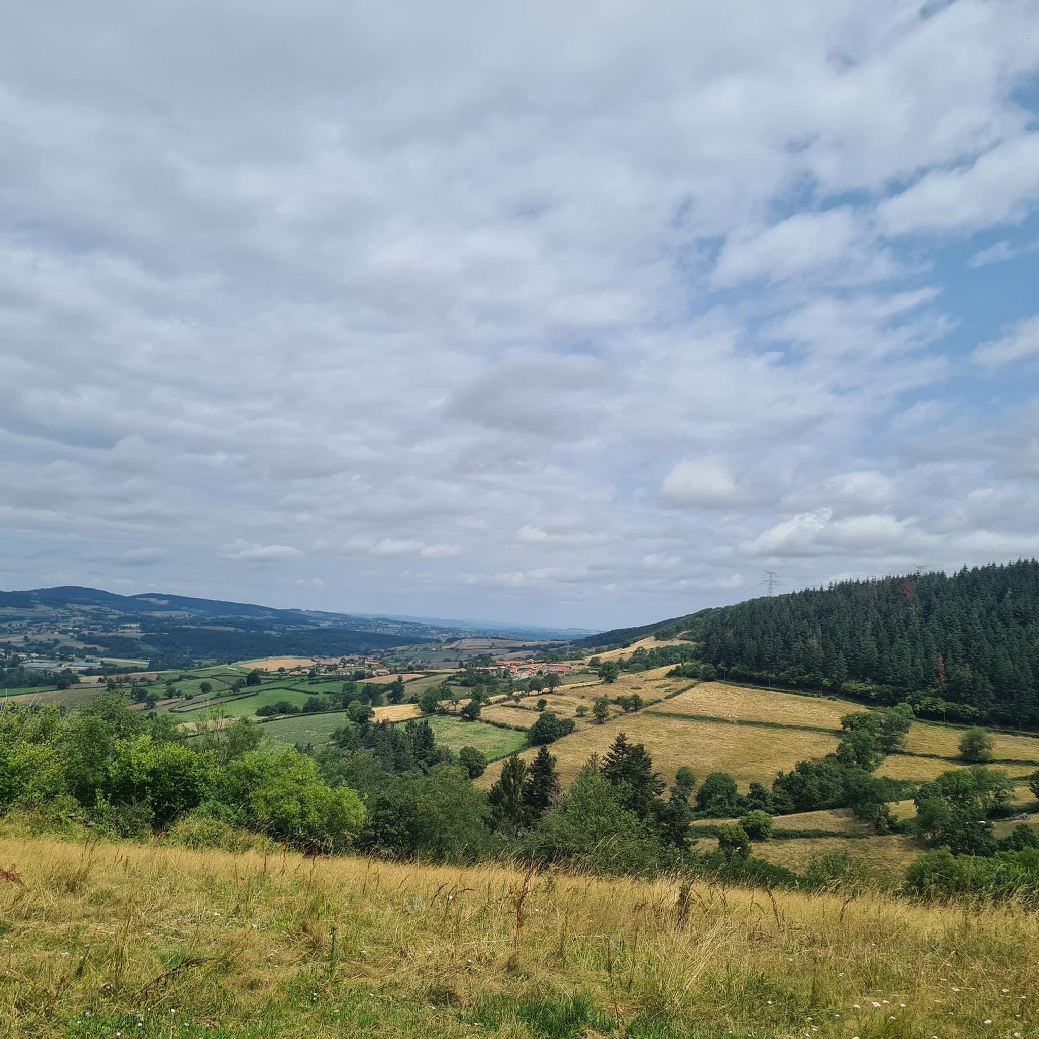
Beautiful view of the Lamartine Valley
1
0

Bring a light jacket; it can get cold inside. For those with vision problems, don't be afraid; the lighting isn't too bright.
0
0
Frequently Asked Questions
How many mountain bike trails are available around Bourgvilain?
There are over 100 mountain bike trails around Bourgvilain, offering a wide range of options for different skill levels. You'll find everything from easier routes to more challenging paths with significant elevation changes.
What kind of terrain can I expect on mountain bike trails near Bourgvilain?
The terrain around Bourgvilain is characterized by gently rolling landscapes, extensive meadows, and dense woodlands. You can expect a mix of unpaved segments, offering both less demanding paths and challenging climbs and descents, particularly around the Col des Enceints, which is the highest point in the area.
Are there any family-friendly mountain bike trails in Bourgvilain?
Yes, while many routes offer moderate challenges, the gently rolling nature of the landscape means there are also less demanding paths suitable for families. Look for trails with lower elevation gains and shorter distances for a more relaxed family outing.
Can I bring my dog on the mountain bike trails around Bourgvilain?
Many trails in natural areas like Bourgvilain are generally dog-friendly, especially if your dog is well-behaved and kept on a leash. However, it's always best to check specific local regulations or trail signage for any restrictions, particularly within the Natura 2000 protected areas.
What natural features or landmarks can I see while mountain biking near Bourgvilain?
The region is rich in natural beauty and historical sites. You can encounter the prominent Roche de Solutré, a significant natural and prehistoric site, or the Tunnel du bois clair. The area is also part of a Natura 2000 protected zone, ensuring diverse flora and fauna. Some routes, like the View of Solutré-Pouilly – Mount Pouilly loop from La Roche-Vineuse, offer direct views of these impressive formations.
What is the best time of year for mountain biking in Bourgvilain?
Bourgvilain's varied landscape makes it enjoyable throughout much of the year. Spring and autumn generally offer pleasant temperatures and beautiful scenery with changing foliage. Summer is also suitable, though some trails might be busier. Winter riding is possible, but conditions can vary, especially at higher elevations like the Col des Enceints.
Are there any challenging mountain bike routes for experienced riders?
Absolutely. The presence of the Col des Enceints and routes with significant elevation changes, such as the Siberia Pass (638 m) – Access to Tête du Pis loop from Les Fougères, provide challenging climbs and exhilarating descents. This particular route features over 900 meters of elevation gain and is rated as difficult.
What do other mountain bikers say about the trails in Bourgvilain?
The mountain bike trails around Bourgvilain are highly rated by the komoot community, with an average score of 4.4 stars from over 100 reviews. Riders often praise the diverse terrain, the scenic woodlands, and the well-maintained paths that cater to various skill levels.
Where can I find parking for mountain bike trails in Bourgvilain?
While specific parking spots for every trailhead are not detailed, many routes start from villages or accessible points where public parking is typically available. For example, routes like the View of Solutré-Pouilly – Mount Pouilly loop often begin from locations like La Roche-Vineuse, which usually offer parking facilities.
Are there any loop mountain bike trails around Bourgvilain?
Yes, many of the popular mountain bike routes around Bourgvilain are designed as loops, allowing you to start and finish in the same location. Examples include the Tour of the Bois du Mont de Mandé – Croix de Roche Coche loop from La Roche-Vineuse and the Lamartine House – Pierreclos Castle loop from Sologny.
Are there any cafes or pubs near the mountain bike trails in Bourgvilain?
Bourgvilain and its surrounding villages offer local amenities where you can find cafes and pubs. While specific establishments directly on trails are rare, you can often find options in the starting or ending points of routes, such as La Roche-Vineuse or Sologny, perfect for a post-ride refreshment.
Do I need a permit to mountain bike in Bourgvilain?
Generally, you do not need a specific permit for mountain biking on public trails in the Bourgvilain area. However, as parts of the region are within a Natura 2000 protected area, it's important to respect local regulations, stay on marked paths, and avoid disturbing wildlife to preserve the natural environment.
Most popular routes around Bourgvilain
Most popular attractions around Bourgvilain

Get inspired with the komoot mobile app


Explore more
Browse the best MTB trails in other regions.
