The best road cycling routes around Étraye
4.5
(7)
272
riders
37
rides
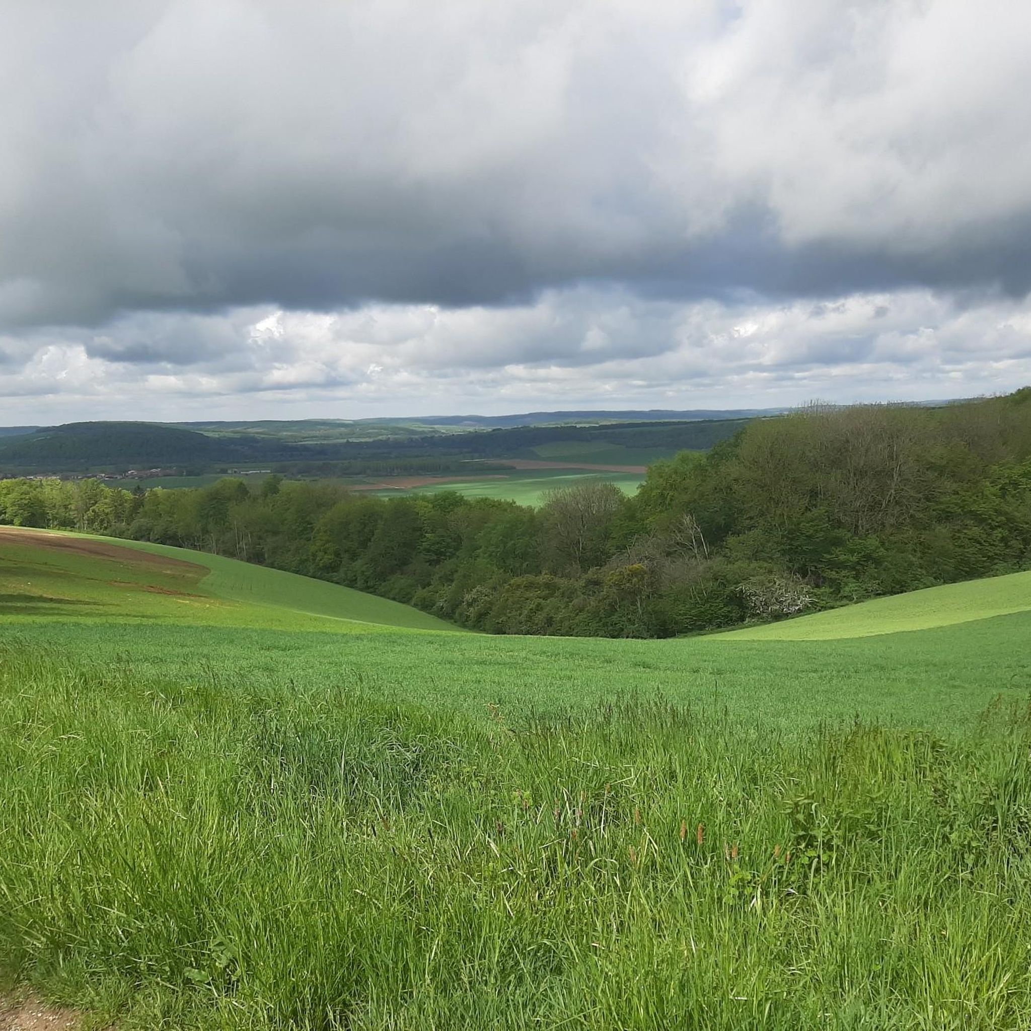
Road cycling routes around Étraye traverse the Meuse department in the Grand Est region of north-eastern France. The area features elevations ranging from 216 to 373 meters, providing varied terrain for cyclists. This rural commune is characterized by rolling hills, forests, and agricultural lands, offering a tranquil environment for road cycling. The topography includes both gentle gradients and more challenging ascents.
Best road cycling routes around Étraye
- The most popular road cycling route is Citadel of Verdun – Chemin forestier…
Last updated: July 9, 2026
16
riders
63.8km
02:54
620m
620m
Moderate road ride. Good fitness required. Mostly well-paved surfaces and easy to ride.
27
riders
112km
05:21
660m
660m
Hard road ride. Very good fitness required. Some segments of this route may be unpaved and difficult to ride.

Sign up for free
11
riders
37.6km
01:53
410m
420m
Moderate road ride. Good fitness required. Mostly well-paved surfaces and easy to ride.
5.0
(1)
10
riders
40.6km
01:47
330m
330m
Moderate road ride. Good fitness required. Mostly well-paved surfaces and easy to ride.
5
riders
51.2km
02:17
440m
440m
Moderate road ride. Good fitness required. Mostly well-paved surfaces and easy to ride.
Get access to more routes and recommendations from other explorers.
Sign up for free
Already have an account?
Our route recommendations are based on thousands of hikes, rides, and runs completed by other people on komoot.
Start today with a free account
Your next adventure awaits.
Login or Signup


Tips from the Community

The museum offers a good insight into soldiers' lives during World War I. Using an augmented reality helmet, visitors can travel through the underground citadel. Admission is €16 per person (as of October 2025). However, for background information, it is recommended to visit the Verdun Memorial beforehand.
6
0

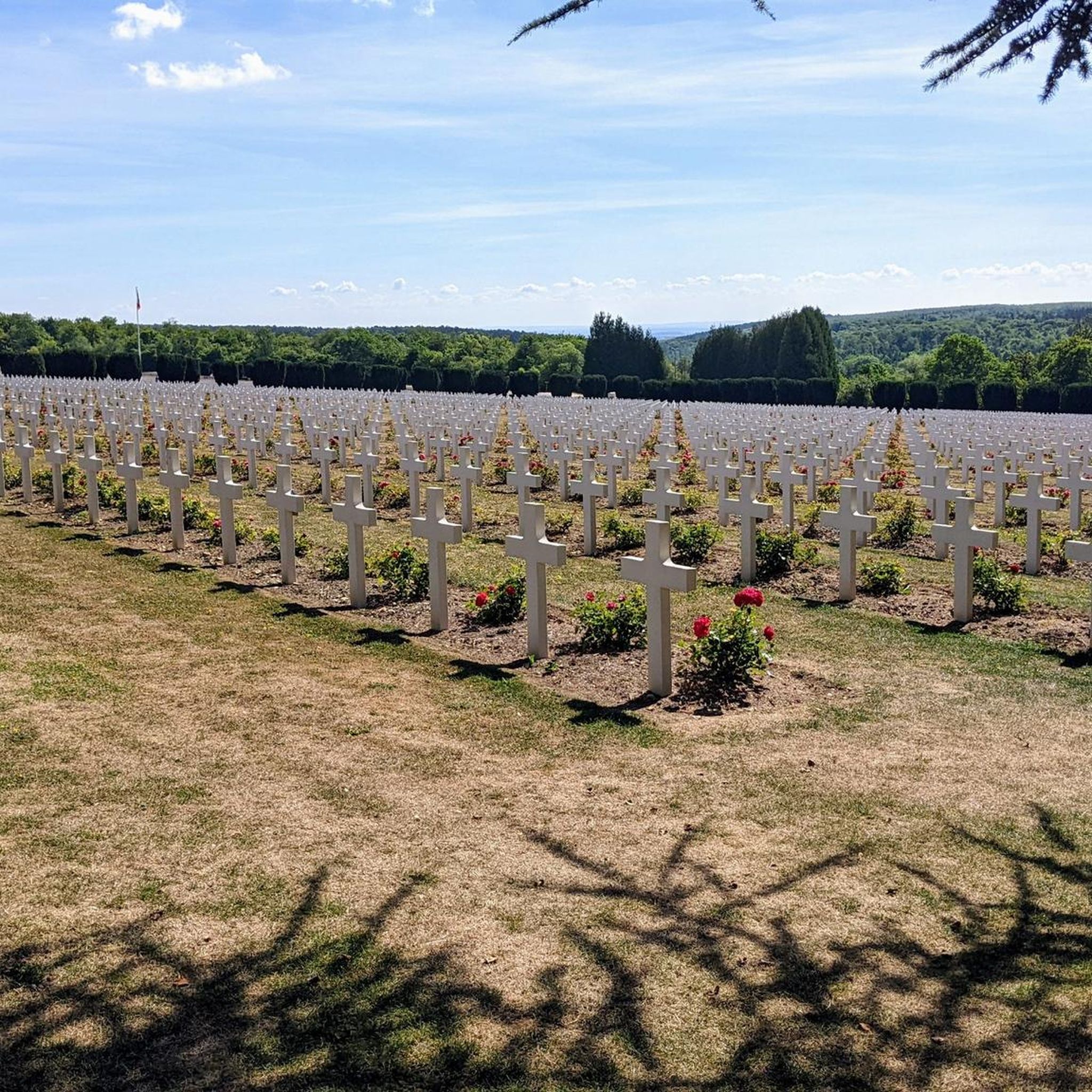
The Ossuary of Douaumont is an impressive memorial that holds the remains of more than 130,000 unknown French and German soldiers who died during the Battle of Verdun (1916). The bones are visible through small windows in the base – a confronting reminder of the horrors of war. In front of the ossuary is the Nécropole nationale de Douaumont, the largest French military cemetery of the First World War, with 16,142 graves, including a Muslim and Jewish plot. The complex was recognized as a UNESCO World Heritage Site in 2023.
8
0

The gate was part of the city fortifications in the Middle Ages.
5
0

The Citadel of Verdun is a symbolic and strategic site of the Battle of Verdun, nestled in stone. It will be a visit like no other during which you will walk through the underground galleries thanks to augmented reality. This unmissable memorial site immerses us in the lives of the soldiers during the war, 16 meters under the rock. An unprecedented experience! Triggered? Click through to https://www.landofmemory.eu/nl/sites-historiques/ondergrondse-citadel/
3
0
The Myth of the First World War “In memory of the French soldiers who sleep standing, rifle in hand, in this trench – their brothers in America.” This is the inscription in front of the Memorial of the Battle of Verdun in the ghost town of Douaumont. The monument was financed by a wealthy American banker, George T. Rand, who was moved by the famous legend surrounding the site. It is said that French soldiers buried standing, with weapons in hand, died from enemy shells. Bayonet Trench is one of the myths of the First World War. In 1922, it was classified as a historical monument and in 2014 it was considered a site of national importance. After the war, excavations uncovered 21 bodies of French soldiers. Fourteen were identified and buried in the Necropolis of Fleury, opposite Douaumont. The seven other bodies that remained unknown were reburied in the "Bayonet Trench". For many, the myth persists, while others question it. Especially since no body was found standing upright. In any case, the legend of the "Bayonet Trenches" shows above all how much the Great War left an almost indelible mark on the collective imagination. As the bloody conflict of the Battle of Verdun drew to a close, glorious stories quickly emerged in which the nation sacrificed itself for the fatherland. Source: https://www.landofmemory.eu/sites-historiques/tranchee-des-baionnettes/
7
0
Official entrance to the city since its construction in the 14th century and a defensive element of the Great Wall of China that surrounded Verdun in the Middle Ages. It was offered to the city by the bourgeoisie Wautrec, a councillor. It symbolises the new status of Verdun, which became a “free imperial city” in 1374. This status obliged the city to maintain its own ramparts and to organise its defence in the event of an attack.
6
0
Official entrance to the city since its construction in the 14th century and a defensive element of the Great Fortress that surrounded Verdun in the Middle Ages. It was offered to the city by the bourgeoisie Wautrec, a councillor. It symbolises the new status of Verdun, which became a “free imperial city” in 1374. This status obliged the city to maintain its own ramparts and to organise its defence in the event of an attack. Source: Tourism Verdun
6
1

Frequently Asked Questions
How many road cycling routes are available around Étraye?
There are over 30 road cycling routes documented around Étraye on komoot, offering a variety of options for different skill levels. You'll find 12 easy routes, 14 moderate routes, and 6 more challenging options.
What kind of terrain can I expect when road cycling in Étraye?
Road cycling in Étraye features varied terrain, with elevations ranging from 216 to 373 meters. You can expect a mix of rolling hills, agricultural lands, and quiet country roads. The region offers both gentle gradients and more challenging ascents, typical of the rural Meuse department.
Are there easy road cycling routes suitable for beginners in Étraye?
Yes, Étraye offers 12 easy road cycling routes perfect for beginners or those seeking a relaxed ride. An example is the Citadel of Verdun – Chemin forestier tranquille loop from Consenvoye, which is 47.1 km long and takes about 2 hours to complete through tranquil forest paths.
Where can I find more challenging road cycling routes in the Étraye area?
For those seeking a challenge, Étraye has 6 difficult road cycling routes. These routes often feature notable elevation changes and longer distances. An example of a more extensive route is the Scenic Country Road – Caure wood loop from Damvillers, which spans over 111 km and includes significant climbs.
Are there any circular road cycling routes around Étraye?
Many of the road cycling routes around Étraye are designed as loops, allowing you to start and finish in the same location. For instance, the Douaumont Ossuary – Douaumont Ossuary loop from Damvillers is a moderate 62.6 km circular path that passes historical sites.
What are some scenic points of interest or landmarks I can see while cycling near Étraye?
While cycling near Étraye, you can encounter several points of interest. Routes may pass by historical sites such as the Beaumont-en-Verdunois Destroyed Village. You might also find charming rural settlements like Murvaux or the Church of Forges-sur-Meuse. Some routes even incorporate sections of the Cycle path along the Meuse Canal.
What do other cyclists say about road cycling in Étraye?
The road cycling routes around Étraye are highly rated by the komoot community, with an average score of 4.6 stars from over 8 reviews. Cyclists often praise the tranquil environment, the blend of rolling hills and agricultural landscapes, and the quiet country roads that make for a peaceful riding experience.
Is Étraye suitable for family-friendly road cycling?
Étraye's rural setting and the availability of 12 easy routes make it suitable for family-friendly road cycling, especially on quieter roads and dedicated cycle paths. Routes like the Citadel of Verdun – Chemin forestier tranquille loop from Consenvoye offer gentle gradients and a peaceful environment away from heavy traffic.
What is the typical duration for road cycling routes in Étraye?
The duration for road cycling routes in Étraye varies significantly based on distance and difficulty. Easy routes, such as the 47.1 km Citadel of Verdun – Chemin forestier tranquille loop from Consenvoye, can take around 2 hours. Longer, more challenging routes can extend to several hours, with the most difficult ones potentially taking over 6 hours.
Are there any specific historical sites accessible by road bike in the region?
Yes, the Étraye area, being close to historical battlefields, offers routes that pass by significant sites. For example, the Douaumont Ossuary – Douaumont Ossuary loop from Damvillers takes you past historical landmarks, providing a chance to combine cycling with exploring the region's past.
What are the best seasons for road cycling in Étraye?
The Grand Est region, including Étraye, generally offers pleasant conditions for road cycling from spring through early autumn. During these seasons, you can expect milder temperatures and lush landscapes, making for an enjoyable ride through the rolling hills and agricultural lands.
Are there options for longer, more extensive road cycling tours in Étraye?
Yes, for cyclists looking for longer tours, Étraye provides several options. The region features routes that extend over 100 km, such as the Scenic Country Road – Caure wood loop from Damvillers, which is 111.3 km long. These routes offer a more extensive exploration of the Meuse department's diverse scenery.
Can I find routes that combine natural scenery with small villages?
Absolutely. Many routes in Étraye are designed to showcase both the natural beauty and the charm of local life. The Main Square of Marville loop from Lissey, for instance, leads through rural landscapes and small villages, offering a picturesque journey through the French countryside.
Most popular routes around Étraye
Most popular attractions around Étraye

Get inspired with the komoot mobile app


Explore more
Browse the best Road cycling routes in other regions.
