The best walks and hikes around Jarménil
4.5
(1911)
9,233
hikers
187
hikes
Hiking around Jarménil offers a diverse landscape characterized by dense woodlands, rolling hills, and notable water features. The region features varied elevations, with routes traversing through forest paths and ascending to cols, providing different perspectives of the terrain. This area provides a range of hiking experiences, from gentle forest strolls to more challenging ascents.
Best hiking trails around Jarménil
- The most popular hiking route is Great Tendon Waterfall – View of Tenon. loop from Col de la Bijoire, a…
Last updated: October 8, 2026
4.5
(4)
26
hikers
Hard hike. Very good fitness required. Easily-accessible paths. Suitable for all skill levels.
5.0
(2)
14
hikers
2.44km
00:45
80m
80m
Easy hike. Great for any fitness level. Easily-accessible paths. Suitable for all skill levels.

4.5
(2)
15
hikers
14.2km
03:44
120m
120m
Moderate hike. Good fitness required. Easily-accessible paths. Suitable for all skill levels.
5.0
(2)
15
hikers
2.40km
00:43
80m
80m
Easy hike. Great for any fitness level. Easily-accessible paths. Suitable for all skill levels.
4.7
(3)
12
hikers
2.96km
00:53
100m
100m
Easy hike. Great for any fitness level. Easily-accessible paths. Suitable for all skill levels.
Get access to more routes and recommendations from other explorers.
Already have an account?
Our route recommendations are based on thousands of hikes, rides, and runs completed by other people on komoot.
Start today with a free account
Your next adventure awaits.


Tips from the Community

The Moraine de Noirgueux near Saint-Nabord in the Vosges is an impressive testament to the last ice age. Around 15,000 years ago, the Moselle glacier pushed its way down the valley, leaving behind four striking moraine arcs of rubble, sand, and gravel. The glacier at the time was about 40 kilometers long. A short educational trail explains the ice age landscape and the formation of the former Remiremont lake.
0
0
Roche des Cuveaux is located near Éloyes in the Vosges. The viewing tower of the Tête des Cuveaux is 9 m high and stands at an altitude of around 783 m. From the top, you have a beautiful panoramic view over the Moselle valley and the Vosges; an orientation map helps with summit identification. Tourisme Vosges +1
0
0
Roche des Cuveaux is located near Éloyes in the Vosges. The Tête des Cuveaux observation tower is 9 m high and stands at an altitude of around 783 m. From the top, there is a beautiful panoramic view of the Moselle valley and the Vosges; an orientation map helps with summit identification.
0
0


A trail without technical difficulties in the Saint-Nabord trail station.
2
0
A site of both natural and historical importance. The Noirgueux site features a set of four moraine arches identical to what they were when the glacier formed them approximately 15,000 years ago. It also houses a memorial commemorating the liberation of Remiremont during the Second World War.
2
0

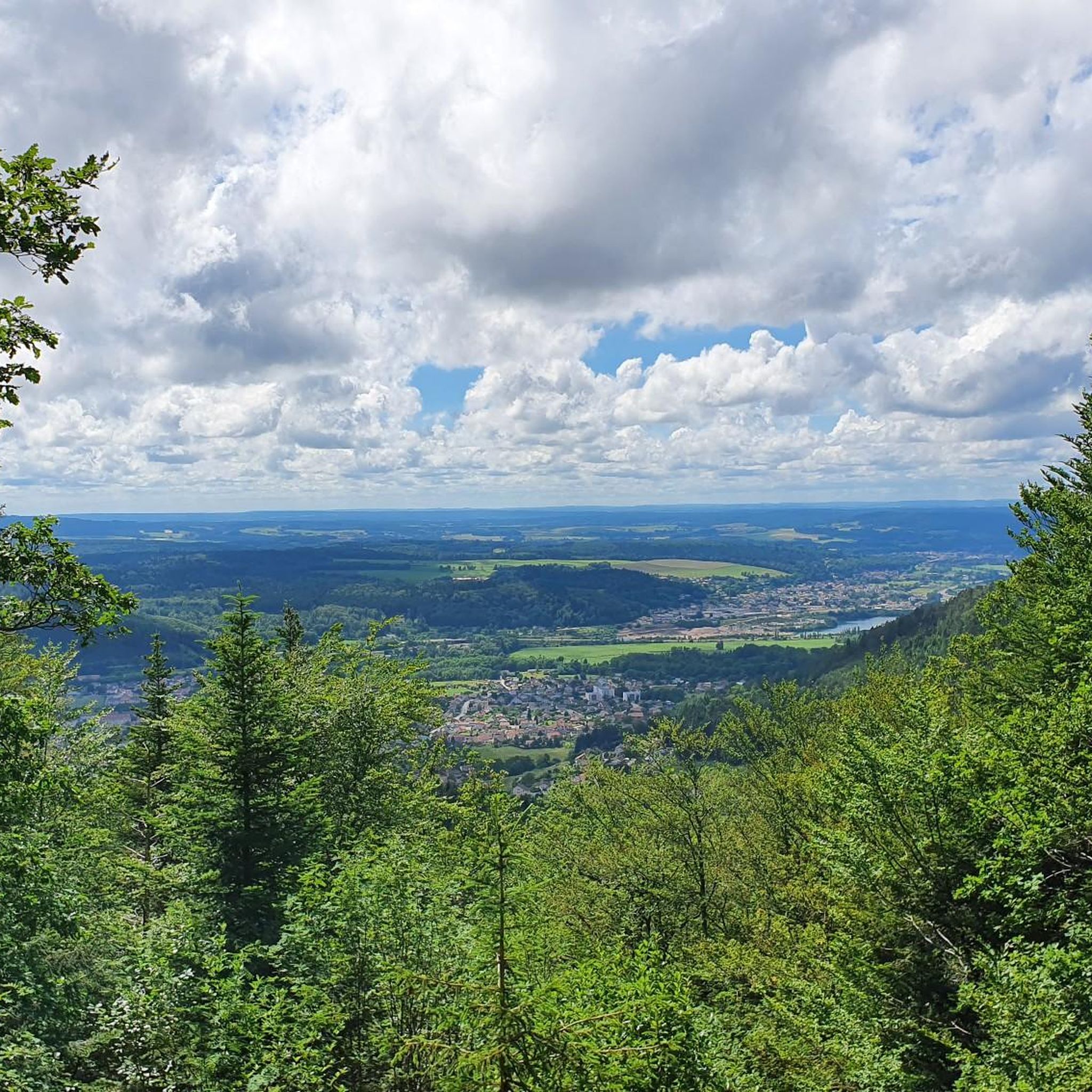
You have to know that there's a viewpoint here—otherwise, all you'll see from the path are rocks and you might carelessly walk past them, because they block the view of the actual viewpoint. Once you find it, you'll have a fantastic view of the valley.
3
0

Very nice hike but viewpoint is off-limits...Disappointing
2
0
Frequently Asked Questions
How many hiking trails are available around Jarménil?
Jarménil offers a wide selection of hiking opportunities, with over 150 routes available. These range from easy strolls to more challenging ascents, catering to various fitness levels.
Are there easy hiking trails suitable for beginners or families in Jarménil?
Yes, Jarménil has over 50 easy hiking trails. A great option for families or beginners is the Nice restaurant – Forest Path loop from Le Ruxelier. This easy 1.8-mile (3.0 km) path offers a pleasant forest walk, ideal for a shorter outing.
What kind of terrain can I expect on hikes around Jarménil?
The region is characterized by dense woodlands, rolling hills, and notable water features. You'll find routes traversing through forest paths, ascending to cols, and offering varied elevations. The landscape provides diverse perspectives, from gentle forest strolls to more challenging climbs.
Are there any circular hiking routes in Jarménil?
Many of the trails around Jarménil are designed as loops, offering convenient circular routes. For example, the Hiking loop from La Croix Bouquot is a 4.0-mile (6.5 km) trail that takes you through varied terrain and brings you back to your starting point.
What are the best times of year to go hiking in Jarménil?
The spring and autumn months are generally ideal for hiking in Jarménil, offering pleasant temperatures and beautiful scenery as the foliage changes. Summer is also popular, though some trails might be busier. Winter hiking is possible, but be prepared for colder conditions and potentially icy paths, especially at higher elevations.
Are there any waterfalls to see on hikes near Jarménil?
Yes, the Jarménil area is known for its scenic waterfalls. You can visit the impressive Great Tendon Waterfall or the charming Little Waterfall of Tendon. The Great Tendon Waterfall – View of Tenon. loop from Col de la Bijoire is a longer route that features a significant waterfall.
What do other hikers say about the trails in Jarménil?
The routes in Jarménil are highly regarded by the komoot community, with an average score of 4.6 stars from over 1,500 reviews. Hikers often praise the diverse terrain, the beauty of the woodlands, and the well-maintained paths.
Are dogs allowed on the hiking trails in Jarménil?
Generally, dogs are welcome on most hiking trails in the Jarménil region. However, it's always recommended to keep your dog on a leash, especially in nature reserves or areas with livestock, and to clean up after them. Check local signage for any specific restrictions.
Are there any interesting landmarks or viewpoints along the trails?
Beyond the waterfalls, you can discover unique natural features like the Sandstone boulders at Les Archettes. For panoramic views, consider seeking out the View from La Brostille (862 m), which offers a stunning perspective of the surrounding landscape.
Is public transport available to access hiking trails in Jarménil?
While some trailheads might be accessible by local bus services, public transport options can be limited in more remote areas around Jarménil. It's advisable to check local bus schedules in advance or consider driving to trail starting points. The Pouxeux train station – Church of Saints Gorgon and Nabord loop from Pouxeux starts near a train station, offering an option for public transport access.
Where can I find parking for hikes in Jarménil?
Many popular trailheads and villages around Jarménil offer designated parking areas for hikers. Look for parking lots near visitor centers, churches, or specific trail starting points. It's always a good idea to arrive early during peak season to secure a spot.
Are there any hikes that pass by a restaurant or a place to eat?
Yes, some routes are designed to include amenities. The Nice restaurant – Forest Path loop from Le Ruxelier explicitly mentions a restaurant, making it a convenient option for a hike combined with a meal. Many villages near trailheads also offer local eateries.
Most popular attractions around Jarménil

Get inspired with the komoot mobile app


Explore more
Browse the best Hikes in other regions.
