The best road cycling routes around Saint-Céols
4.4
(9)
125
riders
31
rides
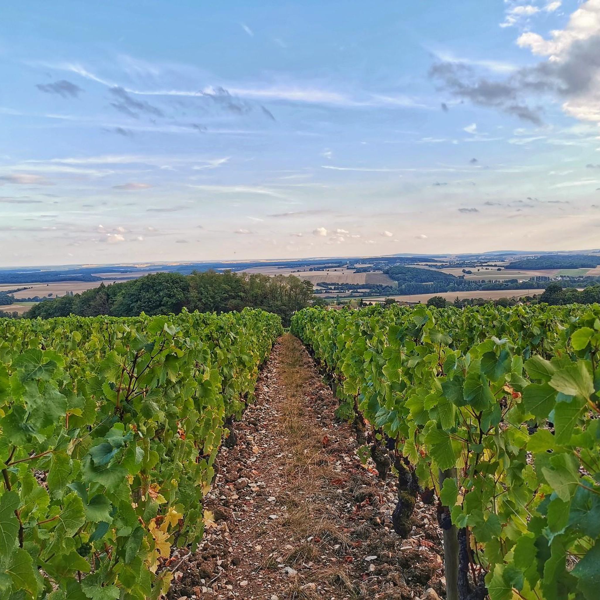
Road cycling around Saint-Céols features routes through the rural French countryside, connecting small villages and cultural sites. The terrain typically includes rolling hills and agricultural land, with moderate elevation changes suitable for road bikes. Cyclists can expect to pass through areas with open fields and occasional wooded sections, offering varied scenery.
Best road cycling routes around Saint-Céols
- The most popular road cycling route is Saint-Germain Collegiate Church – Gibjoncs Landscape Park loop from Les Aix-d'Angillon, a 26.1 miles (41.9 km) trail that takes 1 hour 54 minutes to complete. This moderate route features rolling terrain and passes through varied rural landscapes.
- Another top favourite among local road cyclists is Morogues church – La Borne, potters' village loop from Morogues, a moderate 21.7 miles (34.9 km) path. This route includes a visit to La Borne, a historic potters' village, and offers views of the surrounding countryside.
- Local road cyclists also love the La Borne, potters' village – Morogues church loop from Aubinges, a 20.7 miles (33.3 km) trail leading through agricultural fields and small hamlets, often completed in about 1 hour 31 minutes.
- Road cycling around Saint-Céols is defined by its rural landscapes, connecting historic villages and cultural sites like La Borne, the potters' village. The network offers options for different ability levels, from easy to challenging road cycling routes.
- The routes in Saint-Céols are highly rated by the komoot community with an average score of 4.5 stars from over 8 reviews. More than 90 road cyclists have used komoot to explore Saint-Céols's varied terrain.
Last updated: August 27, 2026
29
riders
119km
05:21
1,090m
1,090m
Hard road ride. Very good fitness required. Mostly well-paved surfaces and easy to ride.
6
riders
Moderate road ride. Great for any fitness level. Some segments of this route may be unpaved and difficult to ride.

Sign up for free
4
riders
Easy road ride. Great for any fitness level. Mostly well-paved surfaces and easy to ride.
5.0
(2)
4
riders
Moderate road ride. Good fitness required. Mostly well-paved surfaces and easy to ride.
4
riders
51.9km
02:25
600m
600m
Moderate road ride. Good fitness required. Mostly well-paved surfaces and easy to ride.
Get access to more routes and recommendations from other explorers.
Sign up for free
Already have an account?
Our route recommendations are based on thousands of hikes, rides, and runs completed by other people on komoot.
Start today with a free account
Your next adventure awaits.
Login or Signup



Tips from the Community

This church dates from the 12th century. It was restored around 1600 and then remodeled in the 18th century. The church's bell tower was listed as a historical monument by decree of October 22, 1913. The bell tower was struck by lightning in 2019, damaging the spire. Repairs were approved by the municipality in 2021. The 19th-century bells were also listed as historical monuments that same year.
0
0


Rivers and canals crisscross the country, the latter in particular being a crucial part of the transport infrastructure in earlier times. Later, first rail, and later again trucks, took over the task of transporting goods. In the competition between different modes of transport, they were faster and cheaper than barges – and thus more efficient. When building the artificial waterways, however, it had to be taken into account that differences in elevation always had to be overcome, and so locks are often lined up along the canals – at varying intervals, depending on the local situation. Only with their help was shipping possible.
0
0
It is presumably a former "chemin de halage" (in German "treidelpfad" or "leinpfad"), which runs alongside the canal's bed. In earlier times, such a path was an essential part of the transport infrastructure. Before ships could be powered by motors, horses walked along the bank, pulling the boat against the current. This was called "treideln" (pulling), and this is how the towpaths got their name, which has been passed down to this day. Where these paths, which run close to the bank, have been preserved, they are popular with hikers, walkers, joggers, and cyclists.
1
0

The trip along the canal is a meditation - at least as relaxing as one.
1
0

Romanesque church from the 12th century, remodeled in the 19th century. Of the old building, only the choir remains.
0
0
Frequently Asked Questions
How many road cycling routes are available around Saint-Céols?
There are over 30 road cycling routes around Saint-Céols, offering a variety of options for different skill levels and preferences.
What is the general terrain like for road cycling in Saint-Céols?
The terrain around Saint-Céols typically features rolling hills and agricultural land, characteristic of the rural French countryside. You can expect moderate elevation changes, making it suitable for road bikes, with varied scenery including open fields and occasional wooded sections.
Are there routes suitable for beginners or less experienced road cyclists?
Yes, Saint-Céols offers several routes suitable for beginners. There are 7 easy road cycling routes available, providing a gentle introduction to the region's beautiful landscapes.
Are there challenging road cycling routes for experienced riders?
While the majority of routes are moderate, there are 2 difficult road cycling routes for those seeking a greater challenge. These routes will feature more significant elevation changes and longer distances.
What cultural or historical sites can I visit while road cycling near Saint-Céols?
You can explore several interesting sites. For instance, the route Morogues church – La Borne, potters' village loop from Morogues includes a visit to La Borne, a historic potters' village, known for its ceramic creation. Other nearby attractions include Pesselières Castle and the Saint-Aignan Church of Veaugues.
What do other cyclists say about road cycling in Saint-Céols?
The road cycling routes in Saint-Céols are highly rated by the komoot community, with an average score of 4.5 stars from over 8 reviews. More than 90 road cyclists have used komoot to explore the varied terrain, often praising the rural landscapes and connection to historic villages.
Are there any circular road cycling routes in the area?
Yes, many of the road cycling routes around Saint-Céols are designed as loops, allowing you to start and finish at the same point. Examples include the Saint-Germain Collegiate Church – Gibjoncs Landscape Park loop from Les Aix-d'Angillon and the La Borne, potters' village – Morogues church loop from Aubinges.
What kind of elevation changes can I expect on road cycling routes here?
The routes generally feature moderate elevation changes, typical of rolling hills. For example, the Saint-Germain Collegiate Church – Saint-Palais loop from Les Aix-d'Angillon has an ascent of around 424 meters, while the Saint-Germain Collegiate Church – La Borne, potters' village loop from Les Aix-d'Angillon involves about 325 meters of climbing.
How long do road cycling routes typically take in Saint-Céols?
Route durations vary depending on length and difficulty. For instance, the Saint-Germain Collegiate Church – Gibjoncs Landscape Park loop from Les Aix-d'Angillon typically takes about 1 hour 54 minutes, while the Morogues church – La Borne, potters' village loop from Morogues takes around 1 hour 40 minutes.
What is the best time of year for road biking in Saint-Céols?
While specific seasonal details are not provided, regions with rolling hills and agricultural landscapes like Saint-Céols are generally best enjoyed in spring and early autumn when temperatures are mild and the scenery is vibrant. Summer can also be pleasant, though it might be warmer.
Are there scenic viewpoints along the road cycling routes?
The routes often offer views of the surrounding countryside, agricultural fields, and charming small villages. While specific named viewpoints are not detailed, the varied rural landscapes provide many picturesque moments, including views of highlights like Trail above Morue🤗.
Can I find places to eat or drink along the road cycling routes?
The routes connect small villages, which often have local cafes or small shops where you can stop for refreshments. Planning your route to pass through these villages will ensure opportunities for breaks and local experiences.
Most popular attractions around Saint-Céols

Get inspired with the komoot mobile app


Explore more
Browse the best Road cycling routes in other regions.
