The best walks and hikes around Montmelas-Saint-Sorlin
4.6
(740)
4,150
hikers
21
hikes
Hiking around Montmelas-Saint-Sorlin offers diverse landscapes characterized by picturesque Beaujolais vineyards and rolling hills. The region is part of the "Pays des Pierres Dorées," featuring distinctive golden-hued stone in its architecture and natural surroundings. Hikers can explore forests and moors, with panoramic views of the Saône Valley and, on clear days, the distant Alps and Mont Blanc. The terrain includes varied elevation changes, providing options from gentle strolls to more challenging treks.
Best hiking trails around Montmelas-Saint-Sorlin
- The most popular…
Last updated: October 10, 2026
4.9
(7)
50
hikers
4.12km
01:15
140m
140m
Easy hike. Great for any fitness level. Easily-accessible paths. Suitable for all skill levels.
4.6
(5)
34
hikers
8.77km
02:40
280m
280m
Moderate hike. Good fitness required. Easily-accessible paths. Suitable for all skill levels.

5.0
(1)
38
hikers
13.8km
04:13
470m
470m
Moderate hike. Good fitness required. Easily-accessible paths. Suitable for all skill levels.
4.9
(8)
29
hikers
11.0km
03:18
350m
350m
Moderate hike. Good fitness required. Easily-accessible paths. Suitable for all skill levels.
5.0
(1)
70
hikers
3.26km
00:53
40m
40m
Easy hike. Great for any fitness level. Easily-accessible paths. Suitable for all skill levels.
Get access to more routes and recommendations from other explorers.
Already have an account?
Our route recommendations are based on thousands of hikes, rides, and runs completed by other people on komoot.
Start today with a free account
Your next adventure awaits.

Tips from the Community

Ridden over D20, from Le Parasoir. Short, one-way climb.
0
0

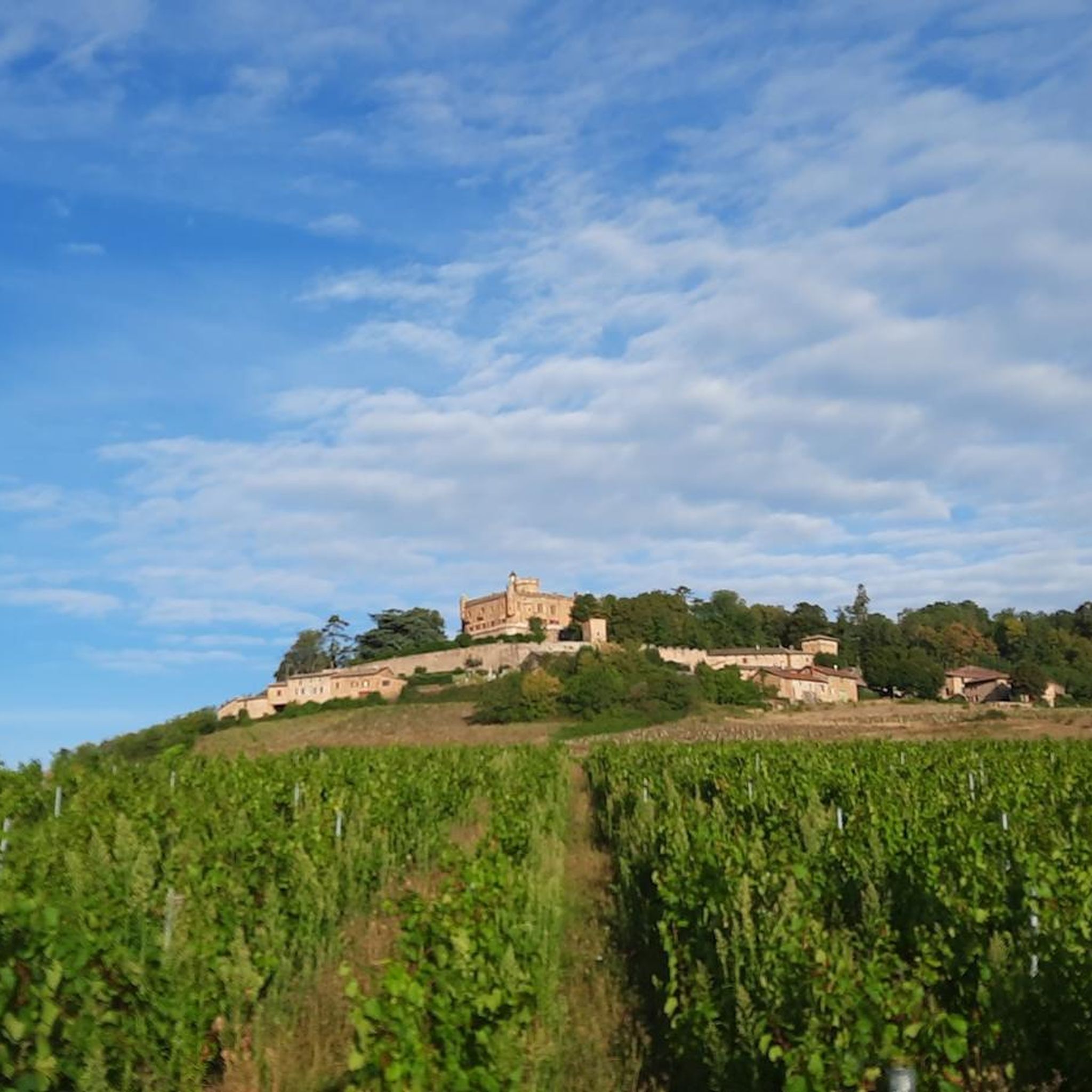
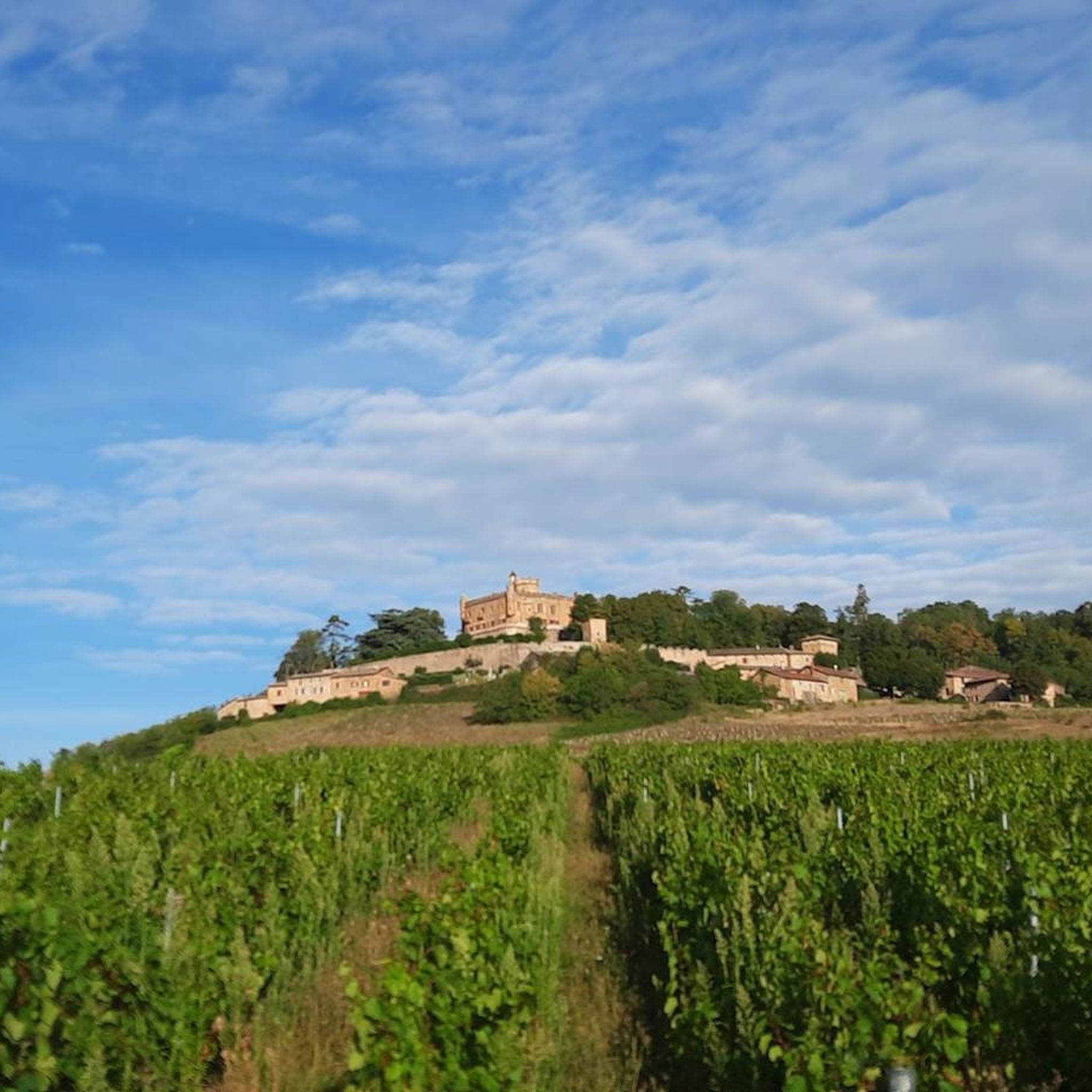
Its existence has been traced back to 1225.
0
0

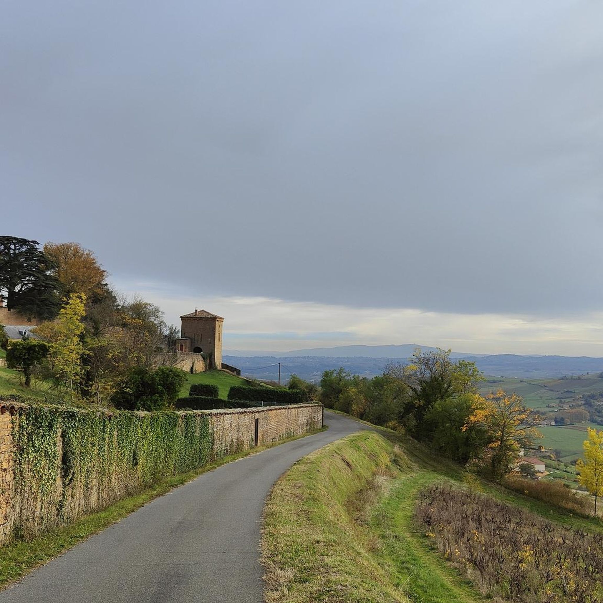
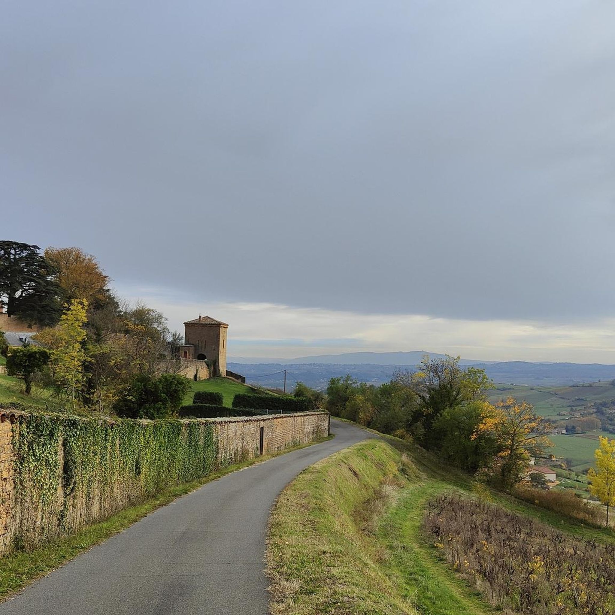
beautiful view of the Beaujolais
0
0

Magnificent castle in the commune of Montmelas St Sorlin
0
0
very much better clockwise
2
0

The Col de Saint-Bonnet, located in the heart of the Alps, offers a spectacular panorama of the surrounding mountains and green valleys. This pass, perched at an altitude of 1,499 metres, is a favourite passage for hikers and cyclists in search of magnificent landscapes. As you climb the slopes of the pass, the view gradually opens up onto the Alpine peaks, forests and flowery meadows.
0
3

The Saint-Bonnet signal peaks at 676 meters. The place offers beautiful panoramas over Montmelas, then over the vineyard and the Beaujolais mountains. At the top is a 12th century chapel, of Romanesque architecture. It is dedicated to Saint Bonnet, bishop of Clermont in the 8th century. It was a place of pilgrimage to cure gout and headaches.
1
0
Frequently Asked Questions
How many hiking trails are available in Montmelas-Saint-Sorlin?
There are over 18 hiking trails around Montmelas-Saint-Sorlin, offering a variety of experiences from easy strolls to more challenging treks. You'll find options suitable for different fitness levels.
What types of landscapes can I expect to see while hiking in Montmelas-Saint-Sorlin?
The region is characterized by picturesque Beaujolais vineyards, rolling hills, and expansive panoramic views. You can expect to see the Saône Valley, and on clear days, even the distant Alps and Mont Blanc. The area is also known as the 'Pays des Pierres Dorées' due to its distinctive golden-hued stone architecture.
Are there any easy, family-friendly hiking options in Montmelas-Saint-Sorlin?
Yes, there are 7 easy routes available. For a family-friendly experience, consider the nature trail developed by the local village school, which features educational equipment and an ornithological observatory for birdwatching. While not listed as a specific komoot route, it offers an engaging experience for all ages. For a short, easy hike, the Way of Assisi: Signal de Saint-Bonnet Loop is a great option.
What are some notable landmarks or attractions to see along the hiking trails?
Many trails offer views of significant landmarks. The 12th-century Romanesque Chapel of Saint-Bonnet is a historical monument and former pilgrimage site, offering spectacular panoramic views. You can also see the impressive Montmelas Castle, a historic castle still inhabited by the same family since 1566. The nearby medieval village of Oingt is also a charming stop with superb views.
Are there any circular hiking routes in the area?
Yes, many of the trails in Montmelas-Saint-Sorlin are circular. For a moderate loop with varied terrain, you could explore the La Chapelle de Chevennes loop from Montmelas-Saint-Sorlin, which covers approximately 11.3 km.
What do other hikers say about the trails in Montmelas-Saint-Sorlin?
The routes in Montmelas-Saint-Sorlin are highly rated by the komoot community, with an average score of 4.6 stars from over 600 reviews. Hikers often praise the diverse terrain, the stunning vineyard views, and the well-maintained paths that cater to various skill levels.
Are there any longer, more challenging hikes for experienced hikers?
Yes, for those seeking longer excursions with greater elevation changes, there are 10 moderate and 1 difficult route. The Col de la Croix du Ban - 440 m – Col du Failly loop from Montmelas-Saint-Sorlin is a moderate 14.8 km trail that offers elevated perspectives of the Saône valley and the Alps, typically taking around 4 hours 27 minutes to complete.
What kind of views can I expect from the higher points in the region?
From elevated points like the Signal de Saint-Bonnet (690 meters altitude) and Crêt de Charnat, you can enjoy inspiring panoramic views of the Beaujolais vineyards, the Beaujolais mountains, the Saône Valley, and on clear days, even the distant Alps and Mont Blanc.
Is there parking available near the trailheads in Montmelas-Saint-Sorlin?
While specific parking locations for each trailhead are not detailed here, Montmelas-Saint-Sorlin is a village, and parking is generally available in or near the village center, often close to starting points for local loops. It's advisable to check local signage upon arrival.
Are there any specific trails that offer views of the 'Pays des Pierres Dorées' architecture?
Many trails in the region will naturally pass through or offer views of the distinctive golden-hued stone architecture characteristic of the 'Pays des Pierres Dorées'. The village of Montmelas-Saint-Sorlin itself, and nearby villages like Oingt, showcase this unique style, which can be appreciated on most local walks.
What is the typical duration for a moderate hike in Montmelas-Saint-Sorlin?
Moderate hikes in Montmelas-Saint-Sorlin can vary in duration depending on their length and elevation gain. For example, the Col de Saint-Bonnet – Saint-Bonnet Pass loop from Montmelas-Saint-Sorlin, which is 7.1 km long with 255 meters of elevation gain, typically takes around 2 hours and 11 minutes to complete.
Most popular routes around Montmelas-Saint-Sorlin
Most popular attractions around Montmelas-Saint-Sorlin

Get inspired with the komoot mobile app


Explore more
Browse the best Hikes in other regions.
