The best mountain hikes around Montegrosso
4.5
(26)
133
hikers
9
hikes
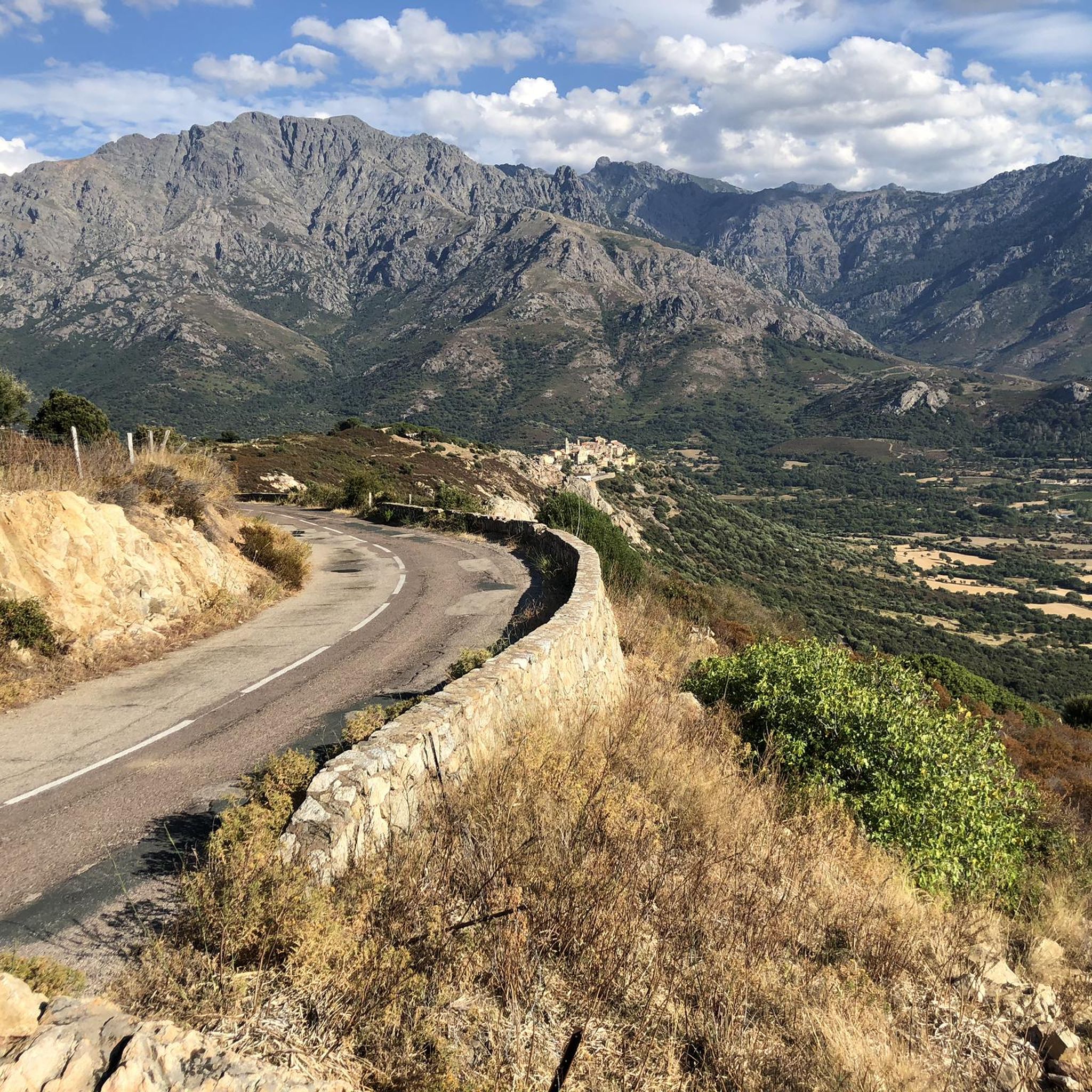
Mountaineering routes around Montegrosso, located in Haute-Corse, France, are characterized by a rugged, alpine environment. The region features prominent peaks such as Monte Grosso, with elevations reaching 1,937 meters (6,355 ft), offering steep slopes and natural rock formations. This area provides diverse botanical zones that change with elevation, presenting challenging terrain for experienced mountaineers. The landscape includes the Bonifatu Valley, known for its steep ascents and high-altitude hiking opportunities.
Best mountaineering routes around Montegrosso
- The most popular mountaineering route is…
Last updated: August 17, 2026
4.9
(7)
43
hikers
10.4km
04:43
660m
660m
Hard mountaineering route. Good fitness required. Sure-footedness, sturdy shoes and alpine experience required.
3.5
(2)
10
hikers
7.58km
03:26
460m
460m
Hard mountaineering route. Good fitness required. Sure-footedness, sturdy shoes and alpine experience required.

Sign up for free
9
hikers
14.0km
06:47
1,000m
1,000m
Hard mountaineering route. Very good fitness required. Mostly accessible paths. Sure-footedness required.
4.5
(2)
12
hikers
12.4km
05:13
670m
670m
Hard mountaineering route. Very good fitness required. Sure-footedness, sturdy shoes and alpine experience required.
5.0
(2)
4
hikers
Moderate mountaineering route. Good fitness required. Mostly accessible paths. Sure-footedness required.
Get access to more routes and recommendations from other explorers.
Sign up for free
Already have an account?
Our route recommendations are based on thousands of hikes, rides, and runs completed by other people on komoot.
Start today with a free account
Your next adventure awaits.
Login or Signup

Tips from the Community

fine bikes for a trip on two wheels
0
0

pretty here, very pretty
1
0

I did the loop in June 2025. It's generally a nice tour, but I highly recommend doing the large southern loop up to the church, including the single trail, in the opposite direction, so you go up the paved road and down the steep motocross section. Strangely enough, the original track above includes an additional loop where you also have to go up the single trail with a few short pushing sections and then return on a well-maintained forest road (not steep). Definitely do it in the opposite direction; then everything is rideable. By the way, I've also reported this to Komoot support. They might change the direction. I recommend doing the loop from Calvi to the church counterclockwise and the short loop at the top of the church clockwise. Have fun on this fantastic and varied loop.
0
0

Extraordinary panorama from the heights of Capu di a Conca above the Gulf of Calvi.
0
0

History Antiquity [Edit | Edit source text] Little is known about early historical settlement, but Phoenicians, Greeks and Etruscans already had settlements in the area of today's Calvi. The Romans built a settlement in the area of the lower town called Sinus Caesiae (possibly also Sinus Casalus), from which the current name Calvi is said to be derived; another source refers to the Latin word "calvus" for the place name of Calvi, which means "bald" and insofar as the name goes back to the originally uncultivated and uninhabited bare rock on which a citadel was later built. Middle Ages [Edit | Edit source text] After Saracen raids, Pisa, to whom Corsica was awarded by the Pope, occupied the city in the 11th century. After disputes between Pisa and the Republic of Genoa over ownership of the island, a turbulent period followed with alternating rule between Corsican nobles, Genoa and the Crown of Aragon. In 1278, the inhabitants of Calvi asked Genoa for support against the local nobles. Calvi thus fell under the influence of Genoa, which expanded the citadel of Calvi (and also that of Algajola), granted Calvi an autonomous status and granted the people of Calvi a number of privileges. The inhabitants thanked Genoa with loyalty, even during the struggle for independence. Even today, the Latin motto Civitas Calvi semper fidelis ("The city of Calvi is always loyal") can be seen at the entrance to the upper town. Modern times [Edit | Edit source text] In the 16th century, Calvi resisted attempts to conquer the city by the Corsican freedom fighter Sampiero Corso and his allies, the Turks and French. In the 18th century, there was a brief period of Corsican independence under Pascal Paoli, which ended with the French taking power. When Paoli attempted to bring Corsica back under his influence with the support of the Kingdom of Great Britain, Calvi was largely destroyed by the British fleet in 1793.
1
0
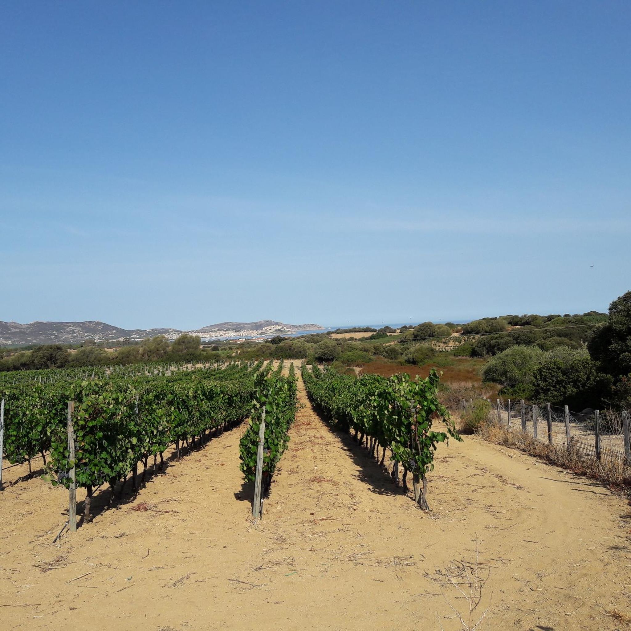
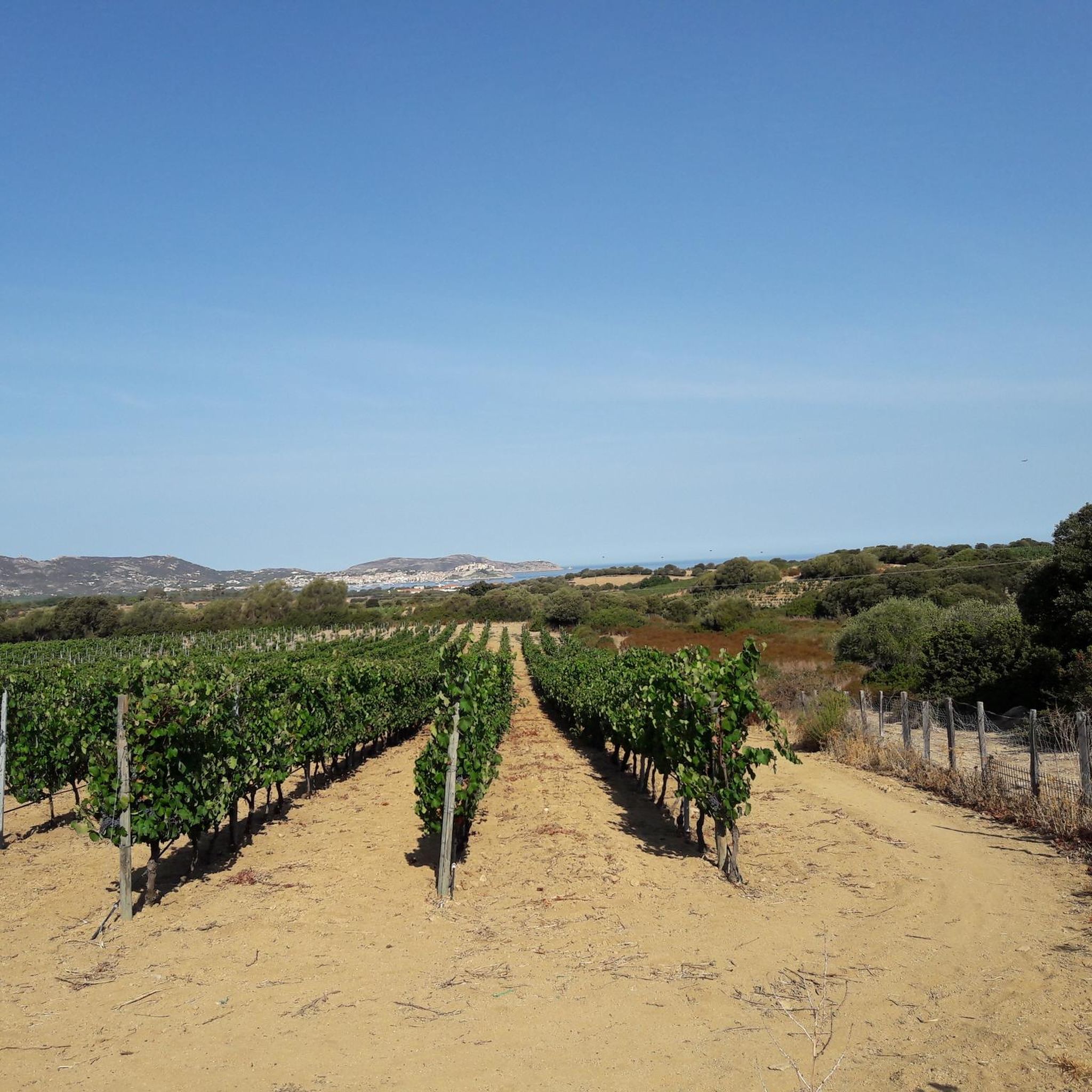
Calvi is located 95 km from Bastia and 24 km from L'Île-Rousse on the Gulf of Calvi. The city consists of the lower town, where the town hall, the market square and the important marina are located, and the upper town, which is dominated by the governor's palace and the citadel.
1
0
Calvi is a French port city on the northwest coast of Corsica and the capital of the Balagne region. With 5,746 inhabitants, it is the fifth largest municipality in Corsica. Calvi is located 95 km from Bastia and 24 km from L'Île-Rousse on the Gulf of Calvi. The city consists of the lower town, where the town hall, the market square and the important marina are located, and the upper town, which is dominated by the governor's palace and the citadel. There are seven ports in Corsica that are served by transport ships or ferries from the French (Marseille, Toulon, Nice) or Italian (Savona, Genoa, La Spezia, Livorno, Piombino) coasts and from Sardinia (Santa Teresa di Gallura, Porto Torres, Palau). These are L'Île-Rousse, Calvi, Propriano, Ajaccio, Bonifacio, Bastia and Porto-Vecchio. Ferry service in Calvi has now been suspended.
1
0
Frequently Asked Questions
How many mountaineering routes are available in the Montegrosso area?
There are 10 mountaineering routes around Montegrosso, offering a range of experiences from moderate to difficult. These routes are highly rated by the komoot community, with an average score of 4.4 stars.
What are the typical difficulty levels for mountaineering routes near Montegrosso?
The mountaineering routes around Montegrosso are primarily challenging. You'll find 3 moderate routes and 7 difficult routes, characterized by steep slopes and rugged mountain terrain. For example, the Capu d'Occi loop from Lumio is a moderate option, while the Capu di a Veta Summit loop from Calvi E Padule is considered difficult.
Are there any circular mountaineering trails in Montegrosso?
Yes, many of the routes in Montegrosso are circular. For instance, the popular Capu di a Veta Summit loop from Calvi E Padule and the View of the Corsican Mountains – Funtana of ortiventi loop from Calenzana are both circular routes, allowing you to start and end in the same location.
What kind of landscapes and natural features can I expect to see while mountaineering in Montegrosso?
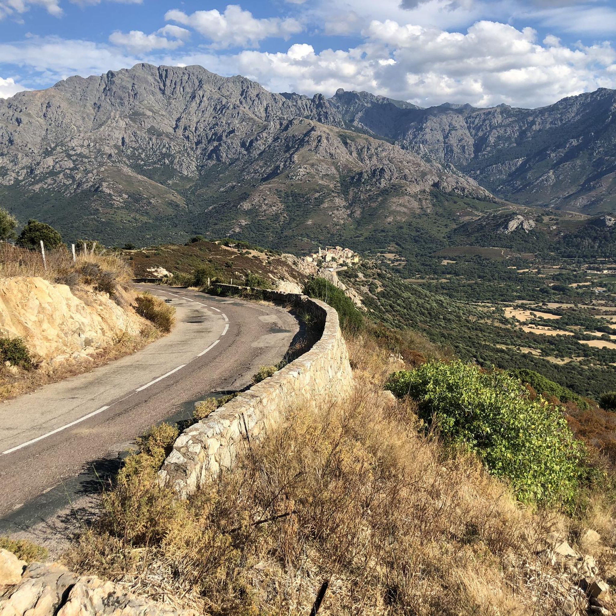
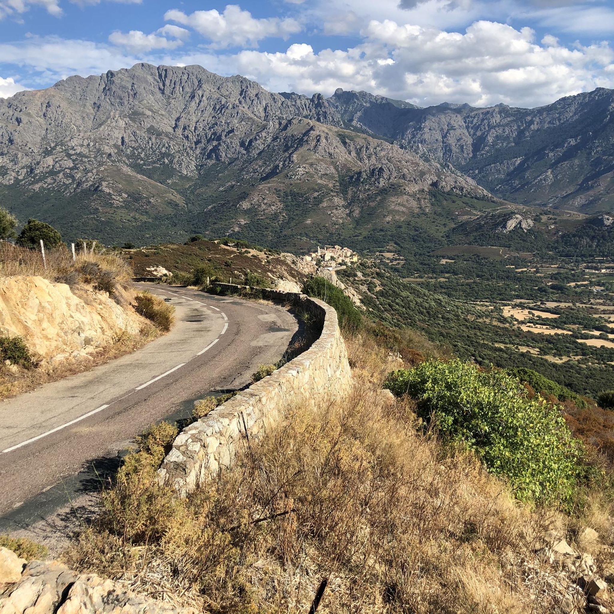
The Montegrosso area, located in Haute-Corse, France, offers a rugged, alpine environment. You'll encounter prominent peaks like Monte Grosso, steep slopes, and natural rock formations. The region also features diverse botanical zones that change with elevation, and the Bonifatu Valley is known for its steep ascents and high-altitude terrain. From certain points, you can enjoy panoramic views of the bay of Calvi.
What are some notable landmarks or attractions to see near the mountaineering routes?
Beyond the challenging trails, the area offers several points of interest. You can visit the charming village of Sant' Antonino, explore the historic Abandoned Village of Occi, or take in the views from La Revellata Lighthouse. For religious history, Our Lady of the Serra is also nearby.
What are the typical durations for mountaineering routes in Montegrosso?
Route durations vary depending on difficulty and length. For example, a moderate route like the Capu d'Occi loop from Lumio can be completed in about 2 hours 35 minutes. More challenging routes, such as the View of the Corsican Mountains – Funtana of ortiventi loop from Calenzana, can take around 6 hours 52 minutes due to their length and significant elevation gain.
What do other mountaineers enjoy most about the Montegrosso routes?
The routes in Montegrosso are highly rated by the komoot community, with an average score of 4.4 stars from over 20 reviews. Mountaineers often praise the challenging terrain, the rewarding panoramic views from summits like Capu di a Veta, and the rugged alpine environment that provides a true test of skill.
Are there any routes suitable for advanced mountaineers seeking a significant challenge?
Yes, the Montegrosso area is well-suited for advanced mountaineers. Routes like the View of the Corsican Mountains – Funtana of ortiventi loop from Calenzana offer over 3,300 feet of elevation gain across 8.8 miles (14.2 km) of rugged mountain terrain, providing a substantial challenge for experienced climbers.
What is the best time of year for mountaineering in Montegrosso?
Given the alpine environment and high elevations, the best time for mountaineering in Montegrosso is typically during the warmer months, from late spring to early autumn. This period generally offers more stable weather conditions and less snow, making the trails more accessible. Always check local weather forecasts before heading out, as mountain conditions can change rapidly.
Are there any specific peaks or viewpoints worth seeking out in the Montegrosso area?
Absolutely. The region boasts several impressive peaks and viewpoints. You can aim for the Panoramic view of Calvi and the Revellata lighthouse, enjoy the expansive Panorama of the Bonifatu valley, or reach Bocca di Battaglia (1010 m) for stunning vistas. The View from Capu d'Occi is also highly recommended.
What kind of wildlife might I encounter on the mountaineering trails?
The rugged alpine environment of Montegrosso supports diverse wildlife. While specific sightings are never guaranteed, you might encounter various bird species, including raptors soaring above the peaks. Keep an eye out for local mountain fauna adapted to these high-altitude conditions. Respecting their habitat and maintaining a quiet presence will increase your chances of observing them.
Are there any routes that start from specific locations like Calvi or Lumio?
Yes, several routes conveniently start from nearby towns. For example, you can embark on the Capu di a Veta Summit loop from Calvi E Padule, or explore the Capu d'Occi loop from Lumio. Another option is the Capu di a Veta Summit loop from Notre-Dame della Serra.
Most popular routes around Montegrosso
Most popular attractions around Montegrosso

Get inspired with the komoot mobile app


Explore more
Browse the best Mountain Hikes & Routes in other regions.
