The best running trails around Salles-Arbuissonnas-En-Beaujolais
4.5
(175)
8,796
runners
312
runs
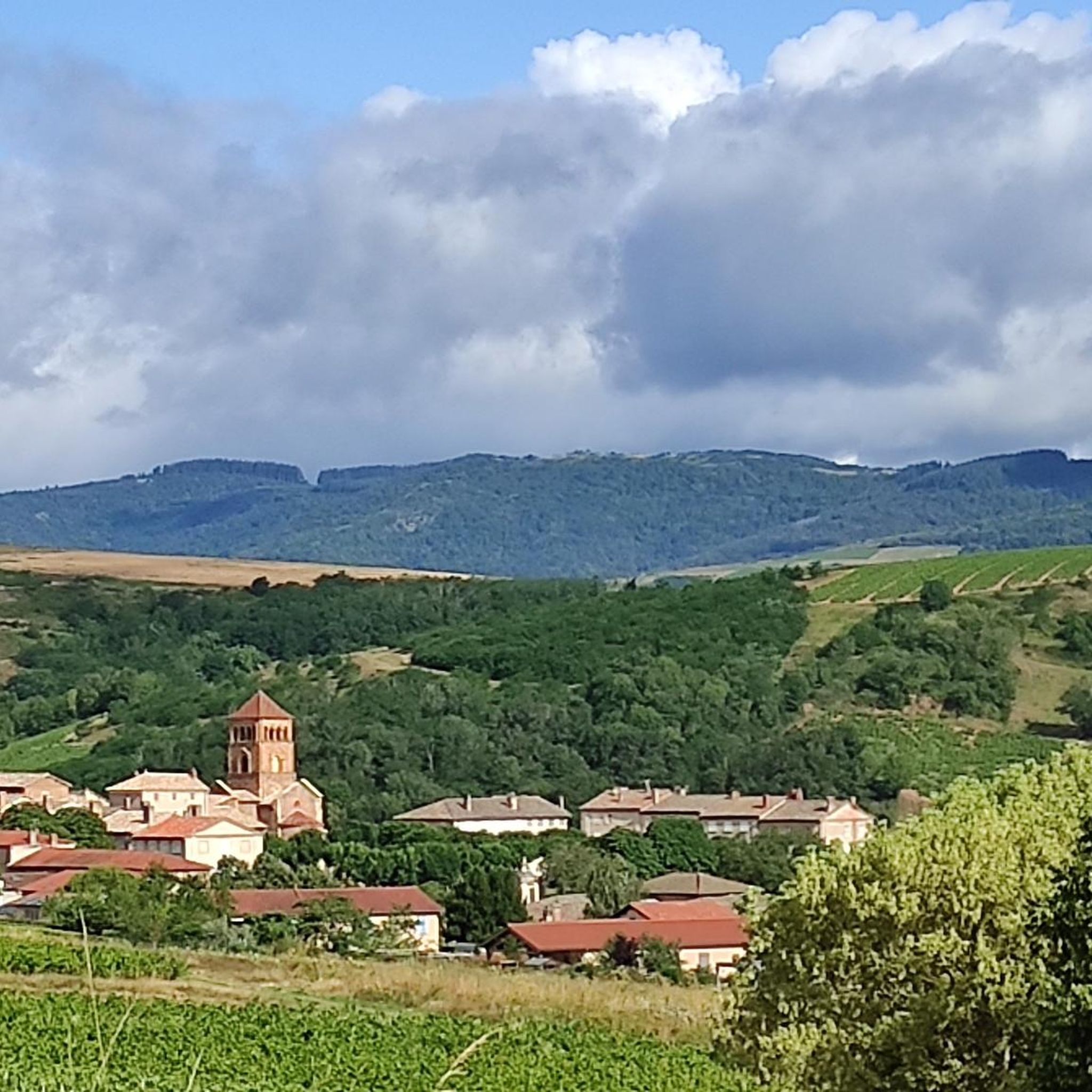
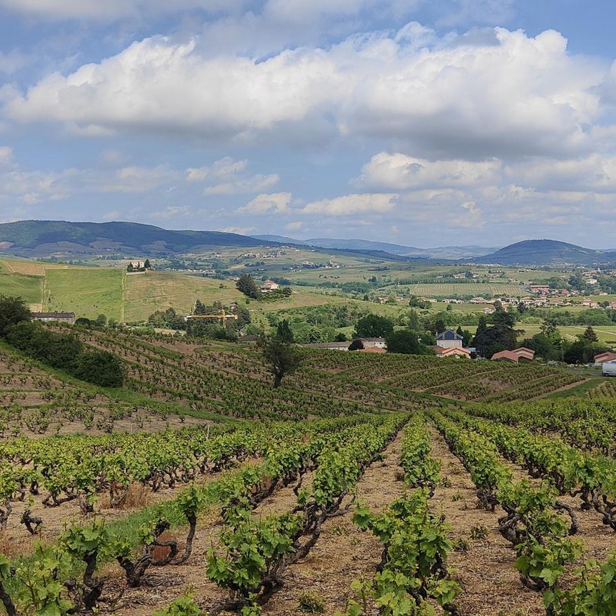
Jogging around Salles-Arbuissonnas-En-Beaujolais offers diverse terrain within the Beaujolais wine region. The area is characterized by rolling hills, expansive vineyards, and varied topography, providing a mix of ascents and descents. Runners can explore paths winding through vineyards, shaded forest trails, and unpaved "chemins de terre." This landscape, part of the Beaujolais UNESCO Global Geopark, features diverse geology and offers panoramic views.
Best jogging routes around Salles-Arbuissonnas-En-Beaujolais
- The most popular jogging route is Departure Salles loop from Salles, a 7.4…
Last updated: October 22, 2026
4.5
(4)
51
runners
12.0km
01:29
300m
300m
Hard run. Very good fitness required. Mostly paved surfaces. Suitable for all skill levels.
4.0
(1)
39
runners
22.3km
02:51
700m
700m
Hard run. Very good fitness required. Mostly paved surfaces. Suitable for all skill levels.

5.0
(1)
20
runners
10.5km
01:14
120m
120m
Moderate run. Good fitness required. Mostly paved surfaces. Suitable for all skill levels.
20
runners
16.5km
02:09
510m
510m
Hard run. Very good fitness required. Mostly paved surfaces. Suitable for all skill levels.
11
runners
20.3km
02:19
490m
490m
Hard run. Very good fitness required. Mostly paved surfaces. Suitable for all skill levels.
Get access to more routes and recommendations from other explorers.
Already have an account?
Our route recommendations are based on thousands of hikes, rides, and runs completed by other people on komoot.
Start today with a free account
Your next adventure awaits.
Popular around Salles-Arbuissonnas-En-Beaujolais

Tips from the Community

Ridden over D20, from Le Parasoir. Short, one-way climb.
0
0

Magnificent castle in the commune of Montmelas St Sorlin
0
0
very much better clockwise
2
0

The Col de Saint-Bonnet, located in the heart of the Alps, offers a spectacular panorama of the surrounding mountains and green valleys. This pass, perched at an altitude of 1,499 metres, is a favourite passage for hikers and cyclists in search of magnificent landscapes. As you climb the slopes of the pass, the view gradually opens up onto the Alpine peaks, forests and flowery meadows.
0
3

The Saint-Bonnet signal peaks at 676 meters. The place offers beautiful panoramas over Montmelas, then over the vineyard and the Beaujolais mountains. At the top is a 12th century chapel, of Romanesque architecture. It is dedicated to Saint Bonnet, bishop of Clermont in the 8th century. It was a place of pilgrimage to cure gout and headaches.
1
0
Single a little technical, be careful ⚠️ walking 3/4 of the route which can be avoided by going to the right
0
0
Many trails to go to St Bonnet or Mad Rock, among others.
0
0
Frequently Asked Questions
How many running routes are available in Salles-Arbuissonnas-En-Beaujolais?
Salles-Arbuissonnas-En-Beaujolais offers a wide variety of running routes, with over 340 options listed on komoot. These include approximately 19 easy routes, 195 moderate routes, and 128 difficult routes, catering to all fitness levels.
What kind of terrain can I expect on running trails in Salles-Arbuissonnas-En-Beaujolais?
The region is characterized by diverse terrain, including paths winding through expansive vineyards, rolling hills with varied ascents and descents, and shaded forest trails. Many routes feature unpaved "chemins de terre" (dirt paths), which are ideal for reducing impact while running. The landscape is part of the Beaujolais UNESCO Global Geopark, offering visually rewarding panoramic views.
Are there challenging trail running options in Salles-Arbuissonnas-En-Beaujolais?
Yes, for experienced trail runners seeking a challenge, there are numerous difficult routes. One notable option is the Montmelas Castle – Col de Saint-Bonnet loop from Salles, a demanding 22.2 km path with significant elevation gain, passing near historical landmarks.
Are there easy jogging routes suitable for beginners in the area?
Absolutely. While the region is known for its rolling hills, there are around 19 easy routes perfect for beginners or those looking for a more relaxed run. These often traverse vineyard-lined paths with gentle inclines, providing a scenic and accessible experience.
What can I see along the jogging routes in Salles-Arbuissonnas-En-Beaujolais?
Many running routes offer opportunities to explore historical and natural landmarks. You might pass by the historic Montmelas Castle or the Romanesque cloister in Salles-Arbuissonnas. The trails also lead through picturesque vineyards and offer expansive views of the Beaujolais countryside, with various geological 'geosites' to discover as part of the UNESCO Global Geopark.
Are there any circular running routes in Salles-Arbuissonnas-En-Beaujolais?
Yes, many of the running paths in the region are circular, allowing you to start and finish at the same point. For example, the Departure Salles loop from Salles is a 11.9 km challenging route that navigates through the region's characteristic rolling hills.
What do other runners enjoy the most about jogging in Salles-Arbuissonnas-En-Beaujolais?
The running routes in Salles-Arbuissonnas-En-Beaujolais are highly rated by the komoot community, with an average score of 4.5 stars from over 130 reviews. Runners frequently praise the stunning vineyard landscapes, the varied terrain that offers both physical challenge and natural beauty, and the well-maintained dirt paths.
Can I find running routes that pass through vineyards?
Yes, the Beaujolais wine region is famous for its vineyards, and many running routes are specifically designed to wind through them. These vineyard-lined paths offer a unique and picturesque backdrop for your run, often featuring gentle to moderate inclines.
Are there any running routes that offer views of castles or historical sites?
Indeed. The region is rich in history, and several running routes provide glimpses of historical landmarks. The Montmelas Castle – Col de Saint-Bonnet loop from Salles, for instance, passes near the impressive Montmelas Castle, allowing you to combine your run with cultural exploration.
What is the best time of year for running in Salles-Arbuissonnas-En-Beaujolais?
The Beaujolais region is beautiful year-round, but spring and autumn are particularly pleasant for running. In spring, the vineyards burst with new growth, and in autumn, the foliage offers stunning colors. Summers can be warm, making early morning or late afternoon runs ideal, while winters are generally mild enough for outdoor activity, especially on less exposed trails.
Are there running routes suitable for families in Salles-Arbuissonnas-En-Beaujolais?
While specific 'family-friendly' routes are not explicitly detailed, the presence of 19 easy routes suggests options suitable for families or those with younger runners. These routes often feature less strenuous terrain, such as the accessible dirt paths through vineyards, allowing for a pleasant shared experience.
Where can I find parking for running trails in Salles-Arbuissonnas-En-Beaujolais?
Many running routes in the region, especially those starting from villages like Salles-Arbuissonnas, typically have designated parking areas nearby. It's advisable to check the specific route details on komoot or local tourism websites for precise parking information at your chosen starting point.
Most popular routes around Salles-Arbuissonnas-En-Beaujolais
Most popular attractions around Salles-Arbuissonnas-En-Beaujolais

Get inspired with the komoot mobile app


Explore more
Browse the best Running Trails & Routes in other regions.
