The best walks and hikes around Bois-Bernard
4.5
(739)
4,214
hikers
187
hikes
Hiking around Bois-Bernard offers exploration of a rural landscape characterized by agricultural fields and gentle terrain. The commune, situated in the Pas-de-Calais department, features an elevation ranging from 41 to 70 meters, providing mostly flat or gently undulating paths. This area is integrated into broader regional hiking circuits, allowing for peaceful walks through the countryside. The landscape also holds historical significance, shaped by past events and agricultural use.
Best hiking trails around Bois-Bernard
- The most popular hiking route is The…
Last updated: June 26, 2026
5.0
(1)
31
hikers
2.56km
00:39
10m
10m
Easy hike. Great for any fitness level. Easily-accessible paths. Suitable for all skill levels.
4.0
(3)
14
hikers
20.1km
05:11
100m
100m
Hard hike. Very good fitness required. Easily-accessible paths. Suitable for all skill levels.

Sign up for free
9
hikers
10.5km
02:41
30m
30m
Moderate hike. Good fitness required. Easily-accessible paths. Suitable for all skill levels.
5.0
(1)
18
hikers
6.45km
01:40
30m
30m
Easy hike. Great for any fitness level. Easily-accessible paths. Suitable for all skill levels.
7
hikers
8.04km
02:03
30m
30m
Moderate hike. Good fitness required. Easily-accessible paths. Suitable for all skill levels.
Get access to more routes and recommendations from other explorers.
Sign up for free
Already have an account?
Our route recommendations are based on thousands of hikes, rides, and runs completed by other people on komoot.
Start today with a free account
Your next adventure awaits.
Login or Signup


Tips from the Community


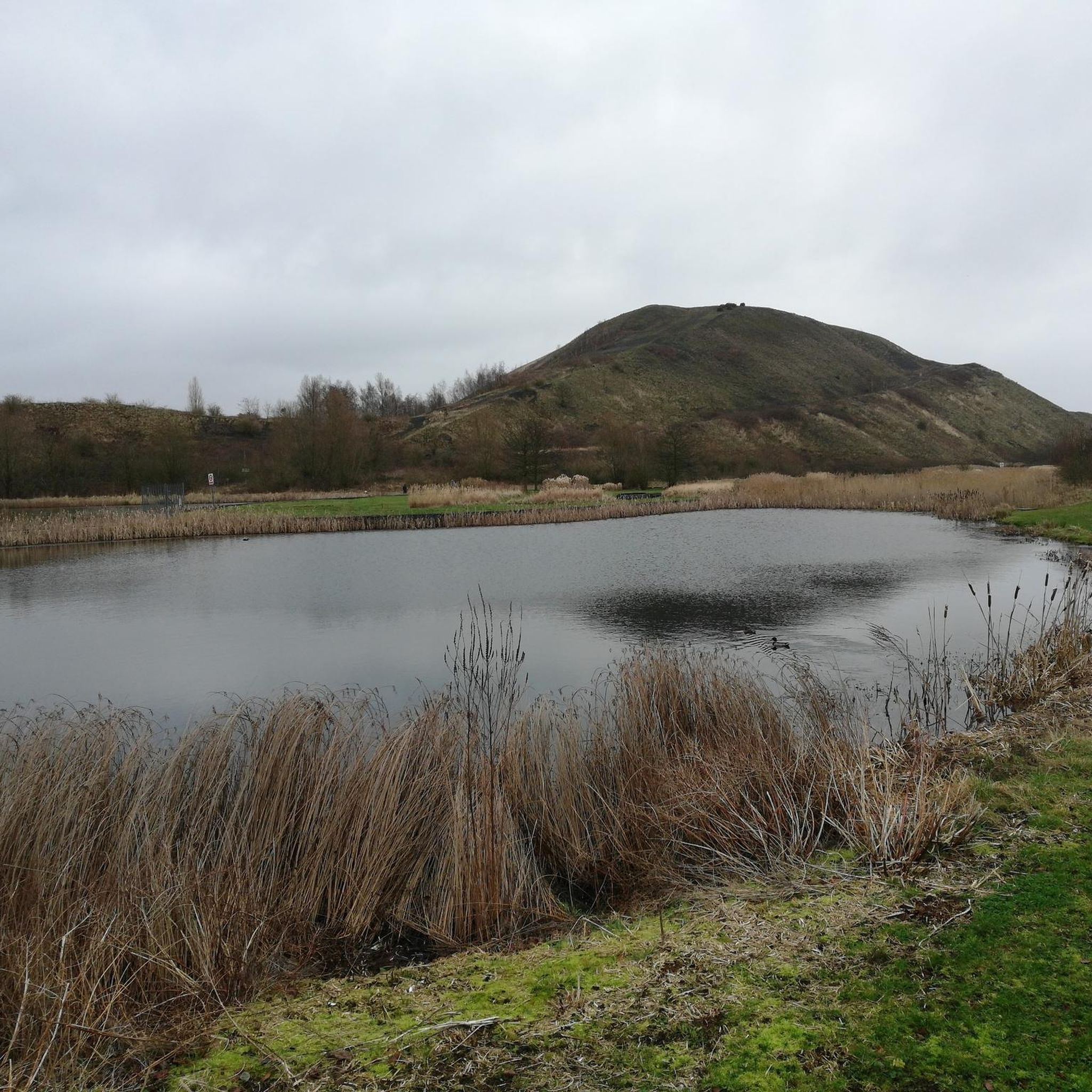
This viewpoint is located at the top of an old mining slag heap in the Parc de la Glissoire, a 55-hectare park which offers various activities such as fishing, canoeing and playgrounds. From the belvedere, you can enjoy a panoramic view of the landscape, in particular of the twin slag heaps of Loos-en-Gohelle, listed as a UNESCO world heritage site. The Parc des glissoires viewpoint is a privileged place to discover the beauty and diversity of the Pas-de-Calais region.
3
0

Crossed by the EV5, the V31..... The Parc de la Glissoire is a park located in the communes of Avion and Lens, along the Lens-Arras road axis. It takes its name from the river that once fed the ponds. It covers 55 hectares. There are 10 kilometers of trails, 8,000 trees and shrubs. Wikipedia
0
0

New belvedere with several points of view
3
0
Frequently Asked Questions
What kind of terrain can I expect on hikes around Bois-Bernard?
Hikes around Bois-Bernard feature a rural landscape dominated by agricultural fields and gentle terrain. The elevation ranges from 41 to 70 meters, meaning paths are mostly flat or gently undulating, suitable for relaxed walks through the countryside. You'll find a mix of open fields and some forested areas, as seen on routes like the Trail and Stairway in the Forest loop from Puits n° 7.
Are there many hiking trails available in the Bois-Bernard area?
Yes, the Bois-Bernard area offers a wide selection of routes. There are over 190 hiking trails available, catering to various preferences and fitness levels. These include 77 easy routes, 101 moderate paths, and 12 more challenging trails.
Are there any family-friendly hiking options near Bois-Bernard?
Absolutely. The gentle terrain and numerous easy routes make Bois-Bernard suitable for families. An excellent option is The Sculpture Island loop from Drocourt, which is an easy 4.1 km (2.5 miles) trail, perfect for a pleasant outing with children.
Can I bring my dog on the hiking trails in Bois-Bernard?
Many of the rural and agricultural paths around Bois-Bernard are suitable for walking with dogs. However, it's always recommended to keep your dog on a leash, especially when passing through agricultural fields or near livestock, and to check local regulations for specific trails or natural areas.
What are some interesting landmarks or natural features to see while hiking?
While Bois-Bernard itself is a farming village, the wider region offers historical and natural points of interest. You can explore sites related to World War I history, such as the Vimy Ridge Shell Craters or the Canadian National Vimy Memorial. For natural features, consider routes that pass by terrils (slag heaps) which offer unique viewpoints, like the View of the mining basin and the hills of Artois.
Are there circular walking routes available?
Yes, many of the hiking routes around Bois-Bernard are designed as loops, allowing you to start and end at the same point. Examples include Terril 81 – Lake loop from Méricourt and Forêt de l'Escrebieux – L'Escrebieux Stream loop from Quiéry-la-Motte, offering convenient options for exploration.
What is the best time of year to go hiking in Bois-Bernard?
The rural landscape of Bois-Bernard is pleasant for hiking throughout much of the year. Spring and autumn offer comfortable temperatures and beautiful scenery, with blooming fields or changing foliage. Summer is also suitable, though it can be warmer. Winter hikes are possible, but paths might be muddy, especially in agricultural areas.
What do other hikers enjoy most about the trails in Bois-Bernard?
The trails in Bois-Bernard are highly rated by the komoot community, with an average score of 4.5 stars from over 700 reviews. Hikers often praise the quiet rural settings, the peaceful agricultural landscapes, and the historical context of the region, which offers a unique blend of nature and history.
Are there any longer, more challenging hikes in the area?
While many routes are easy to moderate, there are options for longer hikes. For instance, the View from Terril 81 – Terril 81 loop from Billy-Montigny is a difficult 20.1 km (12.5 miles) trail, offering a more extended challenge with varied elevation.
Is public transport available to access hiking trailheads around Bois-Bernard?
Bois-Bernard is primarily a farming village, and while local bus services might connect it to larger towns, direct public transport access to specific trailheads can be limited. It's advisable to check local bus schedules and routes in advance if you plan to rely on public transport for reaching your starting point.
Where can I find parking for hiking trails near Bois-Bernard?
As Bois-Bernard is a rural area, parking is generally available in or near the villages that serve as starting points for hikes. Look for designated parking areas in towns like Drocourt, Méricourt, or Quiéry-la-Motte, which are common access points for the regional hiking circuits.
Most popular routes around Bois-Bernard
Most popular attractions around Bois-Bernard

Get inspired with the komoot mobile app


Explore more
Browse the best Hikes in other regions.
