The best walks and hikes around Wittersburg
4.5
(472)
1,874
hikers
92
hikes
Hiking around Wittersburg offers a network of trails through gentle terrain and varied landscapes. The region features paths winding through forests, past canals, and around local ponds. These routes provide accessible outdoor experiences with modest elevation changes, suitable for a range of abilities.
Best hiking trails around Wittersburg
- The most popular hiking route is Canal next to the campsite – Old oak loop from Altwiller, a moderate 11.1 miles (17.9 km) trail that takes 4 hours 41 minutes to…
Last updated: July 2, 2026
4.8
(90)
287
hikers
8.26km
02:07
40m
40m
Moderate hike. Good fitness required. Easily-accessible paths. Suitable for all skill levels.
5.0
(3)
11
hikers
17.9km
04:41
140m
140m
Moderate hike. Good fitness required. Easily-accessible paths. Suitable for all skill levels.

Sign up for free
4.0
(1)
16
hikers
9.01km
02:21
60m
60m
Moderate hike. Good fitness required. Easily-accessible paths. Suitable for all skill levels.
3.5
(2)
6
hikers
13.0km
03:23
90m
90m
Moderate hike. Good fitness required. Easily-accessible paths. Suitable for all skill levels.
5
hikers
12.8km
03:19
80m
80m
Moderate hike. Good fitness required. Easily-accessible paths. Suitable for all skill levels.
Get access to more routes and recommendations from other explorers.
Sign up for free
Already have an account?
Our route recommendations are based on thousands of hikes, rides, and runs completed by other people on komoot.
Start today with a free account
Your next adventure awaits.
Login or Signup

Tips from the Community

When I passed the ordeal was no longer there 🤷🏻♀️
1
0

A very beautiful sandstone cross from the 17th century.
1
0

Hirbach Pond blends history and nature. A remnant of the former aquatic Maginot Line, it is now a popular spot for outdoor recreation. Its municipal campsite, open from April to October, offers an ideal setting for a waterfront stay.
0
0

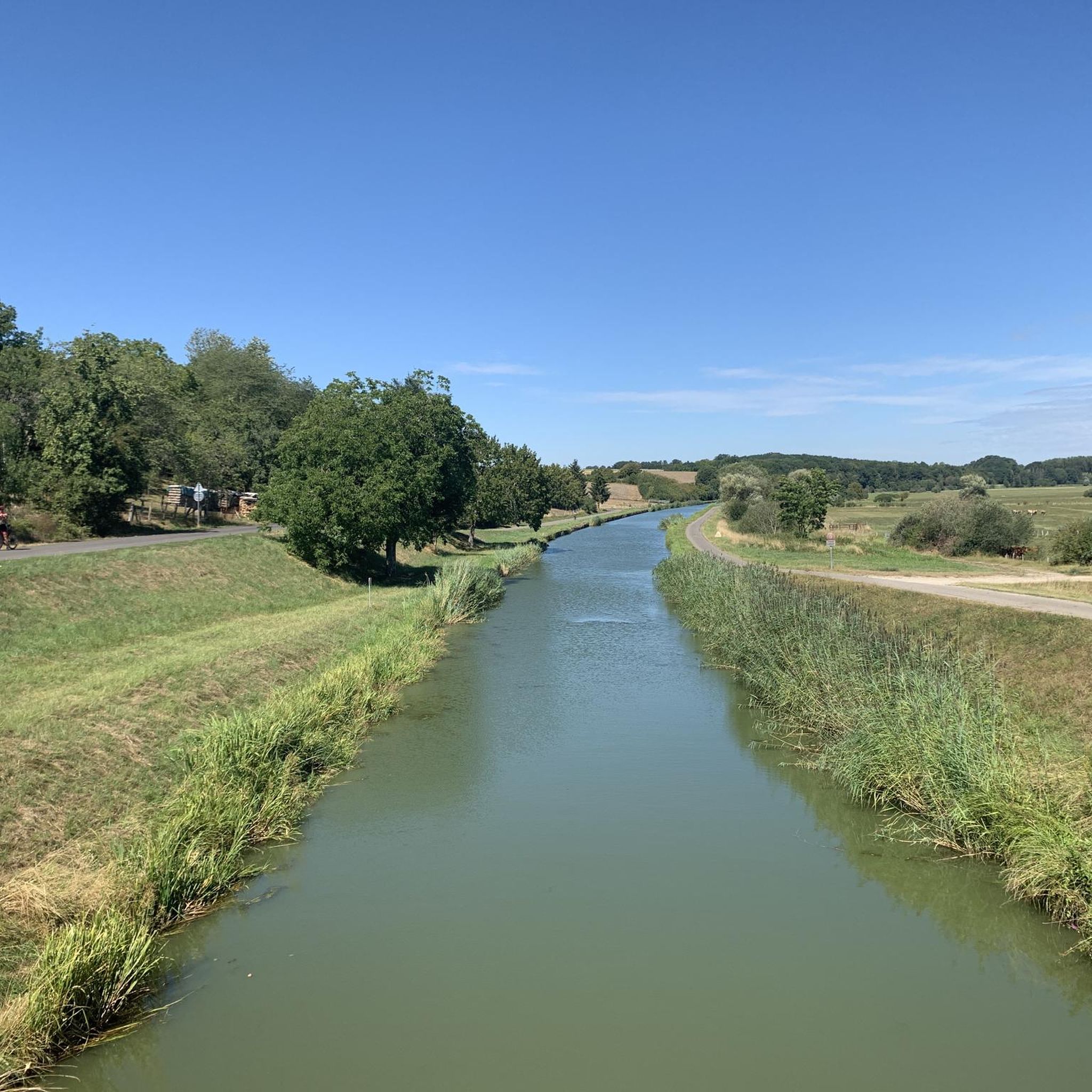
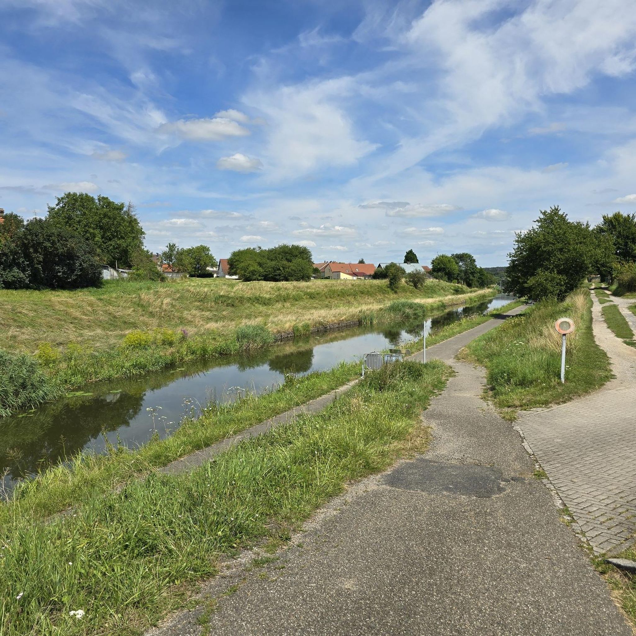
Great cycle path along the Saar Canal.
2
0

The cycle path stretches from Sarreguemines to Gondrexange.
0
0

“Each of these crosses can tell its own story and what motivated people to erect “their” cross at this spot. (...) These wayside crosses were erected as visible signs and attract the attention of many people. The cross is a symbol of life. It stands as a sign of our Christian hope and aims to direct our gaze to Jesus Christ, who has overcome death (...). The cross is part of our lives, just as it was part of the life of Jesus. So I hope that many people ... will visit the wayside crosses, whether as places of silence and breathing before God, whether as places of community gathering, prayer and praise of God.” (Text source: Dean Rainald M. Ollig in: “Wayside crosses... small sacred monuments as signs of popular piety”)
1
1


In 1621, Duke Heinrich II granted market rights to Isming, but the town then suffered during the Thirty Years' War. During the war, an officer saved the city archives in the town hall tower via an underground passage and was able to hold the town for a long time, but then it was also depopulated and the town hall was destroyed. In 1664 there were only 80 households. This cross was erected in front of the south-west entrance to Albestroff, where the old chapel destroyed by the Swedes is said to have stood.
5
0
Frequently Asked Questions
How many hiking trails are there in Wittersburg?
Wittersburg offers a wide selection of hiking opportunities, with over 90 routes available. These trails cater to various preferences, ranging from easy strolls to more moderate excursions.
Are there easy hiking trails in Wittersburg?
Yes, Wittersburg has plenty of easy hiking trails. Approximately 40 of the routes are classified as easy, perfect for a relaxed walk. An example is the Saint George's Church loop from Kappelkinger, which is about 6.9 km long and takes around 1 hour 48 minutes.
Are there any challenging hikes in Wittersburg?
While Wittersburg is known for its gentle terrain, there are a few routes that offer a bit more of a challenge. The region features 3 trails classified as difficult, providing options for those seeking a more strenuous experience within the area's generally modest elevation changes.
Are the hiking trails in Wittersburg suitable for families?
Yes, many of the hiking trails in Wittersburg are well-suited for families. The region's gentle terrain, modest elevation changes, and paths winding through forests and past ponds make for enjoyable outings with children. Look for the numerous easy and moderate routes available.
Can I bring my dog on the hiking trails in Wittersburg?
Generally, dogs are welcome on the hiking trails in Wittersburg, especially on the forest paths and canal-side routes. It's always a good idea to keep your dog on a leash and be mindful of local regulations, particularly around agricultural areas or nature reserves.
What do other hikers enjoy the most about hiking in Wittersburg?
The hiking experience in Wittersburg is highly regarded by the komoot community, with an average rating of 4.6 stars from over 380 reviews. Hikers often praise the tranquil canals, scenic pond-side routes, and gentle forest paths that define the area's charm.
Are there circular walks available in Wittersburg?
Yes, Wittersburg offers many circular walks, allowing you to start and end your hike in the same location. A popular option is the Farms loop from Le Val-de-Guéblange, a moderate 9.0 km path that showcases local farmlands and open countryside.
What kind of landscapes can I expect to see while hiking in Wittersburg?
Hiking in Wittersburg offers diverse and tranquil landscapes. You can expect to find paths winding through peaceful forests, alongside scenic canals, and around local ponds. The terrain is generally gentle, providing a serene outdoor experience.
Are there any interesting landmarks or places to see around Wittersburg?
Yes, beyond the trails, there are several interesting places to explore near Wittersburg. You could visit the Sarralbe Town Centre, enjoy the tranquility of the Grand Pond of Mittersheim, or see the historic Saint-Martin Church. The area also features the Canal des Houillères de la Sarre, which has an accompanying cycle path.
How long do hikes in Wittersburg typically take?
The duration of hikes in Wittersburg varies depending on the route and your pace. Many of the easy and moderate trails can be completed in 2 to 4 hours. For example, the Hirbach Pond – Honnert Oak Tree loop from Le Val-de-Guéblange is an 8.1-mile trail that typically takes about 3 hours 22 minutes.
What is the best time of year to hike in Wittersburg?
Wittersburg's trails are enjoyable throughout much of the year. Spring and autumn offer pleasant temperatures and beautiful scenery, with changing foliage in the forests. Summer is also popular, especially for walks along the canals and ponds. Winter hiking is possible, but some paths might be muddy or icy.
Are there any long-distance hiking options in Wittersburg?
For those looking for a longer excursion, Wittersburg does offer some extended routes. The Canal next to the campsite – Old oak loop from Altwiller is a moderate 17.9 km trail that takes approximately 4 hours 41 minutes to complete, exploring scenic canals and ancient oak trees.
What kind of wildlife might I encounter on the trails?
While hiking through Wittersburg's forests and along its waterways, you might encounter various local wildlife. Keep an eye out for birds, small mammals, and aquatic life near the ponds and canals. The peaceful environment provides a habitat for diverse species.
Most popular routes around Wittersburg
Most popular attractions around Wittersburg

Get inspired with the komoot mobile app


Explore more
Browse the best Hikes in other regions.
