The best walks and hikes around Lindre-Haute
4.6
(23)
190
hikers
36
hikes
Hiking around Lindre-Haute offers access to the diverse landscapes of the Lorraine Regional Natural Park, characterized by its "Pays des étangs" or "Land of Ponds." This area features a rich mix of aquatic environments, including salt ponds and wet meadows, alongside limestone grasslands and wooded valleys. The region's varied ecosystem supports a range of wildlife and provides numerous trails for exploration.
Best hiking trails around Lindre-Haute
- The most popular hiking route is L'étang de Lindre — loop from Lindre-Basse in…
Last updated: July 5, 2026
2.7
(3)
6
hikers
Hard hike. Very good fitness required. Mostly accessible paths. Sure-footedness required.
5.0
(1)
7
hikers
7.61km
01:59
50m
50m
Easy hike. Great for any fitness level. Easily-accessible paths. Suitable for all skill levels.

Sign up for free
4.3
(3)
10
hikers
20.2km
05:15
120m
120m
Hard hike. Very good fitness required. Easily-accessible paths. Suitable for all skill levels.
4.0
(1)
4
hikers
3.29km
00:51
20m
20m
Easy hike. Great for any fitness level. Easily-accessible paths. Suitable for all skill levels.
5.0
(1)
7
hikers
9.85km
02:33
50m
50m
Moderate hike. Good fitness required. Easily-accessible paths. Suitable for all skill levels.
Get access to more routes and recommendations from other explorers.
Sign up for free
Already have an account?
Our route recommendations are based on thousands of hikes, rides, and runs completed by other people on komoot.
Start today with a free account
Your next adventure awaits.
Login or Signup

Tips from the Community

This small tower stands on the site of the castle's former vegetable garden.
2
0

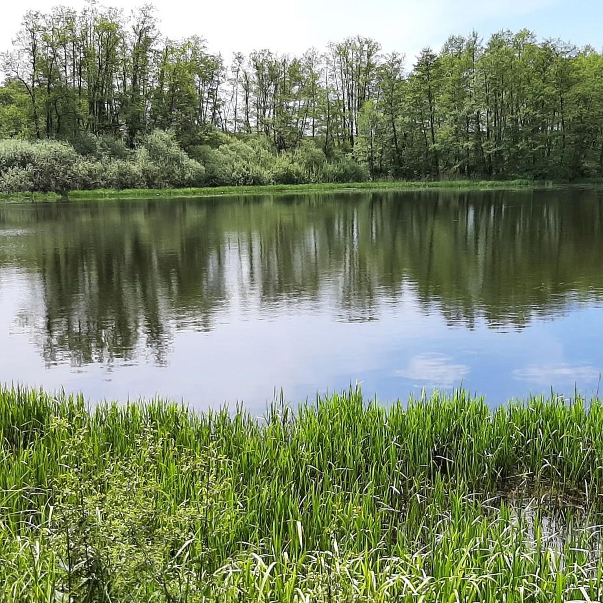
South of Dieuze, the Etang de Lindre belongs to the 134 ponds that make up what is called the country of ponds. Large over six square kilometres, the body of water becomes an Eden for walkers and fishermen during the summer.
1
0
On the GR 5, the Villers pond is a water reservoir wedged between the Bois de la Charbonnière and the Bois du Bourlocq. Its level varying with each season, it becomes a natural curiosity that seduces locals and itinerant alike.
1
0

Nice and good bike path
2
1

On the GR5. Preserved Wetland. Astonishing in all seasons. Work on the restraint system during 2021.
0
0

Château d'Alteville If you ever wanted to stay or eat in a castle, this is the place for you. At the Château d'Alteville, this is possible and even for a reasonable price. The castle from the XVI century allows a journey back in time to another era. More information at: http://www.chateaudalteville.com
3
1
Here you can make great rest, there are food and drinks, a toilet is also available! There is also a lot of information about the Domaine de Lindre and a souvenir shop for the small gifts from the holiday! Here you can see clearly, Lindre is Stocheland!
1
0
A shady spot under a tree with old walls in the background invites for a little break, the bank comes as if called!
0
1
Frequently Asked Questions
How many hiking trails are available around Lindre-Haute?
There are over 25 hiking trails around Lindre-Haute, offering a variety of experiences within the Lorraine Regional Natural Park. These routes range from easy strolls to more challenging treks, catering to different fitness levels.
What kind of landscapes can I expect to see while hiking in Lindre-Haute?
Lindre-Haute is situated in the 'Pays des étangs' or 'Land of Ponds,' so you can expect a rich tapestry of aquatic environments, including salt ponds and wet meadows. The region also features limestone grasslands, wooded valleys, and diverse ecosystems, making it an important area for bird conservation and home to various wildlife.
Are there any easy hiking trails suitable for beginners or families?
Yes, Lindre-Haute offers 11 easy hiking trails. A good option for a relaxed outing is the Lindre Pond loop from Dieuze, which is 7.6 km long and takes about 2 hours. Another easy choice is the Viewing Platform Over the Lake loop from Dieuze, a 5.7 km route.
What are some notable natural features or landmarks to look out for?
The most prominent natural feature is the Lindre Pond itself, which is central to many routes. You might also encounter the Domaine Départemental de Lindre, known for its natural scenery, and the White Stork Sanctuary, offering opportunities for birdwatching.
Are there any circular hiking routes available?
Many of the trails around Lindre-Haute are circular, allowing you to start and end at the same point. For example, the Lindre Pond loop from Lindre-Basse is a moderate 10.4 km circular path, and the L'étang de Lindre — loop from Lindre-Basse offers a longer, more challenging 22.6 km circular experience.
What do other hikers say about the trails in Lindre-Haute?
The trails in Lindre-Haute are highly regarded by the komoot community, with an average rating of 4.6 stars from over 24 reviews. Hikers often praise the tranquil atmosphere, the diverse scenery of the ponds and woodlands, and the well-maintained paths that make for enjoyable exploration.
Is Lindre-Haute a good place for wildlife spotting?
Absolutely. The region's diverse ecosystem, particularly the 'Pays des étangs' and the Lorraine Regional Natural Park, is a haven for wildlife. It's an important area for bird conservation, and you might spot deer, wild cats, and wild boars. The eastern part of the park, including Lindre, is also on a significant migratory bird route.
Are there any historical sites or cultural attractions nearby?
Yes, beyond the natural beauty, you can explore the Château d'Alteville, a historic castle, or visit the Salines de Dieuze, which are historical saltworks. These offer a glimpse into the region's past.
What is the best time of year to go hiking in Lindre-Haute?
The Lorraine Regional Natural Park, where Lindre-Haute is located, is beautiful year-round. Spring and autumn offer pleasant temperatures and vibrant colors, making them ideal for hiking. The area is also known for being on a significant migratory bird route, so spring and fall can be excellent for birdwatching.
Are there any long-distance hiking routes that pass through the area?
Yes, the renowned GR 5, a vast 2150-kilometer trail connecting the North Sea to the Mediterranean, passes through or near the area. While it primarily traverses the Vosges, Jura, and Alps, sections of this European E2 trail can be accessed, offering opportunities for longer treks.
Can I find information about hiking trails on a mobile app?
Yes, for local exploration, the 'Balades en Moselle' app provides access to over 350 trails across the Moselle landscape, guiding hikers and highlighting points of interest. This can be a useful resource for discovering more routes in the wider region.
Most popular attractions around Lindre-Haute

Get inspired with the komoot mobile app


Explore more
Browse the best Hikes in other regions.
