The best MTB trails around Ochancourt
4.3
(90)
503
riders
78
rides
Mountain bike trails around Ochancourt are set within the diverse natural landscapes of the Somme region, offering varied terrain for cycling. The area is characterized by its proximity to the Bay of Somme, a classified Grand Site de France, and the Somme Canal and River. Riders can expect routes that traverse coastal scenery, river valleys, and agricultural lands, providing a mix of surfaces and elevations. The region's emphasis on cycling ensures opportunities for off-road exploration.
Best mountain bike trails around…
Last updated: June 26, 2026
3.0
(1)
5
riders
34.6km
01:59
110m
110m
Easy mountain bike ride. Great for any fitness level. Suitable for all skill levels.
7
riders
36.7km
02:48
350m
350m
Moderate mountain bike ride. Good fitness required. Suitable for all skill levels.

Sign up for free
5.0
(1)
4
riders
34.6km
02:03
110m
110m
Moderate mountain bike ride. Good fitness required. Suitable for all skill levels.
4.0
(1)
7
riders
53.6km
03:45
370m
370m
Moderate mountain bike ride. Good fitness required. Suitable for all skill levels.
3.0
(1)
3
riders
36.2km
02:37
180m
180m
Moderate mountain bike ride. Good fitness required. Advanced riding skills necessary.
Get access to more routes and recommendations from other explorers.
Sign up for free
Already have an account?
Our route recommendations are based on thousands of hikes, rides, and runs completed by other people on komoot.
Start today with a free account
Your next adventure awaits.
Login or Signup

Tips from the Community

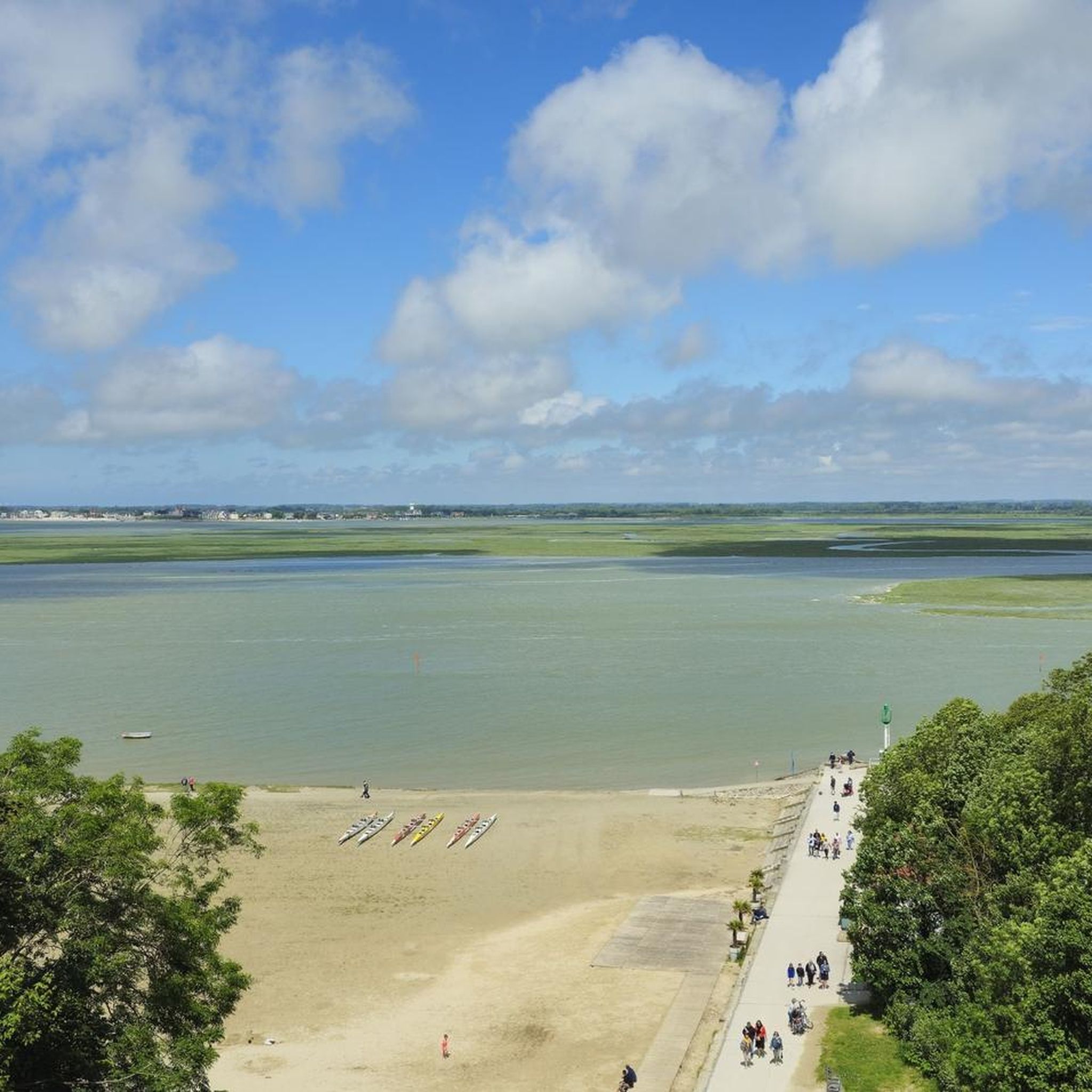
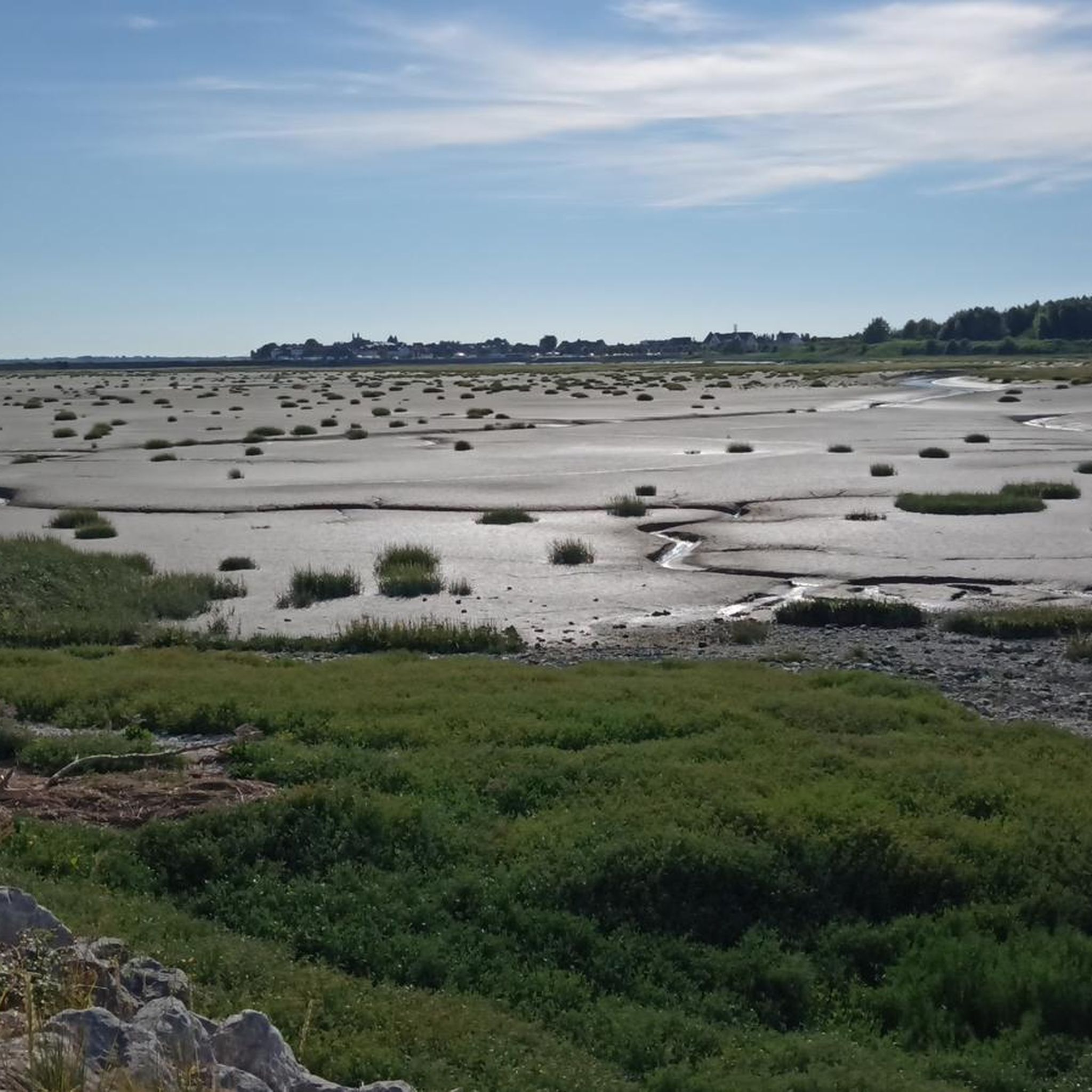
The scenery is very beautiful, with lots of birds, cows, horses, and sheep. The road is made of pebbles and quite strenuous to ride.
0
0

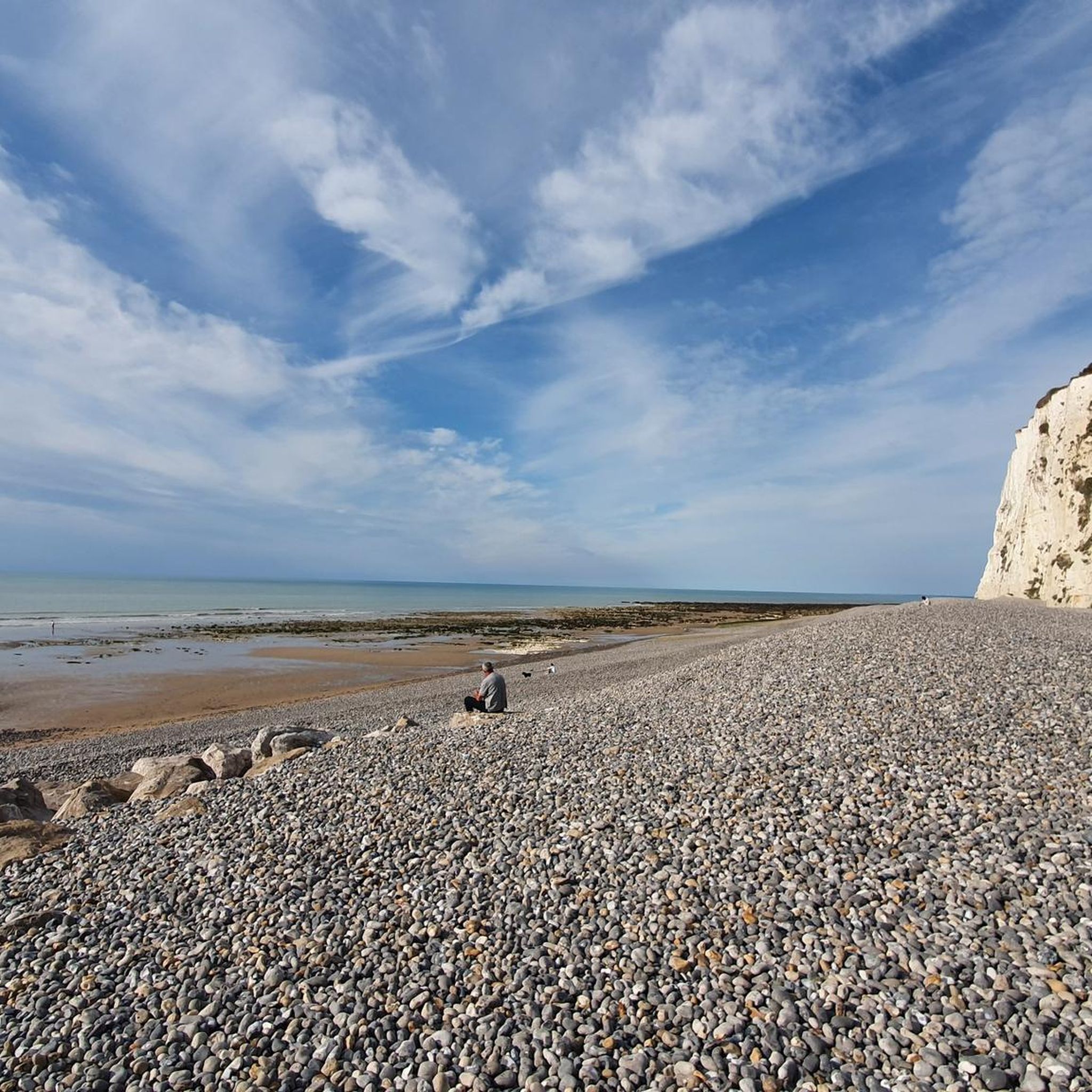
The cliffs are made of chalk and are impressive to look at.
3
0
Here in Ault begin the chalk cliffs, which stretch all the way to Normandy and repeatedly appear as enormous cliffs.
4
0

The cliffs around the beach of Ault are composed of chalk from the Upper Cretaceous, more precisely from the Turonian and Coniacian (around 83 million years ago to 90 million years ago). They are strewn with flint nodules which highlight the subhorizontal stratification planes (the formation of flint has already been discussed in Discovery of the geology of the cliffs of Étretat, presentation of an excursion from the beach of Tilleul (Antifer) to the Porte d'Amont (Étretat Nord)). The relative proportion of chalk and flint is around 90-95% chalk to 5-10% flint. Flint horizons are stratigraphic markers. On the cliffs of Ault, the regular flint band called Seven Sisters is recognizable and characterizes the boundary between the Middle Coniacian and the Upper Coniacian (around 87 million years ago). The boundary between the lower and middle Coniacian is marked by the Shoreham 2 marl level, which is more difficult to identify. These lithostratigraphic markings allow in particular the correlation of distant deposits, such as between the Normandy and Picardy coasts, or between the French and English coasts.
3
0
The cliffs surrounding Ault beach are made of Upper Cretaceous chalk, more precisely from the terminal Turonian and Coniacian (approximately 83 Ma to 90 Ma). They are dotted with flint nodules that highlight the sub-horizontal stratification planes (the formation of flint has already been discussed in À la découverte géologique des falaises d'Étretat, presentation of an excursion going from Tilleul beach (Antifer) to Porte d'Amont (Étretat Nord)). The relative proportion between chalk and flint is approximately 90-95% chalk for 5-10% flint. The flint horizons are stratigraphic markers. On the cliffs around Ault, the regular band of flint called Seven Sisters is recognizable and characterizes the limit between the Middle Coniacian and the Upper Coniacian (approximately 87 Ma). The boundary between the Lower and Middle Coniacian is marked by the Shoreham 2 marl level, which is more difficult to identify. These lithostratigraphic markers allow in particular the correlation of distant deposits, such as for example between the Normandy and Picardy coasts, or between the French and English coasts.
3
0
The cliffs around the beach of Ault are composed of chalk from the Upper Cretaceous, more precisely from the Turonian and Coniacian (around 83 million years ago to 90 million years ago). They are strewn with flint nodules which highlight the subhorizontal stratification planes (the formation of flint has already been discussed in Discovery of the geology of the cliffs of Étretat, presentation of an excursion from the beach of Tilleul (Antifer) to the Porte d'Amont (Étretat Nord)). The relative proportion of chalk and flint is around 90-95% chalk to 5-10% flint. Flint horizons are stratigraphic markers. On the cliffs of Ault, the regular flint band called Seven Sisters is recognizable and characterizes the boundary between the Middle Coniacian and the Upper Coniacian (around 87 million years ago). The boundary between the lower and middle Coniacian is marked by the Shoreham 2 marl level, which is more difficult to identify. These lithostratigraphic markings allow in particular the correlation of distant deposits, such as between the Normandy and Picardy coasts, or between the French and English coasts.
2
0

The cliffs are worth a visit from above and below.
2
1

Frequently Asked Questions
How many mountain bike trails are available around Ochancourt?
There are over 80 mountain bike trails around Ochancourt listed on komoot. These routes offer a variety of experiences, from easy coastal rides to more challenging inland explorations.
What is the general difficulty level of mountain biking in Ochancourt?
The mountain biking trails around Ochancourt cater to a range of abilities. You'll find 23 easy routes, 60 moderate routes, and 1 difficult route, ensuring options for beginners, intermediate riders, and those seeking a challenge.
What kind of terrain can I expect on the mountain bike trails in Ochancourt?
The terrain around Ochancourt is diverse, reflecting its location near the Bay of Somme and the Somme Canal. Riders can expect a mix of coastal paths, routes along river valleys, and trails through varied rural and agricultural landscapes. While dedicated mountain biking trails are not explicitly named, the region's emphasis on cycling and varied natural features provide ample opportunities for off-road exploration.
Are there family-friendly mountain bike trails in the Ochancourt area?
Yes, the region offers several family-friendly cycling options. Many of the 23 easy routes are suitable for families and beginner cyclists, particularly those along the Somme Valley cycle route, which provides leisurely rides past charming villages and historical sites. An example is the Coole Strandcafes – Beach Huts of Cayeux-sur-Mer loop from Saint-Blimont, an easy 21.5-mile path offering coastal views.
Are there any circular mountain bike routes around Ochancourt?
Yes, many of the routes around Ochancourt are designed as loops, allowing you to start and finish in the same location. For example, the popular Somme Bay – Saint-Valery-sur-Somme loop from Valines is a 49.9-mile moderate trail exploring the scenic Bay of Somme.
What natural features or viewpoints can I see along the mountain bike trails?
The trails often offer stunning views of the Bay of Somme, a classified Grand Site de France. You might also encounter the picturesque Somme Canal and River, and coastal features like Cape Hornu near Saint-Valery-sur-Somme, which adds to the dramatic coastal scenery.
Are there any historical sites or landmarks to explore while mountain biking?
Absolutely. The region is rich in history. You can pass by the historic Saint Martin's Church in Ochancourt itself, or explore the vibrant Port of Saint-Valery. The Miannay Manor loop from Chépy, for instance, leads past the historic Château d'Eaucourt, a fine example of medieval architecture.
What do other mountain bikers say about the trails in Ochancourt?
The mountain bike trails around Ochancourt are highly rated by the komoot community, with an average score of 4.2 stars from over 100 reviews. More than 600 mountain bikers have used komoot to explore the varied terrain, often praising the scenic coastal paths and diverse rural landscapes.
When is the best time of year to go mountain biking in Ochancourt?
The Somme region, including Ochancourt, is enjoyable for cycling throughout much of the year. Spring and autumn offer pleasant temperatures and beautiful scenery, while summer provides longer daylight hours. Always check local weather conditions before heading out, especially for coastal routes where winds can be a factor.
Are there places to eat or drink near the mountain bike routes?
Yes, particularly in towns and villages along the routes. The Port of Saint-Valery is a notable hub with a vibrant atmosphere, offering options for refreshments. The Somme Valley cycle route also passes through charming villages where you can find local cafes and restaurants.
Where can I find parking for mountain biking in Ochancourt?
While specific parking spots for each trail are not detailed, you can generally find parking in the starting villages of the routes, such as Valines, Saint-Blimont, Chépy, or Arrest. Larger towns like Saint-Valery-sur-Somme also offer public parking facilities.
Can I bring my dog on the mountain bike trails?
Many outdoor trails in France are dog-friendly, especially if your dog is well-behaved and kept on a leash. However, it's always best to check specific local regulations for nature reserves or protected areas you might pass through. Ensure your dog is fit enough for the distance and terrain, and always carry water for them.
How can I reach Ochancourt by public transport?
While Ochancourt itself is a small village, the broader Somme region is accessible by public transport. You can typically reach larger towns like Abbeville or Saint-Valery-sur-Somme by train or bus, and then cycle or use local transport to get closer to the trailheads. It's advisable to check regional transport schedules in advance.
Most popular routes around Ochancourt
Most popular attractions around Ochancourt

Get inspired with the komoot mobile app


Explore more
Browse the best MTB trails in other regions.
