The best MTB trails around Doncourt-Lès-Conflans
4.5
(204)
1,137
riders
69
rides
Mountain biking around Doncourt-Lès-Conflans offers diverse terrain within the Lorraine Regional Natural Park. The landscape features a mix of dense forests, wooded hills, and agricultural plains, providing varied riding experiences. The region's elevation ranges between 202 and 282 meters, indicating a landscape with gentle climbs and descents. The Orne river greenway also provides accessible routes for cyclists.
Best mountain bike trails around Doncourt-Lès-Conflans
- The most popular mountain bike trail is Jarny to Auboué loop from Ville-sur-Yron, a 22.4 miles…
Last updated: July 9, 2026
5.0
(2)
15
riders
31.6km
02:11
210m
200m
Moderate mountain bike ride. Good fitness required. Suitable for all skill levels.
4.7
(7)
27
riders
65.1km
04:02
330m
330m
Moderate mountain bike ride. Good fitness required. Suitable for all skill levels.

Sign up for free
4.2
(6)
14
riders
37.1km
02:32
190m
190m
Moderate mountain bike ride. Good fitness required. Suitable for all skill levels.
5.0
(1)
18
riders
46.1km
03:34
410m
410m
Moderate mountain bike ride. Good fitness required. Advanced riding skills necessary.
3.0
(1)
4
riders
51.3km
04:09
650m
650m
Moderate mountain bike ride. Good fitness required. Suitable for all skill levels.
Get access to more routes and recommendations from other explorers.
Sign up for free
Already have an account?
Our route recommendations are based on thousands of hikes, rides, and runs completed by other people on komoot.
Start today with a free account
Your next adventure awaits.
Login or Signup


Tips from the Community


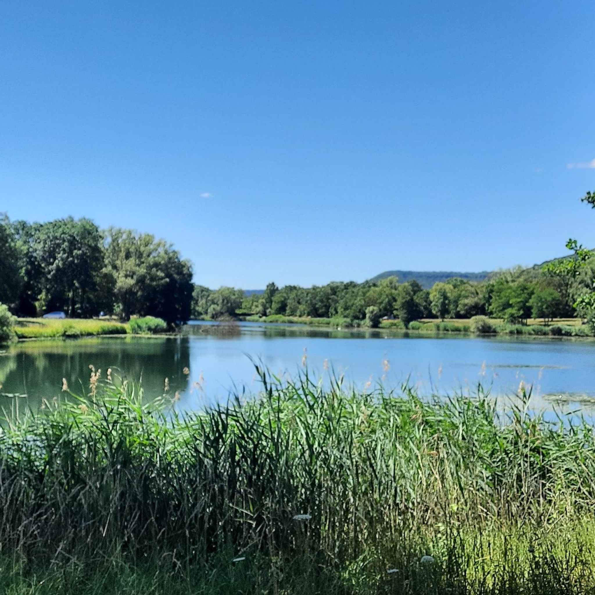
💧 Plan d'Eau de la Sangsue – Small Natural Lake Tucked away in the countryside lies the Plan d'Eau de la Sangsue, a small natural lake with wild shoreline vegetation, calm waters, and a natural charm. While its name ("Leech Pond") is unusual, the body of water is a peaceful spot for walkers, nature lovers, and birdwatchers. 🌿 Surrounded by forest and meadows, the pond is a refuge for amphibians, insects, and waterfowl. A narrow path leads along the shore – ideal for a quiet break in nature. Tip: Particularly beautiful in spring or when there is light fog – then the pond appears almost mystical. Perfect for a quiet rest off the beaten track.
0
0


Each of these crosses that the biker encounters in the villages or in the fields is a sign of remembrance of the crucifixion, but also of the resurrection of Jesus Christ. "Here on earth there is His memory, but in the kingdom of heaven there is His presence: this presence is the joy of those who have already reached salvation. The memory is our consolation, as we are still wanderers, traveling towards our homeland." (Bernard of Clairvaux)
0
0


Very beautiful pond with a lot of activities for children (playground and outdoor activity park)
0
0

Great body of water in the early morning
1
0

Very beautiful hike that I do every year
1
0
Frequently Asked Questions
How many mountain bike trails are there around Doncourt-Lès-Conflans?
There are over 60 mountain bike routes available around Doncourt-Lès-Conflans, offering a wide variety of options for different skill levels and preferences.
What is the typical difficulty level of mountain bike trails in this area?
The mountain bike trails around Doncourt-Lès-Conflans cater to all levels. You'll find 19 easy routes, 38 moderate routes, and 3 difficult routes, ensuring there's something for everyone from beginners to experienced riders.
Are there easy mountain bike trails suitable for beginners or families?
Yes, there are 19 easy mountain bike routes around Doncourt-Lès-Conflans, perfect for beginners or families looking for a more relaxed ride. These trails often traverse the varied landscape of forests and agricultural plains with gentle elevation changes.
What kind of terrain can I expect on the mountain bike trails?
The terrain around Doncourt-Lès-Conflans is diverse, featuring a mix of dense forests, wooded hills, and open agricultural plains. The elevation ranges between 202 and 282 meters, providing engaging rides with gentle climbs and descents. You can also find accessible routes along the Orne river greenway.
What natural features or landmarks can I see while mountain biking?
While mountain biking, you can explore the varied landscapes of the Lorraine Regional Natural Park, including forests and agricultural plains. For specific points of interest, consider visiting the Mont Saint-Germain Archaeological Site or the natural monument known as The Battle Beech. The region also features the 'Prairies humides du Rougeval' (wet meadows of Rougeval), a Sensitive Natural Area.
Are the mountain bike trails around Doncourt-Lès-Conflans dog-friendly?
Many trails in the Lorraine Regional Natural Park are suitable for dogs, especially those that traverse forests and open plains. However, it's always recommended to keep your dog on a leash, especially in sensitive natural areas or near agricultural land, and to check specific trail regulations if available.
When is the best time of year to go mountain biking in Doncourt-Lès-Conflans?
The varied landscape of Doncourt-Lès-Conflans makes it suitable for mountain biking through much of the year. Spring and autumn offer pleasant temperatures and beautiful scenery, while summer provides longer daylight hours. Forested sections can offer shade during warmer months. Always check local weather conditions before heading out.
Are there many circular mountain bike routes in the area?
Yes, many of the mountain bike routes around Doncourt-Lès-Conflans are designed as loops. For example, the Jarny to Auboué loop from Ville-sur-Yron and the Mountainbike loop from Jarny are popular circular options that allow you to start and finish at the same point.
What do other mountain bikers enjoy most about mountain biking in Doncourt-Lès-Conflans?
The area is highly rated by the komoot community, with an average score of 4.2 stars from over 140 reviews. Reviewers often praise the diverse terrain, which includes a good mix of forest trails and open views across agricultural plains, providing varied riding experiences.
What is the typical length of mountain bike trails around Doncourt-Lès-Conflans?
Trail lengths vary significantly. For instance, the Jarny to Auboué loop from Ville-sur-Yron is 36.0 km, while the Étang de la Sangsue – Plan d'Eau de la Sangsue loop from Conflans - Jarny is 47.2 km. You can find routes ranging from shorter, easy rides to longer, more challenging excursions.
Is public transport available to access the mountain bike trails?
While specific public transport options directly to trailheads are limited, the region is part of the Orne Lorraine Confluences intercommunality. For detailed information on local transport, including potential bike transport policies, it's best to check with local transport providers or the Miltol Tourisme website for general leisure information in the area.
Where can I park when visiting the mountain bike trails?
Parking availability can vary depending on the specific trailhead. Many routes start from towns or villages in the vicinity, such as Jarny or Conflans-en-Jarnisy, where public parking is generally available. It's advisable to check the starting point of your chosen route for specific parking recommendations.
Most popular routes around Doncourt-Lès-Conflans
Most popular attractions around Doncourt-Lès-Conflans

Get inspired with the komoot mobile app


Explore more
Browse the best MTB trails in other regions.
